BOU AVENUE
Wilcox Lake And Wilcox Ridge

While I dozed in the passenger seat of my car in the wee hours of the morning on 15 October 2022, Zosia Zgolak turned off the Trans-Canada Highway onto Yoho Valley Road and was dismayed to find a locked gate only a short distance in.  Zosia muttered an expletive as she immediately pulled up the map application in my cell phone to start searching for a Plan B.  Given an unusually nice weather forecast for the weekend, we had planned on hiking in Little Yoho Valley that day, and prior to leaving home, Zosia had checked Parks Canada's website looking for road closure notifications.  None were found, and we assumed that Yoho Valley Road would be open.  In spite of exceptionally warm and dry conditions in the mountains, Parks Canada shut down all seasonal accesses and amenities--including apparently their website administrators--right after the Thanksgiving long weekend.  While we ruminated on where we should go, Zosia drove out to the Trans-Canada Highway and backtracked a bit before turning up the Icefields Parkway.  The decision process was a bit chaotic and too long-winded to detail here, but we ultimately went all the way to the Columbia Icefields in Jasper National Park to hike up Wilcox Pass.  Both of us had already been there before but not for many years (I was last there in 2007).  I also vaguely recalled that there is a hidden lake--Wilcox Lake--in the vicinity, and that provided some extra incentive for us to revisit the pass.

Starting from the signed trailhead (north side of Highway 93, 105.0 kilometres southeast of junction with Highway 16 or 47.0 kilometres northwest of junction with Highway 11), Zosia and I followed the official trail which climbs gradually but steadily for about 3.5 kilometres to Wilcox Pass.  In dry conditions, this trail is very straightforward to hike.  Something new at the pass that neither Zosia nor I had seen before is a signed side trail that climbs southwesterly up to a viewpoint overlooking the Icefields Centre.  The sign refers to the destination as Wilcox Ridge, and virtually everyone we encountered at the pass were heading that way.  We instead turned north and went off-trail aiming for the lower and less technical part of a long ridge flanking the east side of Wilcox Pass.  Some marshy ponds just north of the pass necessitate a bit of route-finding or rock-hopping, but we managed to get past them without getting our feet wet.  As we ascended the slope beyond the ponds, we stumbled onto a convenient trail which led us to the crest of the ridge.  Rounding the corner on the ridge, we were surprised that Wilcox Lake was nowhere in sight.  Not to be denied, we dropped down into the valley on the far side of the ridge, and after crossing some easy but undulating terrain, we finally found the elusive lake.  Zosia also spotted a couple of bighorn sheep lounging on a rise overlooking the lake, and they hardly flinched when we plopped down for an extended break a short distance away.
Hey Boo Boo!

A black bear nonchalantly climbs up an embankment on the side of the Icefields Parkway (Highway 93) near the Big Bend in Banff National Park.

Photo courtesy of Zosia Zgolak

Chilly start!

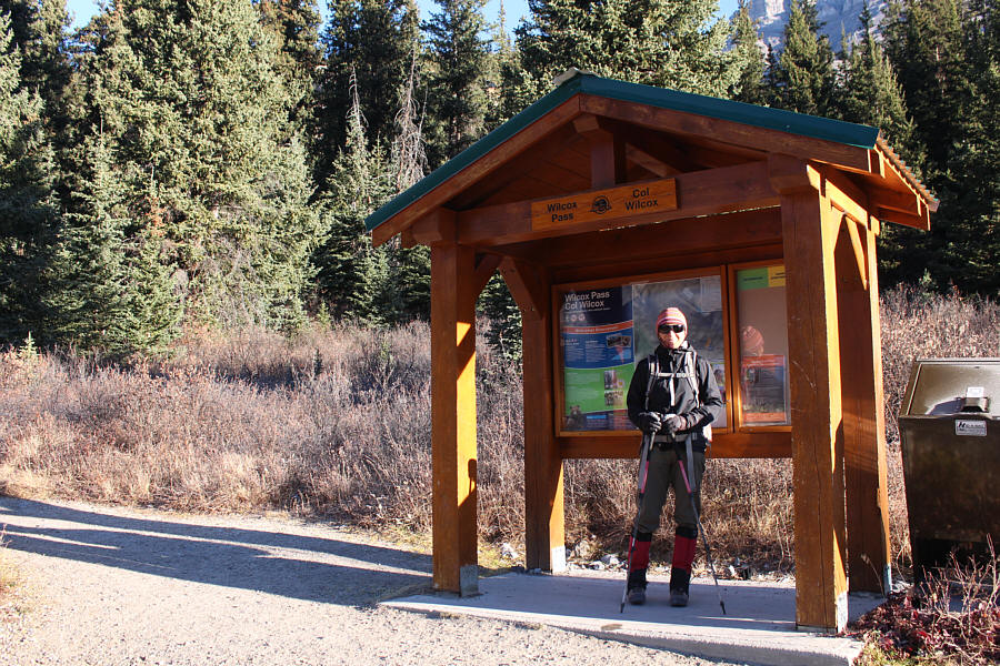
Zosia stands in front of the information kiosk at the Wilcox Pass trailhead.

This hike gives good bang for your buck! 
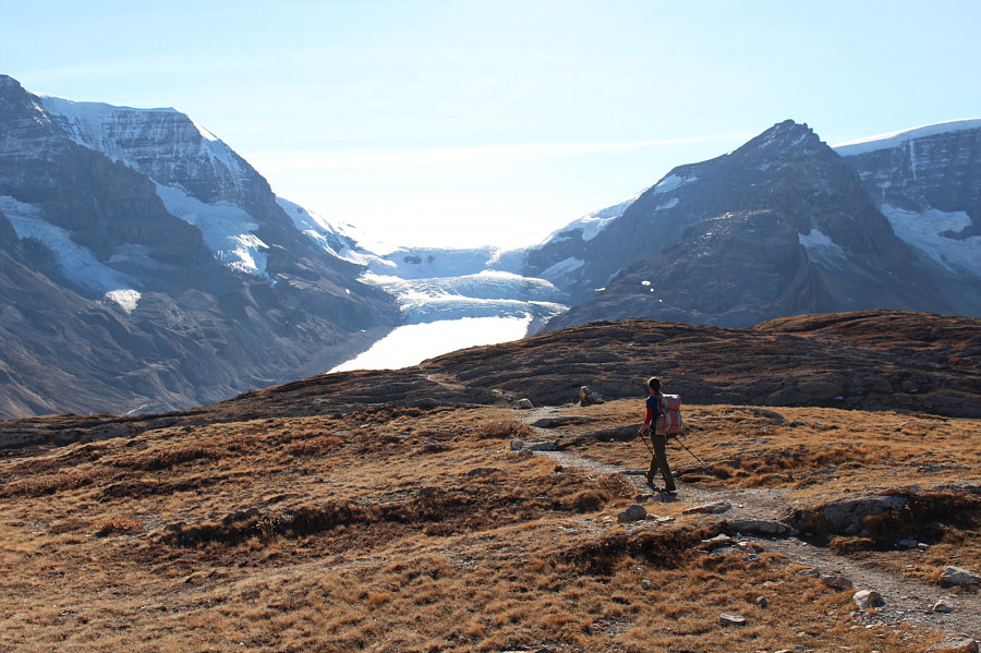
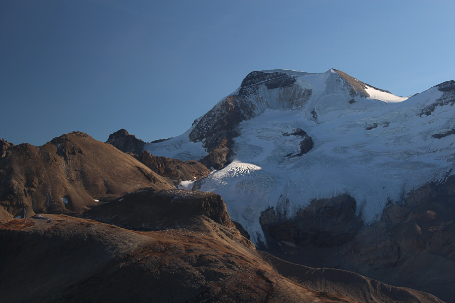
Already there are views to the west of Athabasca Glacier, Snow Dome and Dome Glacier.
It might be nice to come here for a springtime ski... 
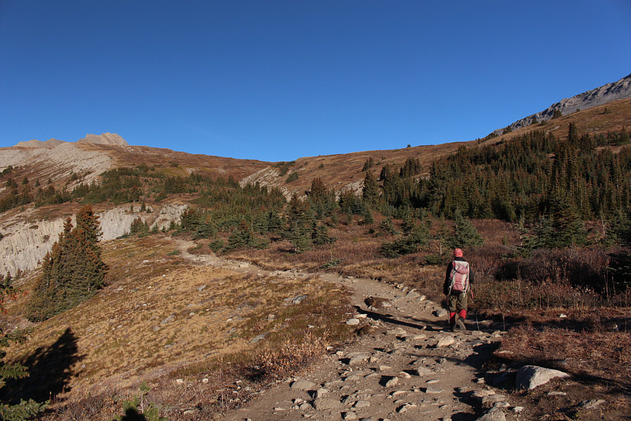
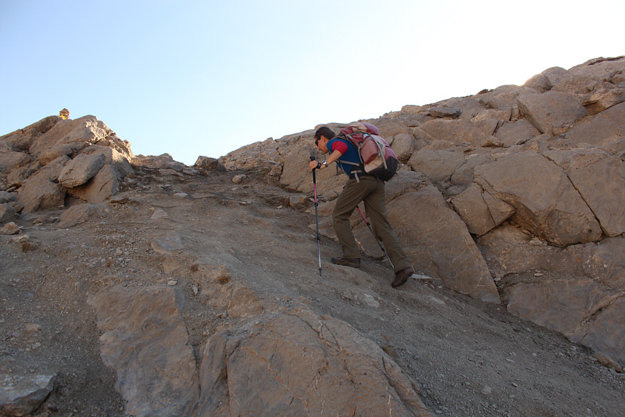
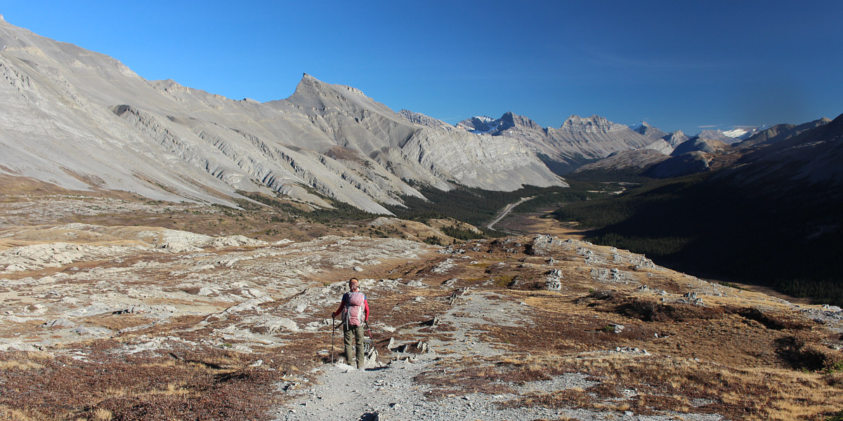
The trees begin to thin out as Zosia continues up the trail.

Boy, did we ever pick the right day to be here!

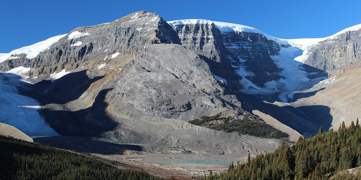
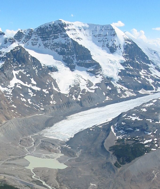
Here is a closer look at Snow Dome (right of centre) flanked by Athabasca Glacier (far left) and Dome Glacier (right).  At bottom centre is Sunwapta Lake.


That was a fun day of scrambling! The summit of Nigel Peak is directly above Zosia.
Both Zosia and I already previously climbed it, but it was tempting to go back up there on this day! 
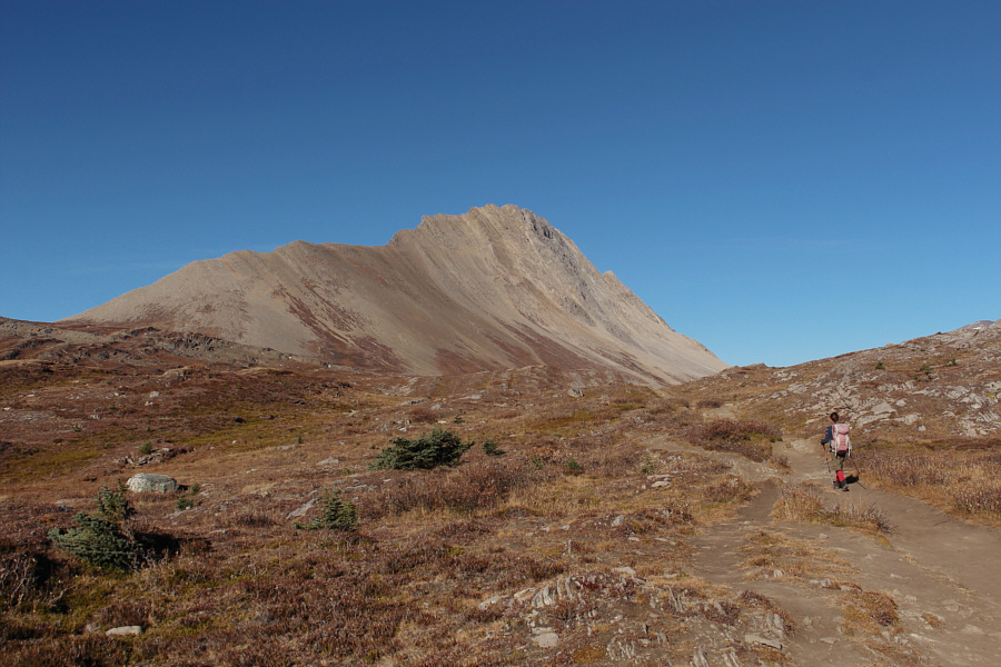
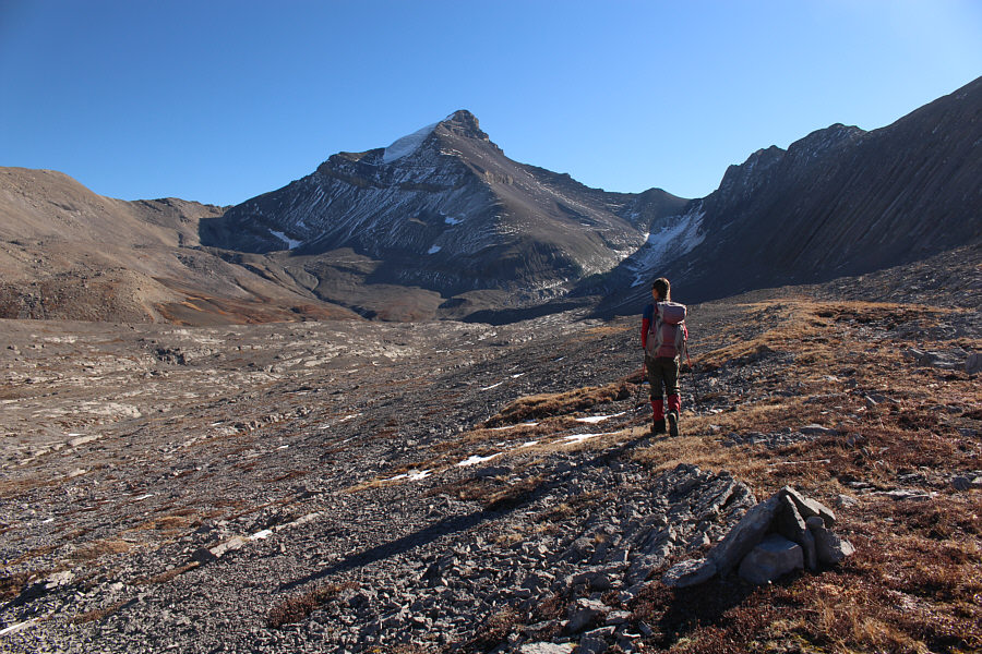
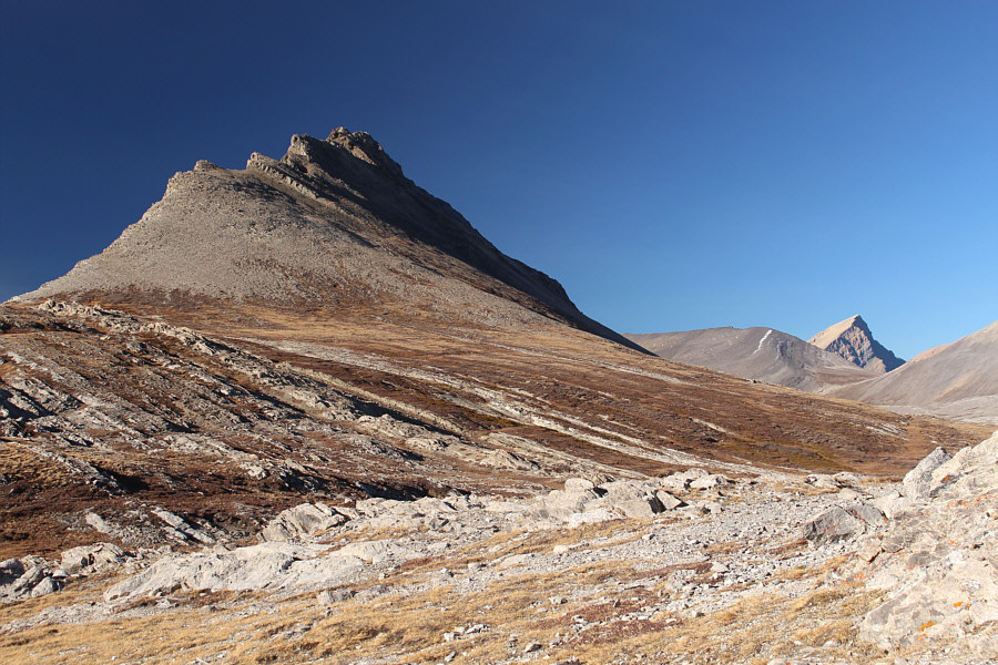
Wilcox Peak dominates the landscape in the vicinity of its namesake pass.
It took us 93 minutes to get here. Zosia arrives at Wilcox Pass (2348 metres).
Alpine beachcombing? 
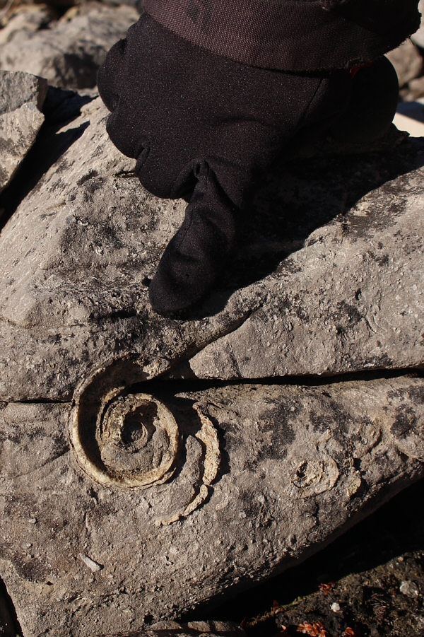
Zosia finds an interesting fossil in some rocks near the pass.
We should have brought ice skates! 
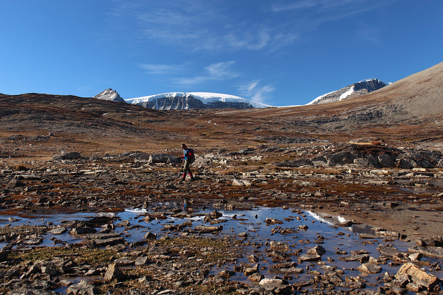
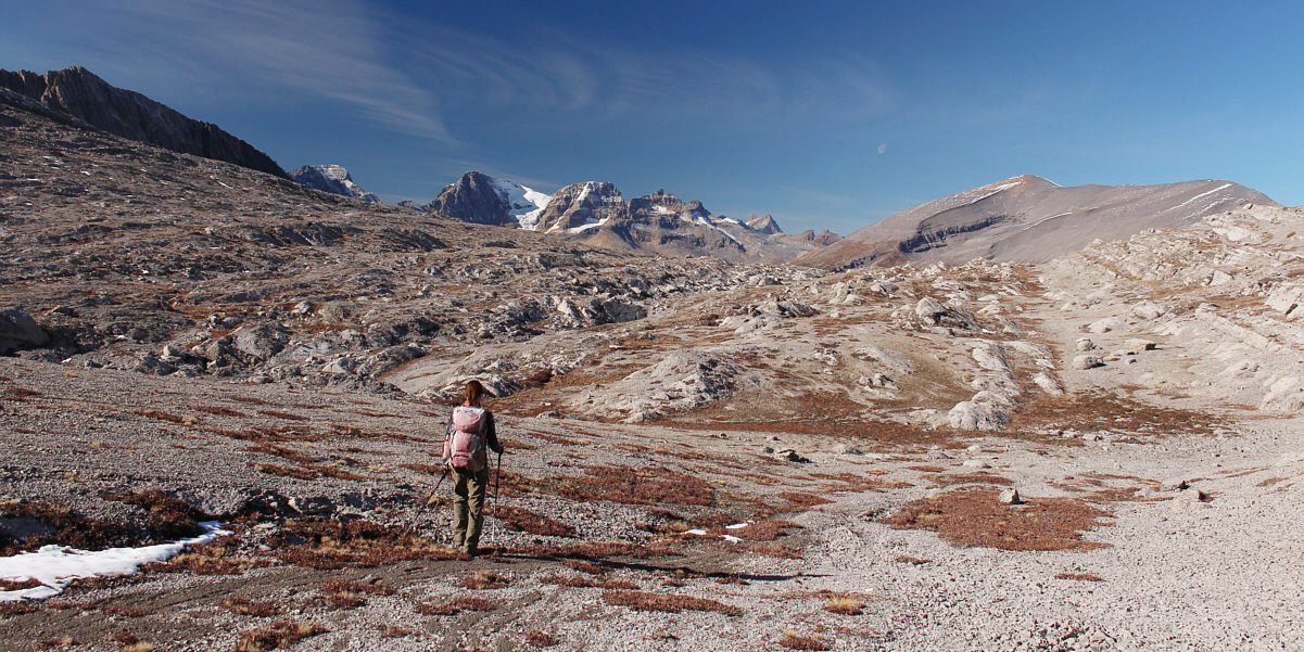
Zosia tries to figure out how to get around this barely frozen pond.  Left of centre on the horizon is Tangle Ridge.
Where's a boardwalk when you actually need one? The tops of Snow Dome and Mount Kitchener peek over Wilcox Ridge as Zosia tries to rock-hop across some wet terrain.

Surprisingly, we didn't notice anyone climbing Wilcox Peak on this day.

This perspective of Wilcox Peak gives a better view of Kane's scramble route along the left skyline.


Nobody followed us...good! This is looking back across Wilcox Pass at Mount Athabasca and Mount Andromeda.
Looks like you could land a plane here! The terrain on the north side of Wilcox Pass shows the hallmarks of glaciation.
This would've been quite a miserable slog without the trail! Zosia follows a trail across a rubble slope.
Where the f**k is the lake? After cresting the ridge flanking the east side of Wilcox Pass, Zosia easily sees Nigel Peak, but Wilcox Lake is surprisingly not visible.
Yep, that's Mount Alberta at far left in the distance! 
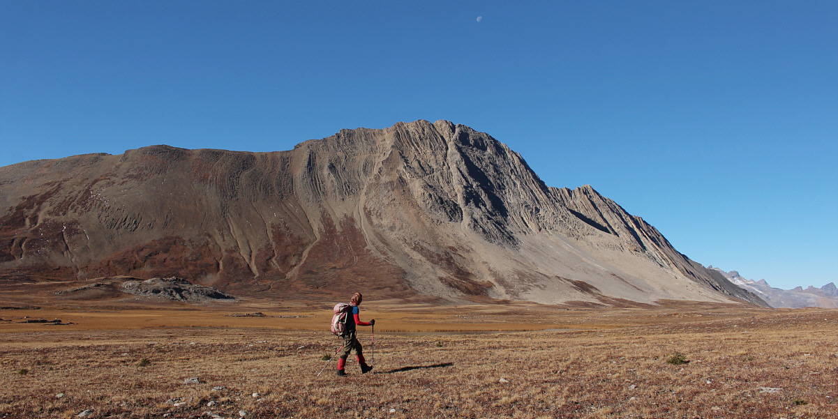
Zosia hikes across undulating terrain in search of Wilcox Lake.
Whew! I thought another lake disappeared because of climate change! 
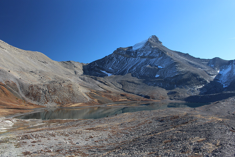
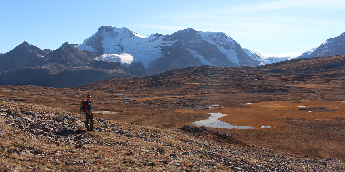
Wilcox Lake finally comes into view.
These ain't the Los Angeles Rams! Relaxing on a rise above the lake are two bighorn sheep--both rams.
Hey, how's it going? 
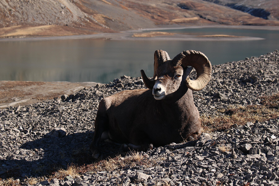
Here is a close-up of one of the rams.
Why you here bothering us? 
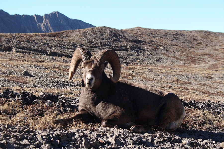
Here is a close-up of the other ram.
When the two sheep eventually tired of our company and moved off, Zosia and I dropped down to the lakeshore briefly before backtracking to the ridge.  We picked up the trail there and followed it down the slope until it petered out near the marshy ponds.  Upon returning to Wilcox Pass, we made a detour to check out Wilcox Ridge.  Other than crossing an annoying dip, the out-and-back trail is easy to follow and ends at a superlative viewpoint.  Once we had our fill of jaw-dropping scenery, we returned the same way to the pass, and from there we easily hiked back to the trailhead without trouble.

See ya!

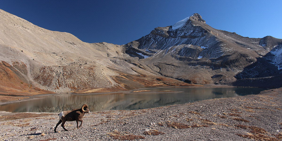
One of the rams moves leisurely to another location in the valley.


What a gem of a lake and not another soul around! Nigel Peak is reflected in Wilcox Lake.
I would definitely like to come back someday to explore some of the surrounding ridges. Sonny and Zosia stand on the shore of Wilcox Lake.

And it's appropriate that we still see the moon from this moonscape!

As Zosia makes her way out of the valley, rugged peaks such as Mount Alberta, Mount Woolley, Diadem Peak, and Mushroom Peak (centre) are noticeable on the horizon.


I tell ya: the long drive to get here is justified when the views just keep coming!

Here is another comprehensive view of Wilcox Pass with Mount Athabasca and Mount Andromeda in the background.  Wilcox Ridge is also visible across the pass.


How annoying! Zosia follows the Wilcox Ridge trail which drops into a dip ahead.
Well, I'm glad it was dry! This short but steep section of trail could be problematic if icy or wet.
The lighting would be better earlier in the day, but the view is still not too shabby! 
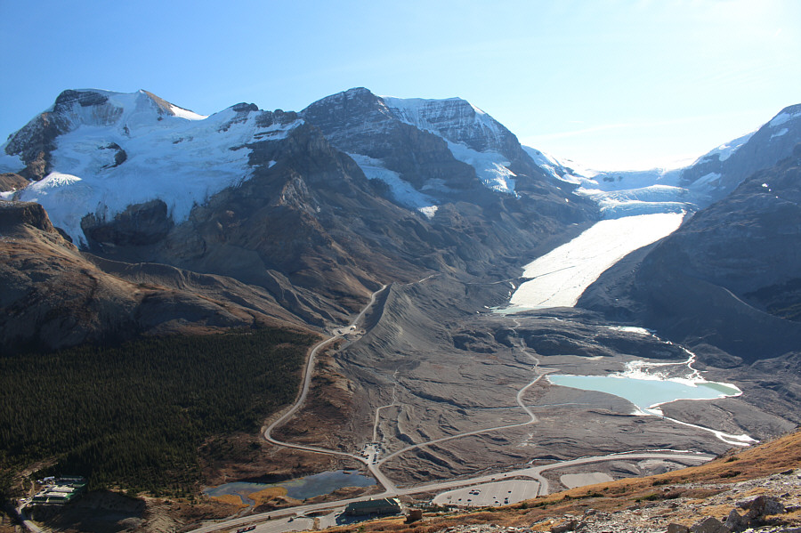
The viewpoint at trail's end overlooks the Icefields Centre (bottom).
I wonder if anyone was climbing Sunwapta Peak on this day. 
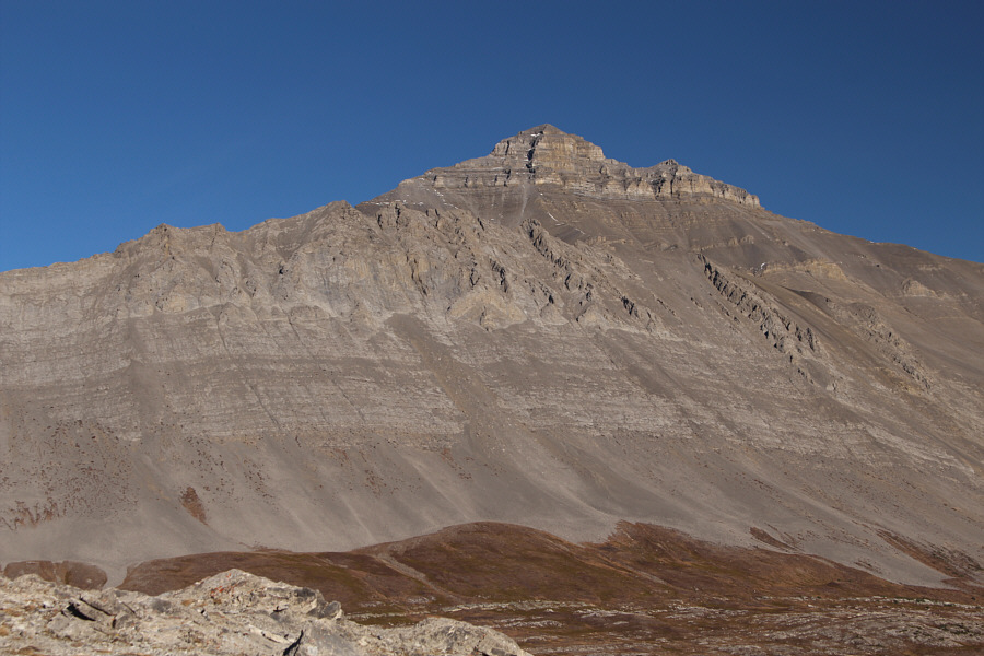
Here is a view of Wilcox Peak's south ridge from the Wilcox Ridge trail.  Also visible on the right horizon is Sunwapta Peak.
Looks more interesting from Wilcox Lake! Nigel Peak commands the eastern flank of Wilcox Pass.
Low brown mound doesn't mean it's a pile of shit! Most of Mount Athabasca's north face is in shadow late in the day.  The low brown mound at far left is Boundary Peak.
I remember walking onto the toe of the glacier in the late 1970s... The Athabasca Glacier is undoubtedly receding at the moment.  For comparison, check out this photo from 2003 which shows the toe of the glacier still covering the upper lake which did not exist then.

Don't try short-cutting back to the trailhead from here; there's a ravine lower down that might be tricky to get across.

Zosia works her way back along the Wilcox Ridge trail with far-reaching views to the southeast.


Made of 100% recycled plastic from landfills! Near the end of their hike, Sonny and Zosia stop and relax in a couple of red Adirondack chairs placed strategically by Parks Canada.
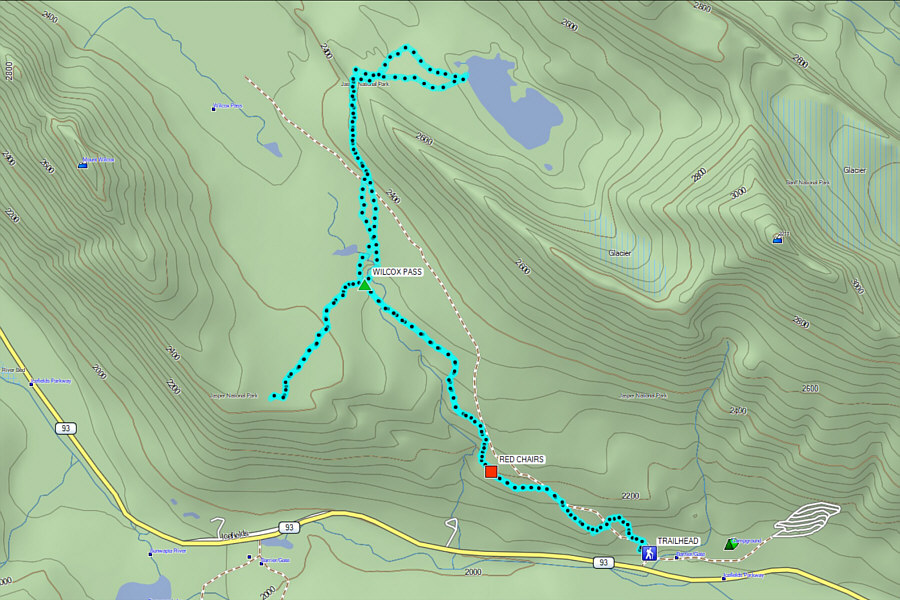
Best Plan B ever! Total Distance:  15.3 kilometres
Round-Trip Time:  7 hours 42 minutes
Cumulative Elevation Gain:  779 metres

GPX Data