BOU AVENUE
Flatiron And Needle Peak
On 4 July 2025, Zosia Zgolak and I climbed both Flatiron and Needle Peak in British Columbia's Coquihalla Summit Recreation Area.  I first climbed Needle Peak on my own in 2014, but at the time, I had been too lazy to include an ascent of its unofficially-named outlier, "Flatiron".  Zosia initially had some misgivings about climbing Needle Peak, but my recollection of the ascent was that the scrambling was a lot of fun while the exposure was mild.  In any case, we opted to tackle the technically easier Flatiron first before making any decisions about continuing up Needle Peak.

The trailhead (49.59528, -121.12534) is located along a dirt road which runs parallel to and on the south side of Highway 5 near Zopkios Rest Area (exit 217).  A narrow tunnel under the highway connects the dirt road with the rest area, but it may be tricky to navigate past trucks parked near the north end of the tunnel.  Use caution when driving here.  There is currently a lot of construction around the trailhead, and most hikers simply park somewhere along the dirt road.  Likely in the future, there will be a proper parking lot built here.

Starting from an unmistakable trailhead sign, Zosia and I followed the well-defined trail through a short stretch of bush and then a recently logged area before entering forest and settling into a steep uphill grind.  We eventually emerged from the forest and continued climbing more moderately up the semi-open access ridge.  Going over rock slabs here, the trail is sometimes not well-defined, but orange trail markers help point the way.  A large cairn marks the turnoff to Needle Peak, but we ignored it for the time being and followed the continuation of the trail which drops steeply into a dip along the connecting ridge to Flatiron.  Climbing out of the dip, we reached a picturesque tarn where we then turned right and scrambled up easy rock bands to gain the summit plateau.  The highest point of Flatiron is marked by a cairn with a pink ammo box, but we wandered further to the southwest side of the plateau before stopping for a break.
They could also use a better highway interchange here instead of just a narrow tunnel! 
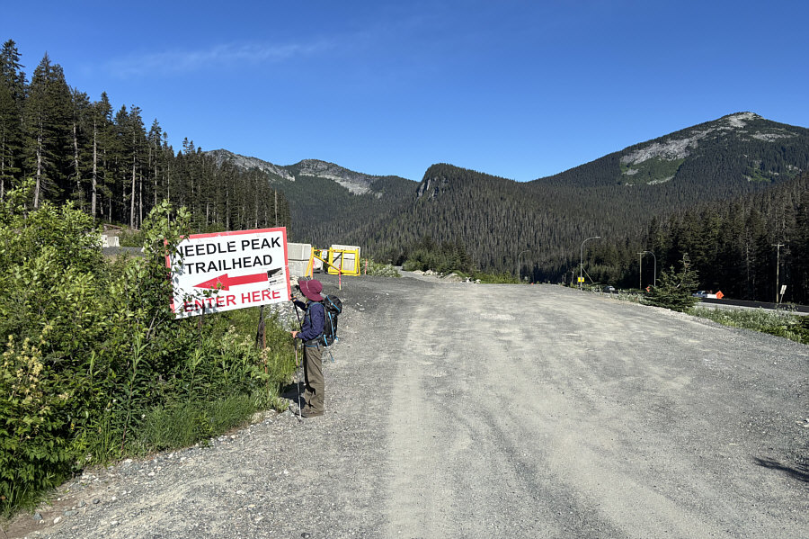
Zosia finds the well-marked trailhead.  The trailhead parking area appears to be slated for some improvements in the near future.
No nonsense--just climb! 
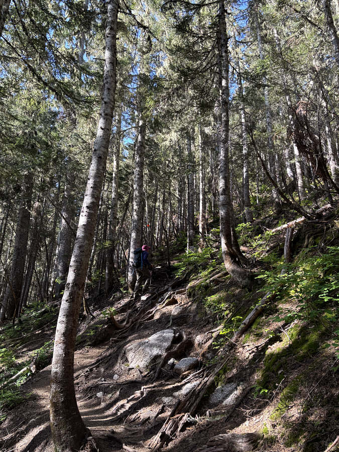
The trail is relentlessly steep for the first couple kilometres.
I'd forgotten what an interesting ascent Yak Peak was. 
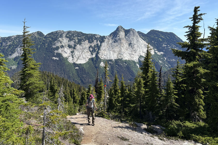
As the angle of the slope eases, the forest begins to thin out allowing views across the valley of Yak Peak.
Doesn't really resemble a needle from this angle! 
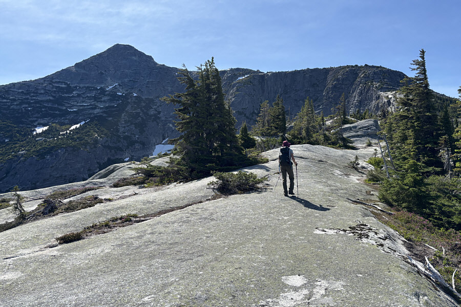
Needle Peak dominates the view as Zosia hikes up the access ridge.

Time to lose some hard-won elevation...

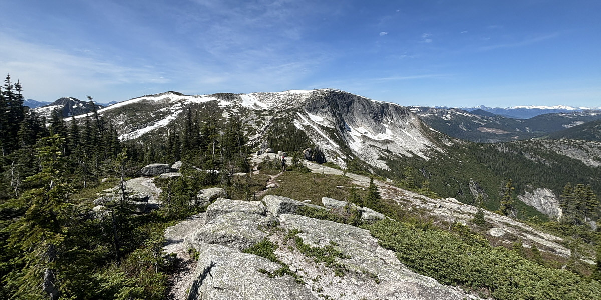
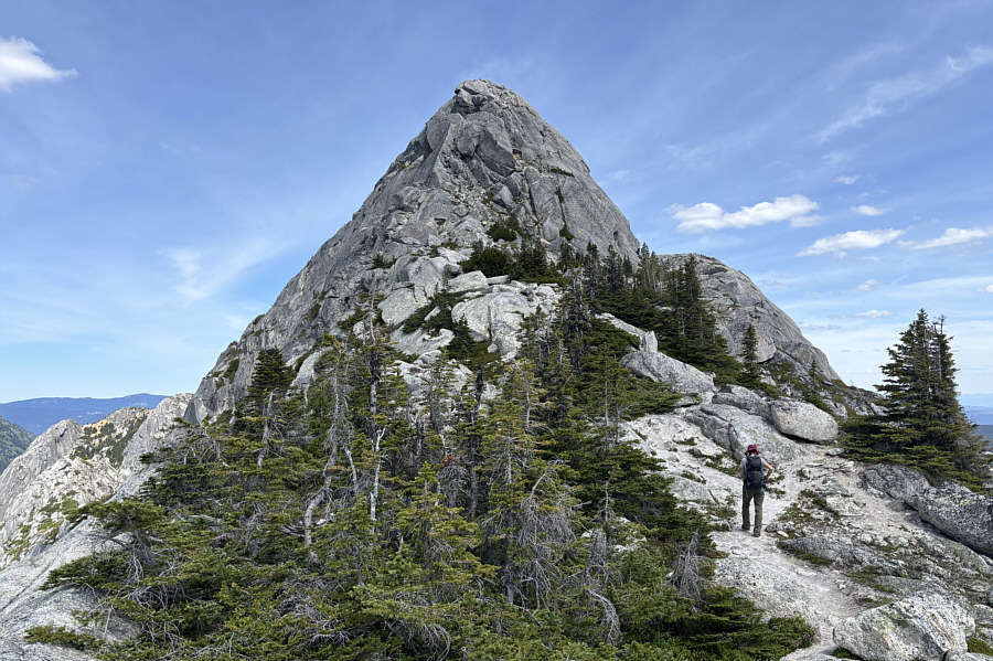
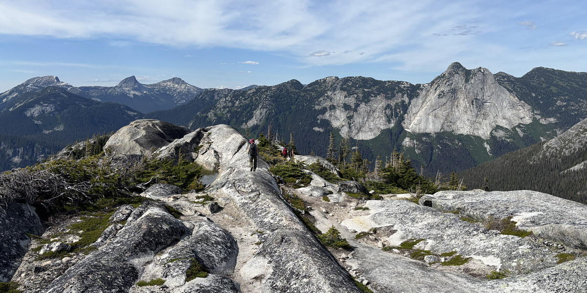
Here is a view of "Flatiron" from the end of Needle Peak's west ridge.


The mountain looks most impressive from this angle. 
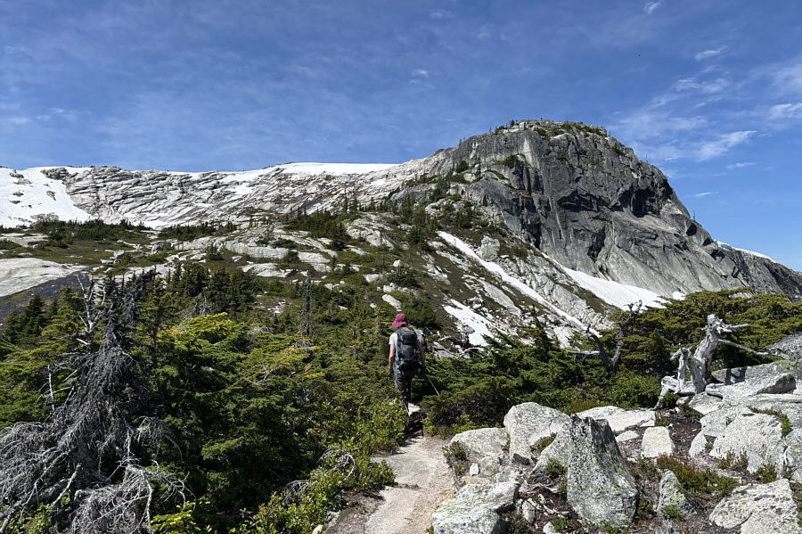
Zosia crosses the connecting ridge to Flatiron.
Looks like some good skiing is still possible above the tarn! 
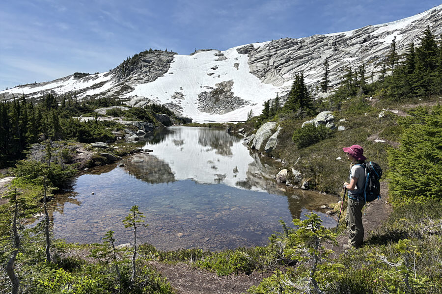
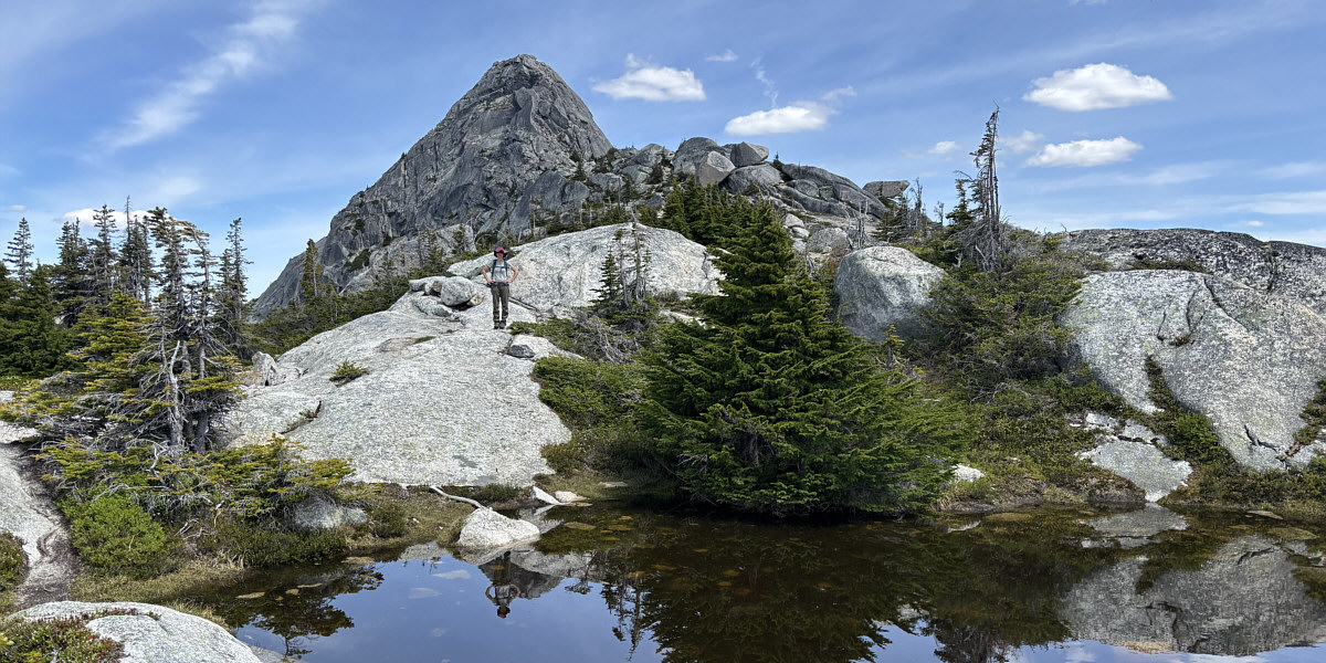
Zosia arrives at a picturesque tarn nestled under the eastern slopes of Flatiron.
Look for beaten paths and cairns/flagging. 
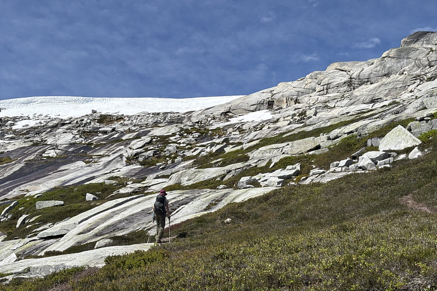
Although the slabs here look innocuous, the easiest line of ascent is actually out of view to far right.
Though the green rocket is shown on a higher contour line on some maps, it's actually lower than the true summit. 
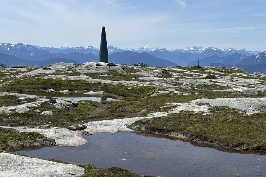
A "green rocket" is situated near the south side of the summit plateau.  Visible on the horizon right of centre is Mount Baker (US).
Lotsa peaks I'll probably never climb (very difficult to access)! 
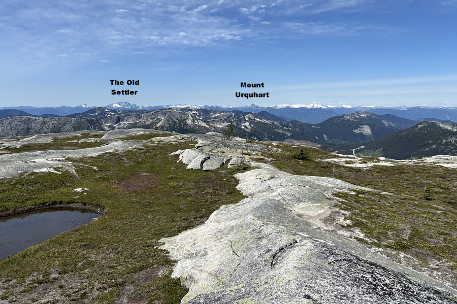
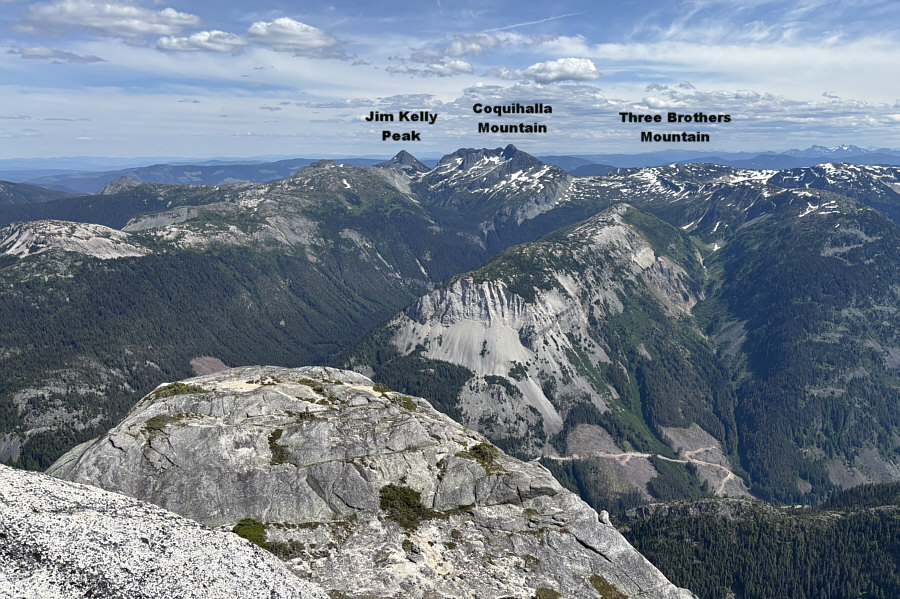
Here is the view to the west from the summit of Flatiron.
Unfortunately no Fireball whiskey in the pink ammo box! 
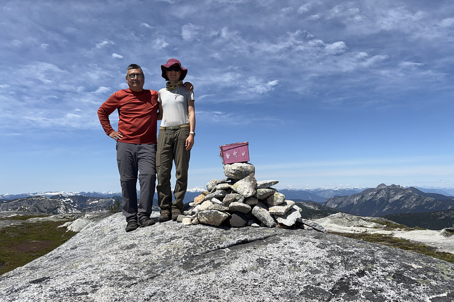
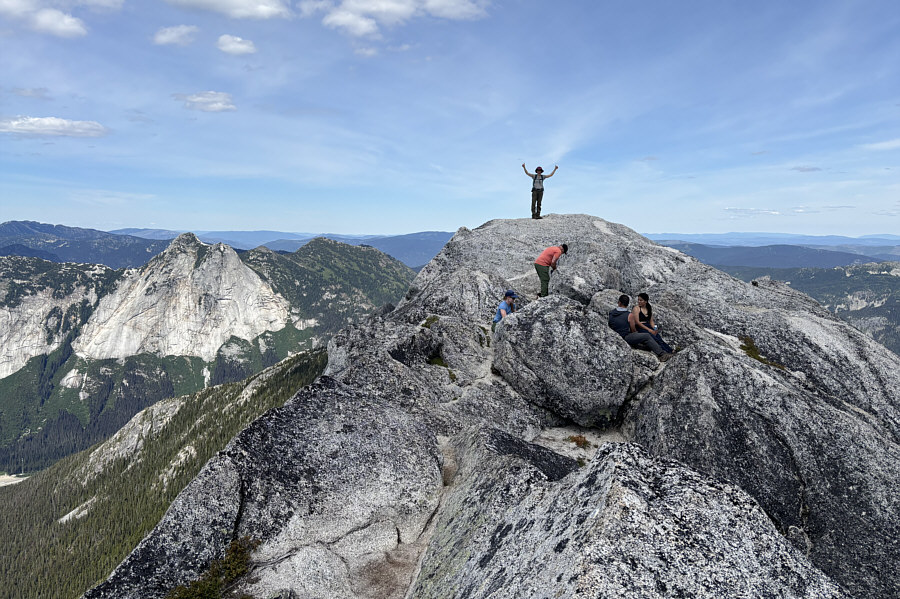
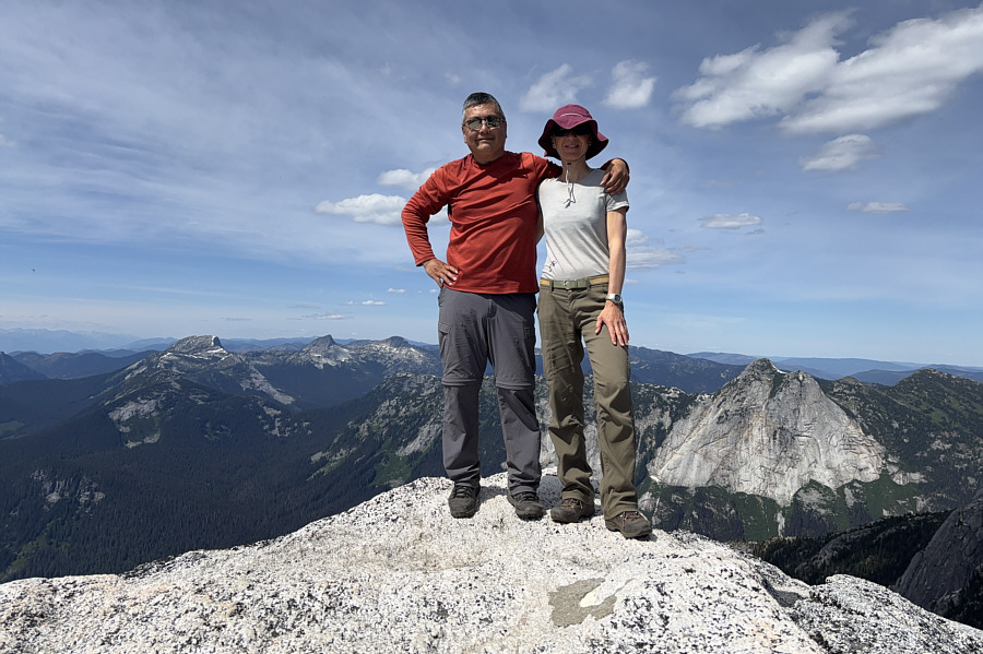
Sonny and Zosia stand on the summit of Flatiron (1903 metres).
Now it looks more like a needle! 
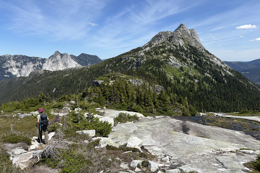
After descending from the top of Flatiron, Zosia turns her attention to Needle Peak (right).
When we resumed hiking, Zosia felt confident enough to give Needle Peak a try, and we promptly retraced our steps down to the tarn and across the connecting ridge.  After climbing back up to the aforementioned large cairn, we took the branching trail that rises up to a rocky knob marking the start of Needle Peak's west ridge.  A fixed chain attests to the difficulty of surmounting the rocky knob which is the first of two cruxes along the west ridge.  Zosia scrambled up the first crux just fine, and in addition, she had to assist another hiker who was shaking uncontrollably with fear while descending the same spot.  Fortunately, she managed to coach him down to safer ground without incident.  Beyond the rocky knob, we enjoyed a relatively level stretch of easy hiking before reaching the base of the summit block.  There are two gullies here, and we inadvertently followed two other couples who went up the incorrect left-hand one.  Realizing our mistake, we all still managed to scramble over to the correct right-hand gully without losing any hard-won elevation, but this entailed an awkward slide through a rock cleft.  Once in the correct gully, we scrambled up the final narrow section--the second crux--before popping out onto easier terrain just before the summit.

For our descent, Zosia and I essentially retraced our steps back along Needle Peak's west ridge and down the access ridge.  We safely down-climbed both cruxes on Needle Peak, and other than one spot along the access ridge where we strayed a little off-track, the rest of the hike out went without a hitch.
Now the real fun begins... 
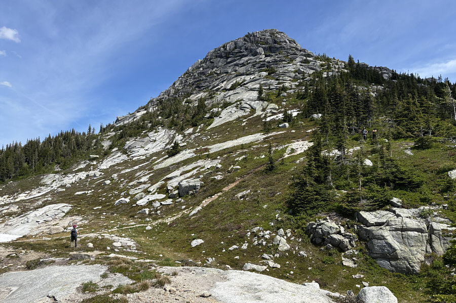
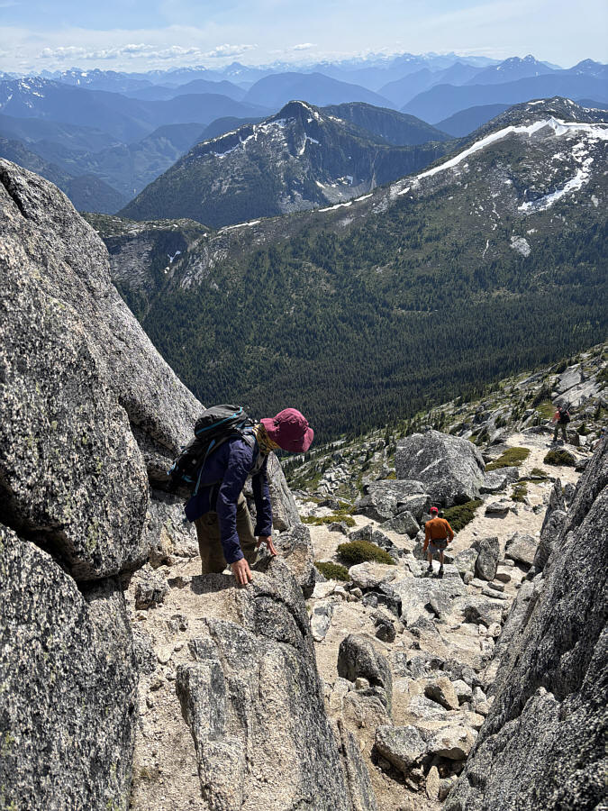
Zosia takes the turnoff to Needle Peak which leads to the rocky knob above--the first crux.
The old adage applies here--if you can't down-climb what you climb up, you shouldn't climb up at all! Two hikers (top centre) can be seen descending the first crux.
This was harder than I remembered! The steepness of the first crux is better illustrated from this angle.

Not a place to linger during mosquito season!

Zosia stands above a small tarn along a broad and flat section of the west ridge.


Maybe after the next big earthquake on the coast... 
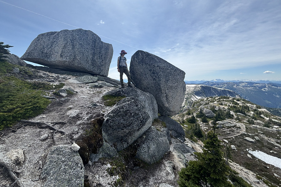
A couple of big boulders look ready to topple down the ridge.
Ready for more excitement? 
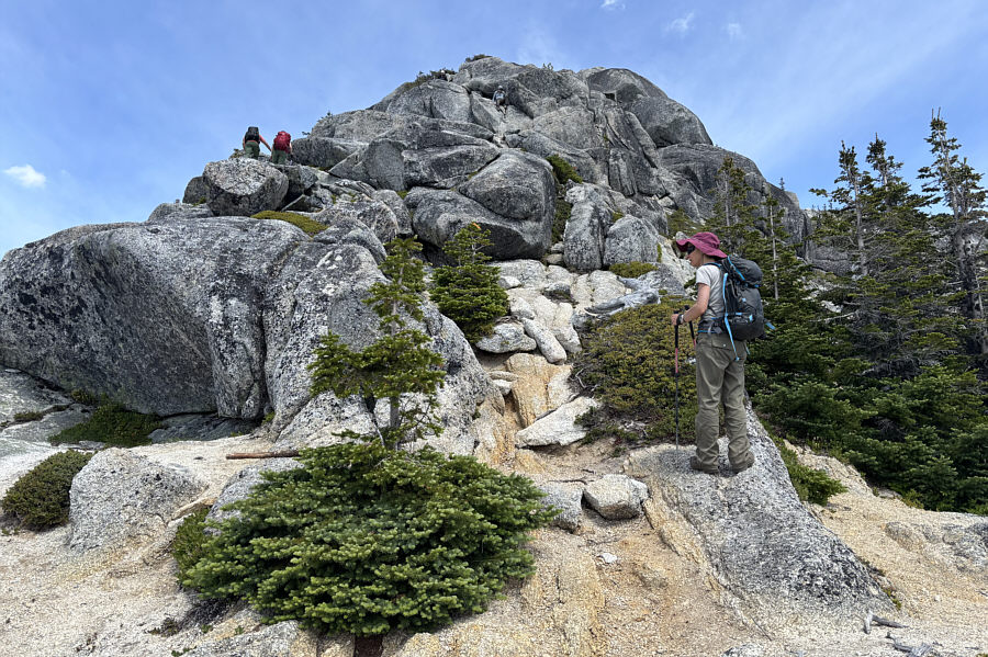
Zosia approaches the summit block of Needle Peak.
Should be going climber's right (out of the photo) instead. Zosia follows another couple up the summit block, but this is not the best way.
Save yourself some grief and don't come up this way! 
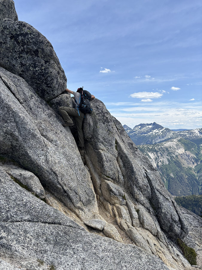
Sonny scrambles up the incorrect gully on the summit block.

Photo courtesy of Zosia Zgolak

This is the way. 
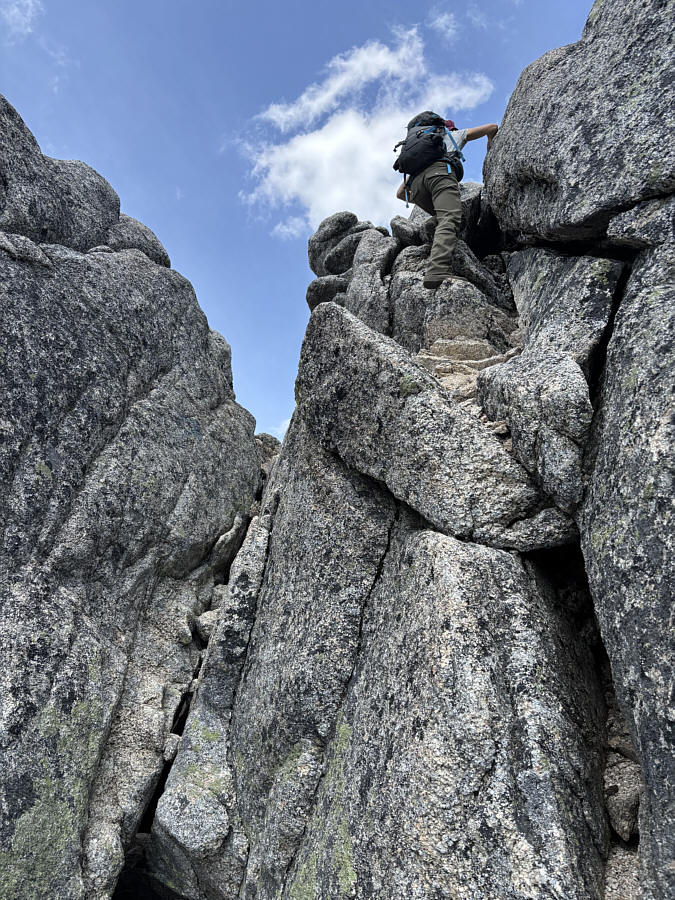
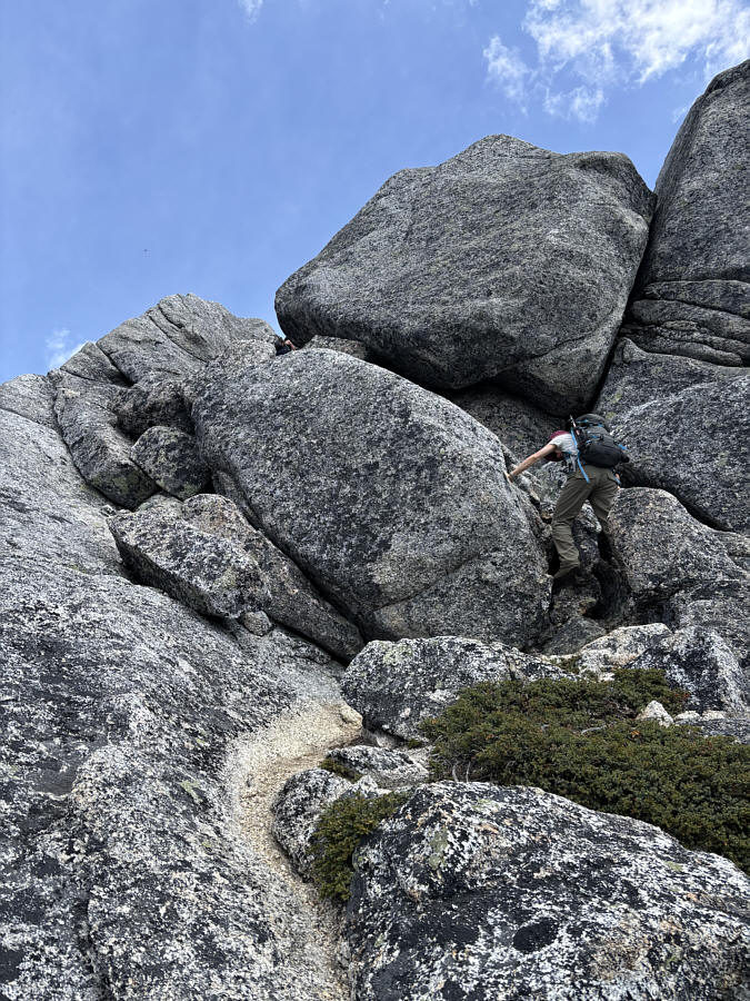
After getting into the correct gully, Zosia scrambles up the second crux.
Yay...second summit of the day! Zosia reaches the summit of Needle Peak (2085 metres).
Even better than the first time I was here! Sonny and Zosia pose together on the summit.
We were on Three Brothers Mountain only two days ago! Here is the view to the southeast from the top of Needle Peak.
We felt some pressure here to descend quickly since there was a really obnoxious foursome right behind us. 
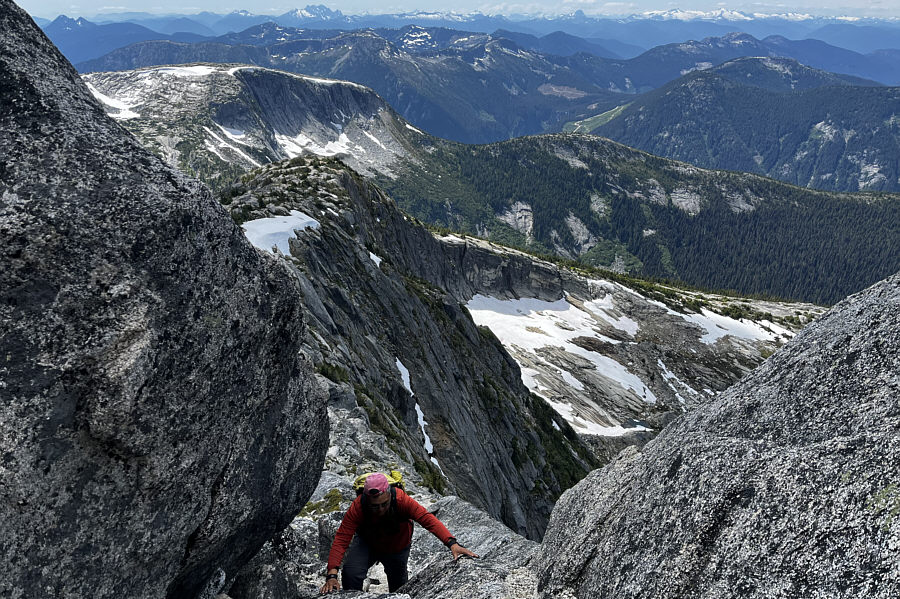
Zosia carefully down-climbs the second crux.
I'm glad we did Flatiron first--it would suck to have to gain elevation again after a second summit! 
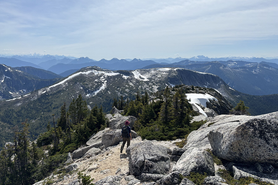
Zosia hikes back along Needle Peak's west ridge with Flatiron visible ahead.

I would like to visit those peaks in the future...

Zosia hikes back down the access ridge.  Visible at far left are (L to R) Alpaca Peak, Vicuna Peak and Guanaco Peak.


Deservedly popular outing and worthy of repeat visits! 
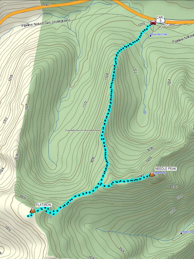
Total Distance:  14.4 kilometres
Round-Trip Time:  9 hours 25 minutes
Cumulative Elevation Gain:  1086 metres

GPX Data