BOU AVENUE
Iron Creek Mountain

Taking advantage of a stellar weather forecast on 3 April 2026 and the recent seasonal re-opening of access road SR 532, Zosia Zgolak and I ventured once again to Alberta's Cataract Creek Snow Vehicle Public Land Use Zone to climb unofficially-named "Iron Creek Mountain".  We were mostly inspired by Bob Spirko's 2008 trip report, but instead of using his approach from Bear Pond, we opted to try part of the route used in 2017 by Cornelius Rott who started higher from The Hump (50.20116, -114.44632).  We had some uncertainty if Rott's route would even be feasible given the abundance of snow in the mountains this spring, but there was really no way of knowing except to go see for ourselves.  The best part about this was that we would find out fairly early in the trip if the route would go or not.

Starting from the pullout at The Hump, Zosia and I climbed the unsigned trail that heads up a draw toward Hailstone Butte.  A few lingering snow patches along the trail here did not pose any serious issues for us.  The crux of the trip was crossing the steep slope under the east side of Hailstone Butte's summit block--this is described as the "Elk Traverse" in Gillean Daffern's Kananaskis Country Trail Guide.  The lingering snow patches here were of greater concern especially since we had neglected to bring ice axes.  Fortunately, we were able to keep mainly to the dirt which was just loose enough to allow us to tramp a stable beaten path.  Also, the few small but unavoidable snow patches we had to cross were not too icy.

After safely getting across the Elk Traverse, Zosia and I tagged the rocky knob at the far end which turned out to be the actual high point of the entire trip.  From there, we made a gradual descent of the northeastern slopes of Hailstone Butte.  The abundant snow patches here were again a cause for concern mainly because we wanted to avoid post-holing, but luckily, the snow was generally supportive.  We eventually intersected Hailstone Butte's lookout access road, and with the exception of a few short detours, we were able to follow it down into the valley separating Hailstone Butte from Iron Creek Mountain.  Upon reaching the start of Iron Creek Mountain's south ridge, we left the road and began scrambling up easy rock slabs until we gained the summit ridge.  The remaining walk to the summit was straightforward, but we also continued further to tag the north end of the summit ridge before backtracking for a well-deserved break.

For our return trip, Zosia and I pretty much backed out the way we came.  Descending the south ridge of Iron Creek Mountain, we found it easier to drop down loose rubble slightly to skier's right of the slabs we ascended.  Re-ascending the lookout access road was fairly simple, but after leaving it, we sank to our hips a few times while going through a lengthy stretch of snow that was beginning to become isothermic under the warm afternoon sun.  Thankfully, the wallowing was mostly short-lived, and we managed to get through the remaining snow patches with minimal grief.  Re-crossing the Elk Traverse went without a hitch though it still felt a bit sketchy in a few spots.  The final descent back to The Hump was uneventful.
One of my favourite trailheads in K-Country with great views already! 
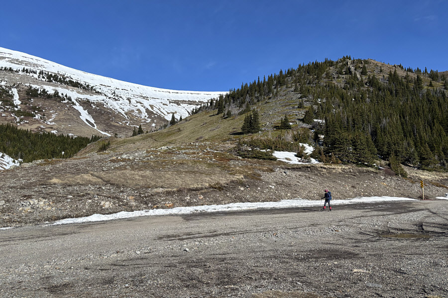
Zosia crosses SR 532 to the start of the trail (left) at The Hump.
I can't believe the conditions I climbed in 13 years ago here! 
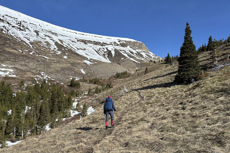
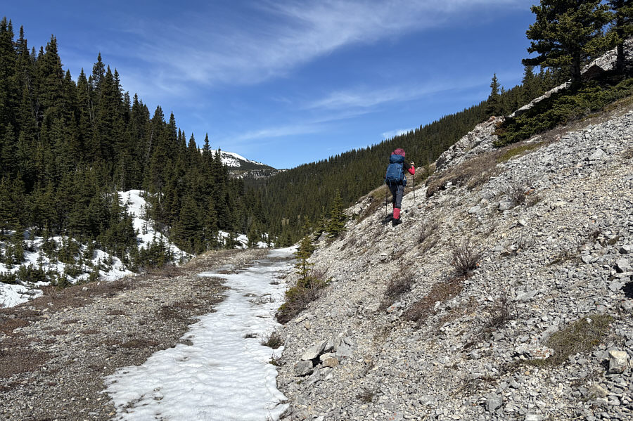
Zosia climbs up the trail leading to Hailstone Butte.
Yeesh...that route doesn't look too appealing from here! 
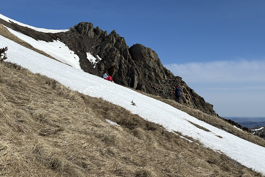
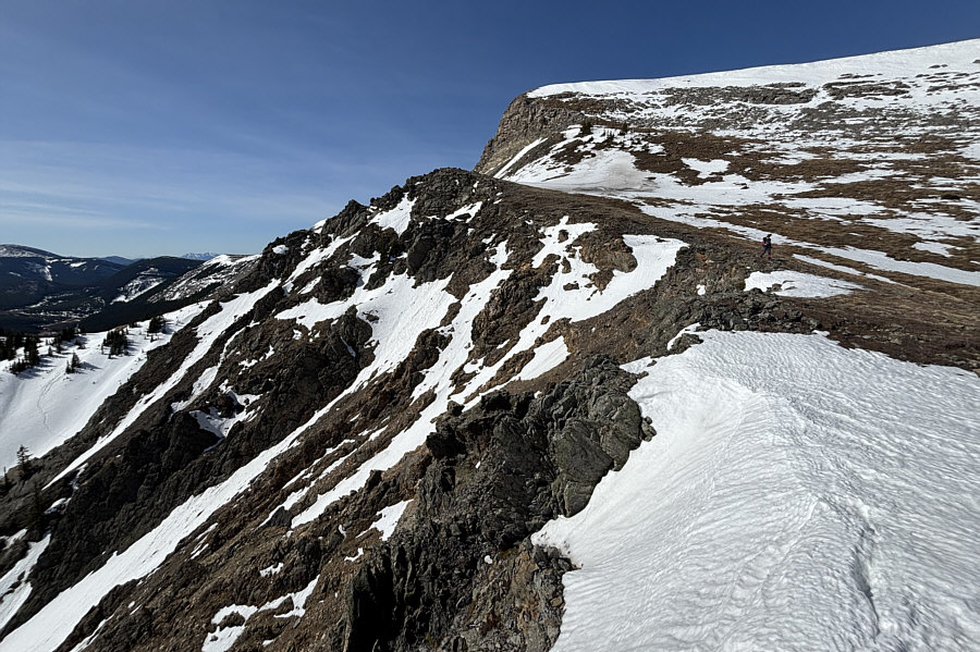
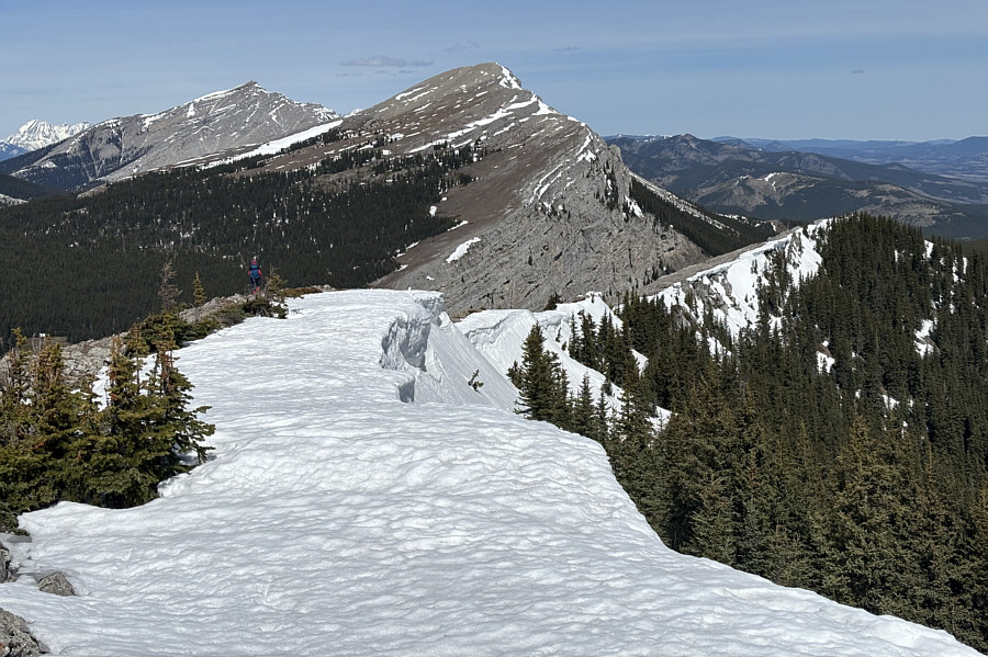
Zosia stops to chat with a couple of hikers from Okotoks.  Zosia would later traverse across the strip of dirt at upper left between the cornice and the snow patch.  Gillean Daffern calls this the "Elk Traverse".
Crux of the hike! 
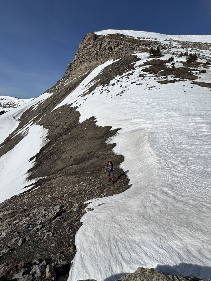
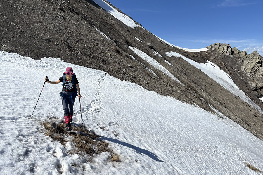
Zosia successfully completes the Elk Traverse (note footprints) below the east side of Hailstone Butte's summit block.
We counted 8 sheep on the slope above Zosia. 
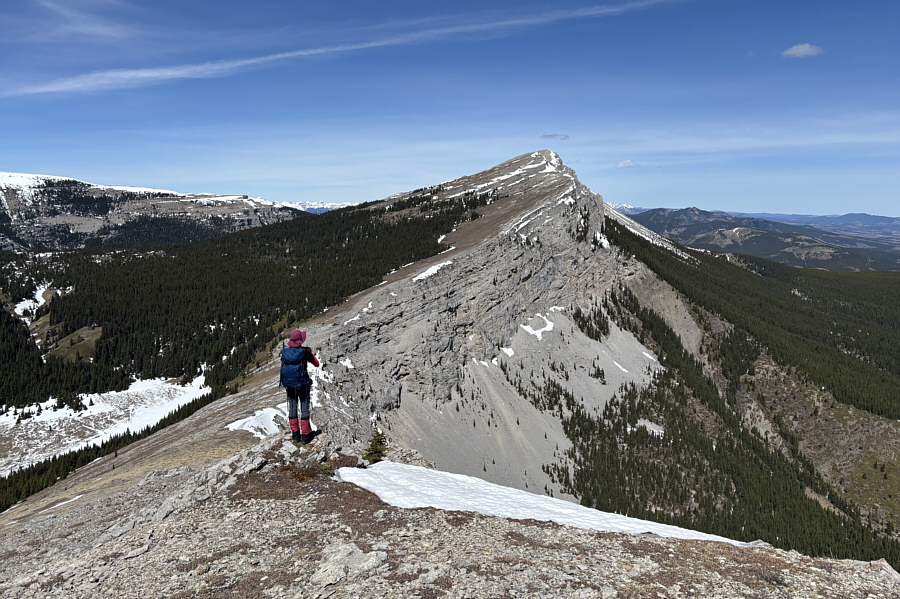
Zosia begins descending from the rocky knob at centre which turns out to be the actual high point (2284 metres) of the entire trip.
We're aiming for the Hailstone Butte access road...see it? 
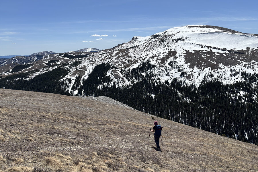
In this view across the snowy northeastern slopes of Hailstone Butte, Sentinel Peak is obvious at centre while, to its right, "Iron Creek Mountain" is harder to discern (it has a large snow patch on the right side of the summit ridge).
Iron Lakes Ridge is another underrated hike in the area. 
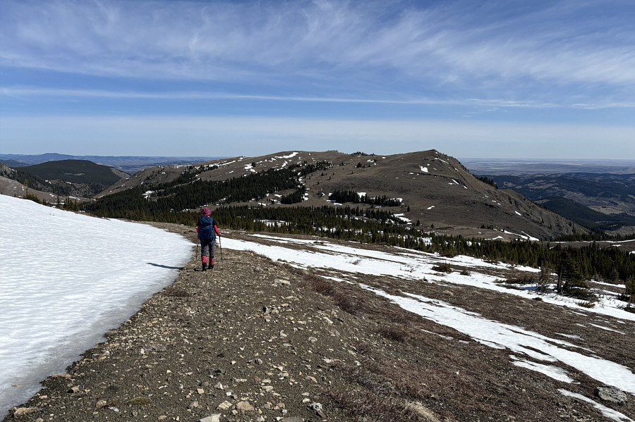
Zosia descends Hailstone Butte's lookout access road.  In the background is "Iron Lakes Ridge".
Looks like a real mountain! 
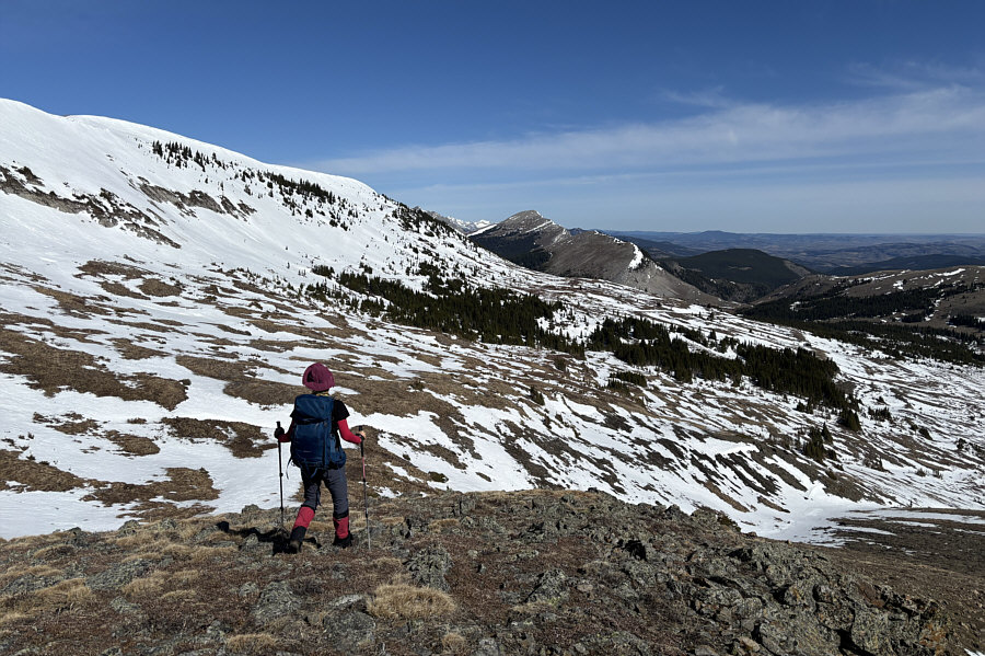
Zosia approaches the rocky south end of Iron Creek Mountain.
The cairn is easy to miss! 
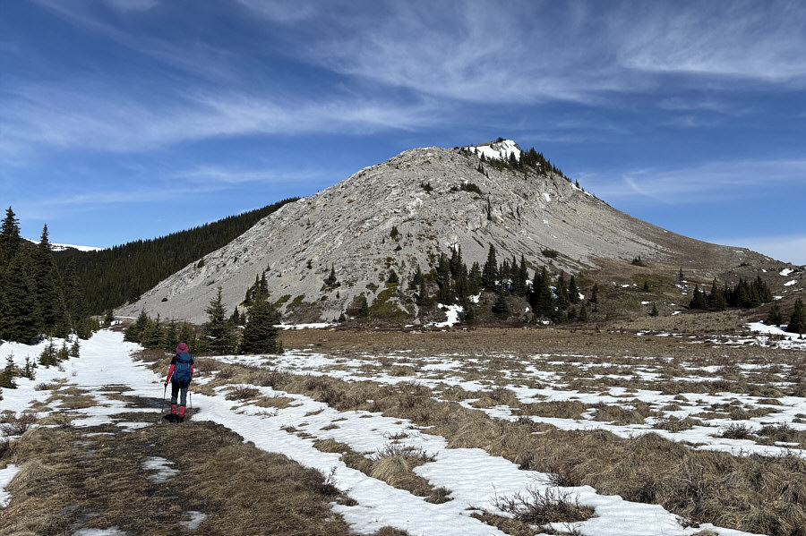
A small cairn (lower centre) marks the start of a beaten path which leaves the road to climb up Iron Creek Mountain.
You can scramble as much or as little as you want here! 
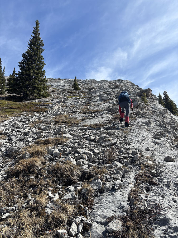
Zosia soon abandons the beaten path and simply climbs straight up the rocky ridge.
Still some climbing left from here! 
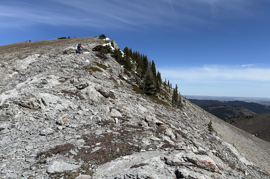
Zosia reaches the end of the rocky section on the south ridge.
Go Raptors! 
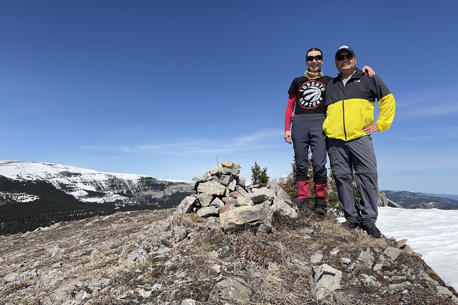
Zosia and Sonny stand on the summit of Iron Creek Mountain (2246 metres).
Watch for some big holes in the snow cornices! Zosia continues to the north end (far right) of Iron Creek Mountain's summit ridge.  Mount Burke (left) and Sentinel Peak dominate the view to the north.
Looks tempting to just keep walking to the top of Sentinel Peak! Zosia stands at the north end (2203 metres) of Iron Creek Mountain's summit ridge.

Maybe we should consider AT skiing on Hailstone Butte next year at this time...

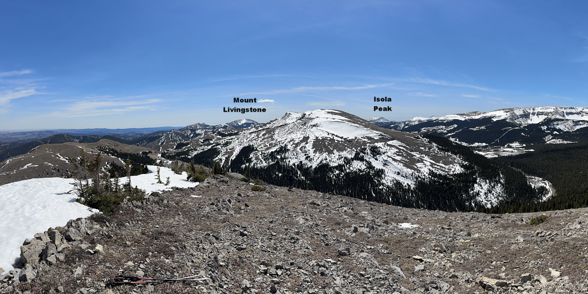
Here is a panoramic view to the south from the summit of Iron Creek Mountain.


A return to Plateau Mountain might be warranted for the near future...

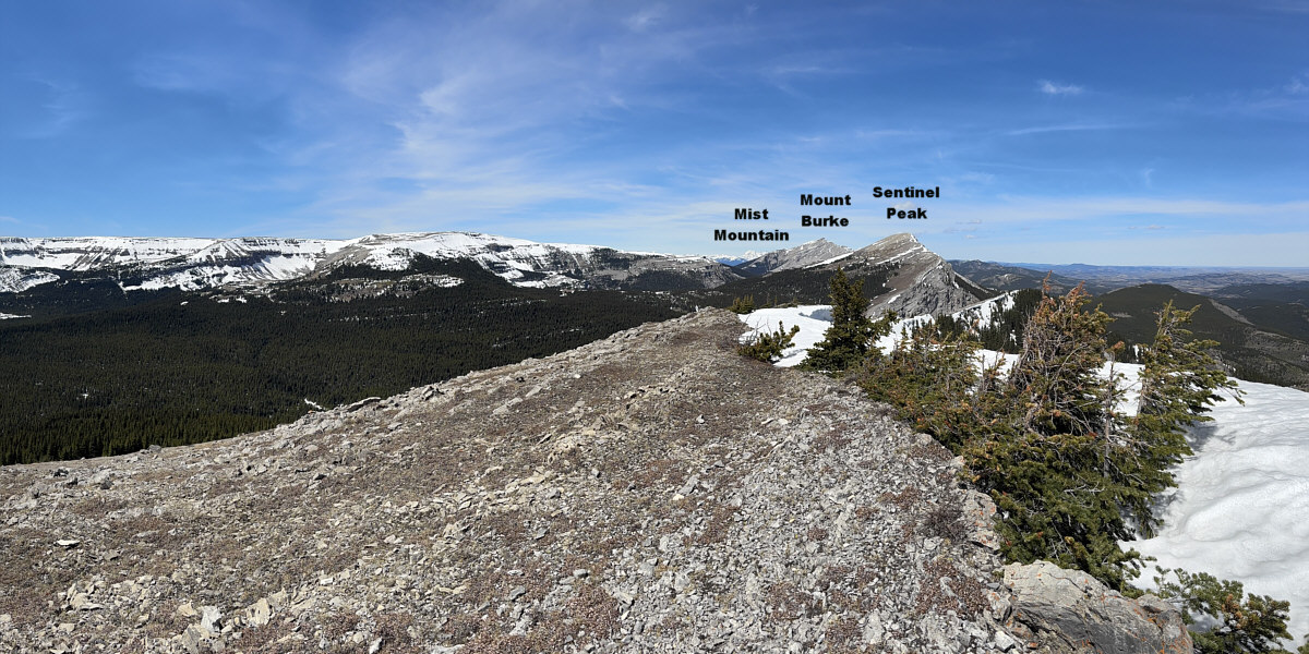
Here is a panoramic view to the north from the summit of Iron Creek Mountain.


We're a long way from the knob below Hailstone Butte's summit block... Zosia descends the south end of Iron Creek Mountain.
This pond is actually one of the sources for Livingstone River. 
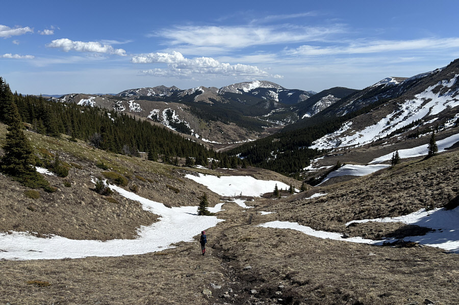
Zosia passes a small pond as she hikes back along the lookout access road for Hailstone Butte.
This time, we counted only 6 sheep in this area. 
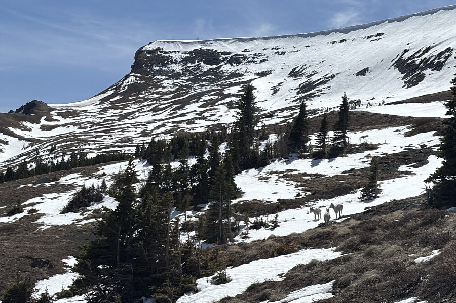
Several sheep move across a snow patch under the northeastern slopes of Hailstone Butte.
Barely! 
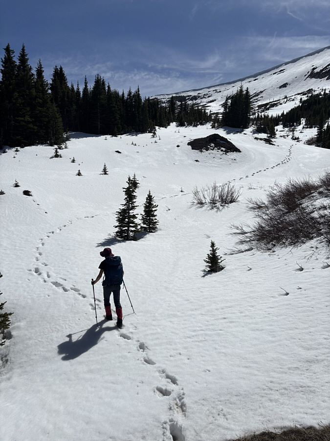
Despite increased temperatures in the afternoon, the snow is still generally supportive.
Nearing the light at the end of the proverbial tunnel! 
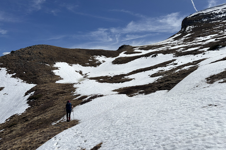
Zosia has a snow-free path back to the rocky knob at centre.
Big sigh of relief! Zosia safely re-crosses the Elk Traverse below the east side of Hailstone Butte's summit block.
Still a few annoying snow patches to navigate on the way down here! Saddle Mountain, Windy Peak and Mount Livingstone are visible on the central horizon as Zosia makes the final descent to The Hump.
A very rewarding hike despite the many ups and downs. 
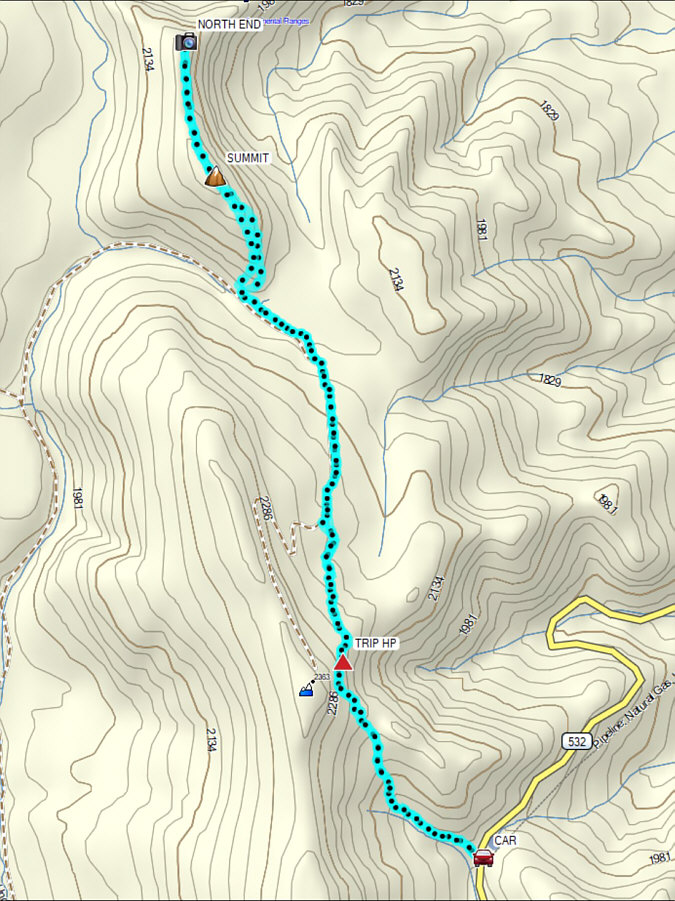
Total Distance:  10.6 kilometres
Round-Trip Time:  7 hours 18 minutes
Cumulative Elevation Gain:  688 metres

GPX Data