


Check out Linda's trip report
here.
|
|
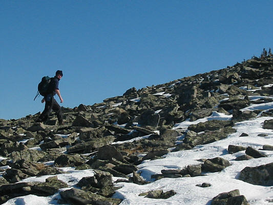
Linda and Kelly emerge above tree line at the north end of Windy Peak. Highway 532 is visible at centre just beyond the cutblock separating North and South Twin Creeks. |
|
|
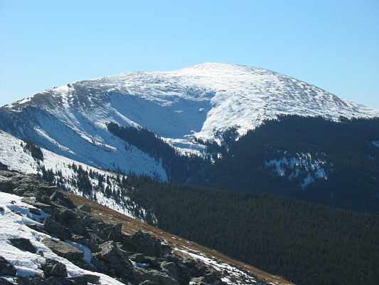
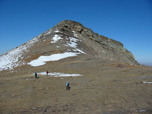
The view to the south is dominated by Mount Livingstone. |
|
|
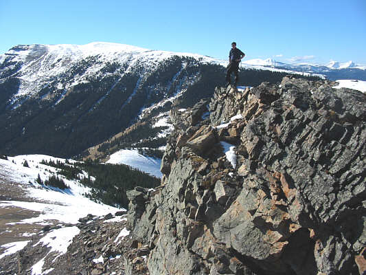
Kelly and Linda stand on top of 2249-metre Windy Peak. Ironically, there is hardly any wind on this day. |
|
|
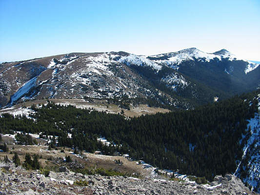
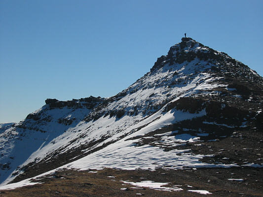
The double summits of Saddle Mountain are visible at right in this view from Windy Peak. |
|
|
Here is a closer look at the double summits. |
|
|
Visible on the horizon to the west are (L to R) Mount Pierce, Mount Farquhar, unnamed (and supposedly unclimbed according to Gillean Daffern), Mount Holcroft, and Mount Scrimger. |
|
|
Linda, Dan and Kelly descend the east side of Windy Peak. |
|
|
Dan climbs the "crux" of the route up Saddle Mountain. |
|
|
The Cache Creek Elevators can be seen from Saddle Mountain's north ridge. |
|
|
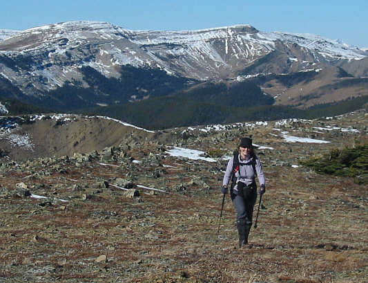
Linda walks up the broad north ridge of Saddle Mountain. Hailstone Butte dominates the view behind her. |
|
|
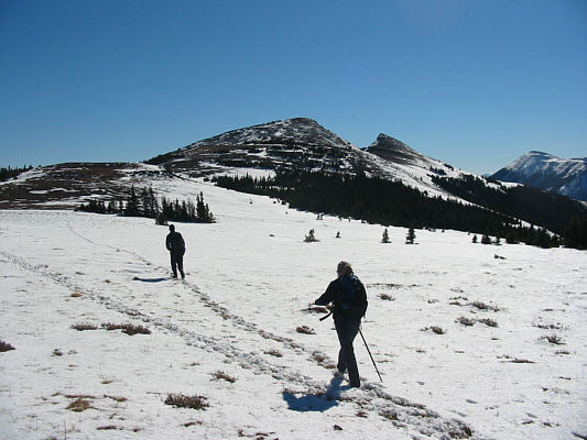
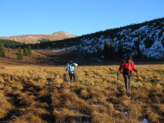
Dan and Kelly follow some tracks in the snow en route to Saddle Mountain. |
|
|
Dan hikes up the final rubble slope. |
|
|
Dan stands atop the north summit of Saddle Mountain. Mount Livingstone is the peak at left. |
|
|
Sonny poses for a photo at the north summit. The marginally lower south summit and Coffin Mountain can be seen in the distance. |
|
|
Dan (silhouetted against the snow at bottom right) makes his way across the 'saddle'. |
|
|
Dan stands on the south summit of Saddle Mountain. |
|
|
There is a lot worth exploring in the Livingstone Range. |
|
|
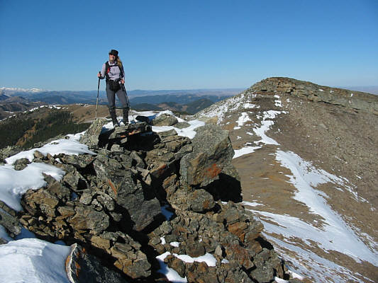
Linda bags her fourth peak of the weekend! The north summit is visible at right. |
|
|
Everyone enjoys a well-deserved break on the south summit. |
|
|
Dan, Linda and Kelly walk back across the saddle in hopes of bypassing the north summit. |
|
|
While bypassing the north summit, Dan scrambles up and over a rare rock band. |
|
|
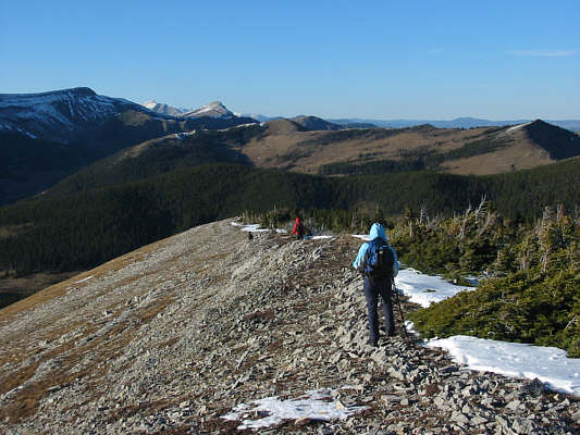
Dan, Linda and Kelly descend the long north ridge of Windy Peak. Visible at upper left are Hailstone Butte, Mount Burke, and Sentinel Peak. |
|
|
Kelly and Linda slosh through the swamp near North Twin Creek. Behind them, Windy Peak is bathed in sunlight. |