


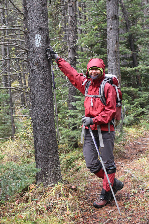
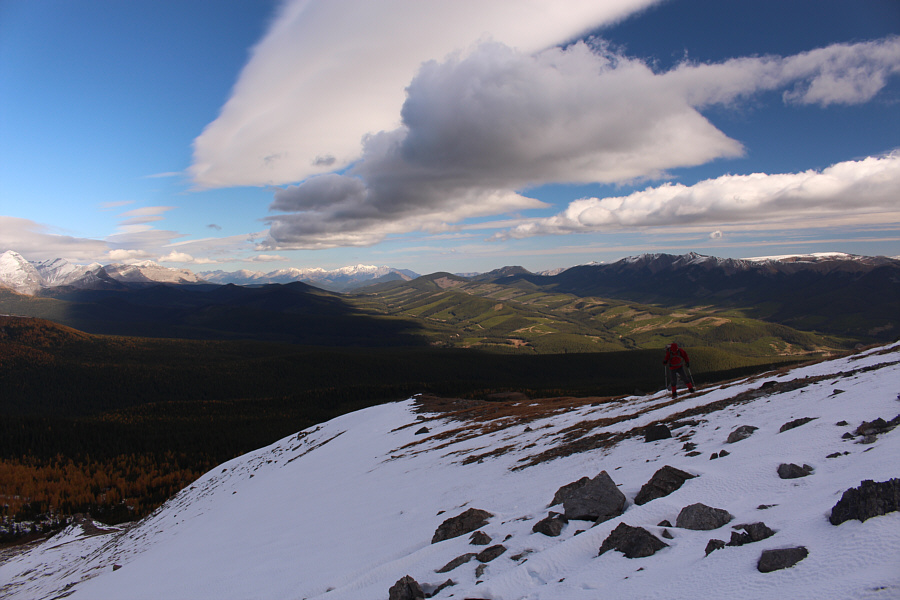
After walking past a large meadow with good camping sites, Aga and I forded Oldman River and made our way through a marshy fen to the start of an obvious cut line heading westward. Although it is unclear whether or not this was Collier's approach route, he likely would have looked at the same topo map (82 J/2) and noted the marked trail which coincides with the location of the cut line. We followed the cut line until it began to turn northward on a high bank overlooking an unnamed creek. We stayed on the trail as it descended slightly until it seemed reasonable to drop down the bank to cross the creek. From there, we did some moderate bushwhacking up the far side aiming for a clearing that I had spotted on Google Earth. Well before we reached the clearing, we stumbled onto an unexpected trail. This trail is not marked on the topo map, but it appeared to be well-maintained. We followed the trail up to tree line and ended up on the Great Divide Trail (GDT) without even realizing it. We briefly hiked the GDT northward before leaving it to climb up an open ridge below Beehive Mountain's northeast face.
Higher up, Aga and I picked up another trail which led us around the north side of Beehive Mountain to a massive west-facing scree slope granting access to the summit ridge. As we climbed up this slope, a thunderstorm crept into the area, and with it came a steady rain. About a hundred metres short of the summit, we hunkered down under a short cliff face to try and wait out the storm. However, this storm would not go away, and when lightning struck the top of a nearby ridge, we quickly pulled the plug on our ascent. We carefully descended the scree slope and then hurried back around the north side of Beehive Mountain as fast as we could with lightning flashing and thunder crashing all around us.
Once Aga and I got back to the lower trail and descended into the trees, we could
relax a bit. Although it was tempting to follow the mysterious
trail out, we were still unsure where it
would lead us. Therefore, we left the trail near where we crossed
the unnamed creek and thrashed up the steep bank to regain our original cut line.
Our return from there was straightforward.
|
|
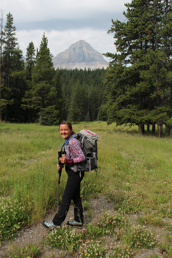
Aga begins hiking in the meadows near Slacker Creek. Beehive Mountain is visible in the distance. |
|
|
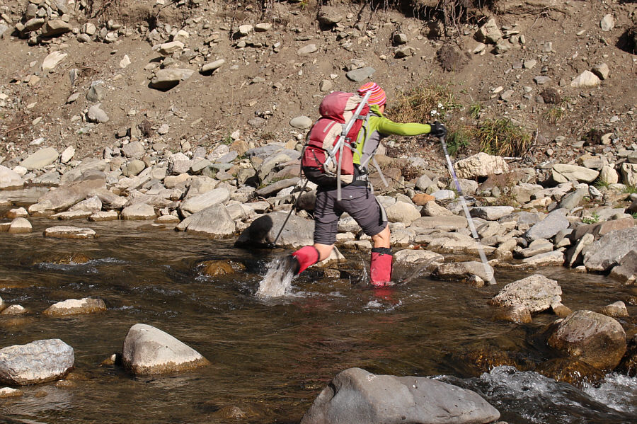
Aga fords Oldman River. |
|
|
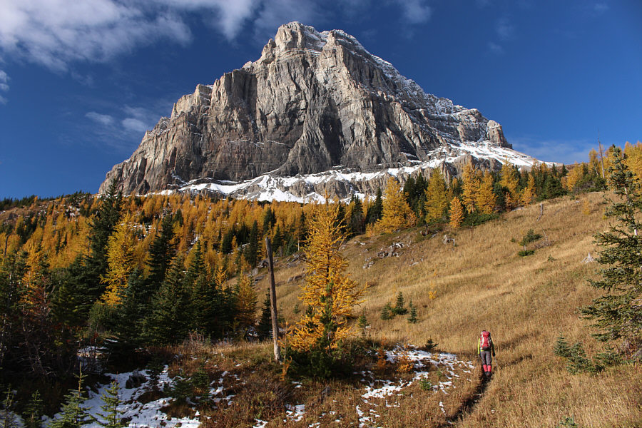
This is the view of Beehive Mountain from near where the cut line turns north. |
|
|
This is the spot to leave the GDT and head uphill. |
|
|
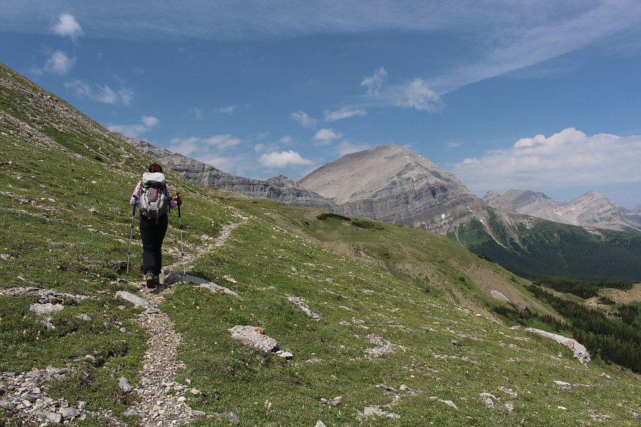
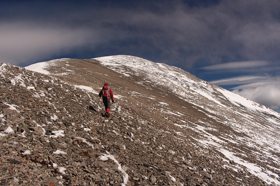
Aga follows a good trail that traverses grassy slopes below the north face of Beehive Mountain. Ahead is Mount Lyall. |
|
|
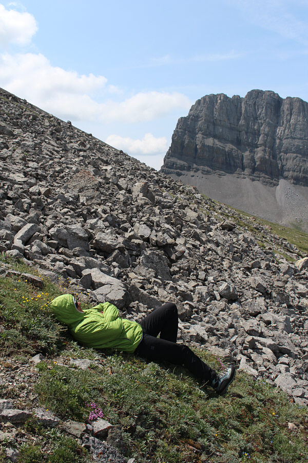
Aga enjoys some alpine napping. |
|
|
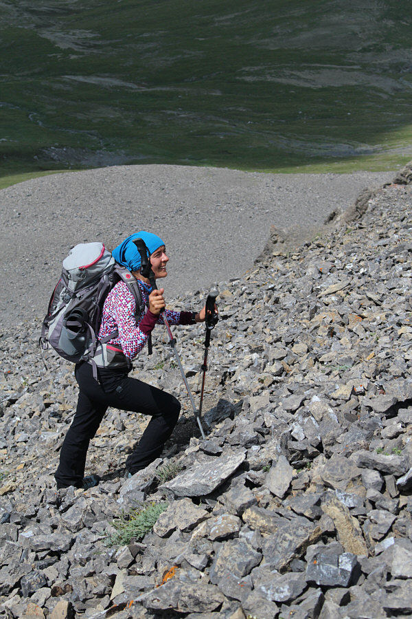
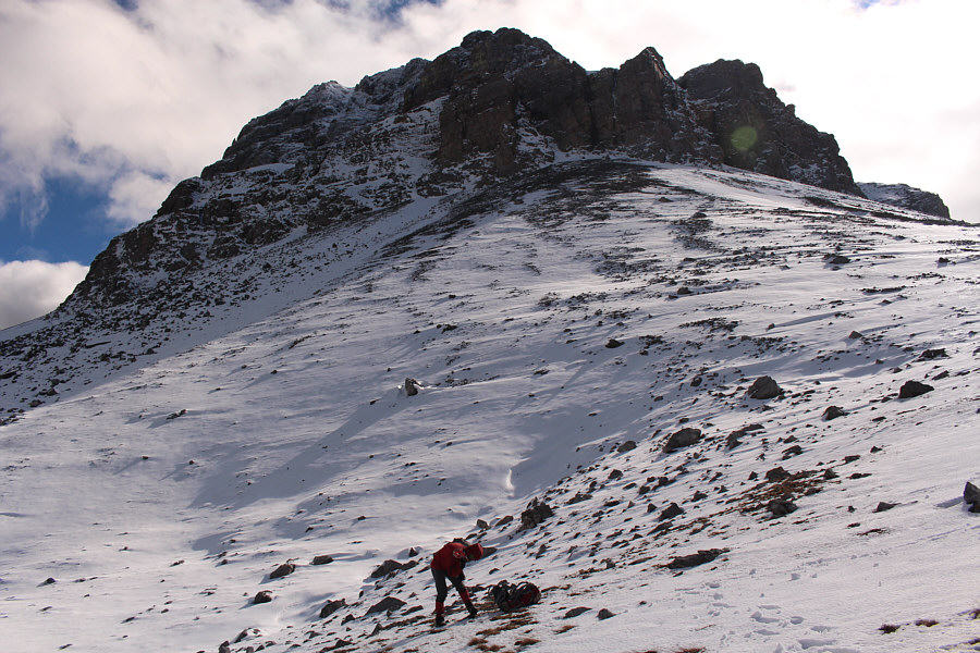
Aga begins climbing a massive scree slope on the west side of Beehive Mountain. |
|
|
Some cliff bands higher up help alleviate some of the monotony of the scree bash. |
|
|
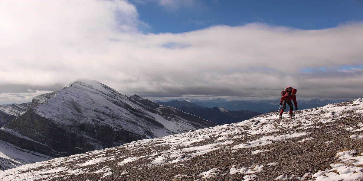
Aga looks up to see how much more suffering she has to endure to reach the top. |
|
|
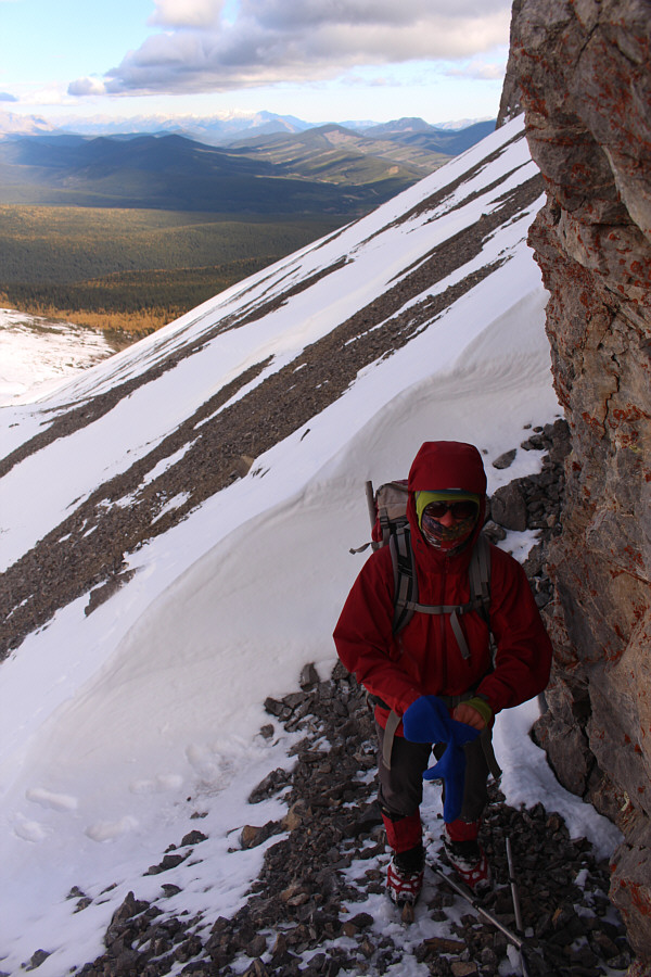
Aga relaxes with an apple as she prepares to wait out a passing thunderstorm. |
|
|
The thunderstorm intensifies over the entire area. |
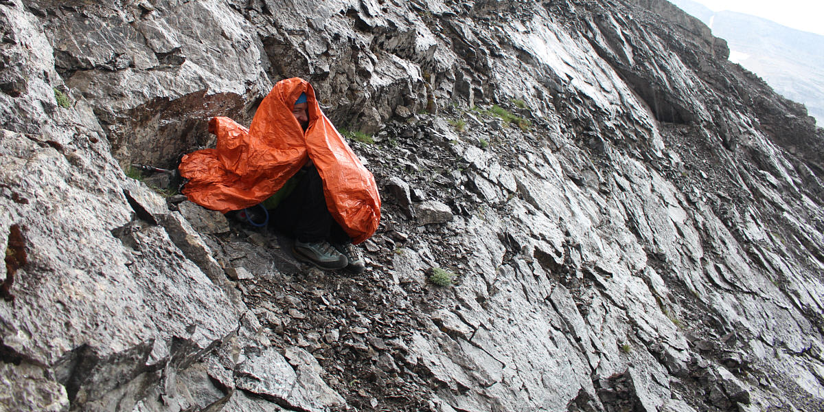
Aga huddles under her emergency bivy sack as rain begins to fall.
 |
This is moments after lightning struck the top of this ridge immediately to the west of Beehive Mountain. |
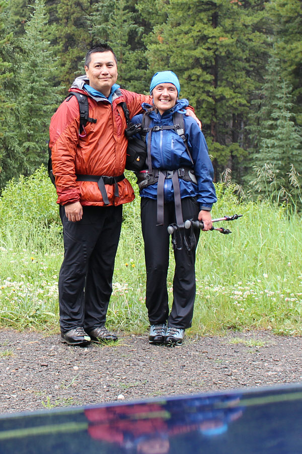 |
Despite missing the summit and getting soaked by rain, Sonny and Aga are happy just to make it back to the car safe and sound. |
After arriving late and camping the previous night near
Oldman River Provincial Recreation Area, Zosia and I ate a quick
breakfast at the campground before driving up Oldman River Road.
The washout along the road a few kilometres before our starting point at
Slacker Creek was still unrepaired over a year later. Fortunately,
the bypass had not gotten any worse, and I was still able to drive across
albeit with a little bit of scraping on the bottom of my Honda CR-V.
From the same spot that I had parked at last year, Zosia and I walked
across grassy meadows to the Oldman River and were delighted to find a
downed tree spanning the waters. Our joy was short-lived though as
we both found that crossing atop the tree was trickier than expected.
On the far bank, we searched around a bit before finding a trail which
paralleled the river. We followed this trail southward until we
reached Soda Creek where we found the start of its namesake trail.
With the exception of a few muddy spots, the Soda Creek trail was in excellent shape overall. Zosia and I hiked up to the GDT without any issues, and from the junction, we hiked northward for another 200 metres before leaving the trail as before to head up the open ridge northeast of Beehive Mountain. Unlike my previous trip, the trail which traverses the north side of the mountain was completely covered with snow on this day. I was still able to discern where the trail went, and the post-holing was not bad. However, the snow was wind-blown and crusty, and I was concerned about the possibility of encountering icy conditions higher up similar to what I experienced on Mount Kidd South Peak years ago. As we rounded the north side of the mountain though, my concerns about the snow were quickly forgotten as we were pummeled by powerful winds. Every step forward now became a struggle as we slowly gained height while traversing toward the vast scree slope on the west side of the mountain. Although much of the scree slope was plastered with snow, conditions were not yet icy, and the snow made climbing much easier. Still, the slope was steeper than I remembered, and because of the foreshortened view, it seemed to take an inordinately long time to reach the broad summit ridge.
At this point, the fierce wind was actually at our backs, and I felt like I was being pushed right up the mountain. At the crest of the summit ridge, the wind was strong enough to knock both Zosia and me off our feet, but we found calmer conditions after stumbling for a few metres to the lee side of the ridge. It felt like heaven to get out of that wind and warm up a bit in the afternoon sunshine! The remainder of the ascent is an easy plod, but we tried to minimize our exposure to the wind by staying to the lee side of the summit ridge. As it turned out, the wind was not as bad at the double summits of equal height, and we were able to prolong our stay there. Unfortunately, we both forgot to look for a geocache which is supposedly stashed in the summit cairn.
For our descent, Zosia and I retraced our steps almost completely. We ran into the teeth of the ferocious wind again while dropping down from the summit ridge, but we quickly got through the worst of it by plunge-stepping down the snowy scree slope. A few steep spots where the snow coverage was thin proved to be a little tricky to descend, but we both managed to get down safely without incident. The hike back around the north side of the mountain went without a hitch, and it was nice to get out of the wind once we regained the GDT and Soda Creek trail. The remainder of our hike out was uneventful.
In retrospect, the route up Beehive Mountain turned out to be more
challenging to research than to climb, but after all my tribulations,
checking this one off my to-do list felt especially gratifying.
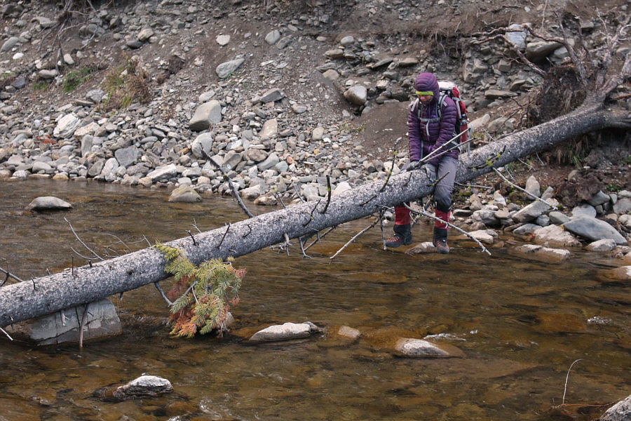 |
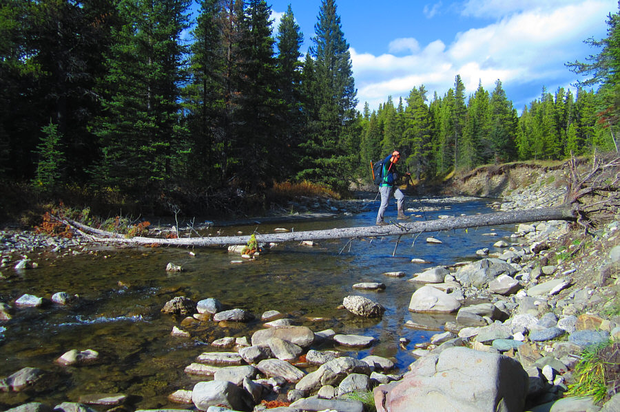
Zosia crosses Oldman River on a downed tree au cheval. |
 |
The white blaze is a reassuring marker along Soda Creek trail. |
 |
Zosia approaches the junction with the GDT under the east face of Beehive Mountain. |
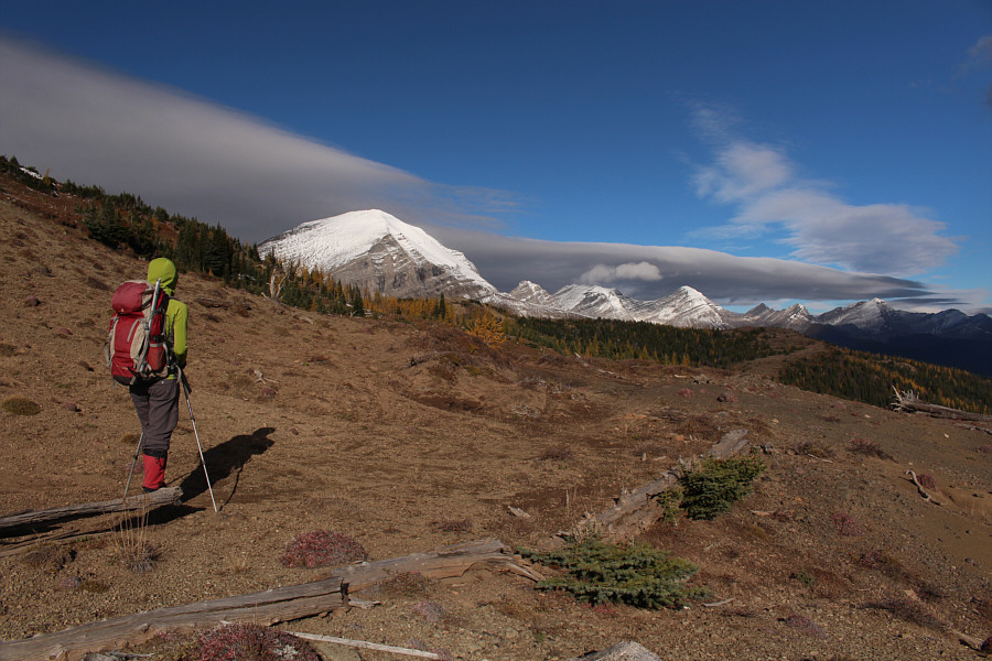 |
Before leaving the GDT here, Zosia looks north toward Mount Lyall and other peaks along the Continental Divide. |
 |
After leaving the GDT, Zosia climbs up the ridge on the northeast side of Beehive Mountain. |
 |
Behind Zosia is the approach valley (Soda Creek). Visible on the eastern horizon at right are the Twin Peaks of Cabin Ridge. |
 |
Sonny follows the snow-covered trail
that traverses the slopes below the north face of Beehive Mountain.
Ahead is Mount Lyall. Photo courtesy of Zosia Zgolak |
 |
Zosia temporarily takes shelter from the wind behind a large rock. |
 |
A chinook arch forms in the sky above Zosia. |
 |
Zosia borrows Sonny's mittens so that she can slip in some hot packs to warm her fingers. |
 |
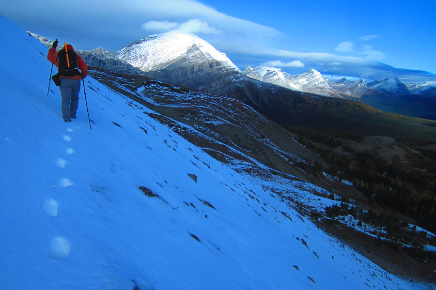
Across the pass is the ridge that was struck by lightning on Sonny's previous trip. |
 |
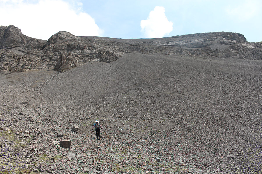
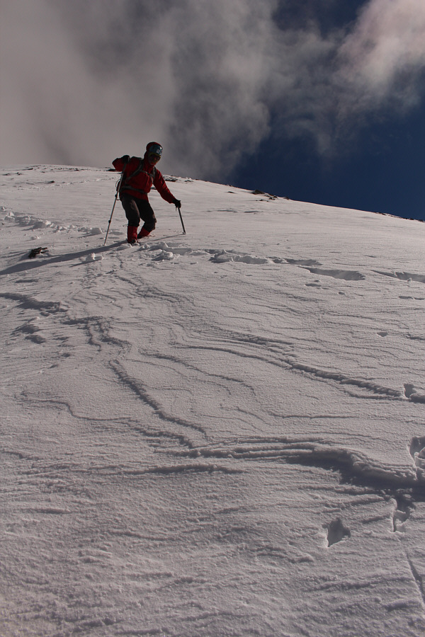
Much of the ascent is a steep grind up endless rubble. |
Zosia can barely stand up in the fierce wind as she gains the broad summit ridge.
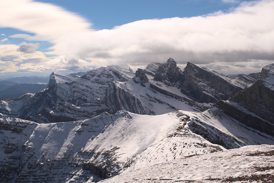 |
The Elevators are an uplifting sight to the south. The top of Tornado Mountain is hidden in clouds just left of centre. |
 |
Zosia stays below the crest of the summit ridge to avoid being blown off the mountain. |
 |
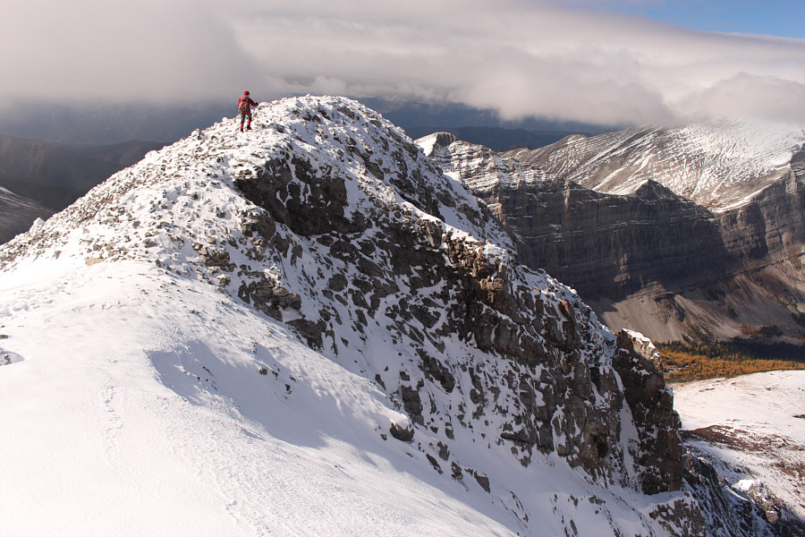
In this view from the top of the west summit, Zosia approaches the cairn on top of the east summit. |
 |
Zosia and Sonny raise their arms on the east summit of Beehive Mountain (2890 metres). |
 |
Zosia climbs back over the equally high west summit. |
 |
The snow makes plunge-stepping easy. |
 |
Zosia stops to re-adjust her gear below the north face of Beehive Mountain. |
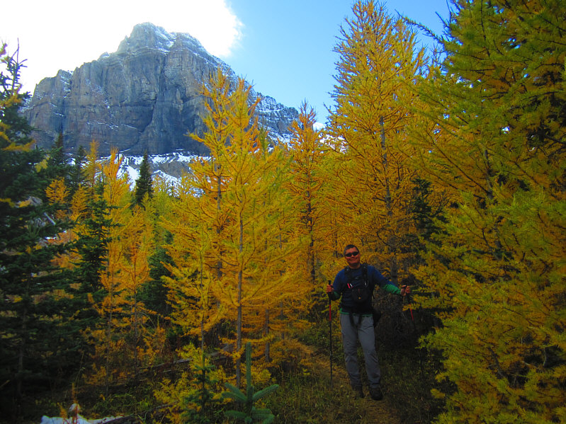 |
Here is a last look at Beehive
Mountain behind some larches. Photo courtesy of Zosia Zgolak |
 |
Zosia quickly runs across Oldman River. |
 |
Sonny re-crosses Oldman River on the
downed tree. Photo courtesy of Zosia Zgolak |
 |
Total
Distance: 15.8 kilometres Total Time: 8 hours 17 minutes Net Elevation Gain: 1169 metres |