BOU AVENUE
Pocaterra Ridge
On 21 August 2016, Dorota Sokolowska and I traversed Pocaterra Ridge in the Highwood region of Alberta's Kananaskis Country.  After an epic ascent of Mount Washburn the day before, I had gotten about an hour's worth of sleep and was not feeling particularly energetic about going on another hike.  However, I felt terrible about cancelling a previous hike with Dorota due to an issue with my car, and I was determined not to disappoint her this time.  Dorota herself had also gotten very little sleep after going out and dancing late into the night, but she seemed buoyed by the excitement of doing her first hike in the Canadian Rockies.

When we started hiking from Highwood Pass, I had not yet made any firm plans for where we would go.  I was unsure about how strenuous a hike Dorota was keen to do, and admittedly, I was not even sure about how strenuous a hike I was keen to do!  When we reached the trail junction to Grizzly Col which I had already previously hiked, I pretended to give Dorota the option of heading up there only to steer her toward Pocaterra Ridge instead.  Frankly, I think she was indifferent about where we went, and she hiked up the steep trail without complaint.

Upon reaching the highest summit of Pocaterra Ridge, we stopped to eat an early lunch and admire the impressive surrounding views.  Although I was quite content to retrace our steps back to the trailhead, Dorota suggested that we continue north and traverse the length of the ridge.  I was initially reluctant to do so since this would leave us far from my car, and the prospect of a lengthy uphill hike along the highway at the end of the day was unappealing to me.  The thought of hitchhiking was even more unsavoury for me since I do not normally like to solicit strangers for help especially with respect to recreational activities.  However, given the fantastic weather and the fact that this was Dorota's first hike in the Canadian Rockies, I threw caution to the wind and quickly decided that I was not going to let a logistical problem spoil a great ridge walk.

We proceeded to hike northward over almost all of the high points along the ridge.  At one point, we stopped for a catnap right on the crest of the ridge, and I vaguely remember some other hikers stepping lightly around us.  Although I was initially a bit groggy after waking up, I felt much more refreshed when we got moving again.  The afternoon sun was very hot on this day, and I welcomed the occasional strong gust of wind which helped to cool us off.

After dropping steeply down the north end of Pocaterra Ridge, we lost the trail in a creek bed and ended up following a flagged beaten path further west of where we should have gone.  Of course, I had not planned on hiking this far and did not have the route description from Gillean Daffern's Kananaskis Country Trail Guide.  We muddled through the bush as best as we could and eventually crossed a stream on some awkward boulders before thrashing up a steep embankment to reach the highway.  We popped out just west of Little Highwood Pass trailhead.

Faced with a 7-kilometre uphill walk back to Highwood Pass, we tried to thumb a ride while walking along the side of the highway.  After walking for less than half a kilometre, a friendly couple from Okotoks hauling kayaks and mountain bikes stopped to give us a lift.  They said that they did not normally pick up hitchhikers, but they noticed our hiking poles and figured that they did not have to drive us very far.  Dorota and I thanked the generous couple after they dropped us off at Highwood Pass.  It was the perfect ending to an enjoyable outing with a most agreeable companion.
This tarn is usually quite busy, but there was no one here when we arrived. 
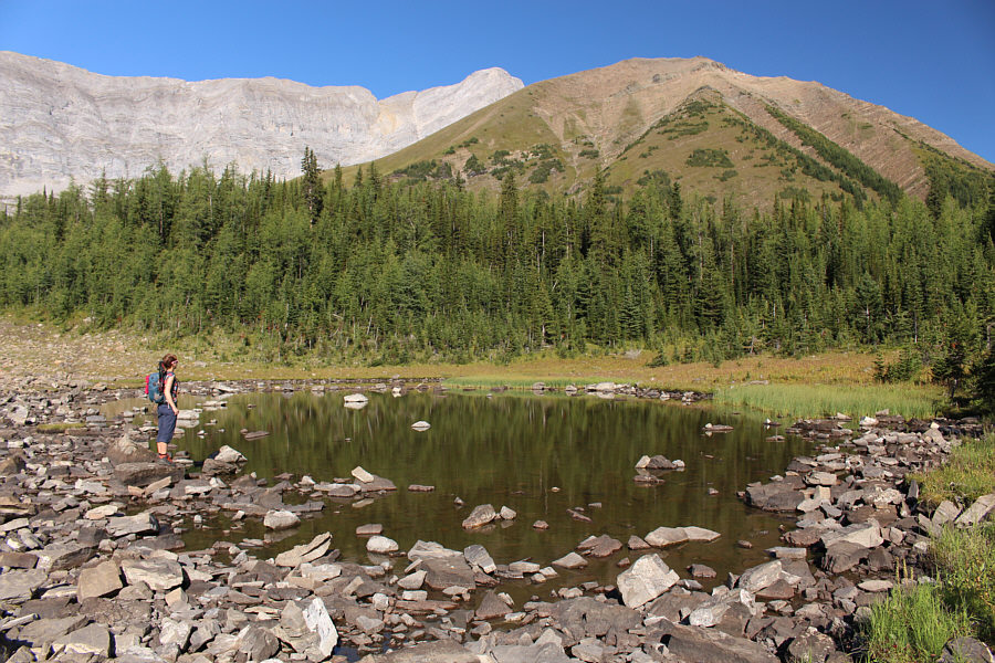
Dorota pauses at a small tarn on the way to Pocaterra Ridge (right).
I would still rather climb up this end of the ridge than the north end! 
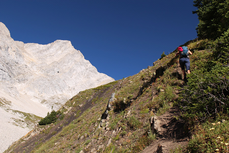
The trail to Pocaterra Ridge is steep.
Hard to believe there's a moderate scramble route up all that! 
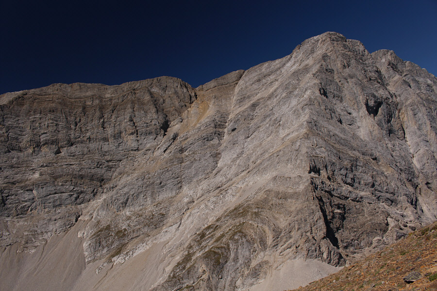
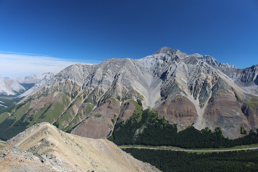
The east face of Mount Pocaterra is an arresting sight.
Probably busy up there today! 
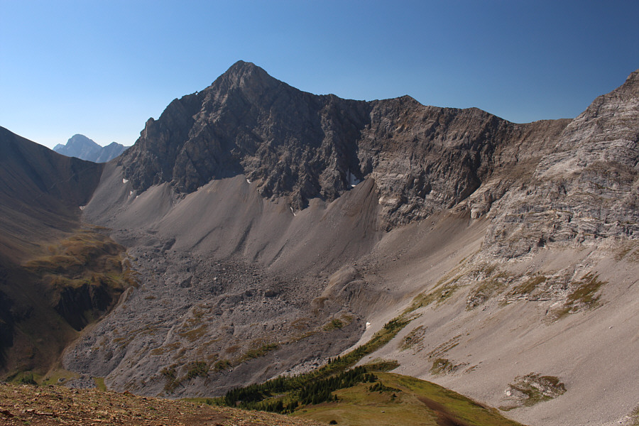
Mount Tyrwhitt is ever present to the south.
Dorota's first summit in the Canadian Rockies! Dorota and Sonny stand on the highest point of Pocaterra Ridge (2671 metres).
The loop hike/scramble of these two high points is not to be missed! To the southeast are Highwood Ridge and Grizzly Ridge.
How could I even think of passing up a glorious ridge walk like this on a gorgeous day?? The rest of Pocaterra Ridge stretches away to the northwest.
I was a much different person when I was up there on 8 August 1998... 
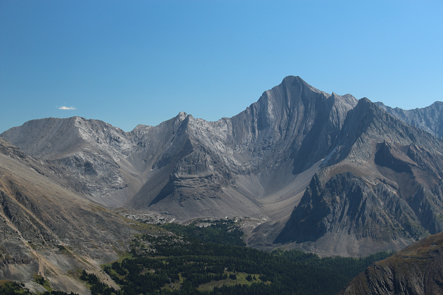
Mount Rae is a sprawling mountain to the northeast.
Still get chills about Kane's alternate descent route for Mount Arethusa! Mount Arethusa sits to the east.  Also visible but difficult to discern is Little Arethusa (right of centre).
I had kinda miserable weather on that one as I recall... 
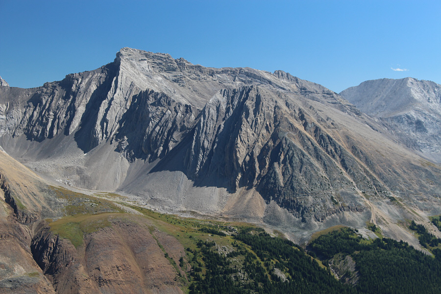
Further to the east is Storm Mountain.

 Dorota looks right at home in the mountains!

Dorota is eager to traverse Pocaterra Ridge.  The big peak to the right is Elpoca Mountain.


Can we count this as a separate summit? Dorota approaches the third highest point (2559 metres) along Pocaterra Ridge.
Nothing to it! Dorota approaches the second highest point (2579 metres) along Pocaterra Ridge.
I wonder if anyone has ever tried to paddle to Calgary from this lake... 
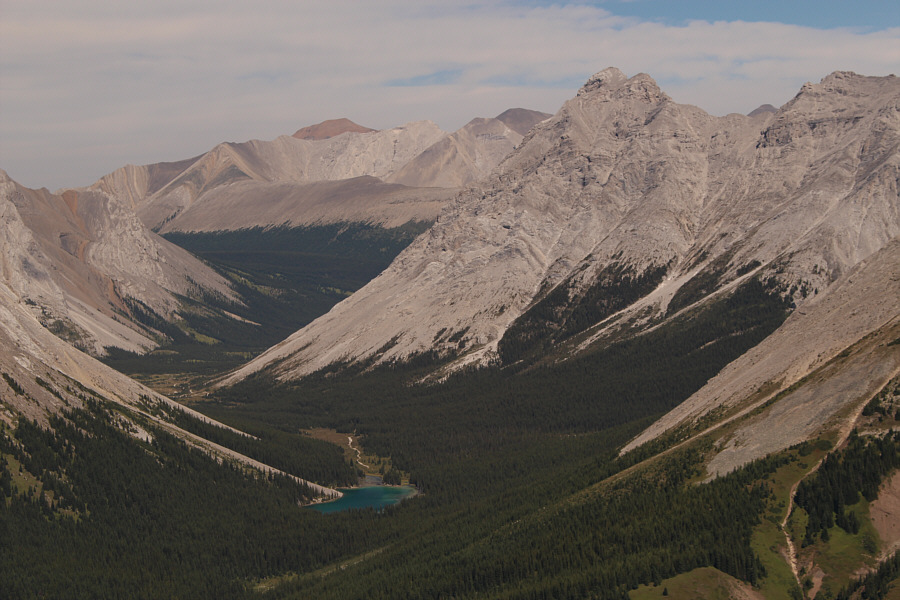
Elbow Lake draws all the attention in this view through the gap of Elbow Pass.
She's using a folded business card as a nose shield-- how clever! 
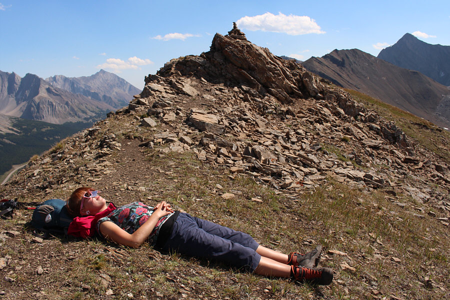
Dorota discovers the joys of alpine napping!
We've come a long way, baby! Here is a look back south from near the north end of Pocaterra Ridge.
I first met Dinah Kruze and Bob Spirko on Gap Mountain in 2003, but we did not introduce ourselves to each other at the time. Dorota begins descending the north end of Pocaterra Ridge.  Gap Mountain is straight ahead.
A most inauspicious ending to an otherwise fabulous ridge walk! Dorota rock-hops across the stream separating the north end of Pocaterra Ridge from the highway.
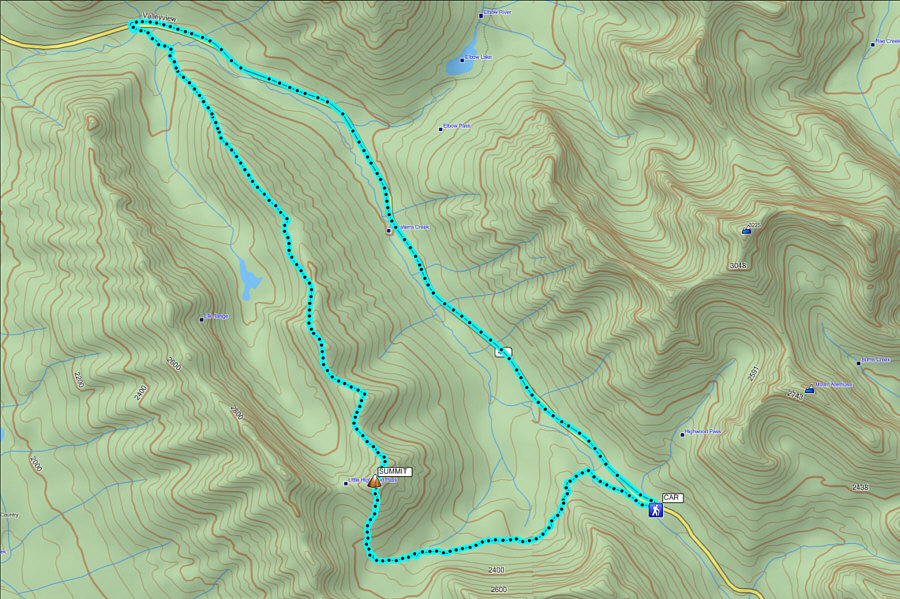
Thank you to the generous couple from Okotoks who gave us a ride back to the trailhead! Total Distance:  10.9 kilometres (traverse only); 18.1 kilometres (complete loop)
Total Time:  7 hours 37 minutes (traverse only); 7 hours 54 minutes (complete loop with hitchhike)
Net Elevation Gain:  475 metres (to highest summit)

Net Elevation Loss:  292 metres

GPX Data