BOU AVENUE
Mount Bishop

On 26 August 2017, I accompanied Marta Wojnarowska and Zosia Zgolak for an attempt at scrambling up Mount Bishop on the Continental Divide between British Columbia and Alberta.  Elisabeth Dupuis and Alan Hardy were also interested in climbing Mount Bishop on the same day, but due to difficulties in coordinating our schedules, we agreed to climb separately with hopes of maybe running into each other somewhere on the mountain.  As per the route description in Andrew Nugara's More Scrambles in the Canadian Rockies, we would approach the mountain from the east via trails along Loomis Creek and Bishop Creek.  Marta, Zosia and I would also use mountain bikes for part of the approach.

Starting from a gate on the west side of Highway 40 near the Lineham Creek day use area of Alberta's Kananaskis Country, we biked down a logging road which quickly leads to an unbridged crossing of the knee-deep Highwood River.  On the other side, we continued to enjoy easy riding all the way to the first crossing of Loomis Creek.  A convenient plank of wood made this crossing very easy, but beyond this point, the road downgrades to a rough single track.  In retrospect, we probably should have left our bikes here as the subsequent creek crossings and numerous mud holes made the trail increasingly difficult to ride.
This car was still here much later in the day when we returned. Zosia and Marta start the trip at the unsigned trailhead.
The water was painfully cold! 
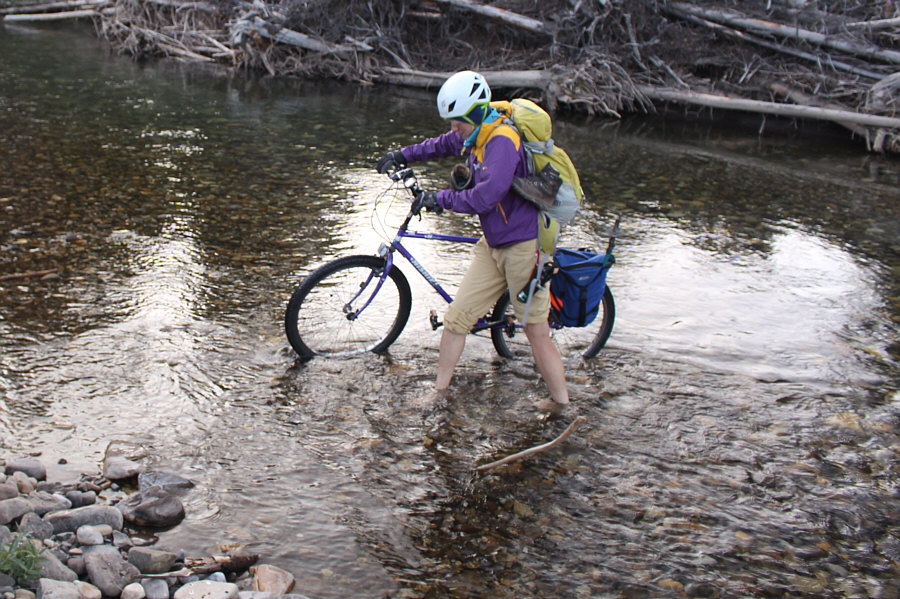
Marta fords Highwood River.
The cycling was still enjoyable here. 
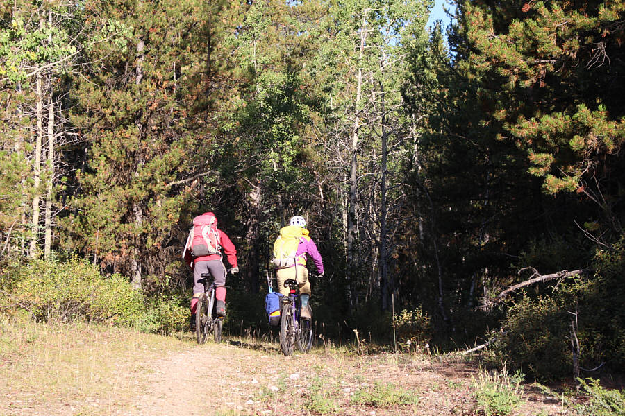
Zosia and Marta cruise along the wide trail.
We probably should have ditched the bikes well before this ford. Bicycles make fording Loomis Creek a bit awkward.
Shortly after the third crossing of Loomis Creek, we finally abandoned our mountain bikes and proceeded the rest of the way on foot.  The junction for the trail up Bishop Creek is at a fairly obvious open meadow with distant views of Mount Bishop.  Travel was initially easy along this trail, but the further we progressed up Bishop Creek, the more overgrown the trail became.  Because deadfall was minimal, we could generally still follow the trail, but we had to plow through several long stretches of thick bush.  Mercifully, the vegetation began to thin out as we approached the basin below Mount Bishop's east face.
Loomis Creek has to be crossed 5 times! Without the bicycles, Zosia and Marta have an easier time rock-hopping across Loomis Creek.
Mount Bishop is still almost 5 km away at this point! 
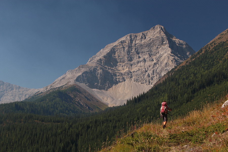
Zosia and Marta approach the junction with the trail up Bishop Creek.  Mount Bishop is visible in the distance at far left.
Someone needs to come here with a chainsaw... Bishop Creek trail is actually an old exploration road that has largely been reclaimed.
Road? What road?? Sonny is "enjoying" the thrash up the Bishop Creek trail.

Photo courtesy of Zosia Zgolak

We're not quite done with the bushy road yet... Zosia momentarily breaks free of the bushes to see this glorious view of Mount Bishop.
Crossing the basin, we climbed onto the crest of the east ridge and took a short break in the shade of some trees.  Someone had left some gear here including a small machete, and we guessed that it belonged to Alan and Elisabeth whom we now suspected were somewhere ahead of us on the upper mountain.  Sure enough, when we resumed climbing, we heard voices high above us, and we eventually spotted Alan and Elisabeth muddling about in what appeared to be very challenging terrain.  Following Nugara's advice to avoid climbing straight up the east ridge, Marta, Zosia and I veered to climber's left as we ascended which led us out onto the southeast face.  We soon ran into Alan and Elisabeth who were on their way down after being stymied trying to go directly up the east ridge.  Due to personal commitments, they were unable to come with us for another stab at the summit, and after a brief chat, we parted ways.

Subsequently, Marta, Zosia and I ran into some route-finding issues of our own as we tried to reconcile what we could see with Nugara's route description.  The terrain is complex here, and the foreshortened view makes route-finding a bit tricky.  Following an aborted attempt to surmount the first significant cliff band we encountered, Zosia felt uncomfortable about continuing and decided to sit tight while Marta and I tried to find another way up.  This first cliff band (probably Class 4) is the crux of the route, and it is definitely harder than Nugara's moderate rating would suggest.
This would be a good bivy site as there is a flowing creek here. 
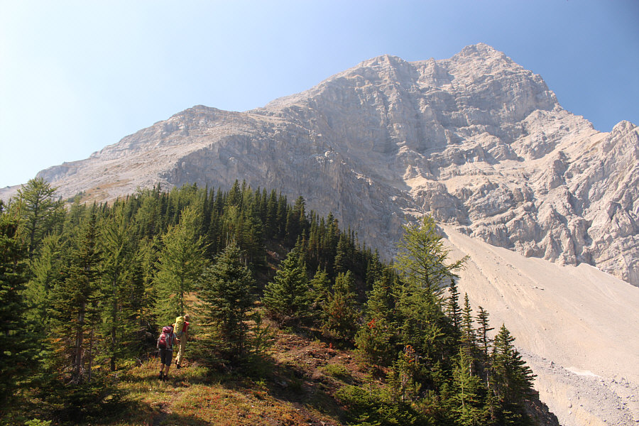
Marta and Zosia cross this basin to gain the east ridge of Mount Bishop.  Note the faint trail at left going up to the ridge crest.
Go up past the last trees before traversing left! Zosia and Marta head up the east ridge of Mount Bishop.
Need to start traversing to far left here. Zosia and Marta grind their way up a rubble slope.  Alan and Elisabeth are somewhere in the cliffs above.
I don't think Alan has a great opinion of Mount Bishop! 
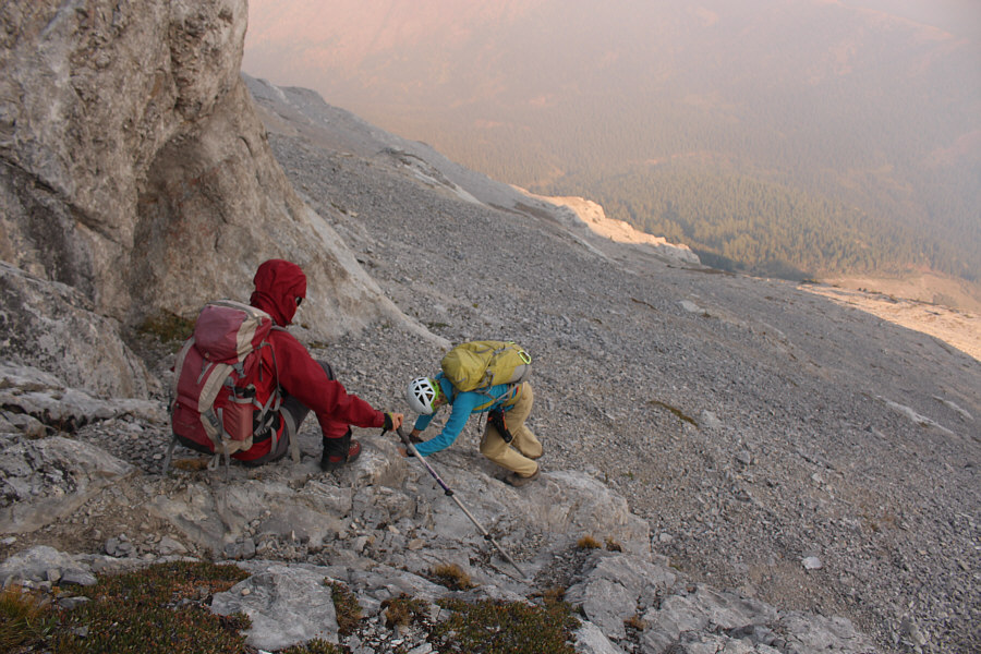
Alan and Elisabeth stop for a chat before resuming their descent.

Photo courtesy of Zosia Zgolak

A route-finder's nightmare! 
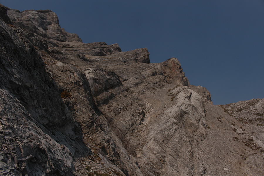
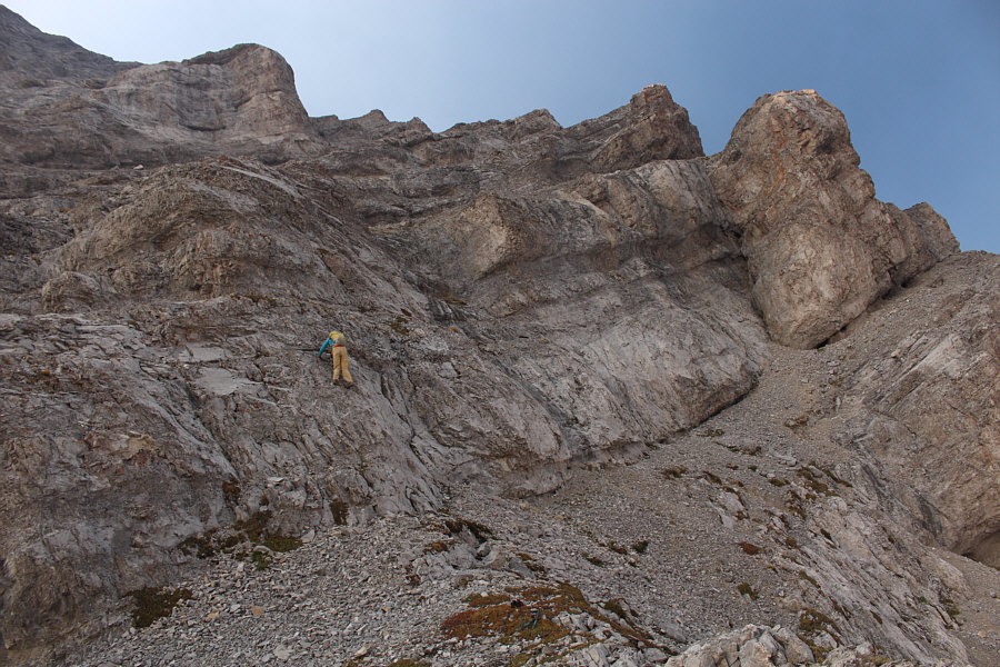
Here is a somewhat comprehensive view of the complex terrain on the southeast face.  This photo was taken from a ledge further south of the actual scramble route.
With some effort, Marta and I managed to surmount the difficult cliff band, but just as Nugara promises, the route-finding became much easier afterward.  We continued up a mix of loose scree, steep gullies and easy rock bands en route to a surprisingly large plateau just before the summit.  We finished the long ascent with an easy plod across the plateau.  Unfortunately, wildfire smoke obscured most of our views at the top, and Marta and I were resigned to content ourselves with reading the Who's Who of names in the summit register.
Going up is not too bad. Coming back down will be the real test! 
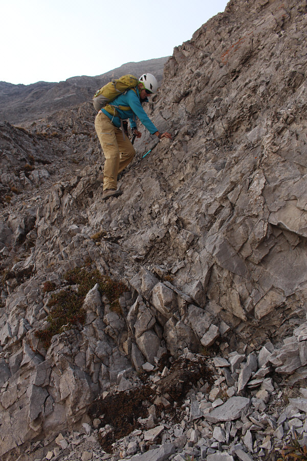
Marta climbs up the crux cliff band.
It's a good idea to build some cairns or place some flagging tape on the way up. 
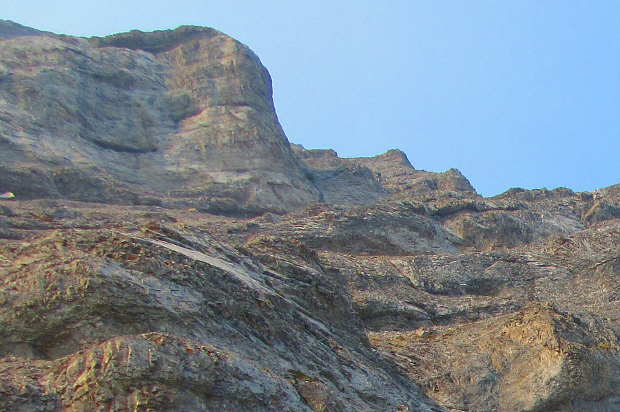
Much of the upper mountain entails sections of moderate scrambling such as this.
We still had a lot of climbing left at this point, but route-finding was straightforward here. Sonny can be seen (right of centre) scrambling up one of the upper cliff bands.

Photo courtesy of Zosia Zgolak

After all the route-finding, you'll be glad to be walking across this easy terrain! Just before the summit is this huge plateau.
A hard-won summit to be sure! Sonny and Marta reach the summit of Mount Bishop (2838 metres).
Oh well, smoke is better than the rain Zosia and I had on top of McPhail last year! 
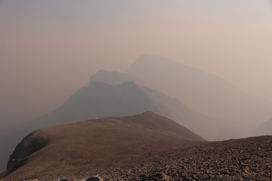
Mount McPhail is barely visible through the smoke to the south.
The smoke was starting to clear up a bit as we began our descent. 
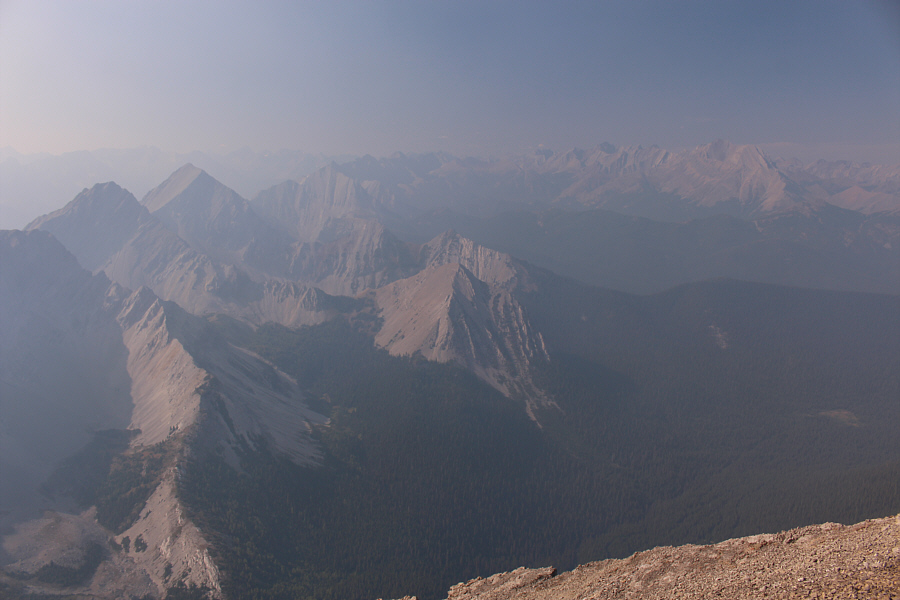
The view to the north is marginally better.
On descent, we retraced our steps back down the southeast face following flagging tape that Marta had the foresight to place during our ascent (we cleaned up all the flagging tape on our way down).  Descending the crux cliff band was not easy as expected, but we both managed to get down unscathed.  Reunited with Zosia, we continued descending the southeast face while veering back towards the east ridge.  Although the terrain is not as complex here as on the upper mountain, some vigilance is still required as both Zosia and I nearly slipped on ball-bearing pebbles overlying smooth slabs.  We were able to relax a bit once we returned to the basin, and from there, we steeled ourselves for another round of thrashing along the overgrown Bishop Creek trail.
A helmet is highly recommended! Marta carefully descends steep and loose terrain on the upper mountain.
Marta makes it look easy though! Some of the rock bands are a bit awkward to get down.

It was a good spot for Zosia to wait for us.

Zosia waits patiently on a sunny ridge with Hill Of The Flowers in the background.


Would you consider this "moderate" scrambling as Nugara suggests?? Marta down-climbs the crux cliff band.
Still some tough terrain below... Zosia and Marta descend a small rock step prior to bashing down a big rubble slope.
More bush coming up! 
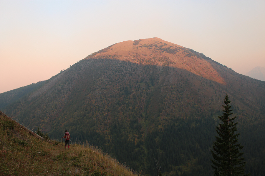
The late day sun illuminates the top of Hill Of The Flowers as Zosia hikes back along the Bishop Creek exploration road.
We felt some relief once we cleared the bushes and regained the Loomis Creek trail, but nightfall was upon us by the time we reached our mountain bikes.  The ride out in the dark was a bit of a surreal experience as we muddled through the aforementioned mud holes and creek crossings while miraculously avoiding any serious wipeouts on some of the screaming downhill sections.  Ultimately, we all made it back to the trailhead in one piece albeit a little frazzled, hungry and tired.

While Marta drove herself home that same night, Zosia and I found a quiet camping spot nearby and promptly went straight to bed without dinner.  Good night!
This is starting to feel like an epic! 
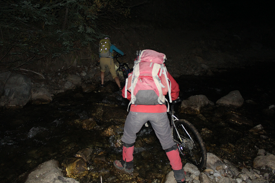
Marta and Zosia ford Loomis Creek with their bicycles in the dark.
Very calm toad--wasn't squirming at all! Sonny holds up a small boreal toad which he almost ran over with his bike.
Are we done yet?? Marta fords Highwood River, the last obstacle of the night.
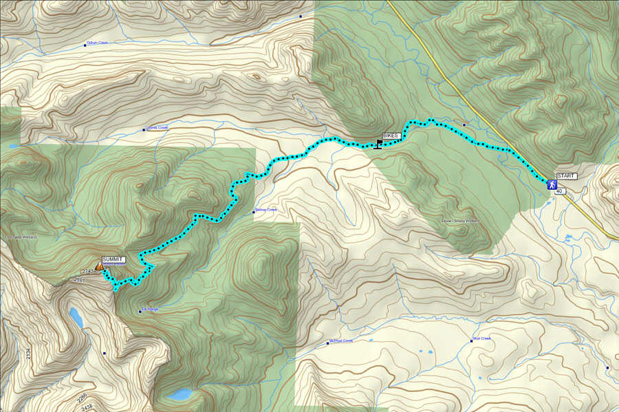
Ugh. Another brutally long Nugara sufferfest! Total Distance:  27.1 kilometres
Round-Trip Time:  14 hours 29 minutes
Net Elevation Gain:  1276 metres

GPX Data