BOU AVENUE
Kapristo Mountain

Located about 18 kilometres southeast of Golden, British Columbia, Kapristo Mountain is the highest peak in the Beaverfoot Range and has been on my peak-bagging radar for some time.  When Josée Menard and Fabrice Carrara published a trip report for Kapristo Mountain in 2016, they made it sound like a fairly straightforward outing, and I half-expected a flurry of visits to follow given how prominent the peak appears along the Trans-Canada Highway between Field and Golden.  As it turned out, their remarkable ascent failed to inspire much interest beyond myself and Rafal (Raff) Kazmierczak.  After chatting about Kapristo Mountain for a couple of years, Raff and I finally decided to give the route a go on 22 July 2018.

From the Trans-Canada Highway, take the turnoff to Beaverfoot Road about 30 kilometres west of Field or 26 kilometres east of Golden.  The westbound exit and the eastbound exit join at a T-intersection on the south side of the Trans-Canada Highway.  From there, drive southeast for 1 kilometre and cross a bridge over the Kicking Horse River.  Drive another 300 metres past the bridge and turn right onto Kicking Horse Road (there was one washout with running water along this road, but it was passable in my Honda CR-V).  Drive west for 5.5 kilometres and turn left onto Kapristo spur road (high clearance vehicle recommended).  Follow this rough road for 3.4 kilometres to its end at a small parking spot in a clearcut.  Be bear-aware as there are lots of raspberry bushes here.

Starting from the parking spot, we headed south and walked over a small berm to follow remnants of the road continuing to the edge of the clearcut.  Here, we were within earshot of the creek which Menard and Carrara followed upstream on their approach.  Raff and I were already bushwhacking here, and we soon dropped down a loose gully into the creek bed.  Almost immediately, Raff and I were alarmed by the substantial amount of water flowing in the creek, and any thoughts of an easy approach quickly evaporated.  We moved up the creek bed as best as we could scrambling on whichever side of the creek provided the least resistance.  The spray from the raging waters rendered many of the adjacent rocks dangerously slick, and we would often rely on very tentative footholds to get up challenging sections.  Both of my feet were soaked early in the proceedings after a couple of inadvertent slips.  More frequently than we would have liked, we were forced to temporarily leave the creek bed and climb along the steep embankments.  This entailed a lot of miserable bushwhacking through alders, devil's club and a host of other unpleasant vegetation.  As a result, our progress was insufferably slow.
Get your game face on 'cause this route is pretty unpleasant right from the get-go! 
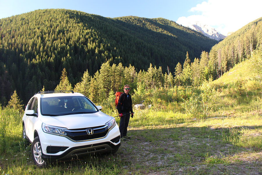
The route heads through the clearcut at right and eventually drops down into the obvious drainage.
Mon dieu, there's a lot of water flowing in this creek! Raff drops down into the creek bed near the beginning of the trip.

Abandon all hope ye who enter here...

Early in the proceedings, Raff realizes that going up the creek bed is not going to be easy.


Might be easier to just get your feet wet and trudge in the creek!

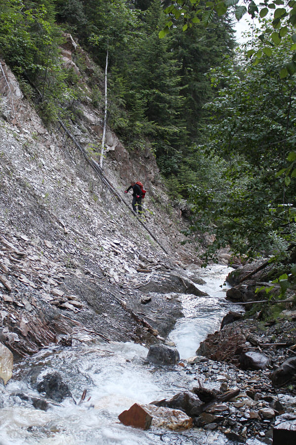
Raff makes his way up the steep embankment beside the creek.

Sketchy going up and worse coming down! The rocks alongside cascades such as this one are treacherously slick.
I managed to snap this shot without using my tripod! Despite all the difficulties of going up the creek bed, there is still beauty to be found here.
One of my proudest ascents! 
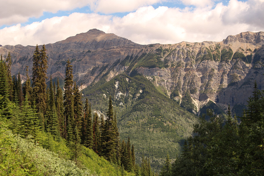
An open section along the creek bed grants this view of Mount Hunter to the north.
I'm mentally numb... 
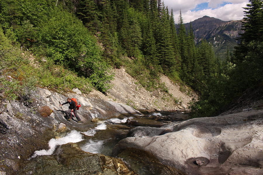
Raff continues to muddle his way up alongside the creek.
Finally, the light at the end of the tunnel!

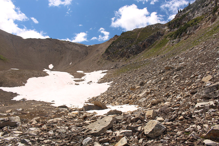
Raff climbs onto a lingering snow patch covering the creek.  An open basin lies just ahead.

After about 4.5 hours of grinding up the creek, we finally entered an open basin below the northeast face of Kapristo Mountain.  We took a well-deserved break here although mosquitoes, which had been largely absent in the creek bed, now harassed us incessantly.  When we resumed hiking, we headed to the back of the basin and climbed steep but easy terrain to reach a high col on Kapristo Mountain's southeast ridge.  From the col, we climbed up the ridge crest for a short distance before heading to climber's right to follow a faint path traversing across the northeast face of a subsidiary bump.  We eventually crossed over the ridge crest and bypassed another minor bump to reach the base of the large summit block.
After all the suffering in the creek bed, now we have to put up with unrelenting f**cking mosquitoes!

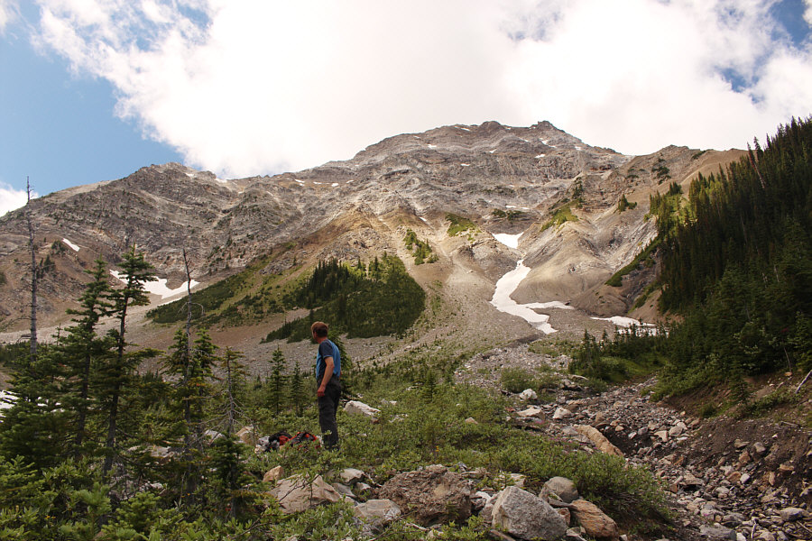
While taking a well-deserved break in an open basin, Raff studies the northeast face of Kapristo Mountain.

Now we're making much better progress!

Raff heads for a high col on the southeast ridge of Kapristo Mountain.

The col is higher up still and not visible here.

Raff climbs up a slope which leads to the head of the basin.

The scree slope would probably also work, but I'd rather climb grass than scree!

At the head of the basin, the shortest route to the col climbs up the steep, grassy ramp at right.

Raff has a lot of patience!

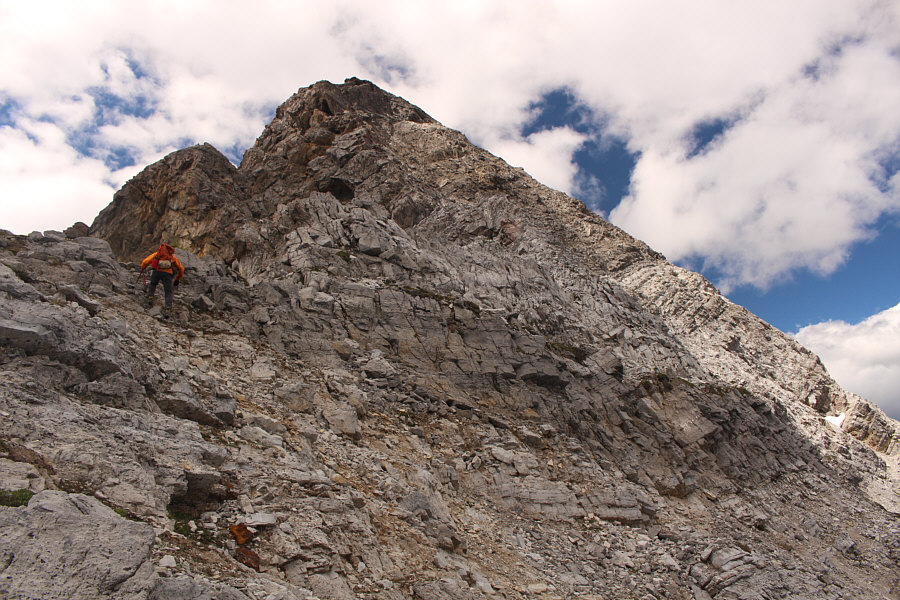
Raff waits patiently on the ridge crest for Sonny to catch up to him.  The route goes a little left just behind the big tree.

Really fun easy scrambling here!

From where Raff is, the route traverses right to go around the next bump.  The summit block is visible just left of centre.

Strangely, there was a lot of sand here (the light stuff at bottom right).

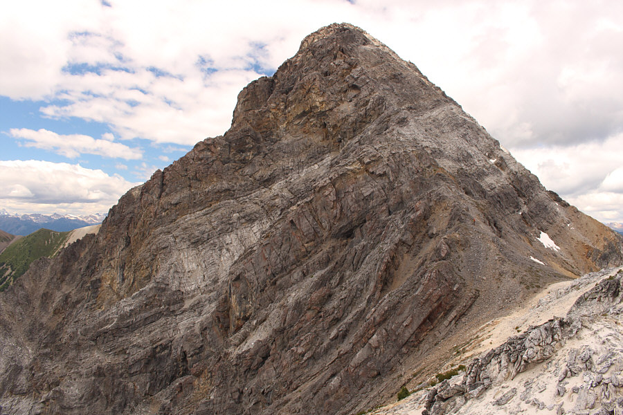
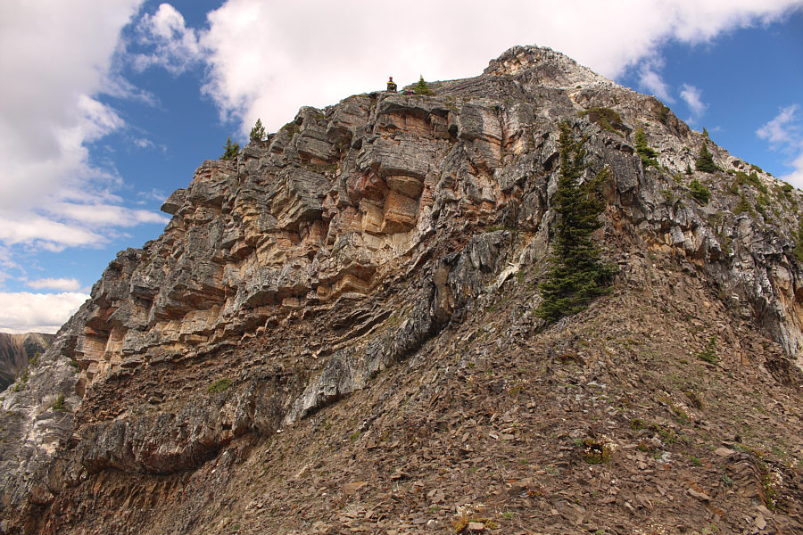
Here is a clearer view of the summit block from the ridge crest.  Raff can be seen near the base of the summit block.

Here, we tackled the ridge crest directly and scrambled as far as the bottom of some ominous-looking cliffs before traversing to climber's right on a ledge of sorts.  When it became feasible to do so, we climbed up the northeast face on a mix of slabs and loose rubble.  Some route-finding is necessary here, but the scrambling should never be more than moderately difficult.  Once we gained the summit ridge, we still had to go over a couple of disheartening false summits before finally reaching the true summit.
Raff was going to start traversing at the lower snow patches until I convinced him otherwise!

On the summit block, the route heads up the broken terrain at centre before traversing to the right near the top of the light-coloured band of rock.

Keep climbing upward until it gets too hard!

Raff scrambles up the summit block.

These ridges all look very inviting...

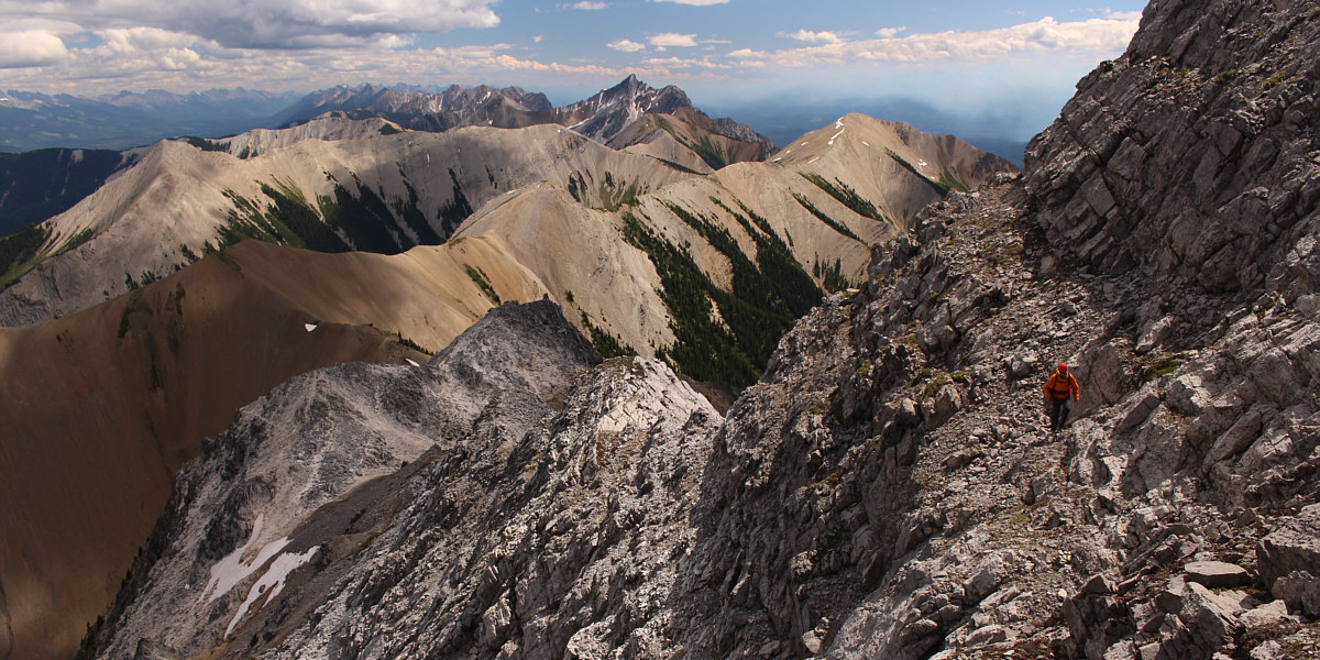
This is looking back down the southeast ridge of Kapristo Mountain.  Note the wildfire burning at distant right.  The pointy mountain in the distance at centre is Bicarbonate Peak.

The ledge is obvious once you get up here.

Raff traverses a ledge onto the northeast face.


Back to the normal program... After traversing onto the northeast face, Raff climbs up slabs and rubble.
Just when you think you've made the top...DOH! 
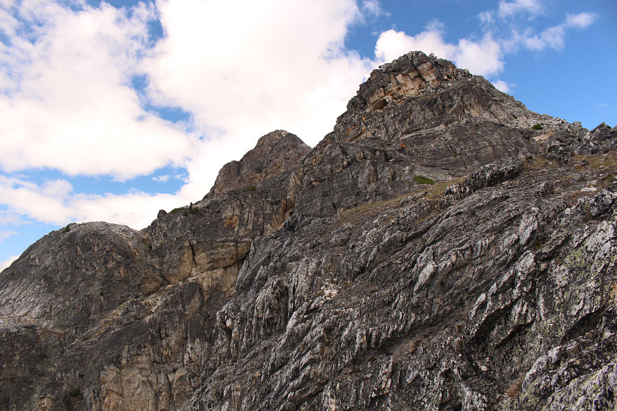
Raff walks over one of the false summits on the summit ridge.

We were the 3rd party to sign the summit register after it was placed by Rick Collier in 2009.

Sonny and Raff stand on the summit of Kapristo Mountain (2711 metres).


Looks a little different from the usual benchmarks. 
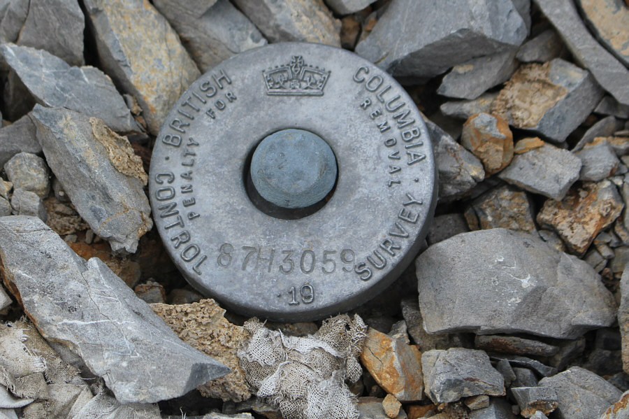
This survey marker is located on Kapristo Mountain's summit.
If you have a keen eye, you can also spot Mount Sir Donald on the horizon at far left. 
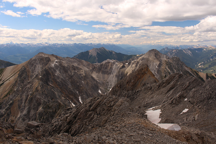
To the northwest, Mount Seven sits at centre beyond two outliers of Kapristo Mountain.
That was a brutally long climb (over 2000 metres elevation gain). 
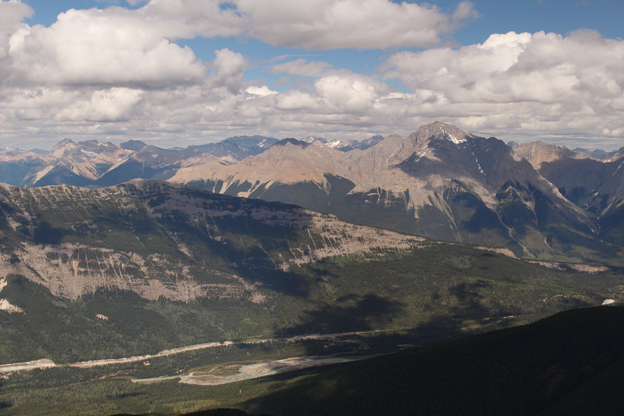
Mount Vaux (right) is the most noticeable peak to the northeast.
Maybe next year, I will give Chancellor Peak a shot... Chancellor Peak (in shadow) and the three peaks of Mount Goodsir attract the most attention to the east.
By this time, the mosquitoes had relented considerably, and Raff and I were able to enjoy a nice break on the summit for an hour before retracing our steps down the mountain.  We had built a couple of cairns on our way up, and these were helpful for descending the summit block safely.  Our descent back to the open basin went without a hitch, but once we dropped below the high col, mosquitoes once again set upon us.  This only made us quicken our pace, and we were soon re-entering the dreadful creek bed.
Seemed easier going up than coming down! 
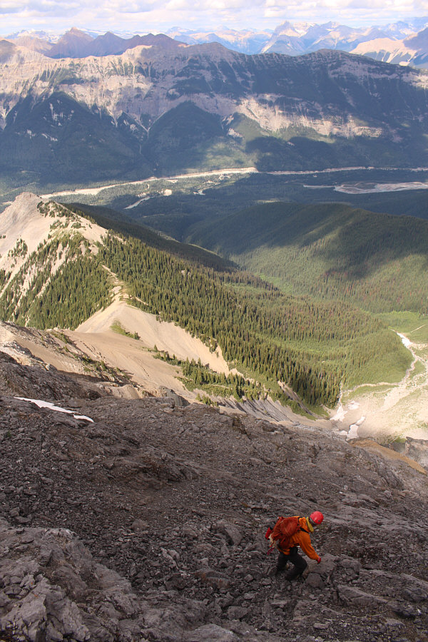
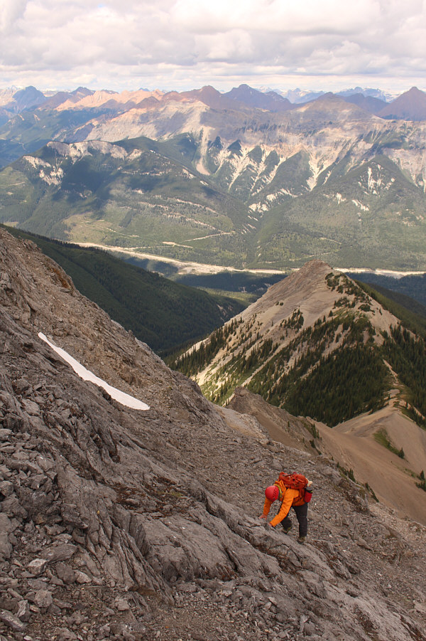
Caution is required while descending the steep and loose northeast face of Kapristo Mountain.
Much easier to descend here than the northeast face.

Raff works his way down the lower part of the summit block.

Where this sand comes from is a mystery... Raff retraces his steps around the first bump along the southeast ridge.  Note the sand-covered snow patches.
Get ready for more misery! Raff re-enters the creek bed on egress.
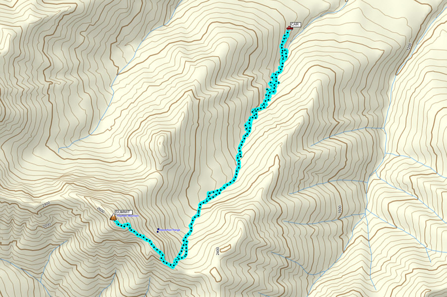
Just as before, our egress along the creek was painfully slow.  In many ways, our return trip was worse because some sections of the creek that were already a bit sketchy to ascend proved to be much more challenging to descend.  We ended up detouring onto the embankments much more frequently which was both time-consuming and demoralizing.  For the most part, we usually detoured onto the western embankment on both the ascent and descent.  At one point, I made the mistake of leading Raff onto the eastern embankment, and after expending a lot of effort thrashing among some horrible alders, we ultimately had to backtrack to the creek bed and try the other side.

With growing fatigue and the onset of darkness, I started to lose some of my focus, and on several occasions, I even felt some genuine despair albeit fleetingly.  I also had quite a few nasty spills including one tumble into the creek that brought back unpleasant memories of a similar dunking on Redstreak Mountain a few years back.  Being completely soaked actually afforded me the option of walking directly in the flowing creek although this was not without complications too.

Raff and I became separated slightly upstream of where we first entered the creek bed in the morning, but we both had the right instinct to abandon the creek here.  After donning headlamps and shouting to one another, we quickly regrouped and then sidehill-bashed our way to the clearcut.  The miserable thrashing continued even in the clearcut as we were unable to locate, in the dark, the remnants of the road until we were almost back at my car.

After changing into fresh clothes and enjoying some sodas from my cooler, we rolled down the access road and made it back to the Trans-Canada Highway without any problems.  The subsequent drive home to Calgary was long but uneventful.
It would be ideal to do this one when the creek is either dry or frozen! Total Distance:  17.6 kilometres
Round-Trip Time:  15 hours 35 minutes
Net Elevation Gain:  1320 metres

GPX Data