Shaun, Zosia and I got up before dawn on the morning of 5 September 2020, and after eating breakfast, we began hiking the signed trail to the Alpine Viewpoint. Just as I remembered from my first trip, this is a grueling ascent which gains 600 metres in a little more than three kilometres. The trail starts from a signed junction just north of Fish Lake and climbs moderately through forest to an avalanche slope which is readily visible from the campground. The trail eventually passes another signed junction (trail to Summer Pass) and climbs up a huge scree-filled basin. The trail downgrades to an unmaintained route at this point, but a good beaten path continues up the basin. The beaten path deteriorates amidst a steep slope of treadmill rubble just below the cliffs guarding the top of the basin, and groveling up this section was a bit unpleasant. At the base of the cliffs, the beaten path becomes more defined again as it rises up a hidden ramp to a weakness that allows easy access to the Alpine Viewpoint. Because of the looseness of the terrain, some care is required in climbing the ramp as a slip here could potentially be fatal.
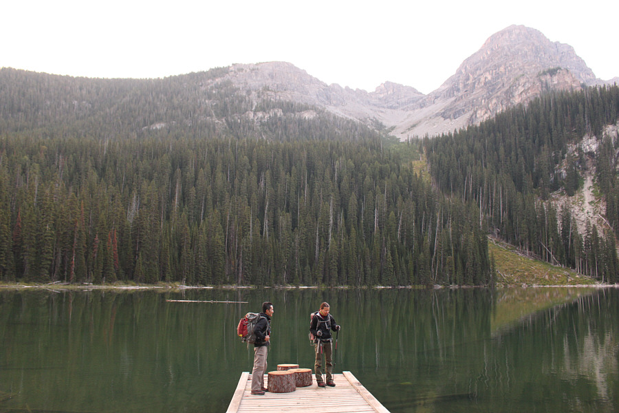 |
Standing on the dock at Fish Lake, Shaun and Zosia prepare to embark on a strenuous ascent to the Alpine Viewpoint which is located at the gap just left of the unnamed peak at upper right. |
 |
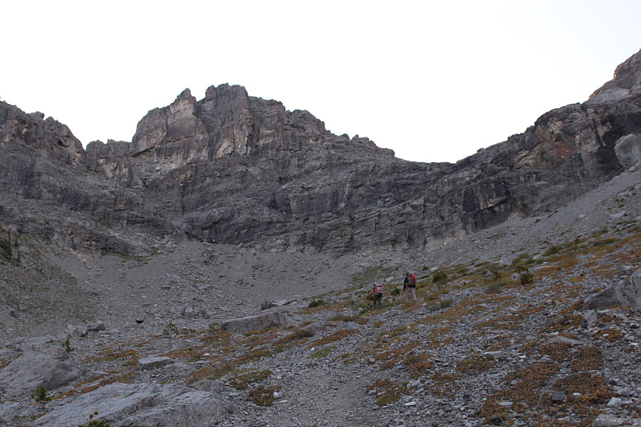
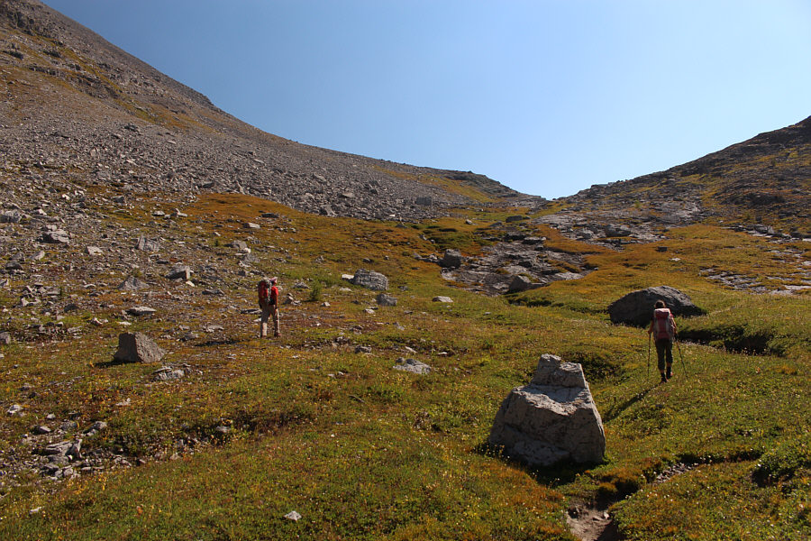
A good trail leads to the basin below the Alpine Viewpoint. |
 |
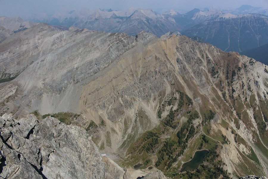
The trail peters out in the upper basin, but signs of passage lead to a hidden ramp which starts a little left of centre in the photograph. |
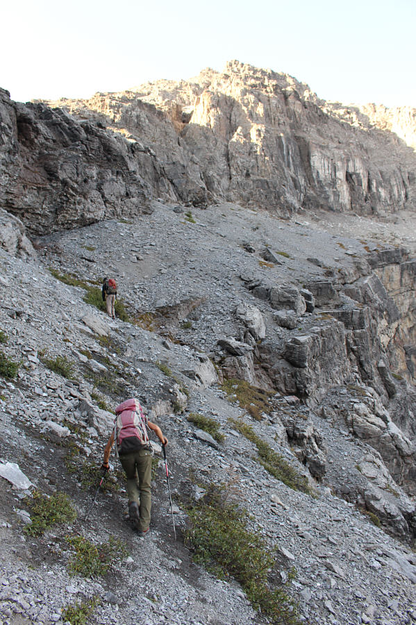 |
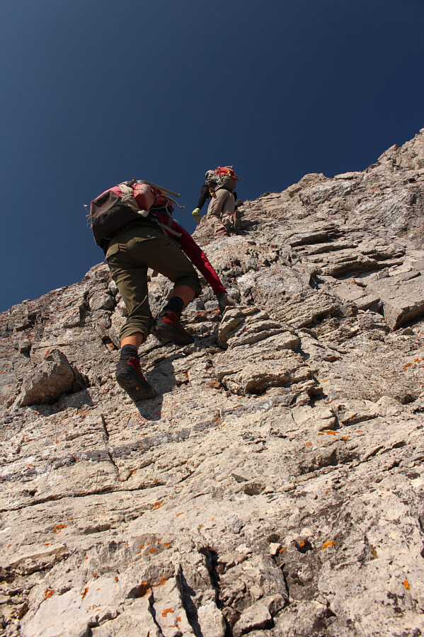
Shaun and Zosia climb up the hidden ramp on a beaten path. Caution is required here as the terrain is very loose. |
Temperatures were warm on this day, and as we stopped for another short break near the last trees below Mount Morro, I noticed that my supply of water and liquid refreshments was running alarmingly low. Unfortunately, the route was completely bone-dry up to this point, and from what I could see of the upper mountain, it was unlikely that I would be able to replenish my water bottles anytime soon. As such, I began rationing my water supply and taking only infrequent small sips. One saving grace for me was a westerly breeze that kicked up once we climbed higher up the mountain. The breeze kept the temperatures tolerable, and consequently, I did not feel the need to drink as much.
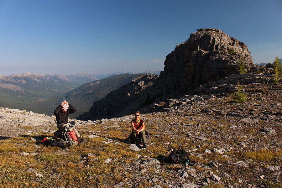 |
Upon reaching the Alpine Viewpoint, Shaun and Zosia take a well-deserved break. |
 |
Resuming his approach to Mount Morro, Sonny leaves the Alpine Viewpoint
behind him. Photo courtesy of Zosia Zgolak |
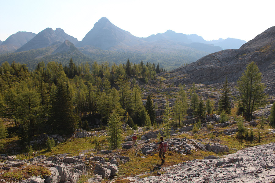 |
Mount Morro (left of centre) seems hopelessly far away as Shaun and Zosia make their way through the lightly forested terrain. |
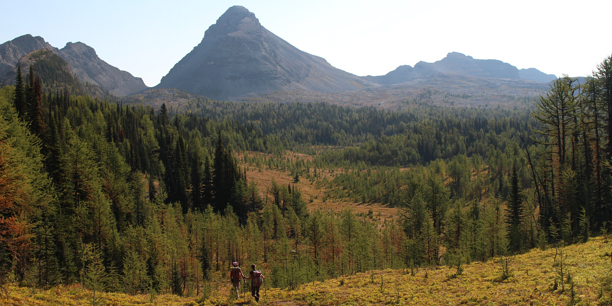
Shaun and Zosia find a grassy corridor of sorts heading in the direction of Mount Morro.
 |
Sonny and Shaun agree that the right-hand skyline is probably the most
feasible route to the top of Mount Morro. Photo courtesy of Zosia Zgolak |
Standing atop Mount Morro fulfilled a 19-year old dream of mine, and I was ecstatic that we were able to find a way up on our own. Having said that, the summit register surprisingly showed that there is a lot more regular traffic on this mountain than I would have expected given its remote location. Many of the register entries are by resident park rangers for which the climb of Mount Morro is probably a rite of passage.
 |
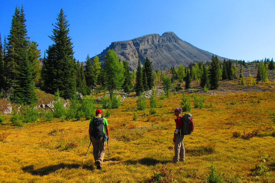
Meadows and karst pavement are typical of the terrain at the foot of Mount Morro. |
 |
Shaun and Zosia both try to stick to the grass as they climb up this dry drainage. |
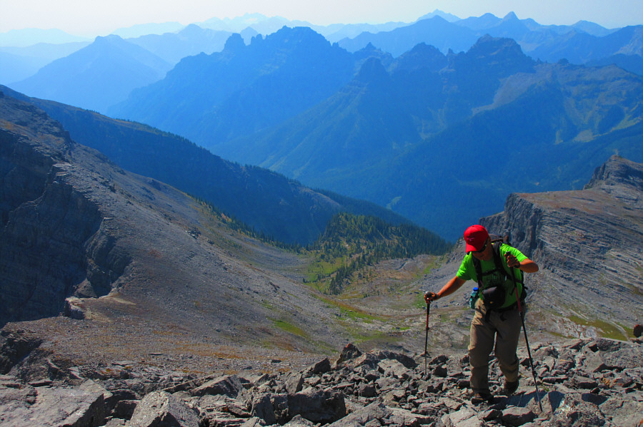 |
Some impressive peaks can be seen to the south as Sonny grinds his way up
a rubble slope. Photo courtesy of Zosia Zgolak |
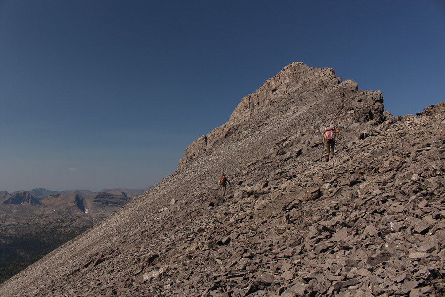 |
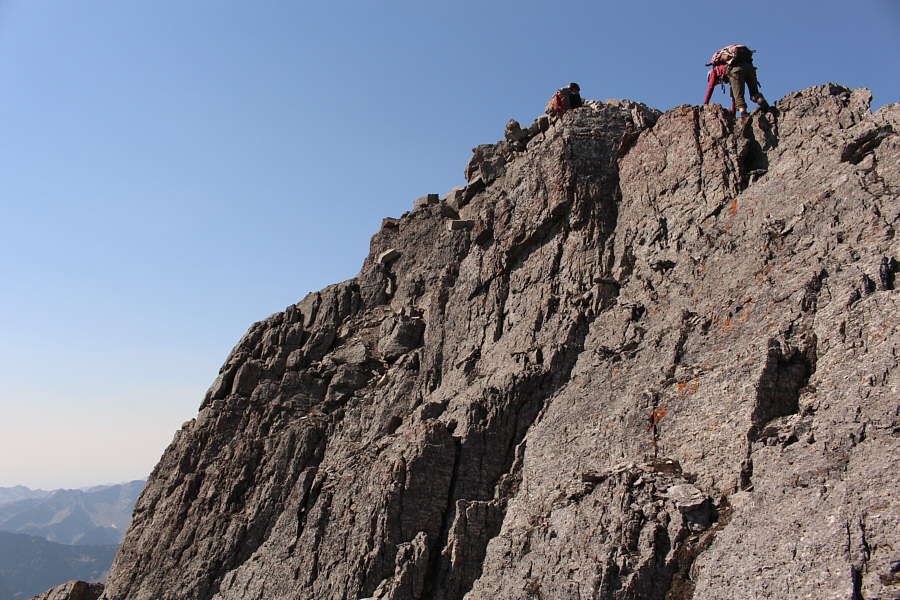
Shaun and Zosia approach the east side of Mount Morro's summit block. |
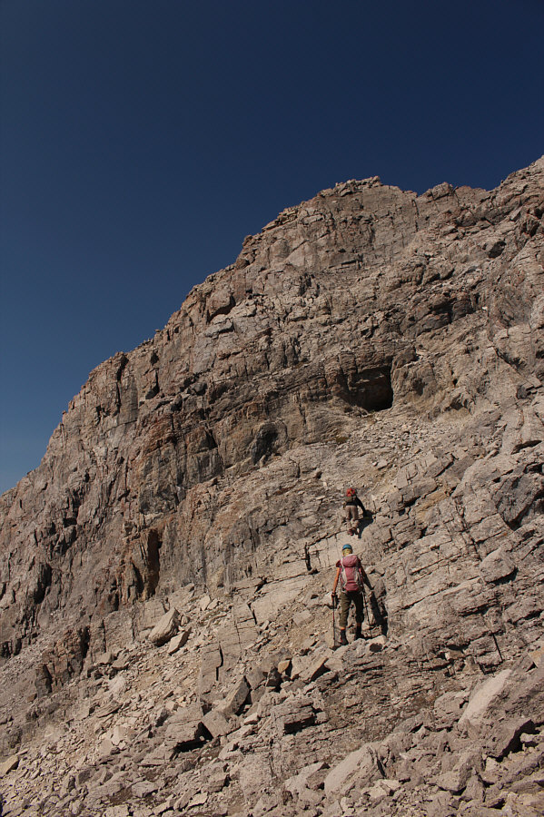 |
Up close, the summit block presents some route-finding challenges. |
 |
Zosia and Shaun begin scrambling up the summit block. |
 |
Shaun waits for Zosia to go over a tricky spot along the ridge. |
 |
Once again, Shaun waits for Zosia to scramble up the final steep section before the top. |
 |
Sonny, Zosia and Shaun give thumbs up on the summit of Mount Morro (2840 metres; the official BC Parks map gives an erroneous height of 2912 metres). |
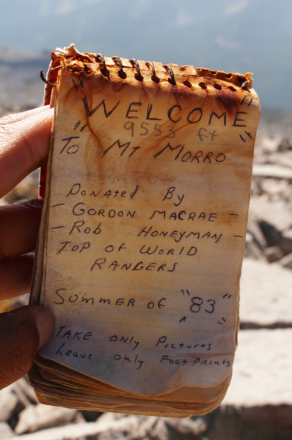 |
The elevation given in the older of two summit register booklets is probably too high by at least 220 feet or 67 metres. |
To the southwest, Empire State Peak (left) and Chrysler Peak (right) stand amidst a number of striking pinnacles. Mount Fisher is also visible on the right horizon.
 |
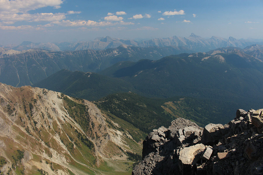
This is looking west toward the Alpine Viewpoint (centre) and the intervening grassy corridor (lower left). The pointy peak on the horizon at centre is Teepee Mountain. |
 |
Several tarns can be seen down the north side of Mount Morro. |
 |
Mount Washburn (right) sticks up like a sore thumb on the eastern horizon. |
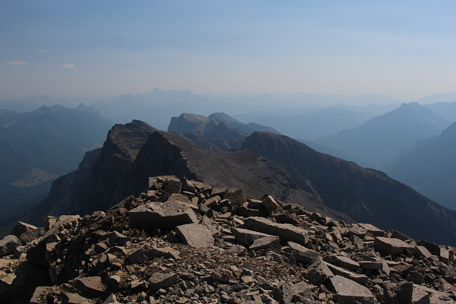 |
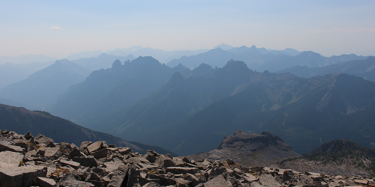
Other unnamed peaks of the Van Nostrand Range stretch away to the south. In the hazy distance at left is Mount Bisaro. |
Of course, the return hike was still an epic slog as we worked our way back across the height of land and up to the Alpine Viewpoint (with at least an additional 160 metres of elevation gain). Just like the summit block, descending the hidden ramp into the scree-filled basin demands some focus and attention due to the slippery footing there. By this point, smoke from wildfires to the west had settled over the area, but this had the benefit of attenuating the heat from the late-day sun. Consequently, we were spared from getting baked while making the knee-jarring descent down the basin. Once we reached the Summer Pass trail junction, we could relax a bit as we settled into an easy hike back to the campground at Fish Lake. A hearty dinner with refreshments in camp capped off a very strenuous but rewarding day.
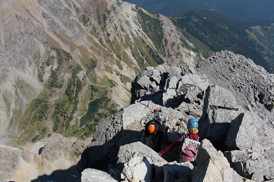 |
Shaun and Zosia carefully descend from the summit. Note the immense drop to the tarns below. |
 |
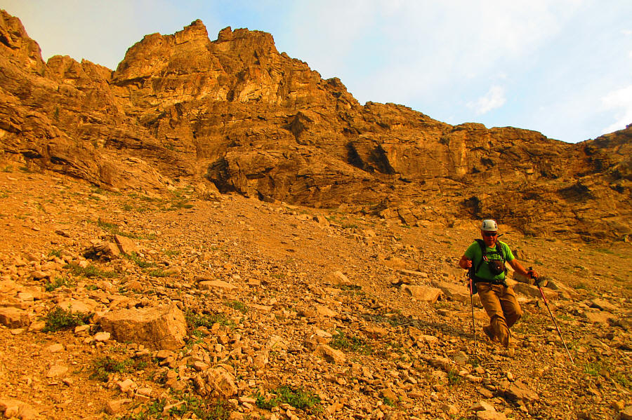
Sonny refills his water bottle from a spring that Zosia discovered
seeping out of the ground. Other than Fish Lake at the very start,
this would be the only place to replenish water bottles on the whole
trip. Photo courtesy of Zosia Zgolak |
 |
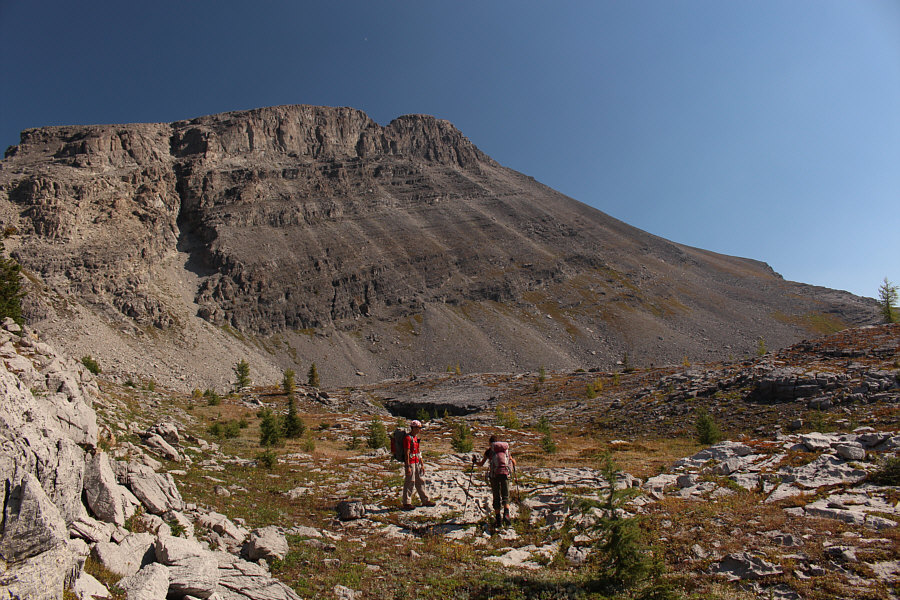
At the foot of Mount Morro, Shaun and Zosia begin the long walk back to the Alpine Viewpoint (distant right). |

Here is a last look back at Mount Morro in the hot afternoon sun.
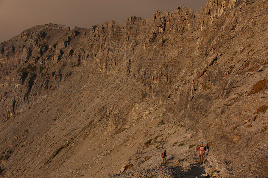 |
Shaun and Zosia carefully descend the ramp below the Alpine Viewpoint. The strange lighting is due to wildfire smoke. |
 |
Sonny surfs down the loosest and steepest part of the upper basin. Photo courtesy of Zosia Zgolak |
 |
Shaun and Zosia continue their steep descent with Fish Lake and Mount Doolan (centre) visible through the smoky haze. |
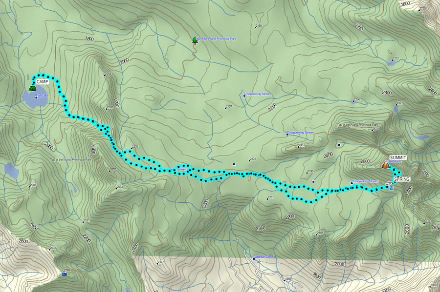 |
Total
Distance: 20.2 kilometres Round-Trip Time: 11 hours 55 minutes Cumulative Elevation Gain: 1573 metres |