BOU AVENUE
Wind Mountain
With a fantastic weather forecast slated for
26 July 2020, Marta Wojnarowska and I headed to Alberta's Bow Valley
Wildland Provincial Park to climb Wind Mountain which is also sometimes
referred to as the 4th peak of Mount Lougheed. A moderate scramble
route is described in Andrew Nugara's More Scrambles in the Canadian
Rockies, but we also had the benefit of a useful GPS track from
So
Nakagawa.
Starting from Ribbon Creek trailhead (past
the
HI-Kananaskis Wilderness Hostel at the end of Ribbon Creek Road), we
biked the first 3.4 kilometres of the wide and gently-graded trail which
ultimately leads to Ribbon Falls. This was my third time biking
Ribbon Creek trail but the first time since the biblical floods of 2013
wiped out significant portions of it. Despite my long absence, I
noticed that many sections of trail had been re-routed with the addition
of new bridges. This, in effect, makes the trail a lot more twisty
than before, and there are now a couple of short sections that require
some pushing at least for us non-hardcore mountain bikers. The bulk
of the trail is still relatively easy to ride though, and it took us less
than 40 minutes to reach the unsigned turnoff to North Ribbon Creek.
We ditched our bicycles here and continued on foot up North Ribbon Creek
trail which also has seen extensive re-routing due to damage from the
2013 floods. North Ribbon Creek trail climbs fairly gently for the first
3 kilometres before reaching a scenic waterfall where there is a somewhat
confusing maze of trails seemingly going every which way. The
correct access for Wind Mountain is the trail that climbs the most
steeply up the slope to the north, and we would gain over 300 metres in a
little more than a kilometre to enter an open valley just south of our
objective.
Near the last trees of the open valley,
Marta and I got our first good look at Nugara's "direct route", and we
were both a little apprehensive about how much snow was still plastered
on the south side of the mountain. Fortunately, we were both
equipped with ice axes, and Marta had also brought along cleats while I
had full crampons. As we progressed up the valley, we made the
mistake of trying to gain elevation while side-hill bashing,
but the rubble on the valley's sides are very loose and tedious to walk
across. It would have been better to stay in the valley bottom
longer before climbing directly up to the first big snow patch.
Nevertheless, we muddled our way with some difficulty to the bottom of
this snow patch and subsequently donned our cleats and crampons.
The snow turned out to be ideal for kicking steps, and Marta did a
great job of leading us up to the first significant cliff band guarding the upper
mountain. We took off our cleats and crampons at the bottom of this
cliff band, but unsure if we would need them higher up, we continued to
carry them in our packs. The cliff band itself has several
weaknesses that can be climbed up (moderate scrambling with mild
exposure), and we each took a different route to avoid knocking loose
rocks down on each other. Above the cliff band, we were largely
able to avoid most subsequent snow patches by veering to climber's right
and ascending a mix of scree and slabs. There are many possible route
variations here, but the idea is to ultimately gain the crest of
the southwest ridge which then leads to a final set of slabs--the
crux--about 60 metres below the top. The crux slabs are not too
difficult to climb up, but I was thankful that they were dry as there is
significant exposure only a short distance to climber's left. The
real test would be down-climbing the slabs on the way back. For the
moment, I was happy to clear them and grind up the remaining easy rubble
to the summit. The views were exceptional on this day due to the
amazingly clear skies, and we took an extended break here before
commencing our descent.
Retracing our steps, Marta and I carefully
down-climbed the crux slabs which proved to be tougher in this
direction due to a paucity of good handholds and footholds. We
managed to get down this section without a slip, but afterward, we both
agreed that Nugara's moderate rating is probably a little soft and that
this is more in the realm of a difficult scramble. After clearing
the crux, we slowly worked our way down easier but still steep terrain,
and occasionally, we would find a good patch of scree to surf. Once
again, we avoided most of the snow patches on the upper mountain, and as
before, we also took separate routes to descend the first significant
cliff band. Below this cliff band, we took out our ice axes and
glissaded the big snow patch that we had ascended earlier. While
this was not the most graceful glissade I have ever done, we lost a lot
of elevation quickly and were soon tramping down easy rubble to the
valley bottom. The remainder of our hike down to North Ribbon Creek
and back to our ditched bicycles was long but easy. Of course, the
real highlight of the day was the rip-roaring bike ride back along Ribbon
Creek trail. The twisty trail made for a slightly more challenging
ride than the straight coasting that I remembered from before, but this
also made the ride that much more fun. With a couple of brief stops
along the way, it took us about 20 minutes to return to the trailhead to
cap off a most enjoyable and rewarding trip.
A big thank you goes to Marta for hauling
our bicycles on her car and for her great company throughout the day.
 |
Marta pushes her bicycle up one of the
steeper sections of Ribbon Creek trail. Note the wood carving
beside the trail. |
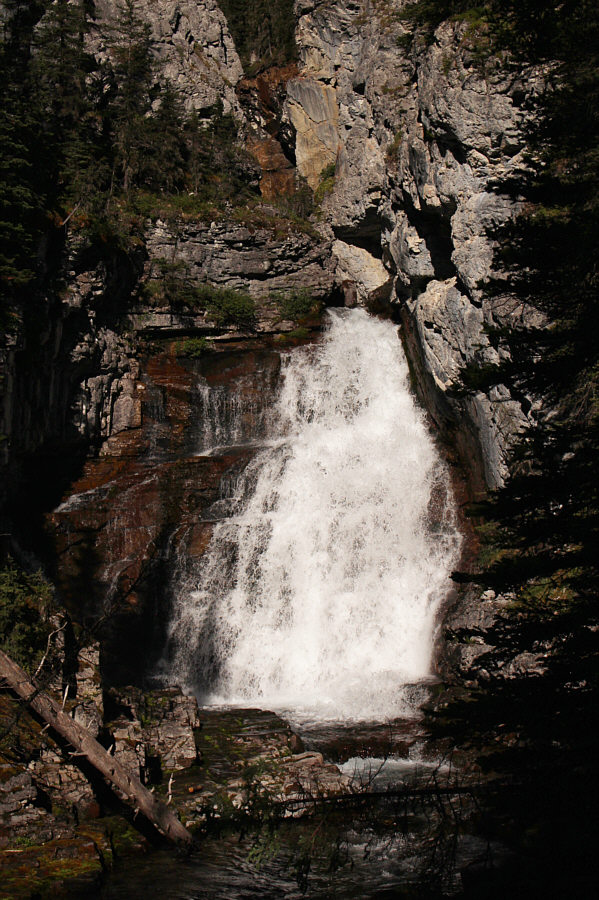 |
This waterfall along North Ribbon Creek is near the spot where a side
trail begins to climb steeply up a valley to the north. |
 |
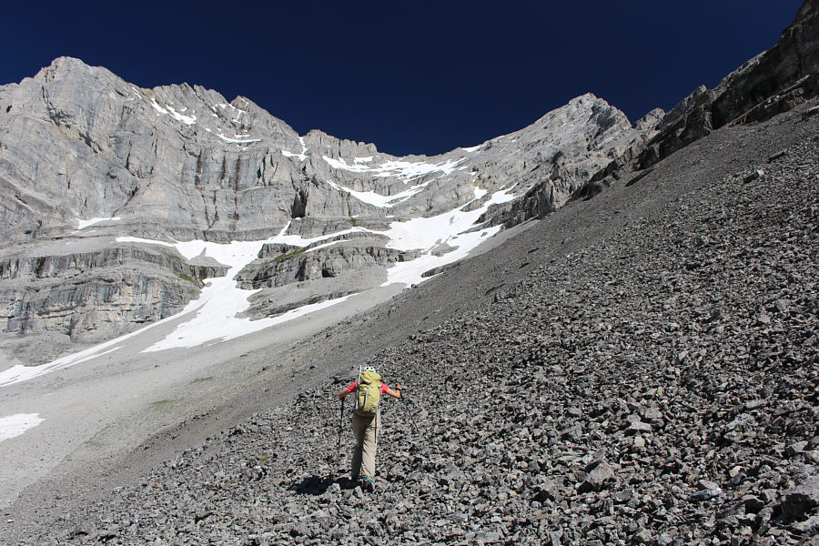
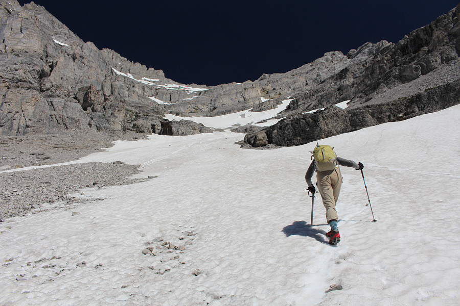
Marta gets her first good look at Wind Mountain. |
 |
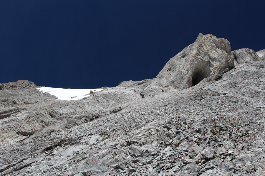
This is not the best approach to the snow patches at centre because of
the loose rocks here. It is better to stay low in the valley and climb
the slope with the patches of vegetation further to the left in the
photograph. |
 |
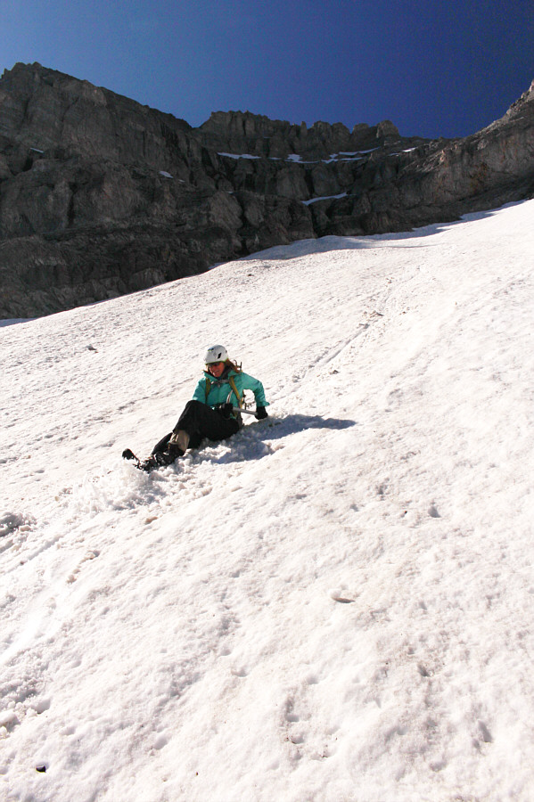
Marta climbs up a big lingering snow patch. |
 |
The rock band ahead of Marta has several weaknesses that can be ascended.
Some are wetter than others. |
 |
Marta picks one of the drier routes up the rock band. |
 |
Despite more lingering snow patches higher up, Marta is able to avoid
most of them. |
 |
Marta scrambles up steep slabs past a
shallow cave. |
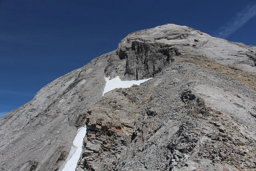 |
Up ahead are the crux slabs. |
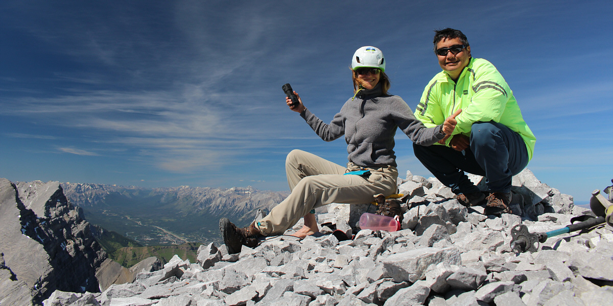
Marta and Sonny reach the summit of Wind Mountain (3096
metres).
 |
Mount Sparrowhawk
sits to the southwest. On the horizon at right is Mount Assiniboine. |
 |
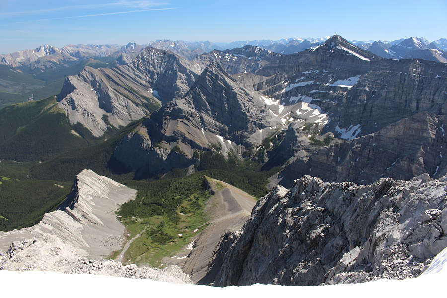
The other three peaks of
Mount Lougheed
overlap each other to the northwest. |
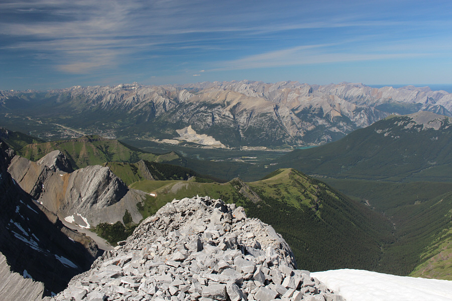 |
The peaks of the Fairholme Range can be seen to the north. The town
of Canmore is visible at far left. |
 |
Notable peaks to the south include
Fisher Peak (far
left horizon), Mount
Kidd (left),
Ribbon Peak (centre),
Mount Kidd South
Peak (right of centre), and
Mount Bogart
(right). |
 |
Marta carefully descends the crux slabs. |
 |
Good handholds and footholds are few and far in between on the crux slabs. |

Sonny prefers to face outward as he steps down the crux
slabs.
Photo courtesy of Marta Wojnarowska