BOU AVENUE
Coyote Hills East
On 14 March 2021, Kevin Caron, Rafal (Raff) Kazmierczak, Shelley Milutinovic, Nancy Petticlerc, Zosia Zgolak and I hiked up the easternmost high point of Coyote Hills--I dub it Coyote Hills East--near Highwood Junction in Alberta's Kananaskis Country.  I remember seeing this lower bump from the highest point of Coyote Hills a couple of years ago and thought that it might make for an easy winter or shoulder-season objective.  While the ascent of the highest point of Coyote Hills is well-documented in Gillean Daffern's Kananaskis Country Trail Guide and numerous online trip reports, I could find no mention of the easternmost high point.  Perhaps that is not too surprising given that it appears to be nothing more than an uninteresting forested bump when viewed from Highwood Junction.

Starting from a pullout on the Forestry Trunk Road (SR 940) about 2.8 kilometres south of Highwood Junction, we climbed up an embankment and crossed a large meadow to the start of a road heading westward.  Although the road was snow-covered, there had already been a lot of foot traffic, and hiking was initially very easy.  About 300 metres from our starting point, we noticed a well-trodden snowshoe track heading north into the trees, but unsure of where it led, we ignored it for the time being.  In a large clearing 150 metres further, we abandoned the road and made our way through light forest toward a glade I had discovered on Google Maps and had marked as a waypoint in my GPS unit.  The ground here was still mostly snow-covered, but fortunately, the post-holing was not too wearisome.  When we crossed the glade, we stumbled onto another snowshoe track, possibly the same one that we ignored earlier.  This time, we opted to follow the snowshoe track upward, and it fortuitously led us to the open and snow-free south end of our objective.  From there, we simply grinded up the south ridge and had no problems reaching the high point which is marked by a small cairn and is surprisingly more scenic than expected.

Since the weather was so nice, we hung out at the high point for well over an hour before commencing our descent by hiking back down the south ridge.  When we re-entered the forest at the end of the ridge, we followed the snowshoe track out in its entirety and found that it was indeed the same one we had initially ignored.  Regaining the road, we turned left and easily hiked the remaining short distance back to our starting point.

In retrospect, this turned out to be a gem of a hike.  Despite a lack of route documentation and the fact that it will always be overshadowed by its higher neighbour to the west, Coyote Hills East is an ideal choice when time and energy are in short supply.  The modest high point evidently receives occasional visitors, and the rewarding views at the top are more than worth the paltry effort required to get there.
Looks like a forested hill with no views from this angle!

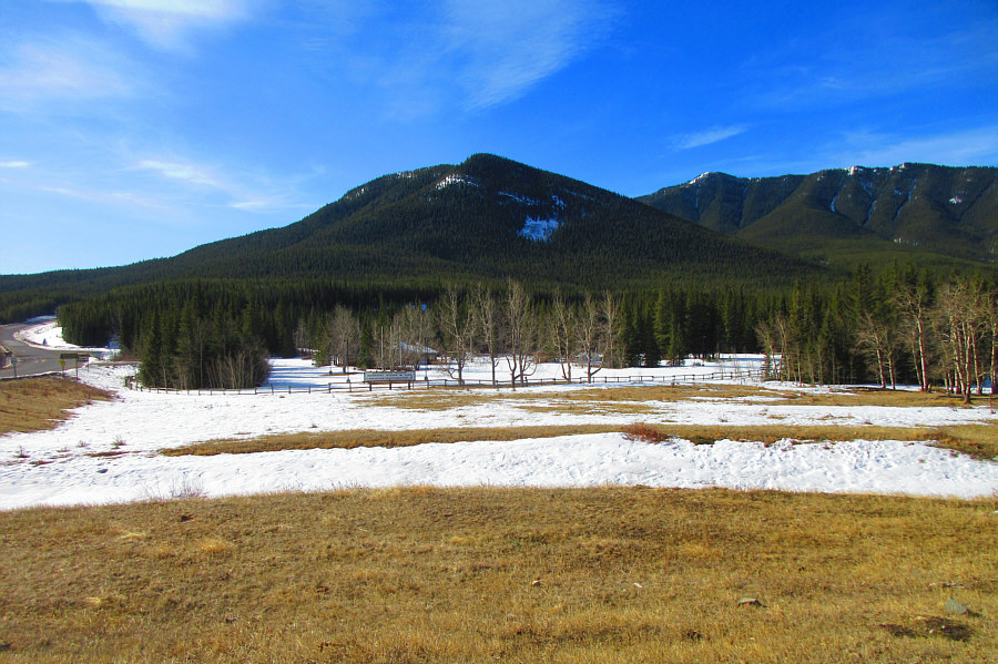
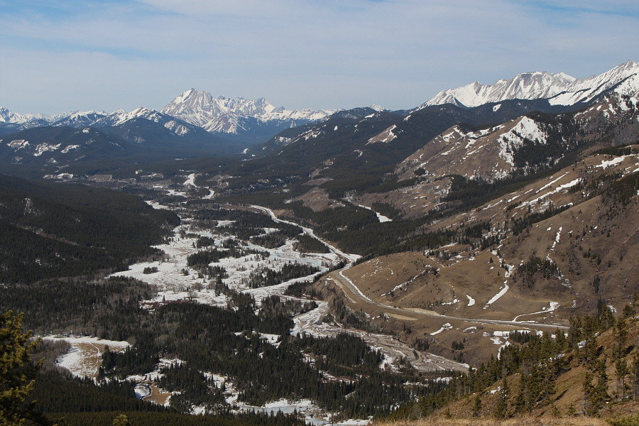
This is Coyote Hills East as seen from Highwood Junction.

Photo courtesy of Zosia Zgolak

We're off to a good start!

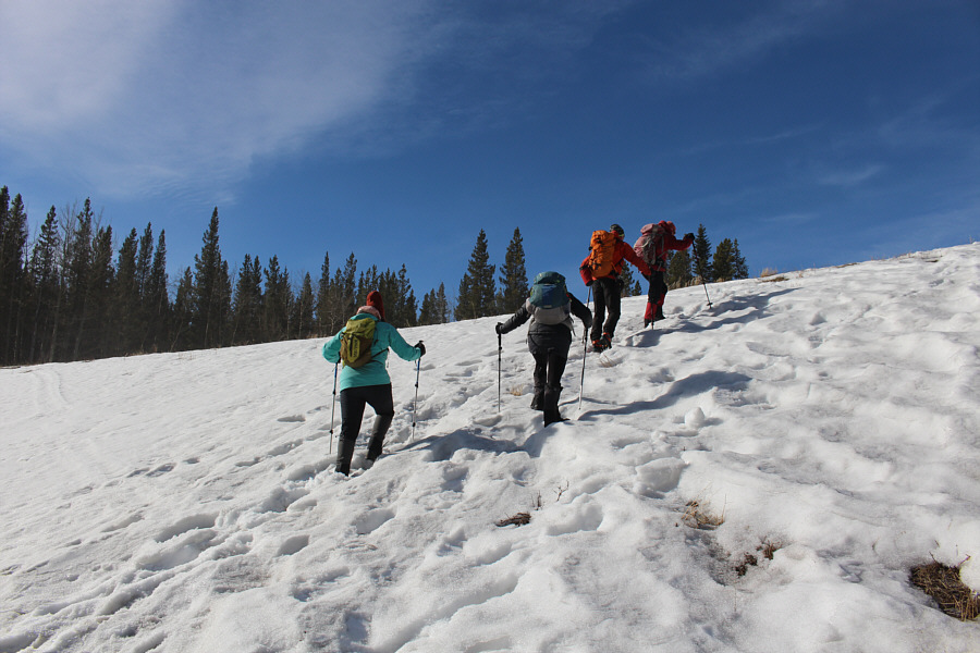
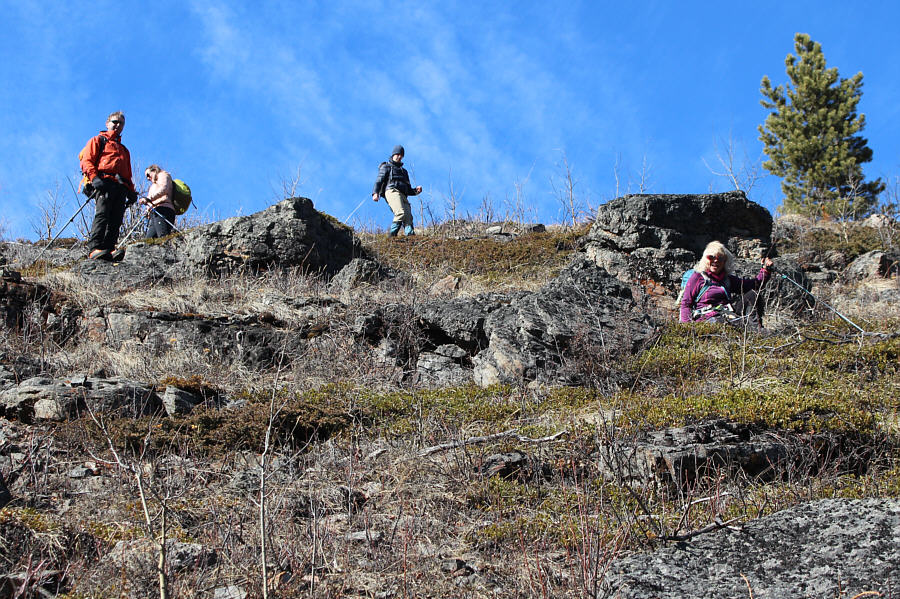
The group starts off by climbing a snowy embankment along the side of the Forestry Trunk Road (SR940).

A surprising amount of foot traffic here in winter! 
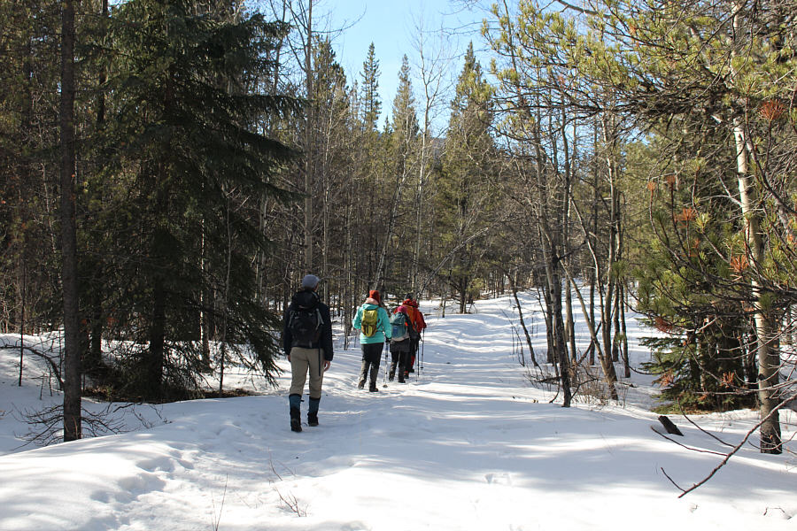
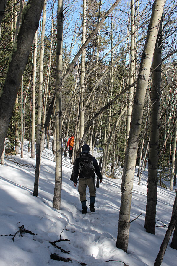
The group follows a well-trodden path along a road through the forest.
Luckily the snow wasn't too deep here! After leaving the road and bushwhacking to this glade, the group gets its first glimpse of Coyote Hills East through the trees at left.
No trail, no problem! 
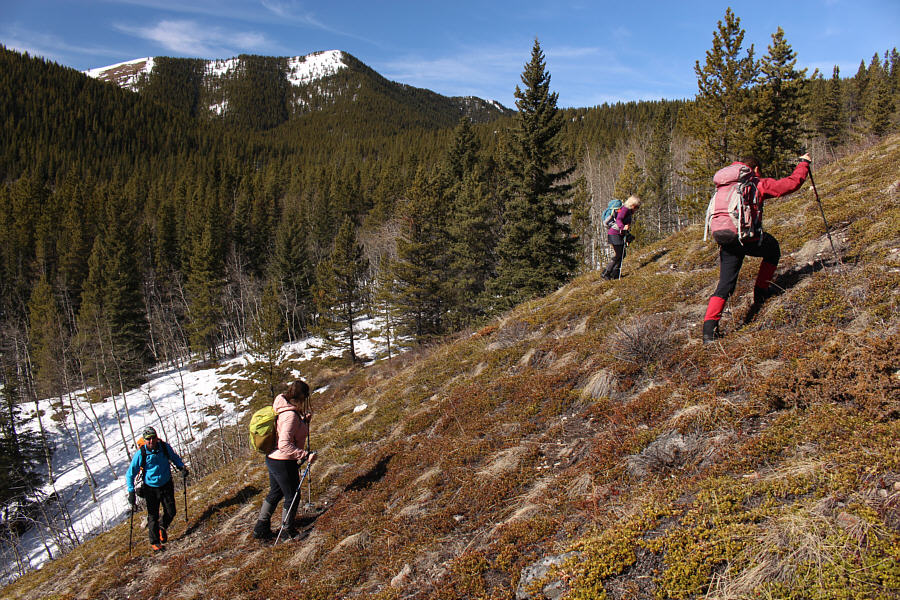
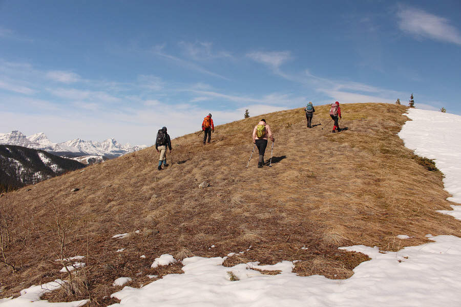
The group begins climbing up the south end of Coyote Hills East.  The highest point of Coyote Hills is visible in the distance.
You can make it as easy or as hard as you like! 
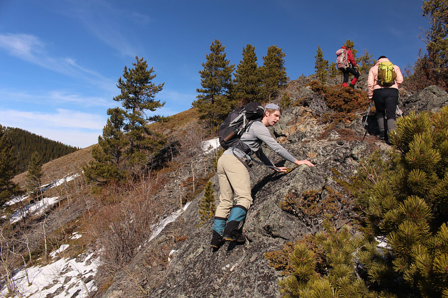
Kevin finds opportunities to scramble on rocks as the group climbs up the ridge.
Just kidding! It is a race to the top!
Amazing reward for very little effort! 
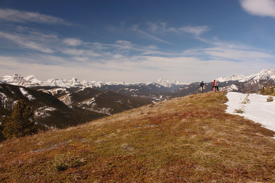
The high point grants surprisingly good views.

And all with proper social distancing!

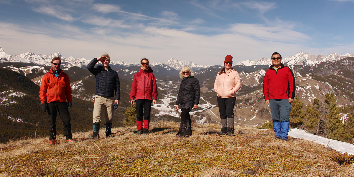
Raff, Kevin, Zosia, Shelley, Nancy and Sonny stand near the high point of Coyote Hills East (1924 metres).


Looks like some good skiing can be had up there! Here is another view of the highest point of Coyote Hills to the west.
This valley is one of my favourite places in K-Country. To the northwest, Mist Mountain stands out on the left horizon at the head of Highwood River valley.
None of us picked up any that I know of, but this would be prime tick habitat!

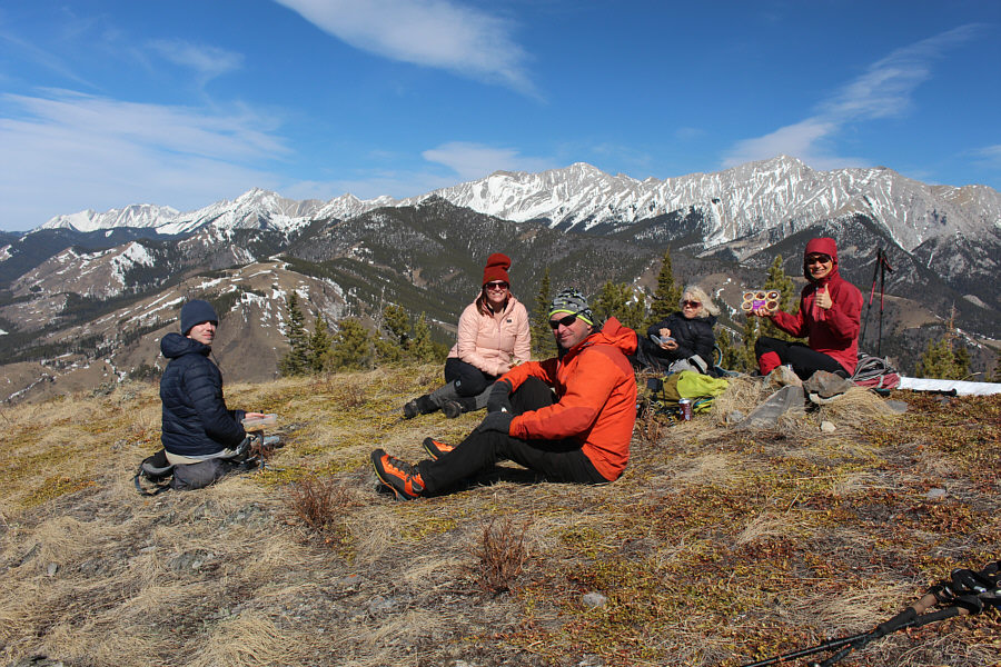
Enjoying some great weather, the group takes an extended break on the high point.

Do, or do not! There is no "try"!

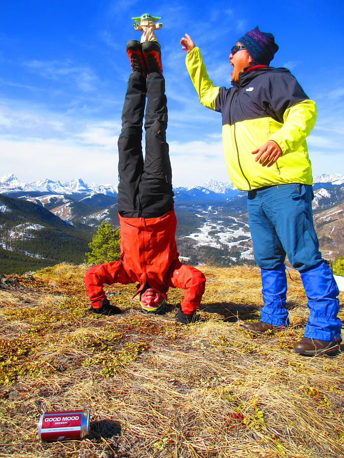
Raff is training to be a Jedi with Grogu (a.k.a. Baby Yoda) balanced on his feet.  Raff has whimsically called this high point Co-yoda Hills.  After drinking a can of "Good Mood" beer, Sonny has inadvertently turned to the dark side and is attempting to unleash Force lightning upon Baby Yoda.

Photo courtesy of Zosia Zgolak

Why do we fall? So that we can learn to pick ourselves up! Shelley (right) accidentally slips while descending a steep slope near the south end of Coyote Hills East.
How convenient! The group descends a snowshoe trail through the forest.
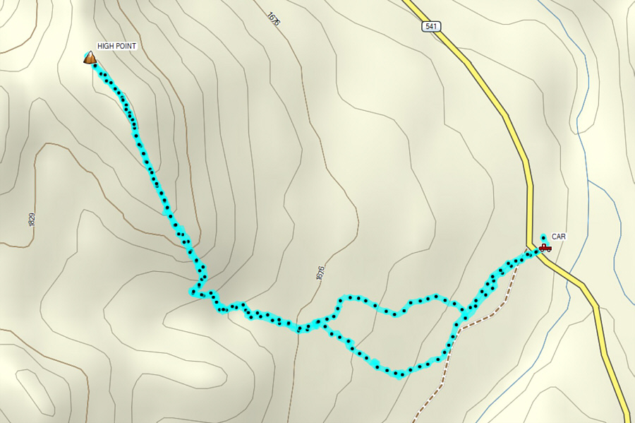
Highly recommended as a short hike when time and/or energy are limited! Total Distance:  5.7 kilometres
Round-Trip Time:  4 hours 11 minutes
Net Elevation Gain:  354 metres

GPX Data