BOU AVENUE
Hoffman Hill And Green Mountain
Taking advantage of the last weekend to access Alberta's Sheep River Provincial Park and Bluerock Wildland Provincial Park before the annual closure of the local highway, I organized a hike to Hoffman Hill and Green Mountain on 27 November 2021.  Both objectives are described in Gillean Daffern's Kananaskis Country Trail Guide, but I believe Bob Spirko coined the unofficial name for Hoffman Hill.  Joining me for the hike were Asieh Ghodratabadi, Ali Shariat, Aga Sokolowska, Dorota Sokolowska, Wil Tabak and Zosia Zgolak.

Starting from Indian Oils trailhead (34 kilometres west of Turner Valley along Highway 546), Asieh, Ali, Aga, Dorota, Wil, Zosia and I walked downhill to the bridge over Sheep River.  After a short pause to admire Tiger Jaw Falls, we turned left at the far end of the bridge and walked along the wide but icy Sheep Trail for about 1.6 kilometres until we reached an obvious clearing just past a creek crossing.  We left the trail here and had no problems climbing the lightly forested southwest slopes of Hoffman Hill.  Upon reaching the top of the hill, we stopped only long enough to take a group photo before descending grassy slopes to the east.
Don't hold your breath on a sign upgrade from the provincial government!

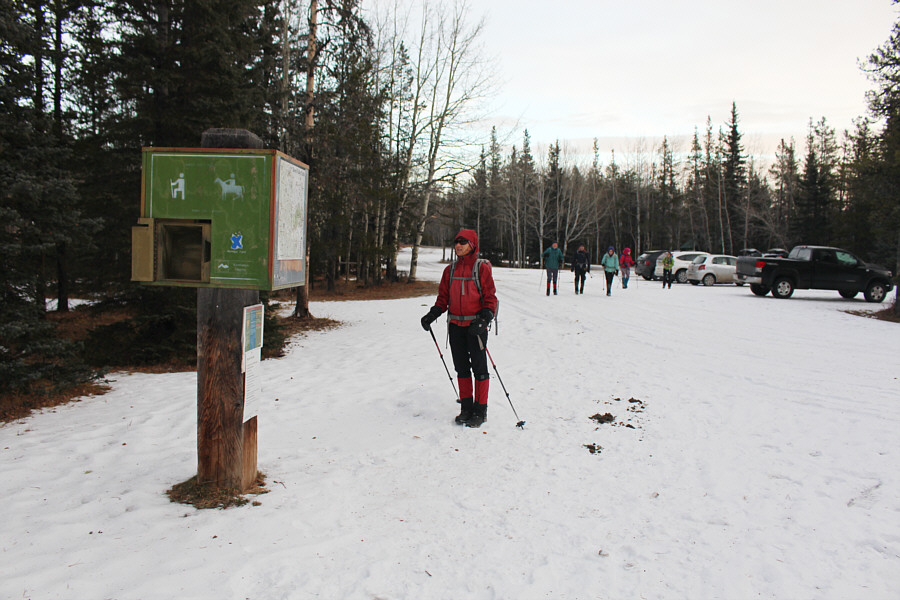
Zosia checks out the Indian Oils trailhead sign which has seen better days.

Nicest bridge in the Sheep River valley! The group pauses just before crossing the bridge over Sheep River.
I wonder if it ever freezes completely in winter... 
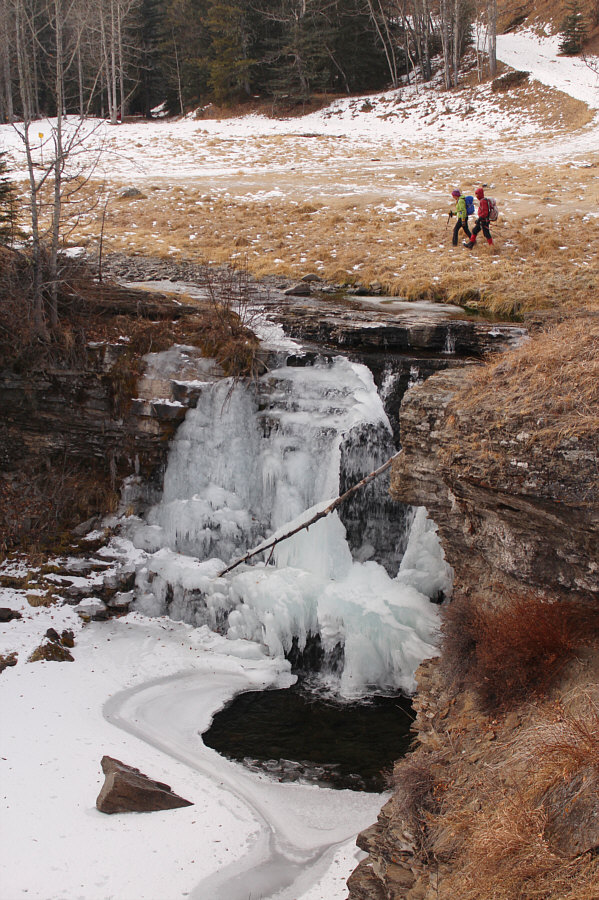
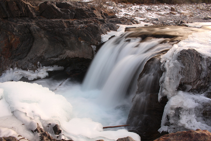
Below the bridge sits Tiger Jaw Falls.
Hoffman Hill doesn't seem like much from here! 
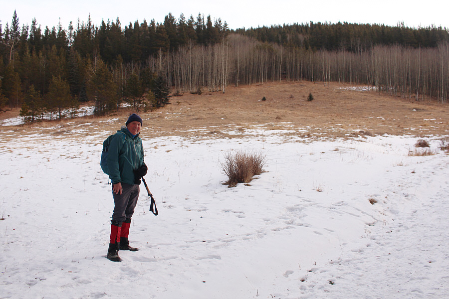
Wil leaves Sheep Trail at this point to climb up the southwest slope of Hoffman Hill.
Great views already for such a diminutive objective! 
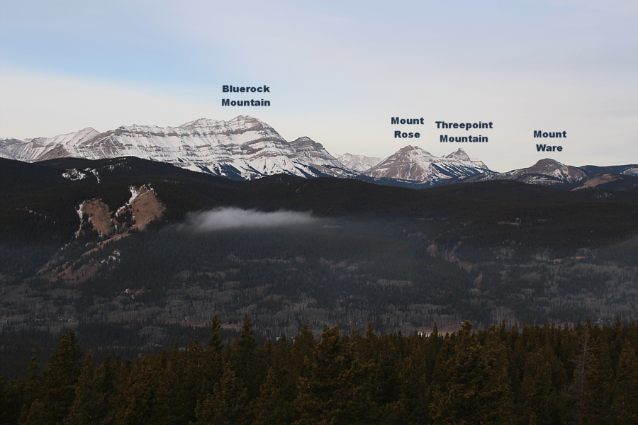
Aga and Zosia climb out of the trees near the top of Hoffman Hill.  On the horizon at centre is Mount Burns, and at far right is Bluerock Mountain.

Everyone is happy to tag the first summit of the day so quickly!

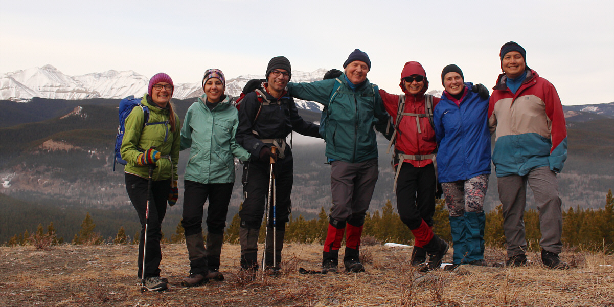
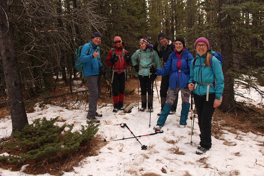
Aga, Asieh, Ali, Wil, Zosia, Dorota and Sonny stand near the high point of Hoffman Hill (1794 metres).


Mount Rose and Threepoint Mountain will likely be on my to-do list for next summer... This is the view to the northwest from the top of Hoffman Hill.
Regaining Sheep Trail in the valley, Asieh, Ali, Aga, Dorota, Wil, Zosia and I continued eastward and stopped briefly to admire Dyson Falls before crossing frozen Dyson Creek to start up Green Mountain Trail.  About 150 metres beyond the creek crossing, we kept left at a major junction (right goes to Junction Lookout) and hiked another 450 metres until we reached a second junction marked by small metallic arrows.  We turned left here and passed a makeshift campsite only to lose the trail completely in the forest.  Undaunted, we pushed our way up the west slopes of Green Mountain until we topped out on the partially open northwest end of the summit ridge.  We then headed southeast into forest to look for the true summit which, according to a trip report by Chris Doering, has a cairn with a survey marker.  Knowing that the true summit is completely covered by trees, we did not try very hard to find this cairn and eventually just picked a spot that felt like the highest point for our "summit" photo.
Who needs to go to Egypt to see the Great Pyramids? 
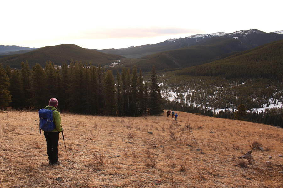
Aga and the rest of the group descend past some pyramid-shaped wire cages on the grassy southeast slope of Hoffman Hill.
This spot would be teeming with people later in the day! 
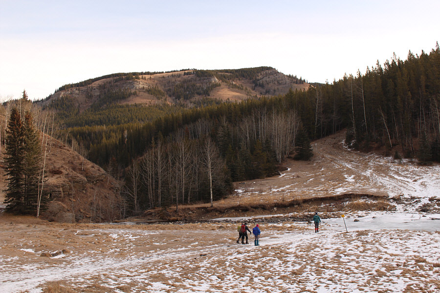
The group prepares to cross frozen Dyson Creek.  In the background is Green Mountain.
A worthy hiking objective in itself. Dyson Falls is partially frozen on this day.
ie. Not bad at all! 
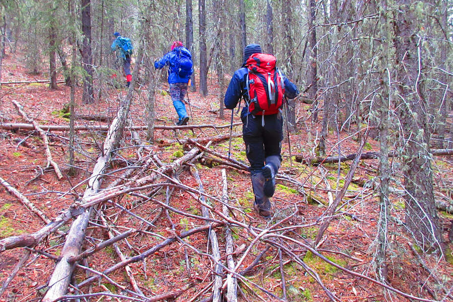
This is about as bad as the bushwhacking gets while ascending Green Mountain.

Photo courtesy of Zosia Zgolak

It's hard to believe how little snow there is here near the end of November. Dorota, Ali, Asieh and Zosia reach a grassy clearing above an aspen forest.
Unfortunately, we ended up skipping The Castle altogether. 
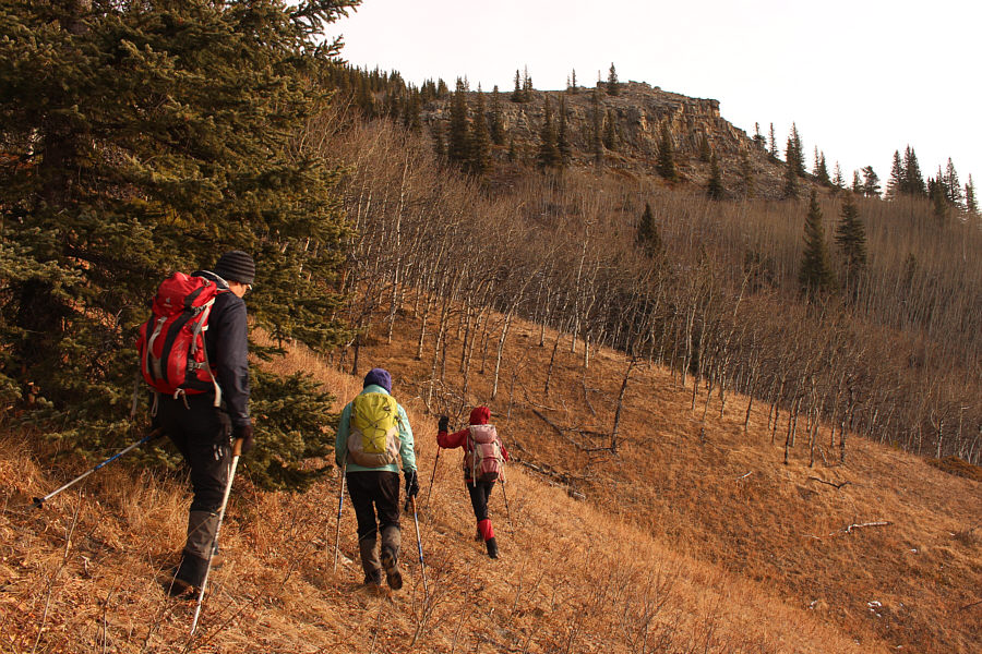
A cliff feature which Gillean Daffern refers to as "The Castle" comes into view.  Instead of approaching The Castle, Ali, Asieh and Zosia would turn left up the aspen-covered ridge just ahead.
We marked this spot with an X just like Bob Spirko! 
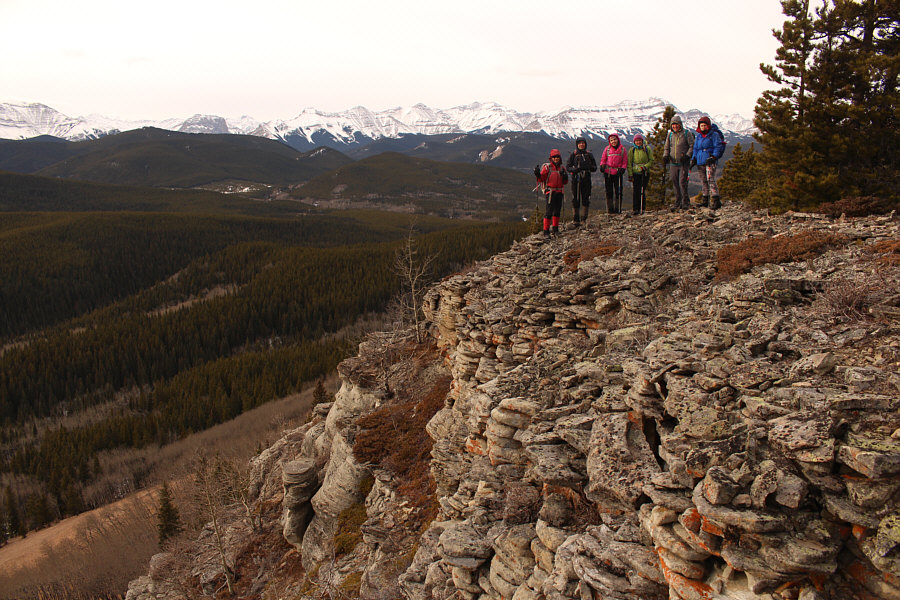
Wil, Zosia, Asieh, Ali, Dorota and Aga stand somewhere near the nebulous high point of Green Mountain (1848 metres).
Instead of lingering in the trees at the top, Asieh, Ali, Aga, Dorota, Wil, Zosia and I promptly continued heading in the same direction until we reached Spaulding Point, a scenic bluff at the southeast end of Green Mountain.  Although the wind made it too uncomfortable to hang out atop the bluff, we took an extended break in the shelter of some nearby trees and also belatedly celebrated Wil's birthday here.  When the birthday party ended, we backtracked a bit before dropping down open slopes below Spaulding Point.  Except for having to climb over a minor forested rib, we enjoyed mostly easy downhill off-trail hiking until we intersected Green Mountain Trail.  Turning right, we had no issues on the long walk back to Dyson Falls and subsequently to Tiger Jaw Falls and the trailhead.
Looks like Spaulding Point is also a forested bump. Why are we going there? 
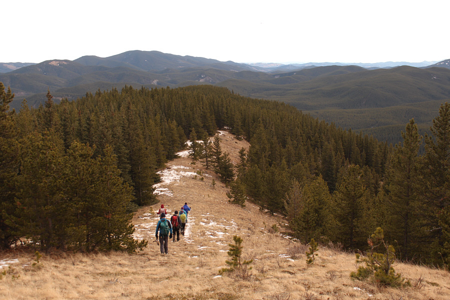
The group heads toward Spaulding Point (centre).  Blue Ridge is on the left horizon.  Further left, the lower forested bump with the bare patch is Mount Dyson.
Not a real summit in my opinion, so I'm not claiming it as such! 
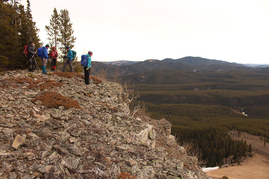
The group arrives at Spaulding Point (1787 metres).
Happy belated birthday, Wil! 
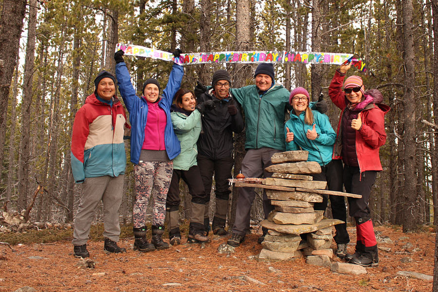
Sonny, Dorota, Asieh, Ali, Wil, Aga and Zosia belatedly celebrate Wil's birthday at an inukshuk near Spaulding Point.
Can you spot Gibraltar Mountain? Here is the view to the west from Spaulding Point.
Here's to all the ladies! Dorota, Asieh, Aga and Zosia descend grassy slopes below the cliffs of Spaulding Point.
I'm glad we didn't leave this hill for the return trip! 
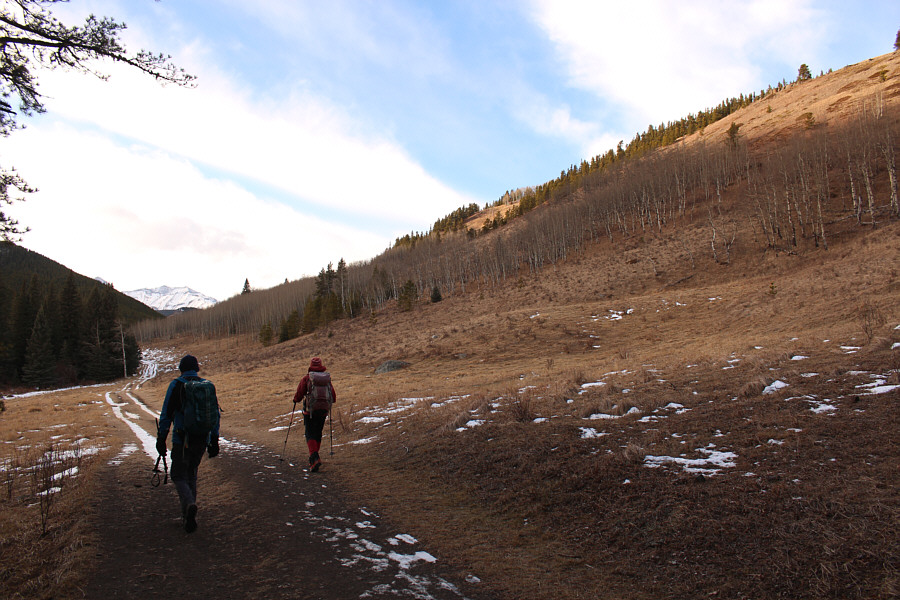
Wil and Zosia bypass Hoffman Hill (right) while hiking back to the trailhead along Sheep Trail.
À la prochaine! Here is a last look at Tiger Jaw Falls near the trailhead.
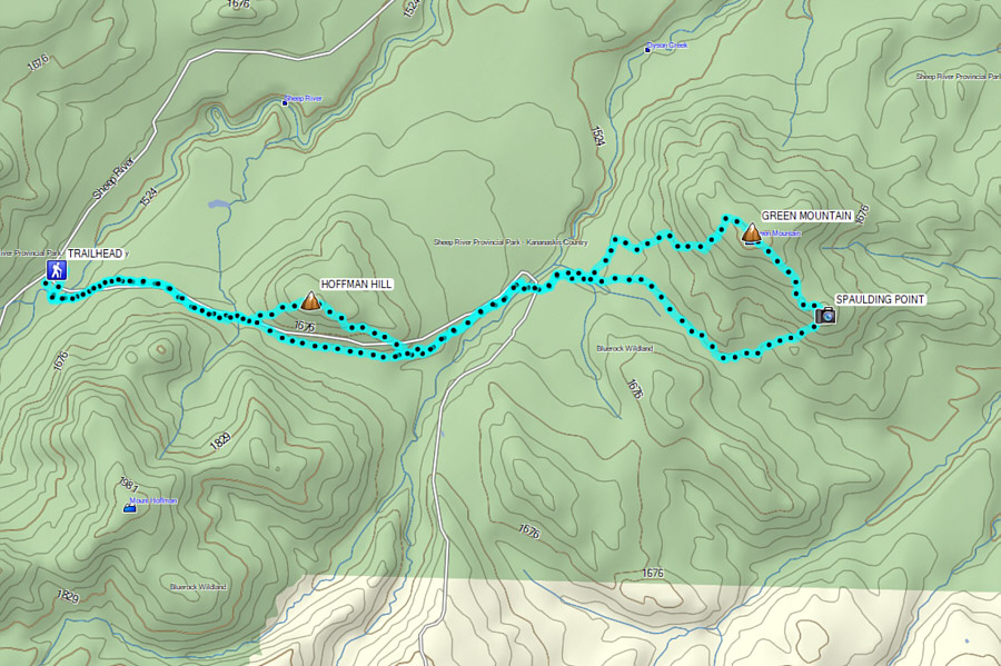
An excellent shoulder-season trip especially just before the annual road closure! Total Distance:  16.6 kilometres
Round-Trip Time:  7 hours 11 minutes
Cumulative Elevation Gain:  726 metres

GPX Data