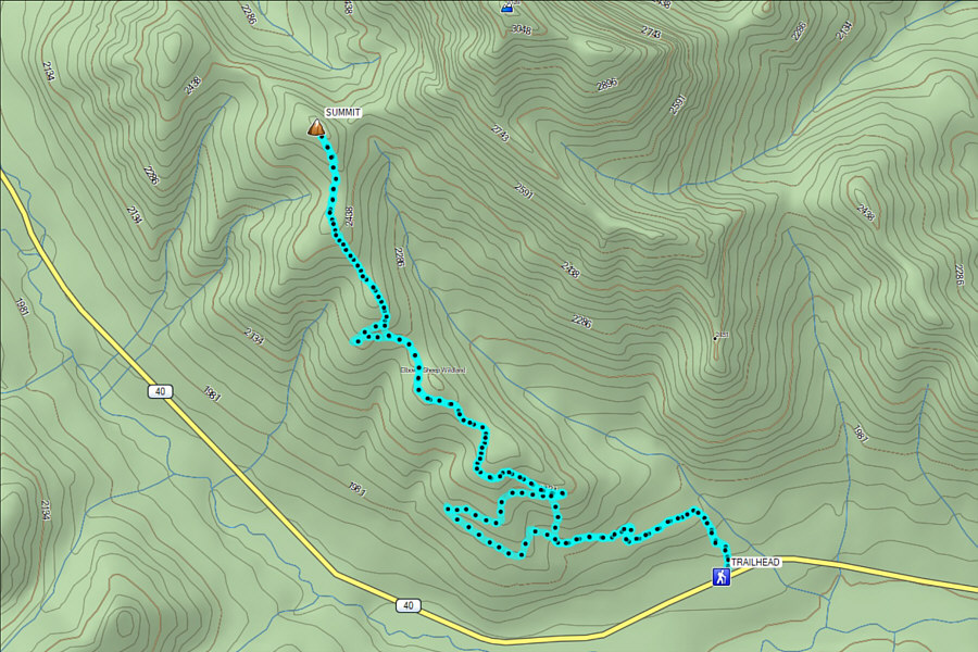
On 30 October 2021, Asieh Ghodratabadi, Ali
Shariat, Wil Tabak, Zosia Zgolak and I ascended Mount Lipsett in
Alberta's Elbow-Sheep Wildland Provincial Park. A straightforward
route up the southeast ridge is described in Gillean Daffern's
Kananaskis Country Trail Guide, and there is also an option to
traverse to a subsidiary peak with an alternate descent down to the
highway. As we drove to the unsigned trailhead (north side of
Highway 40, 13 kilometres south of Highwood Pass or 25 kilometres north
of Highwood Junction), we dropped off a second car about 8.3 kilometres
south of Highwood Pass, but given the abundance of fresh snow in the
area, I was already having doubts about reaching the summit let alone
completing the traverse. When we arrived at the trailhead, there
was already a truck there with what appeared to be a couple of hunters.
Although they did not get out of their truck to speak with us, they were
obviously dismayed by our arrival and promptly drove off. I was
dismayed that the hunters would not be breaking trail through the snow
for us.
Passing a couple of snow-covered bear warning signs on the north side of
the highway, Asieh, Ali, Wil, Zosia and I entered forest to follow a
partially-overgrown exploration road winding up the southeast ridge of
Mount Lipsett. Despite about a foot of fresh snow covering the
ground, the road was still fairly easy to follow, but of course, some
extra effort was required to break trail. Surprisingly, a couple of
backcountry skiers came up behind us, and we leap-frogged each other a
couple of times before they finally took off ahead of us. Although
we now enjoyed the benefit of a broken trail, hiking up the road was
still wearisome due to the slippery footing and general lack of views.
About 6.3 kilometres from the start, we finally broke out of the trees
for good, and while the road traverses left across an open slope here, we
left it to ascend directly up the ridge. Above us, the two skiers
were descending at this point, and we noticed one of them wiping out
seemingly for no reason. As we would soon find out, the snow pack
had no base and was still a tad thin; the skiers were likely scraping on
rocks throughout their descent. After the skiers passed by us, we
followed their tracks up to a false summit which is where they had turned
around. This part of the ridge was exposed to a light but
bone-chilling breeze, and we felt quite frosty as we dropped down
slightly before grinding up the final uncomplicated section to the
summit.
Ali, Wil and Zosia had climbed Mount Lipsett in 2011, but they had taken
a different route from the north and had done so under marginal weather
conditions. Upon reaching the top on this day, they noted that the
summit seemed different, and there was some doubt about whether or not
they had actually reached the true summit ten years earlier.
Regardless, there was no ambiguity about reaching the summit this time,
but given the abundance of snow and poor scrambling conditions, we
decided to abandon both the traverse to the subsidiary peak and the
alternate descent. The light breeze also made it too uncomfortable
to linger on top, and we promptly turned around and retraced our steps
back over the false summit. On our way down, we took a couple of
short cuts to skip some lengthy switchbacks along the road, but
otherwise, there was nothing else worth noting about the long but easy
descent back to the trailhead.
 |
A bear warning sign marks the start of the trail which enters the forest
at left. In the background is
Nameless Ridge. |
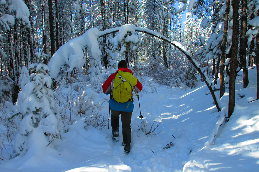 |
Sonny follows an exploration road through the snow-covered forest.
Photo courtesy of Zosia Zgolak |
 |
The road breaks out of trees briefly at a long switchback. |
 |
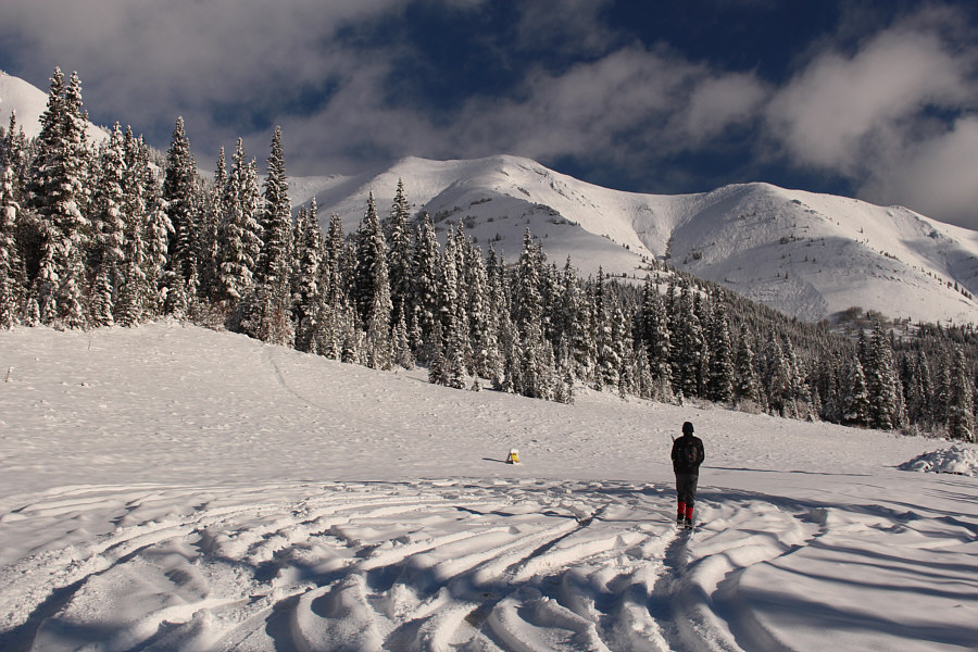
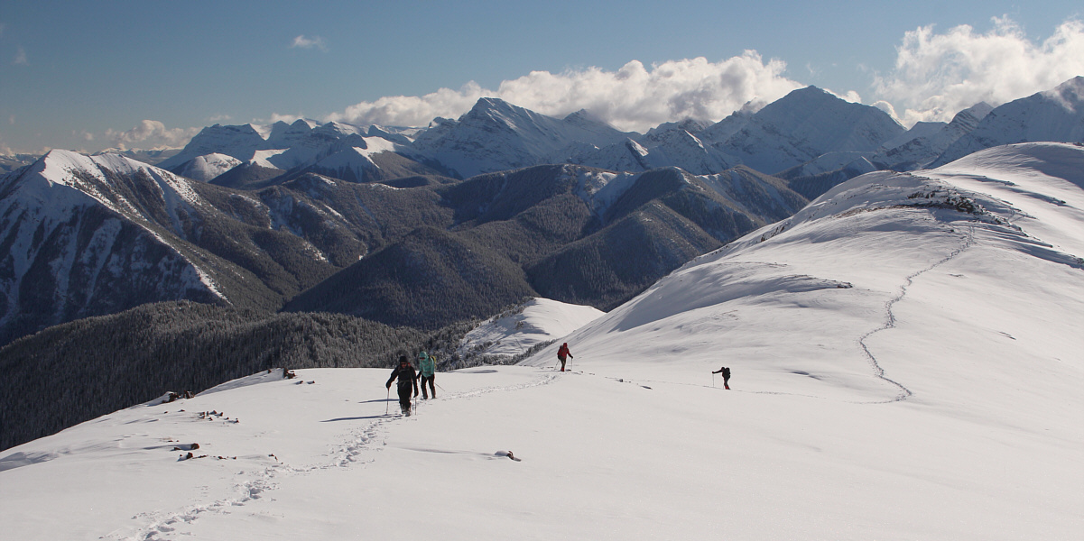
Zosia and Wil finally break out of the forest for good. At right
across the valley is Odlum Ridge. |
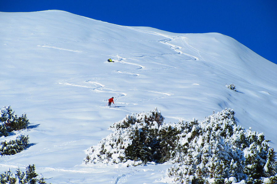 |
A couple of intrepid backcountry skiers get probably their first turns of
the season on the slopes of Mount Lipsett. One of them has wiped
out presumably after hitting a rock under the thin snow cover.
Photo courtesy of Zosia Zgolak |
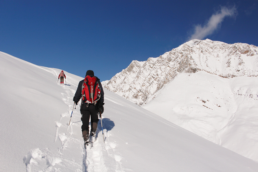 |
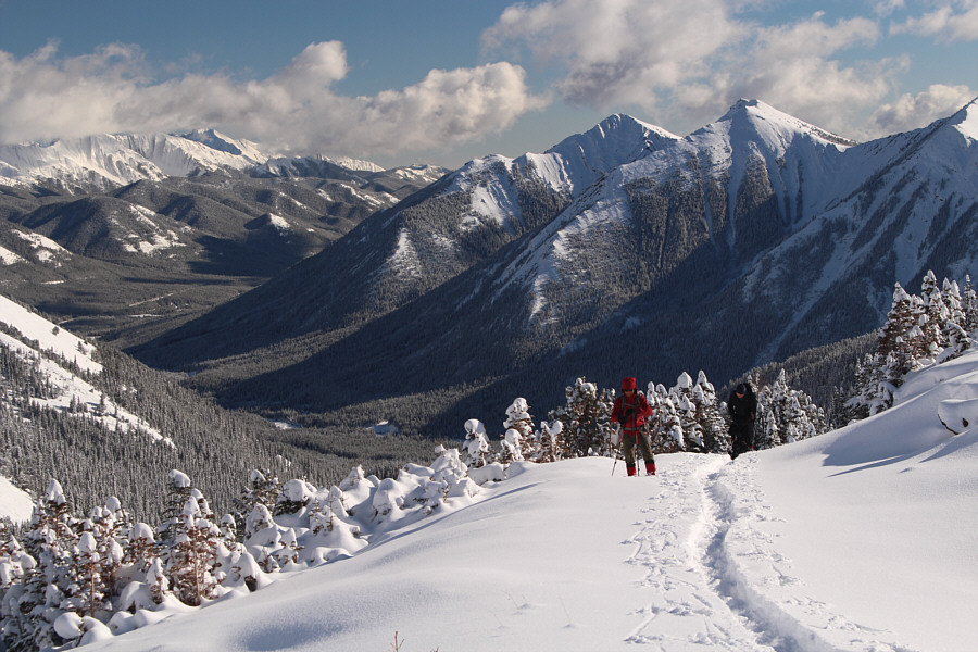
Zosia and Ali follow the skiers' broken track up Mount Lipsett. At
right is Mist Mountain. |
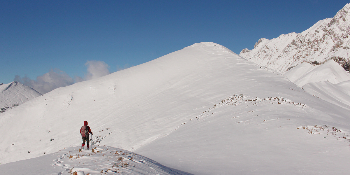
This is the view of the true summit from the false
summit.
 |
Sonny breaks trail en route to the true summit.
Photo courtesy of Ali Shariat |
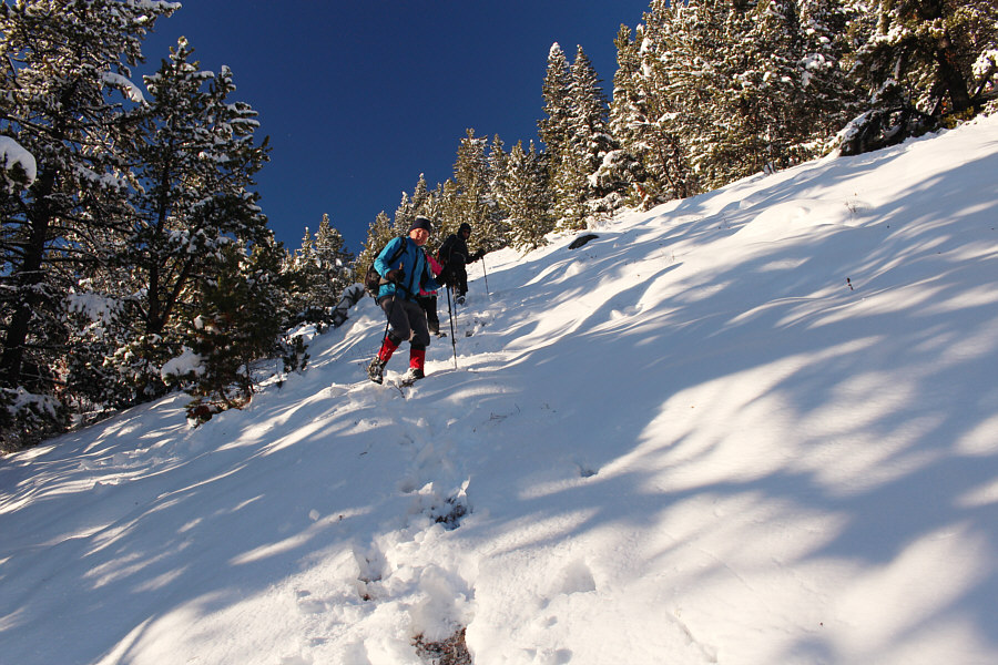
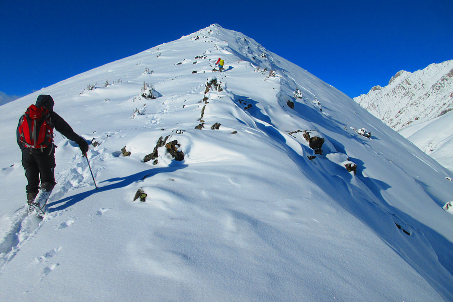
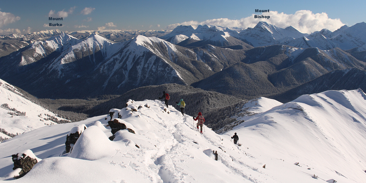
Ali, Asieh, Zosia and Wil follow in Sonny's footsteps
up the ridge.
 |
Ali and Sonny climb up the last
stretch before the summit.
Photo courtesy of Zosia Zgolak |
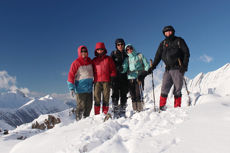 |
Sonny, Zosia, Ali, Asieh and Wil stand on the summit of Mount Lipsett
(2591 metres). |
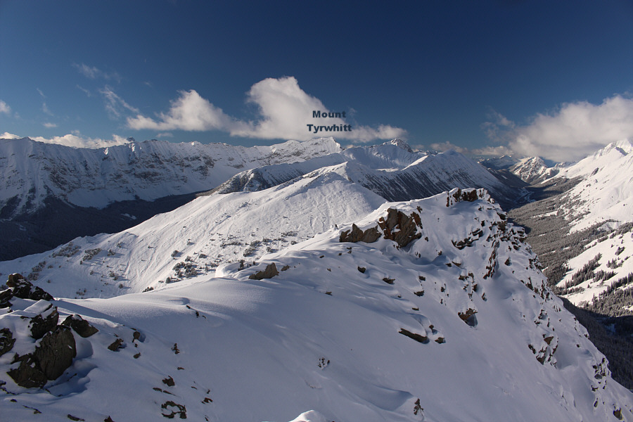 |
Highwood Pass can be seen at distant right in this view to the northwest. |
 |
Highwood Pass can be seen again at distant left in this view to the
north. |
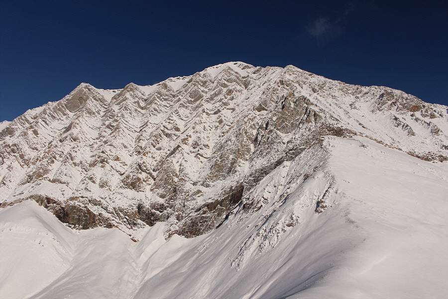 |
Mist Mountain dominates the view to the northeast. |
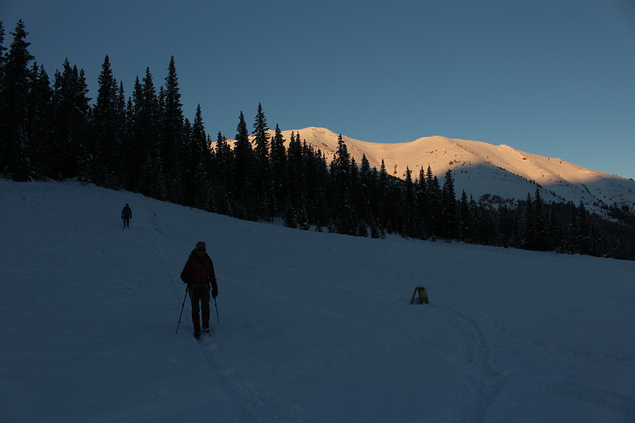
Leaving the summit, Ali, Asieh, Zosia and Wil return
the way they came.