Between working, studying to be a chartered
professional accountant, and helping her husband raise two young boys,
Marta Heske has virtually no time left for recreational pursuits.
Therefore, when she contacted me in advance to let me know that she had
one day available--specifically, 17 October 2021--to join Zosia Zgolak
and me for a hike, I circled that date on my calendar and did some
research to find a worthy hiking objective for us all. As it turned
out, I came up with two separate objectives for Marta to choose from, and
she ended up selecting unofficially-named Prospect Ridge near the north
end of the Opal Range in Alberta's Elbow-Sheep Wildland Provincial Park.
A fairly straightforward ascent route for Prospect Ridge is described in
Gillean Daffern's Kananaskis Country Trail Guide, and she also
includes an option to do a traverse via a clockwise loop. Despite
overcrowding on many trails in Kananaskis Country these days, this trip
has seemingly stayed under most people's radar probably because it
entails a long and somewhat problematic approach via Evan-Thomas Creek.
Joining us for this trek was Aga Sokolowska.
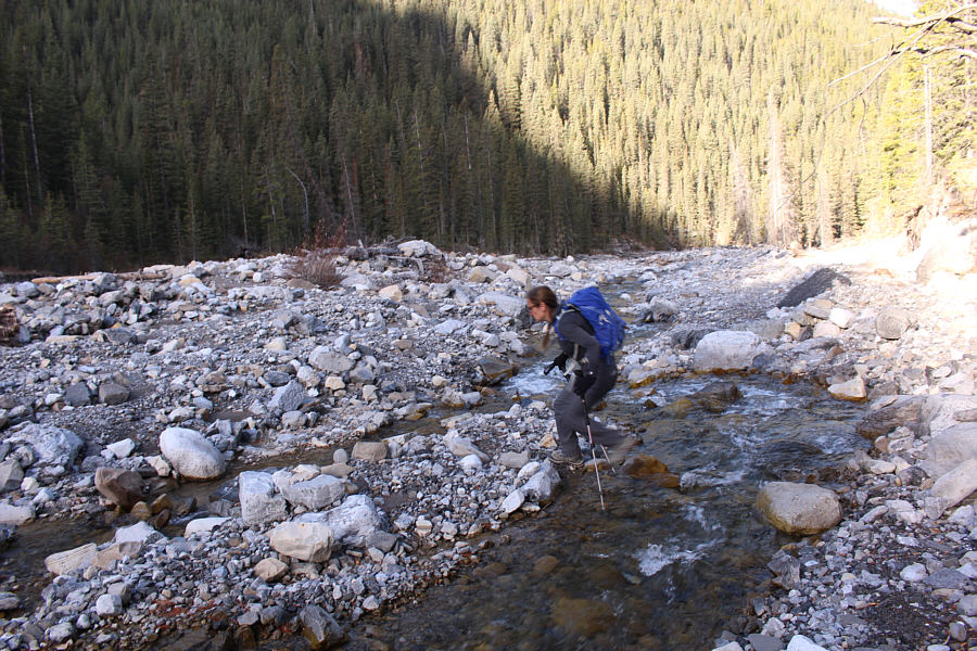
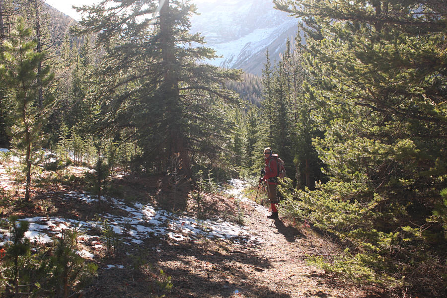
Starting from the Evan-Thomas trailhead (located along Highway 40, 27
kilometres south of Trans-Canada Highway), Marta, Aga, Zosia and I hiked
the trail which runs southward along Evan-Thomas Creek. The wide
trail is initially easy to follow even with some sections re-routed
because of the biblical floods of 2013. Unlike my trip to
Mackay Hills
in 2015, we had no issues this time with bowed trees choking the trail,
but the previously washed-out sections have remained unrepaired.
Although some signs of passage--mostly horses' hoof prints--are
developing in these washed-out sections, route-finding can still be a
little tricky especially in some of the more wide-open confluences with
side creeks. Thankfully, my GPS track from the Mackay Hills trip
was helpful in keeping us pointed in the right direction, and we
eventually reached the Camp Creek turnoff after more than three hours of
slogging up Evan-Thomas Creek. Keeping right at the turnoff, we
climbed westward up a wide but sometimes marshy road to Rocky Creek Pass
which is the jumping-off point for Mackay Hills to the north. We
stuck to the road which soon bends southward and passes an outfitter's
camp replete with cut firewood, picnic tables, and even a pit toilet.
We stopped here for a much-needed lunch break before resuming our hike
along the road. Further south, the road dips slightly to cross to
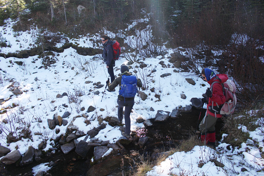
the east bank of Camp Creek. According to Daffern, the road "splits
into two grassy tracks" here, but with snow covering the ground, only the
right-hand track was obvious to us. As such, we followed this track
until it broke out of the trees for good entering meadows near the head
of the valley. From there, we simply grinded up easy open slopes to
the crest of Prospect Ridge and turned northward to reach its high point.
Marta, Aga, Zosia and I took another extended break on the high point of
Prospect Ridge before continuing northward in hopes of connecting with
the left-hand track that we had missed at the split. Surprisingly,
we ran into some hunters who were scouting for game ahead of the opening
of hunting season the following week; they would be the only other people
we would see during our hike. One of the hunters advised us to
stick close to the crest of the north ridge for our descent, and that is
just what we did. We had no problems descending the open upper part
of the ridge, but near tree line, we had trouble locating any defined
trails due to lingering snow cover. Still, the forest was open
enough to allow for fairly easy travel, and we simply followed the path
of least resistance down the ridge until we intersected Daffern's
left-hand track. We then turned southward and followed this track
back to the split to complete Daffern's suggested loop in reverse.
It is worth noting that the left-hand track was largely reclaimed which
explains why we had missed it in the first place. Back on the Camp
Creek road, we settled into a long but uncomplicated march back to the
trailhead. Along the way, the lengthy retreat started to take its
toll on us both physically and mentally. Our discussions seemed to
revolve around aching body parts, food cravings, and wishes for easier
transportation (A bike, a bike! My kingdom for a bike!). We
even had a little contest to guess what time we would make it back to the
trailhead. Zosia turned out to be the winner, and I guess we all
now owe her a back massage. As for Marta, she will have another
year to recover for her next hike with us!
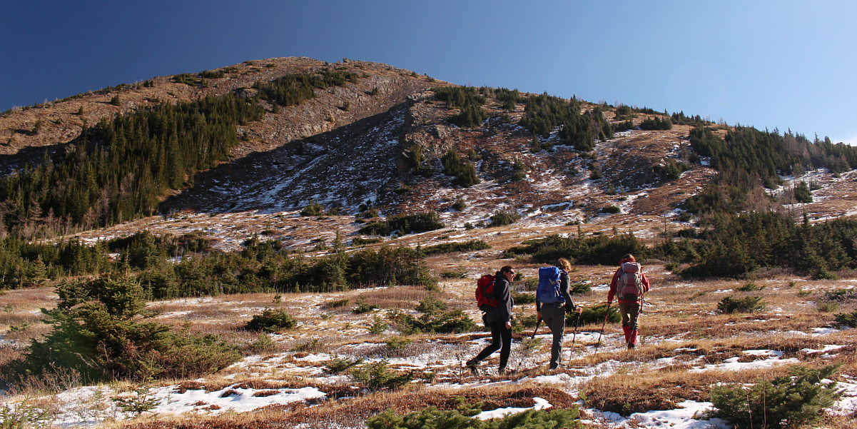
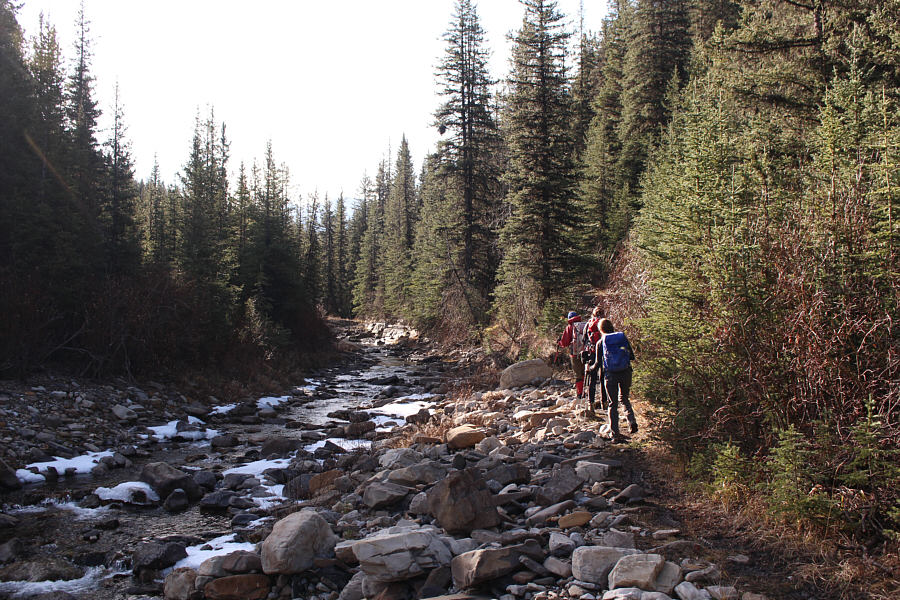
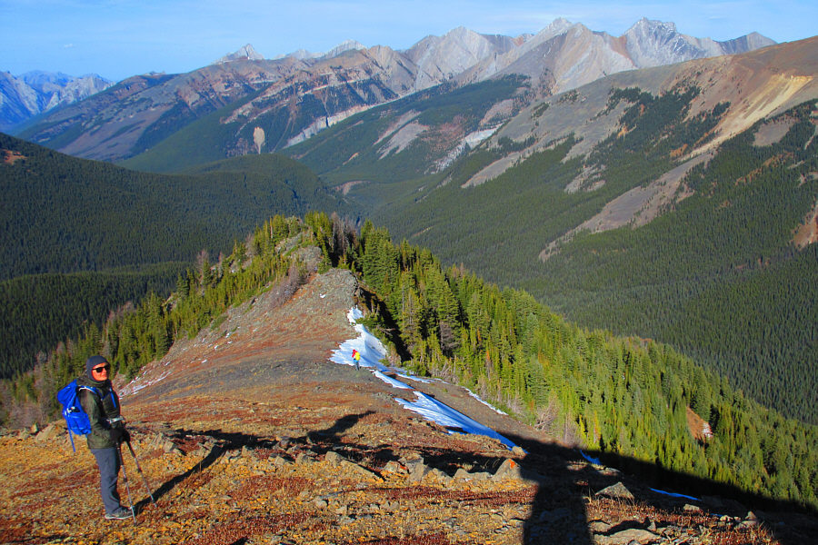
Entering meadows at the head of the valley, the group
prepares to ascend the right skyline ridge.
 |
The group climbs easy slopes. Mackay Hills are visible in the
distance. |
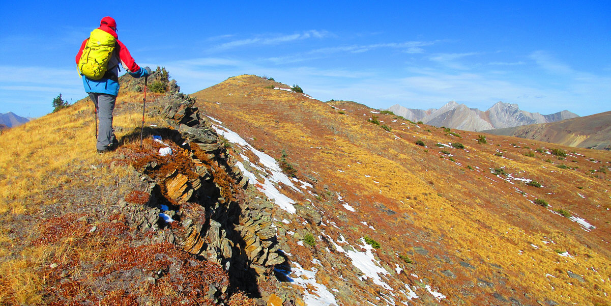
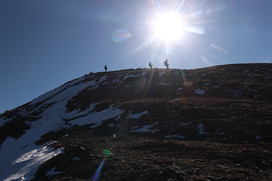
The high point of Prospect Ridge is within sight.
Photo courtesy of Zosia Zgolak
 |
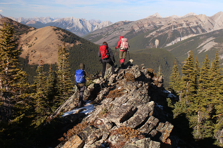
Zosia, Marta and Aga take the last few steps before the top of Prospect
Ridge. |
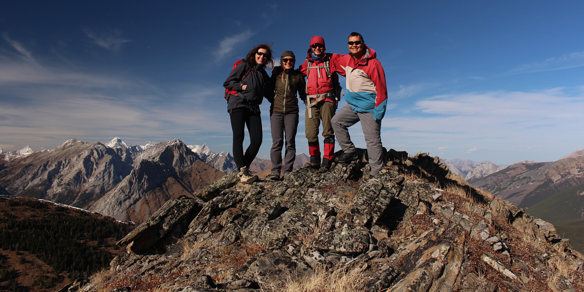
Marta, Aga, Zosia and Sonny stand on the high point of
Prospect Ridge (2471 metres).
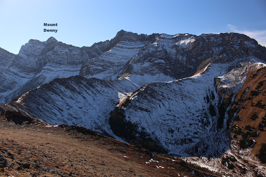 |
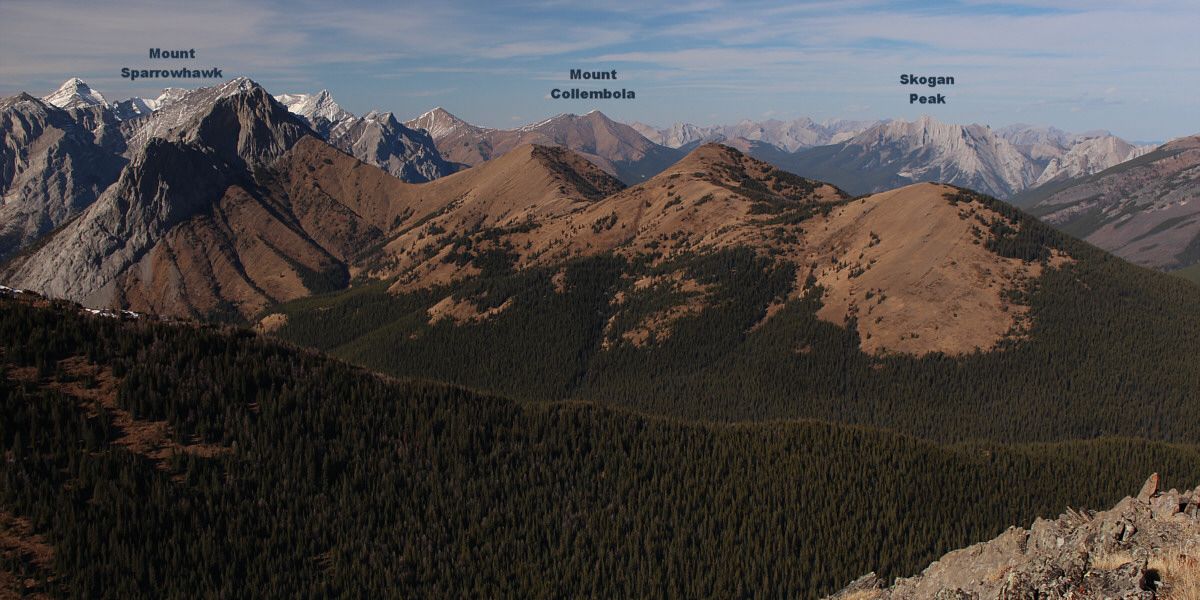
The rugged north end of the Opal Range fills the view to the southwest. |
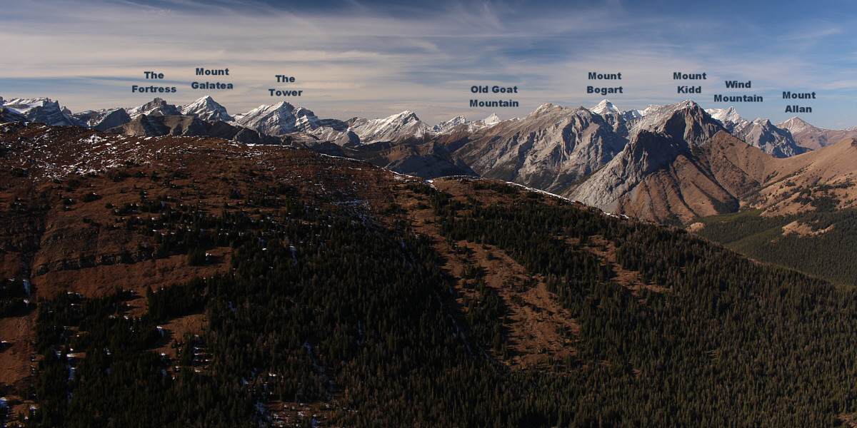
Numerous familiar peaks stretch across the western
horizon.
To the northwest are
The Wedge and the
three distinct high points of Mackay Hills.
 |
Many of the peaks at the north end of the Fisher Range are unnamed. |
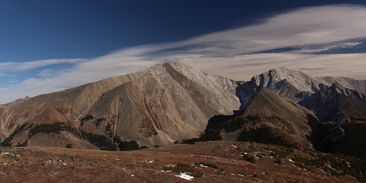
Fisher Peak dominates the view to the east. The subsidiary bump
to the right is unofficially known as Black Ridge.
 |
This is looking southeast through Evan-Thomas Pass. The rugged peak
at right is officially unnamed but called Evan-Thomas East on some maps. |
 |
Aga and Sonny pause at different elevations along the north ridge.
Photo courtesy of Zosia Zgolak |
 |
After chatting with some hunters, the three Polish women descend Prospect
Ridge. |
 |
It is best to stick close to the ridge crest while descending the north
end of Prospect Ridge. |
 |
Zosia descends the left-hand track that was missed on the way in. |
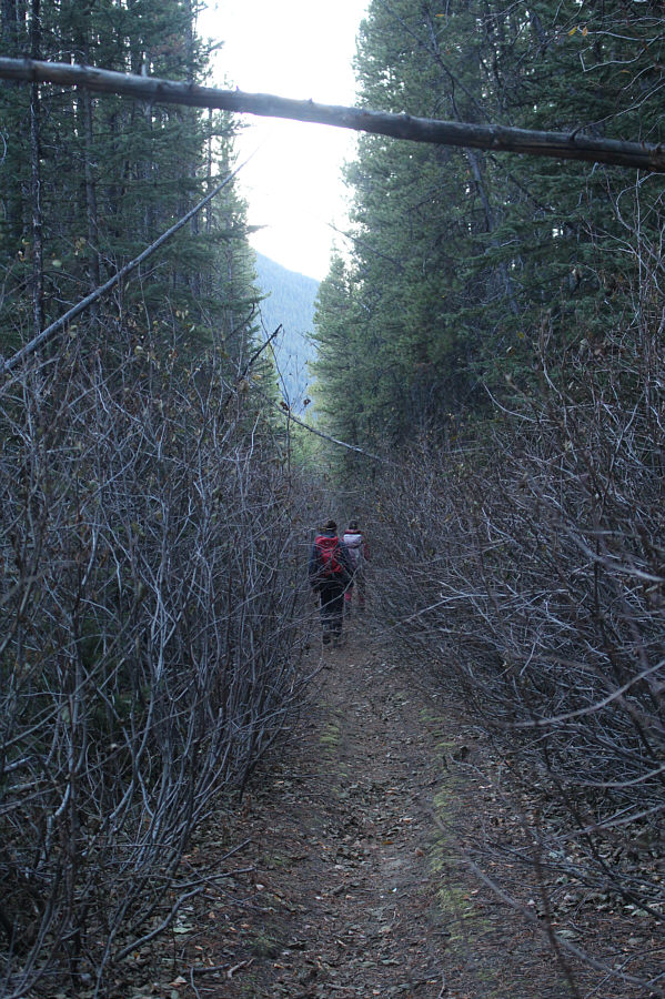 |
The return trip is long and sometimes monotonous. |
 |
Total
Distance: 29.7 kilometres
Round-Trip Time: 11 hours 16 minutes
Cumulative
Elevation Gain: 1117 metres
GPX Data |