BOU AVENUE
Huckleberry Mountain

On 2 July 2022, Zosia Zgolak and I hiked up Huckleberry Mountain in Montana's Glacier National Park.  The officially-named peak is located at the north end of Apgar Mountains and is topped with an active fire lookout tower.  A well-maintained horse trail provides easy access to the lookout tower, and consequently, this is a very popular hike in the area.

The signed trailhead is located along Camas Road, 9.4 kilometres east of the junction with North Fork Road or 9.4 kilometres north of the junction with Going-to-the-Sun Road.  As of this writing, a vehicle reservation is required if accessing Camas Road from Going-to-the-Sun Road between 6 AM and 4 PM each day until 11 September 2022.

From the trailhead, Zosia and I initially set a brisk pace mainly to flee from the numerous mosquitoes that were constantly badgering us even after we applied copious amounts of bug spray.  We quickly crossed McGee Creek and then settled into a long and gradual climb up the valley.  The trail crosses numerous drainages along the way, but there is really not much in the way of views for the first five kilometres or so.  At least the mosquitoes were less abundant after we started to gain some elevation.  The trail eventually climbs over a col and then levels out as it contours around an unnamed high point along the main spine of Apgar Mountains.  A few lingering snow patches were of no consequence, and the hiking here was very enjoyable.  After bypassing the unnamed high point, the trail finally gains the ridge crest and follows it the rest of the way to the fire lookout tower on the summit.  No one was manning the tower on this day, but we only had it to ourselves for a few minutes before a steady stream of hikers began showing up behind us.
There was a second deer here just out of view to the left.

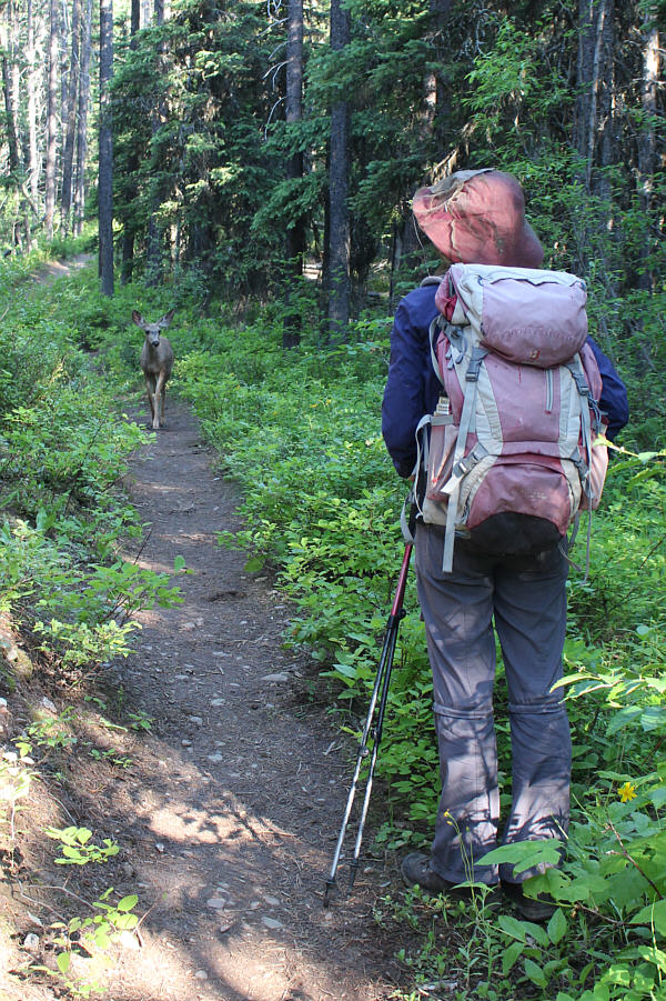
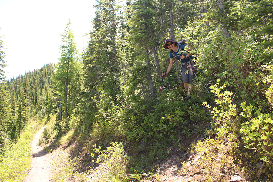
Zosia confronts a deer on the trail.

It's a long walk before you get here!

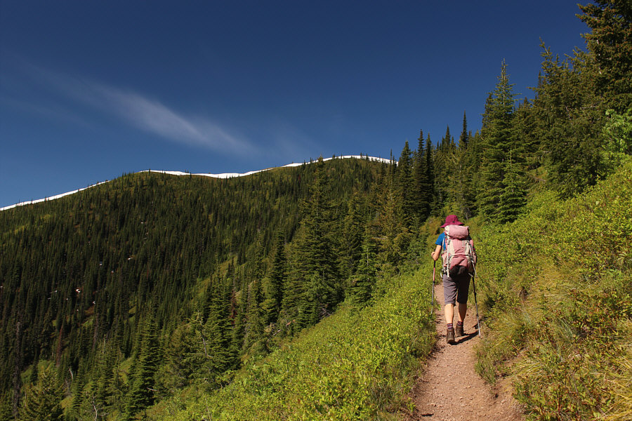
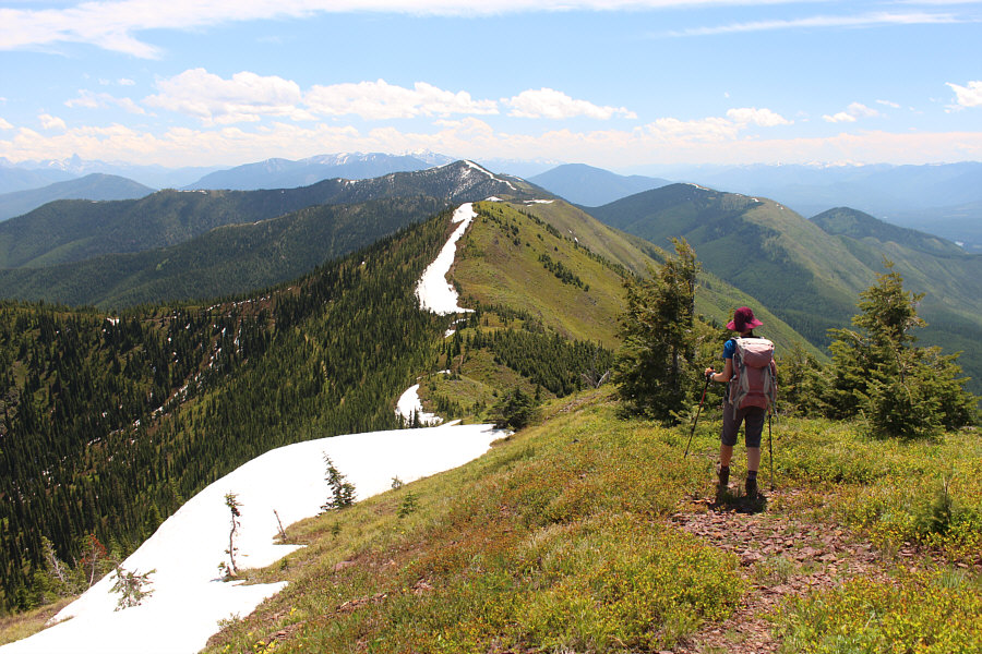
The line of snow ahead marks the main spine of Apgar Mountains.

Can you spot where the trail goes across the far slope? 
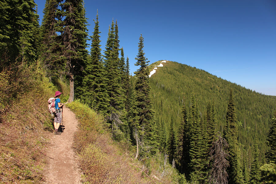
The trail contours around the unnamed high point in the distance.
I wonder if the outhouse is open...

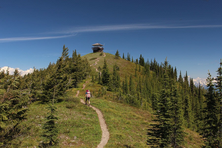
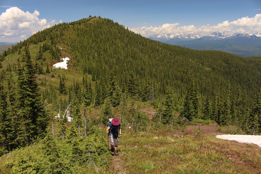
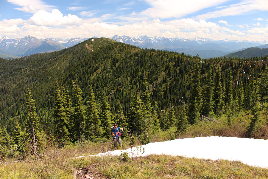
Zosia approaches the top of Huckleberry Mountain.

Nobody's home today!

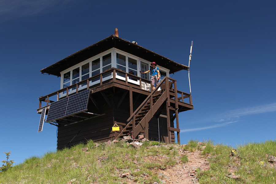
Zosia climbs up the lookout tower at the summit of Huckleberry Mountain (2005 metres).

All these peaks are difficult to access.

The view to the north includes some mountains across the border in Canada (far left) as well as one (Kintla Peak) of the six 10,000-footers in Glacier National Park.


Sadly, all have long approaches usually requiring a bivy or camp. 
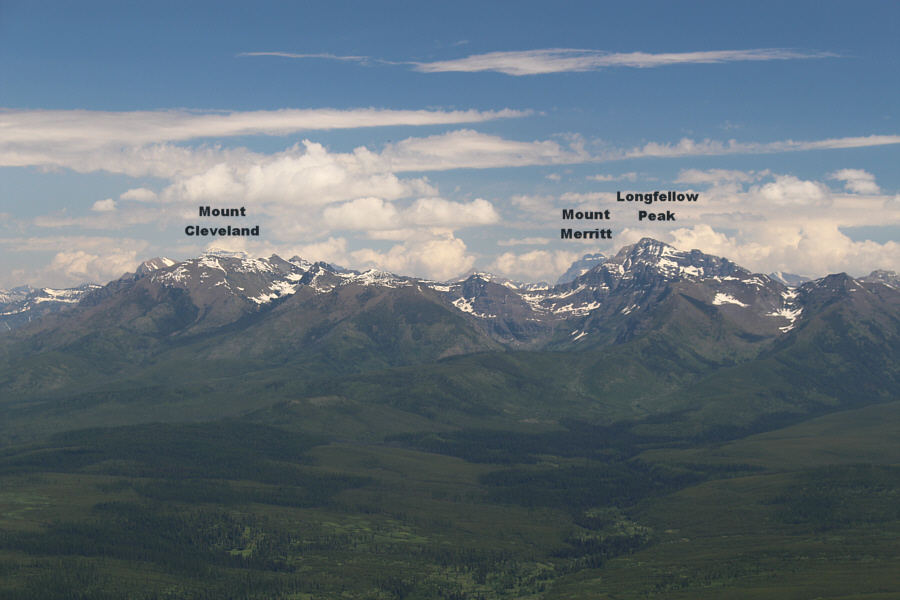
Two (Mount Cleveland and Mount Merritt) of the six 10,000-footers are visible to the northeast.

Tough to climb some of these now that there is a requirement for vehicle registration on the Going-to-the-Sun road.

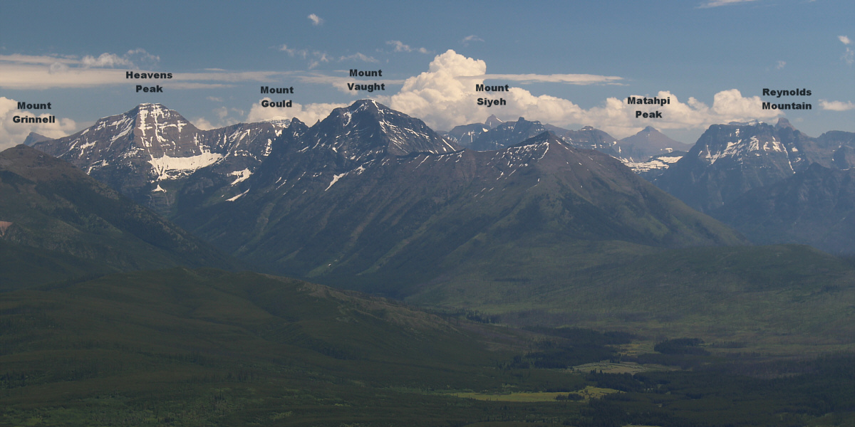
Another 10,000-footer (Mount Siyeh) is visible among these peaks in the heart of Glacier National Park.


Mount Jackson was an epic day...not sure if I could handle it now! 
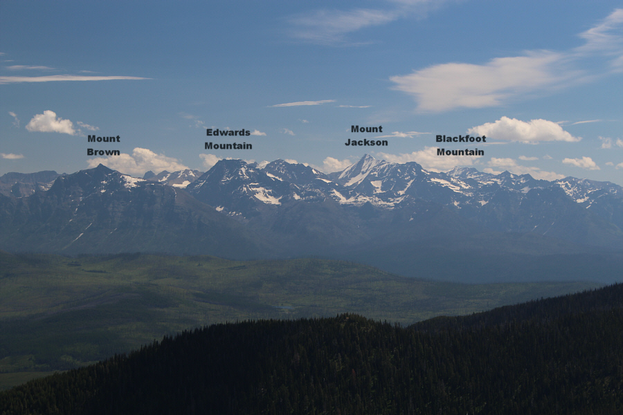
The view to the east includes yet another 10,000-footer (Mount Jackson).
Wow. This might be one of the few places where all six 10,000-footers are visible at the same time! 
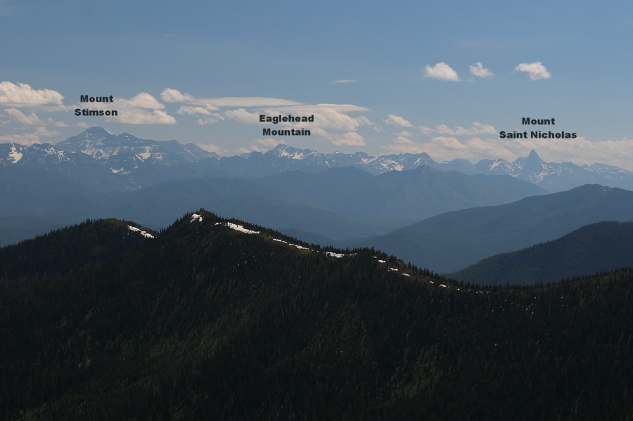
Mount Stimson rounds out the view of all six 10,000-footers in Glacier National Park from the lookout on Huckleberry Mountain.
Couldn't have picked a nicer day to be up here! 
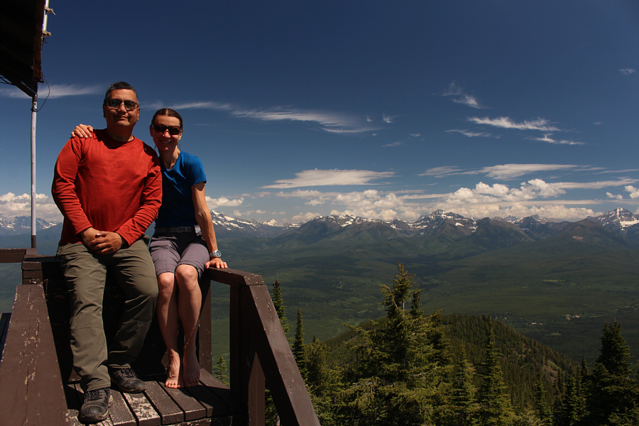
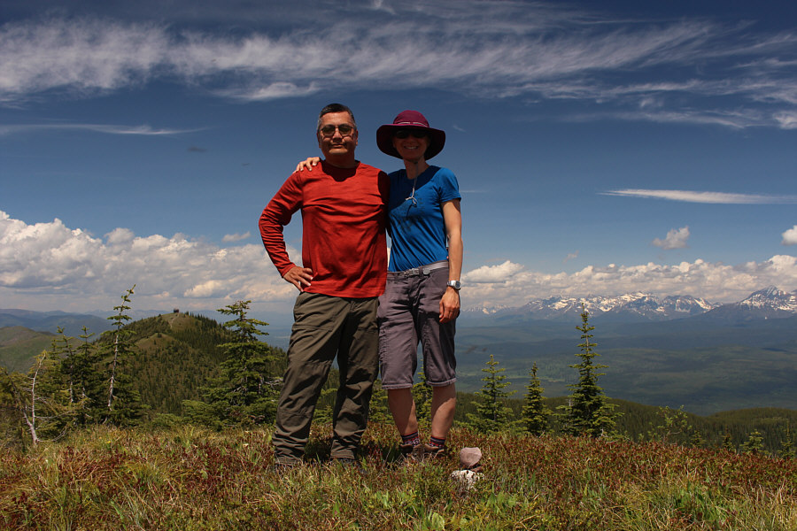
Sonny and Zosia enjoy the great weather and views at the top of the stairs to the lookout tower.
After spending about an hour at the lookout tower, Zosia and I retraced our steps along the trail to the point where it leaves the ridge crest.  We left the trail here to climb up the unnamed high point along the ridge crest and did not encounter any difficulties.  This unnamed high point is actually slightly higher than Huckleberry Mountain itself but is probably about the same height as the lookout tower's balcony.

Instead of backtracking, Zosia and I continued following the ridge crest to the southeast and descended to the low point before the next rise.  We left the ridge crest here and dropped down a short but steep slope to intersect the main trail.  The bushwhacking was a bit unpleasant here, but thankfully, it was short-lived.  Upon regaining the trail, we settled into a long but uncomplicated march back to the trailhead with the hot afternoon sun threatening to fry our brains.  Fortunately, we were able to fill our hats with snow which helped cool us off during the hike out.  A quick splash in McGee Creek left us fully refreshed by the time we arrived back at the trailhead.
Why not extend the hike on such a beautiful day? 
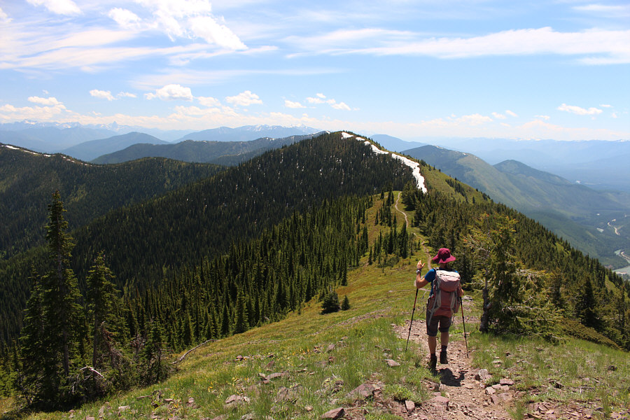
Zosia leaves the top of Huckleberry Mountain and heads for the unnamed high point ahead which is bypassed by the main trail.
Most hikers probably don't bother to climb this unnamed high point. Zosia ascends the unnamed high point with Huckleberry Mountain in the background.
Higher than Huckleberry Mountain but not the highest point of Apgar Mountains. Sonny and Zosia stand on the unnamed high point (2008 metres).
Wow, that would be one helluva ski tour! Zosia continues down the southeast side of the unnamed high point.  A traverse of Apgar Mountains appears very enticing from here, but apparently, it is even more popular with skiers.
You can see the road to our camp for the night. 
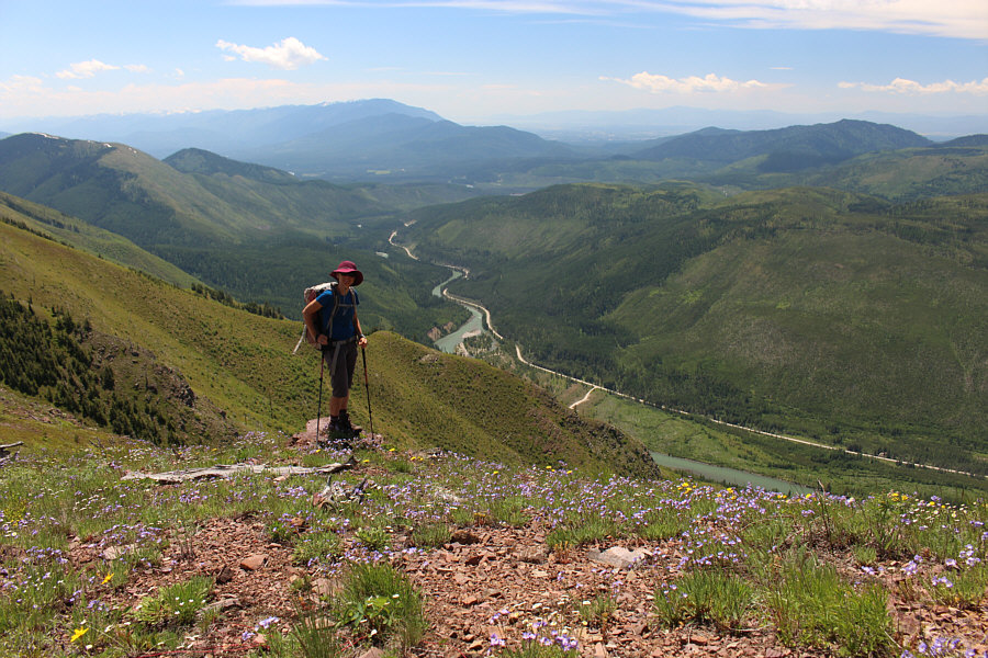
North Fork Flathead River is the western boundary for Glacier National Park.
It's about a 30-metre drop which is equivalent to about 3 fire lookout towers! Zosia adjusts her hat before leaving the ridge crest to bushwhack down to the main trail hidden below.
Not as bad as North Kintla Creek! Zosia emerges from the bush to regain the main trail.
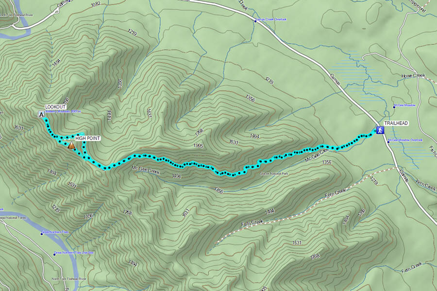
Long but very pleasant approach with great rewards at the end if it's a clear day. Total Distance:  18.7 kilometres
Round-Trip Time:  7 hours 31 minutes
Cumulative Elevation Gain:  948 metres

GPX Data