BOU AVENUE
Mount Berland
With a promising weather forecast for 31 May
2014, I headed out to the south end of British Columbia's Kootenay National Park to
scramble up Mount Berland via the
route
described by Josée Ménard. Although a late winter snow pack still
persisted in the Canadian Rockies, I was confident that Mount Berland was
mostly dry after monitoring the mountain's conditions on DriveBC's Radium
Hot Springs
webcam. Ménard's route--head north up a forested rib that
eventually turns west toward the main south ridge--is not overly
complicated, but is it ever strenuous! After a long winter of
intermittent and modest outings, I may have taken the 1200+ metres of
elevation gain for this trip a little too lightly.
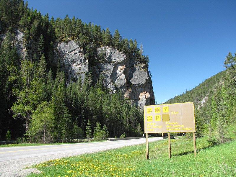
Starting from an
obvious paved pullout beside a large sign, I immediately entered the
adjacent forest and began the long grind up the noted rib.
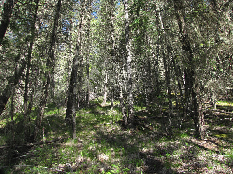
Views are certainly lacking during this initial part of the climb, but
with the warm temperatures that day, I actually welcomed the cool shade
of the forest. Although the route is relentlessly steep, the
bushwhacking is mercifully not too bad, and there are lots of useful game
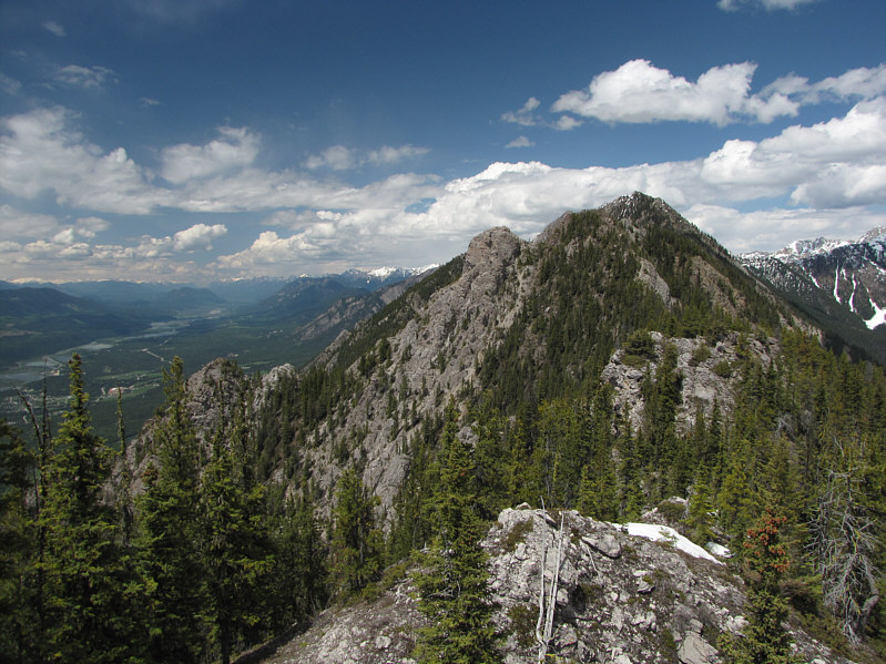
trails crisscrossing the slope. After climbing about 900 metres to
reach a large cairn on the southernmost high point of Mount Berland's
south ridge, I was a bit alarmed by how much time (3 hours 18 minutes) it
had taken me to get this far. The true summit is still some three kilometres away to the north from here with a lot of ups and downs in
between, and though this was not unexpected, I was still discouraged by
the prospect of this lengthy traverse given my slow pace.
Furthermore, the warm day had forced me to drink more than I was
anticipating, and I was starting to run low on liquid
refreshment--another oversight due in part to my mind still being in
winter mode when I tend to drink less. There were still a few snow
patches hidden in the trees as I continued north along the ridge, but I
was not yet desperate enough to start stuffing my mouth with dirty snow!
As a result, my pace slowed even more as I tried to conserve both my
energy and my remaining water. As if that was not bad enough, ticks
were also out in force on this day, and I was regularly flicking them off
my shirt and my neck.
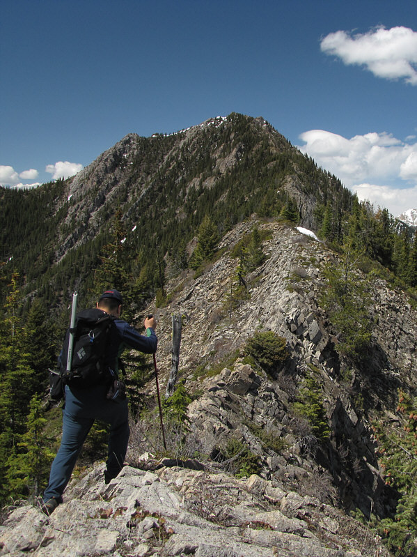
As I got nearer to the summit, the snow
patches grew more abundant, and the terrain became more complex.
Because of the isothermal snow, I opted to stick to the crest of the
ridge as much as possible, but this entailed some fairly exposed
scrambling which was reminiscent of the cockscomb section of Mount Crandell in Waterton National Park. At one point, I even had to
hang precariously over a substantial drop from the branches of a tree that
was blocking the knife-edged ridge. Mount Berland was turning out
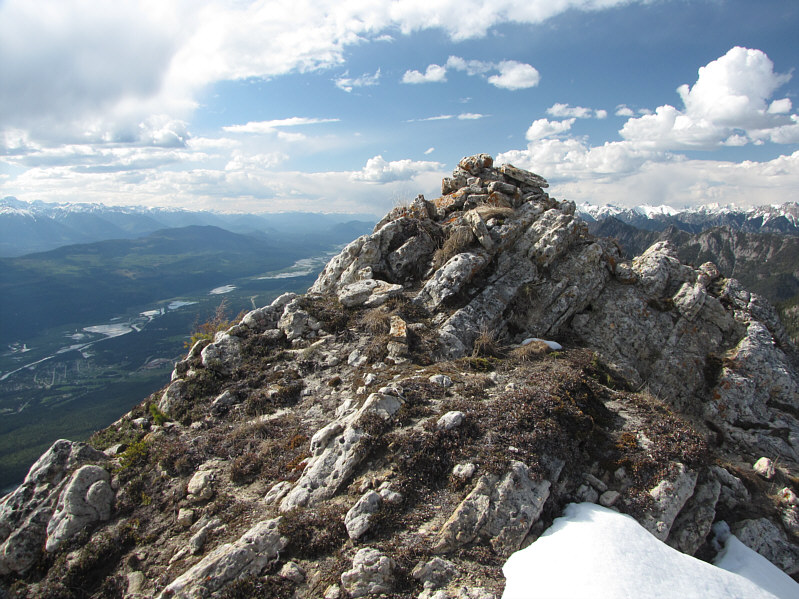
to be quite a tough little sonuvabitch! Nearly seven hours after
leaving my car, I finally staggered onto the airy summit and immediately
sat down to devour an apple I had been saving. Thirty minutes
later, I was retracing my steps back along the ridge.
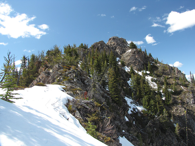
On my return
trip, I circumvented some of the tougher upper sections of the ridge by
dropping down on the west side (skier's right) and traversing the snow.
This was still not a trivial matter as I suffered a few nasty cuts and
bruises due to slipping and crashing into rocks hidden underneath the
snow. Once I reached easier ground, I put my mind on cruise control
as I re-ascended and re-descended almost every high point along the
ridge. Other than some slight route-finding uncertainty below the
southernmost high point (my GPS was not working reliably on this day),
the rest of my descent was largely uneventful. My round-trip time
turned out to be a whopping 11 hours 46 minutes (Ms. Ménard, I salute you
and your 8.0 hours with extra snow to boot!). Exhausted, I drove
into Radium Hot Springs and checked into a motel room which I had
reserved ahead of time. There is a somewhat pathetic epilogue to
this trip, but that is a story for another day.
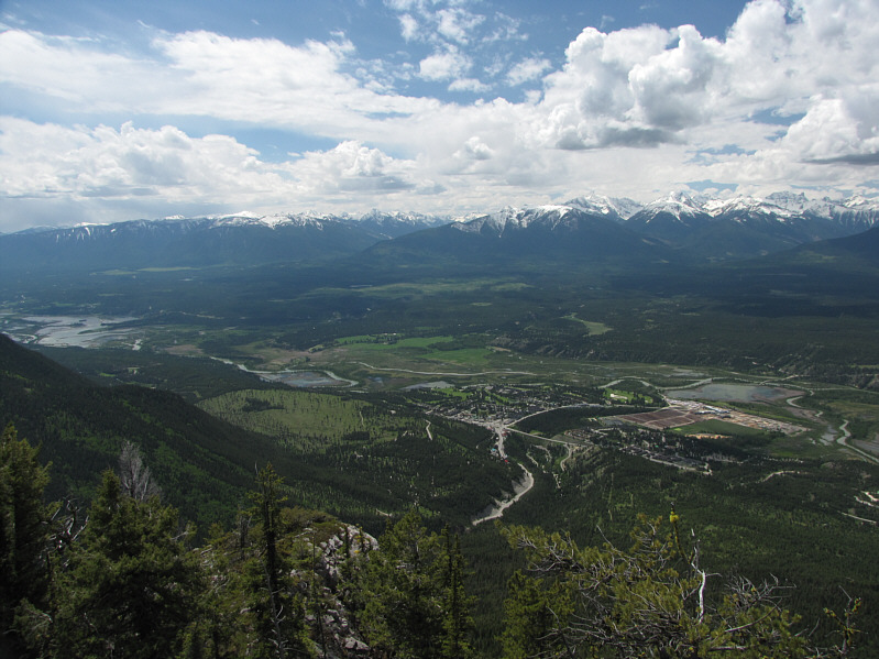
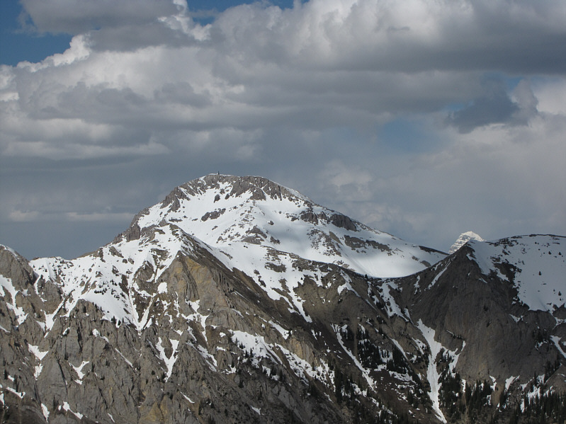
Mount Kindersley (right of centre) is the most
prominent peak to the north.
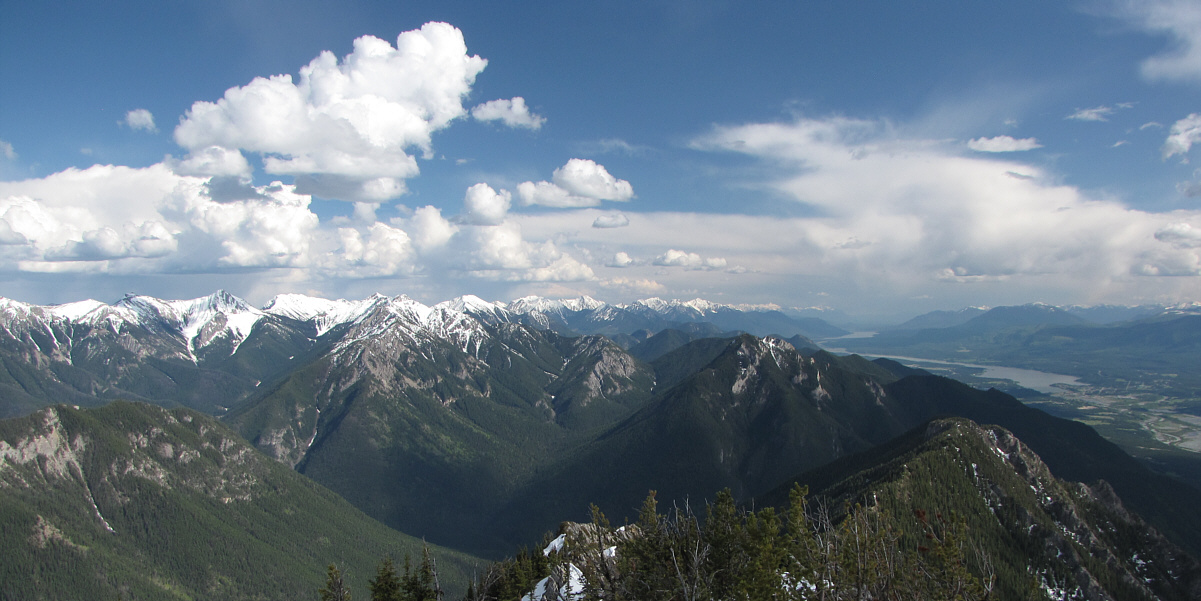
Windermere Lake (far right) is the most recognizable
landmark in this southern panorama.
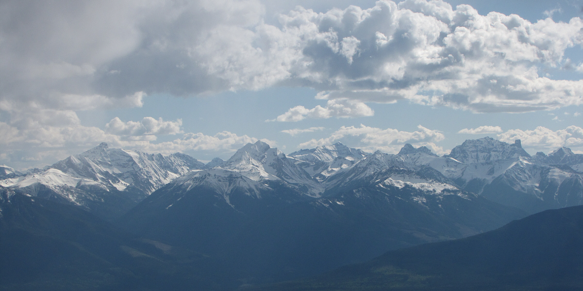
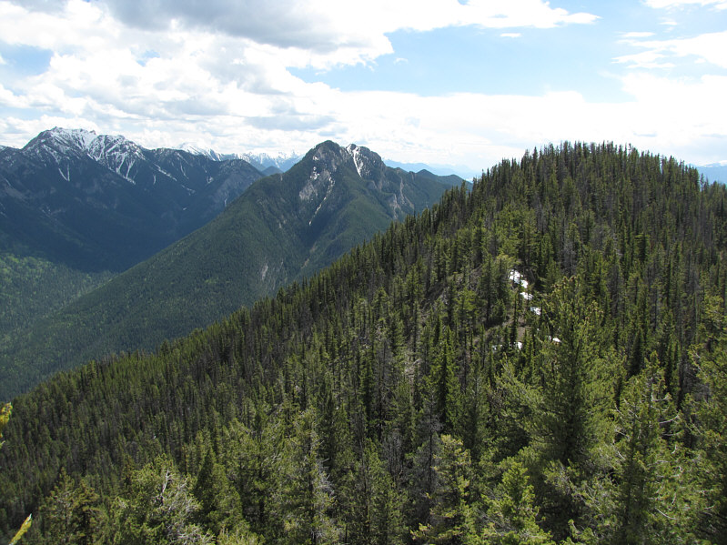
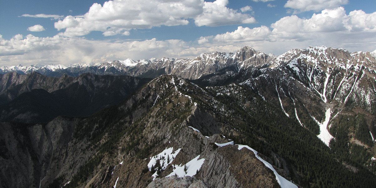
Across the valley to the southwest are some beautiful
peaks including
Mount Nelson (far left), Mount Slade (left of centre), Mount
Delphine (right of centre), and Mount Farnham (far right).
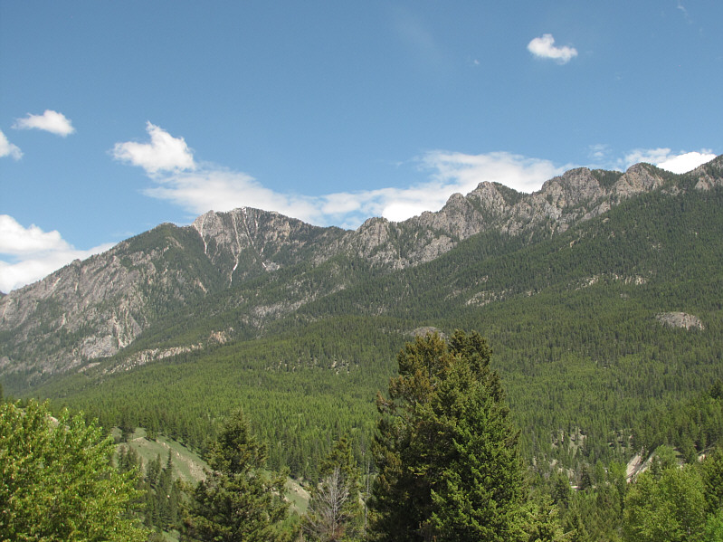 |
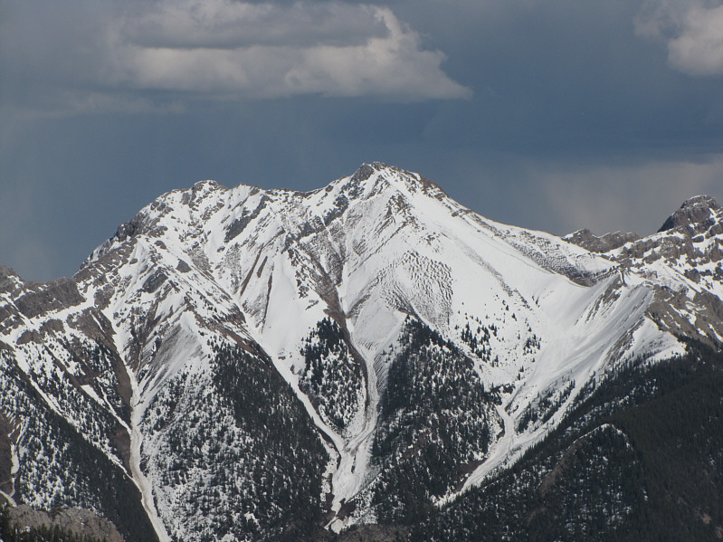
This is Mount Berland as seen from
Radium Hot Springs (photograph was taken the following day). |