BOU AVENUE
Cory Cap
Lured by the promise of a good weather forecast, Zosia Zgolak and I ascended Cory Cap in Alberta's Banff National Park on 28 November 2020.  Cory Cap is the southern outlier of Mount Cory and is probably ignored by most scramblers climbing the lengthy south ridge route popularized by Alan Kane, the author of Scrambles in the Canadian Rockies.  Indeed, neither Zosia nor I have any recollection of this outlier even though we had both previously climbed Mount Cory (separately), and I only recently became aware of it while perusing some online maps which led to the discovery of a trip report by Justyn Perry.  While those that have already climbed Mount Cory might scoff at the notion of subjecting themselves to a second masochistic grind up Kane's south ridge--albeit only partway--just to tag an outlier, I found enough motivation from the fact that I had somewhat disappointing summit views on my 2004 ascent.  An absence of sixteen years (seven years for Zosia) also makes the heart grow fonder--or makes one forget about all the suffering!

Our day started off inauspiciously when Zosia and I discovered that the Bow Valley Parkway (Highway 1A) was once again closed to public vehicular traffic between Fireside day-use area and Rockbound Lake trailhead.  The Parkway had been closed by Parks Canada for most of the year in an effort to limit the number of visitors to popular Johnston Canyon in response to the COVID-19 pandemic.  While the Parkway was re-opened less than two weeks earlier, a recent surge in reported infections prompted Parks Canada to reinstate the closure.  Undeterred, we parked at the east gate and walked the easy 1.7 kilometres to an unsigned pullout which is the starting point for the ascent of Mount Cory.

From the pullout, Zosia and I hiked through a gap in the forest to reach a power line right-of-way before turning right.  There is a cairn in the right-of-way that marks the start of the trail which climbs up Mount Cory's south ridge, but due to my usual poor route-finding skills, we missed it on the way in.  Fortunately, the start of the south ridge is pretty obvious to spot on the far side of the right-of-way, and we were soon grinding up the relentlessly steep trail.  Early in the proceedings, we ran into the crux of the trip at a steep rock band which would normally pose few problems in dry conditions, but on this day, snow rendered the rocks dangerously slippery.  With some care, we were able to surmount this obstacle and carry on up the ridge.  For the next several hours, we slowly grinded our way upwards following bits of trail and occasional flagging or cairns.  In fact, it is pretty hard to get off-track on this ridge even when the route is mostly covered with snow.  Higher up, we began encountering deeper pockets of snow, but any post-holing we had to do was usually short-lived and tolerable.  Upon reaching a windswept saddle, we turned left to ascend the remaining fifty-metre slope below the high point of Cory Cap.  Again, deep pockets of snow hampered our progress here somewhat, but we eventually made it to the spacious top which is adorned with an aluminum tripod.

On this day, the views from the high point of Cory Cap did not disappoint, and had we more daylight, Zosia and I might have extended our stay to longer than twenty-five minutes.  Instead, we promptly took a few requisite photos and had a quick bite before retracing our steps back to the saddle and down the south ridge.  Not surprisingly, our descent took only half as long as our ascent, and although the snow made our footing slippery, it also allowed us to plunge-step quickly with less fatigue.  The aforementioned crux was a bit tricky to down-climb, but we managed to descend it safely without a slip.  The rest of the descent to the Bow Valley Parkway went without a hitch, and we easily strolled back to the east gate to conclude our trip.
All because of this stupid pandemic BS! 
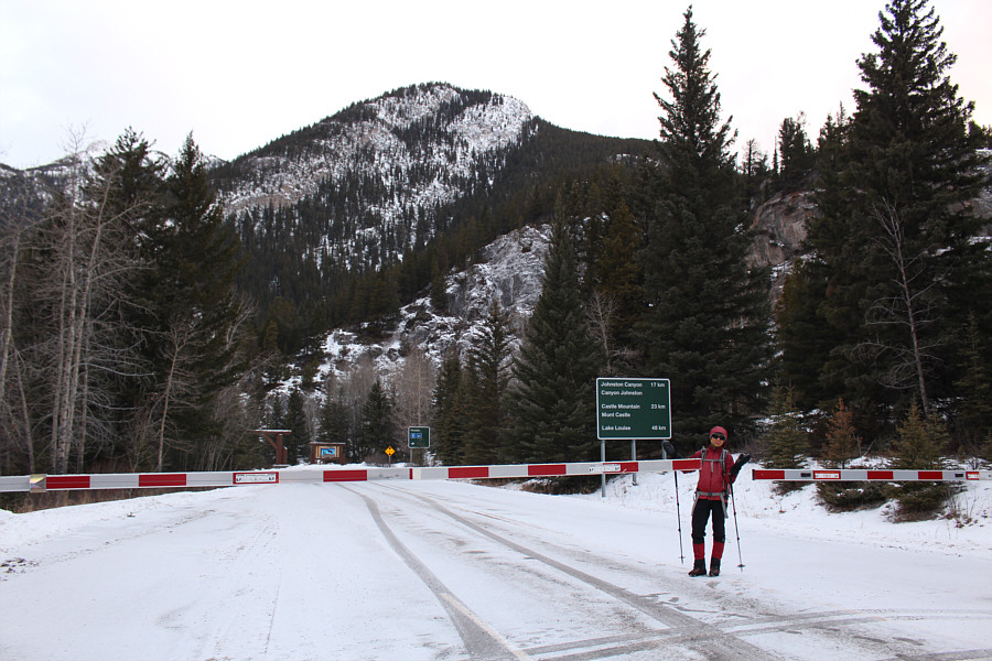
Zosia is dismayed to find that the Bow Valley Parkway is closed to public vehicular traffic which means that she will have to walk an extra 1.7 kilometres (one-way) to reach the trailhead.  Cory Cap is barely visible above the trees at far left.
It took us about 25 minutes to walk here from the gate. 
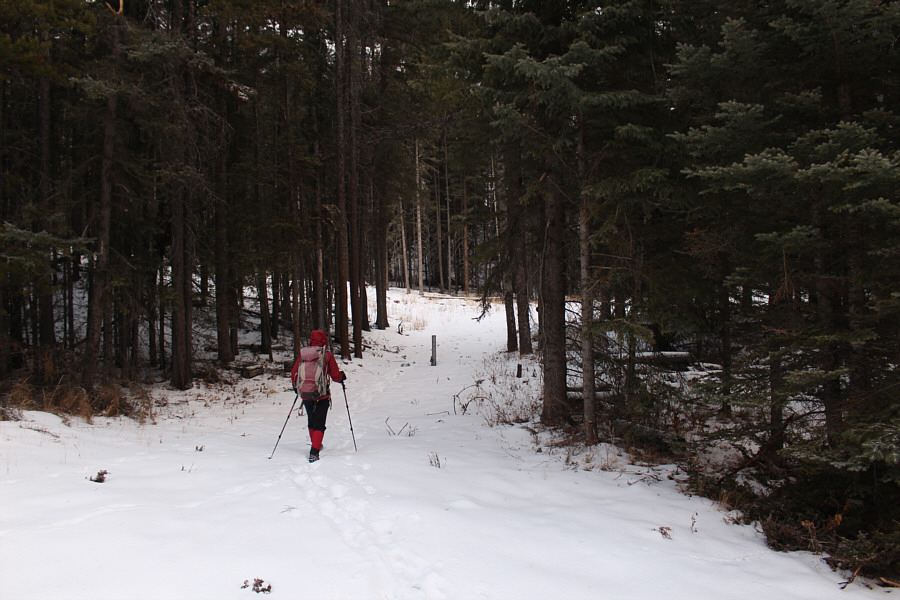
At the trailhead, Zosia leaves the road and heads through a gap in the forest to a power line right-of-way.  The start of Mount Cory's south ridge begins on the far side of the right-of-way a short distance to the right.
I'm already dying trying to keep up with Zosia! 
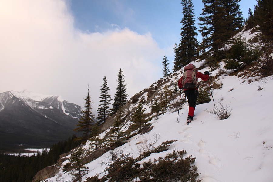
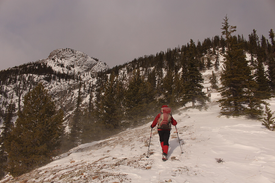
Right from the start, the climb up the south ridge is relentlessly steep.
Technically, it's not scrambling anymore with snow present! 
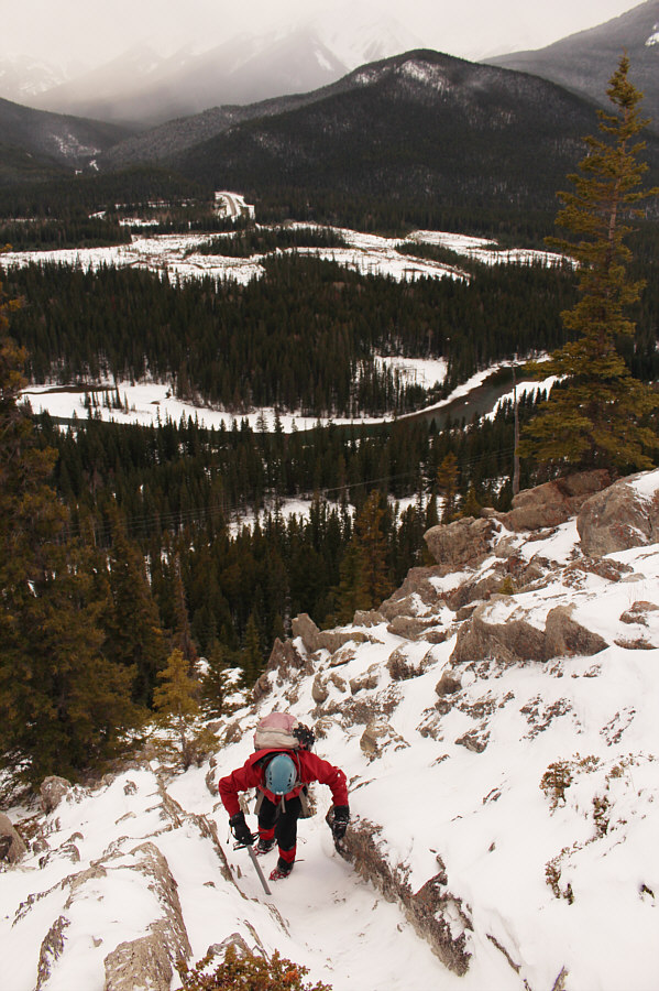
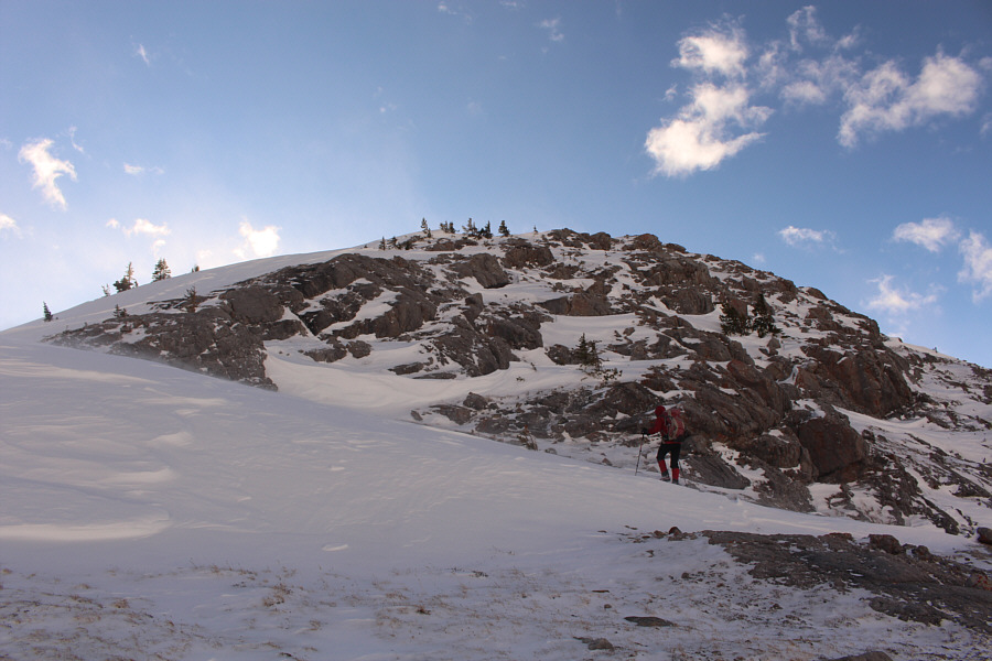
This is the most challenging section of the entire route for Cory Cap, and the snow makes ascending (and descending) here drastically more difficult.
Looks like a serious mountain from here! Zosia gets her first good glimpse of Cory Cap at left.
Zosia was my hero breaking trail all the way! 
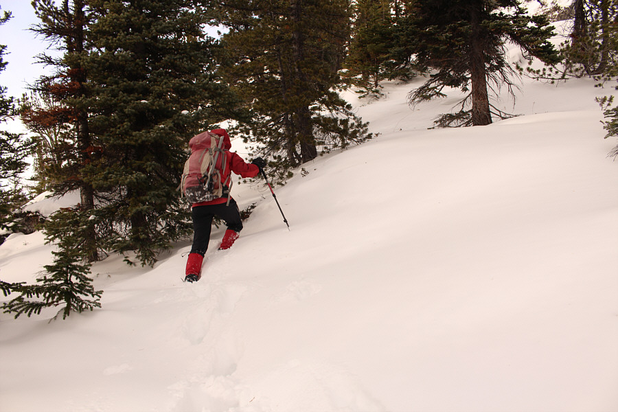
There are some sections of deep snow higher up the ridge.
Almost there... 
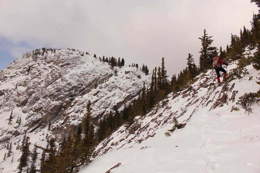
The long ascent is nearly at an end.
After the brutally steep climb, Zosia is still smiling! 
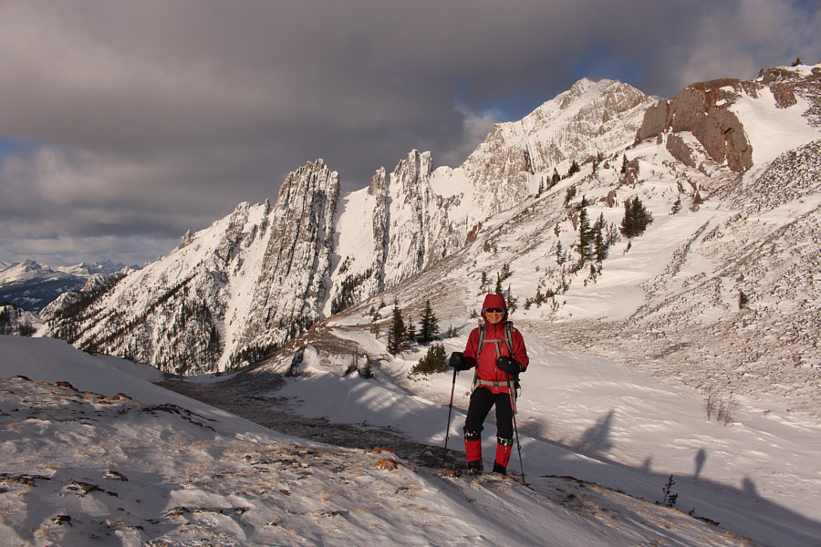
A windswept saddle separates Cory Cap from the main mass of Mount Cory (right).
No worries--it's still easy! On this day, snow complicates what would normally be an easy scramble to the top of Cory Cap.
I'm impressed at how well they stuffed the rocks inside the frame! 
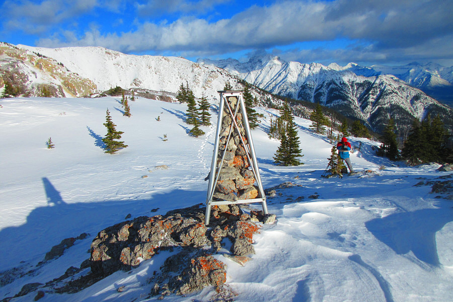
On top of Cory Cap is a tripod presumably used for surveying.

Photo courtesy of Zosia Zgolak

Yes, I'm calling it a separate summit from Mount Cory; so sue me! 
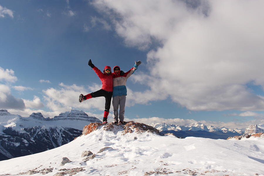
Zosia and Sonny stand on the high point of Cory Cap (2370 metres).

Never thought I would see logging inside a National Park!

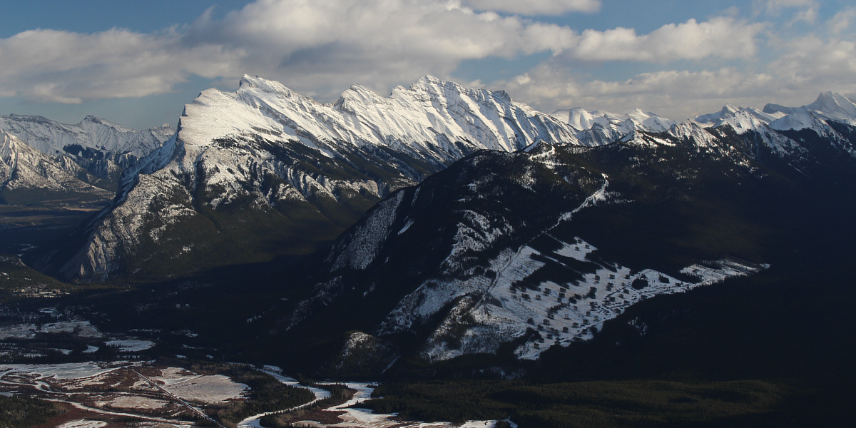
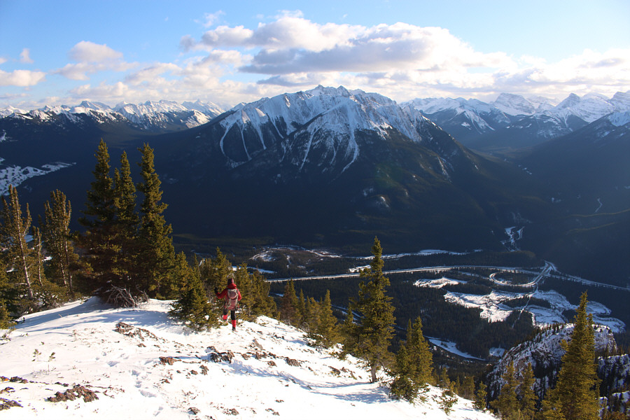
To the southeast, Mount Rundle gleams in the afternoon sunlight.  The clear-cut below Cosmic Ray Road is apparently Parks Canada's proactive measure to prevent a forest fire in the area.


Some subsidiary summits in the photo are intriguing to me... 
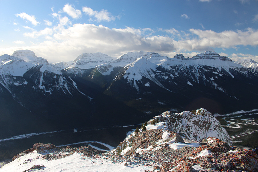
Notable peaks to the west include Mount Bourgeau (far left), Mount Brett (right of centre), and Pilot Mountain (right).
Too many to name! 
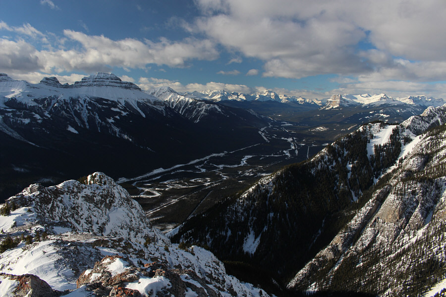
Familiar peaks stretch across the northwest horizon.
Definitely NOT scrambling there! 
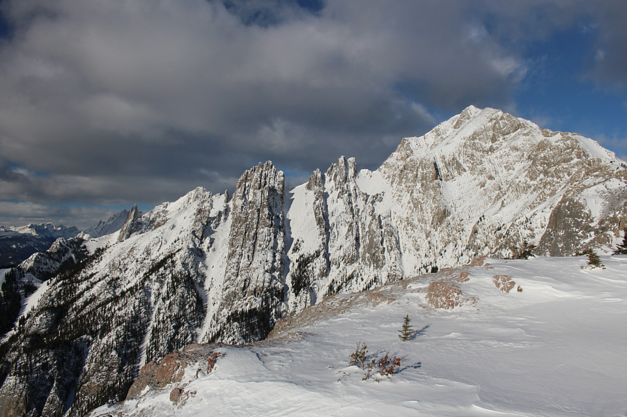
The west ridge of Mount Cory is comprised of some spectacular pinnacles.

Looks tempting to go back up there...

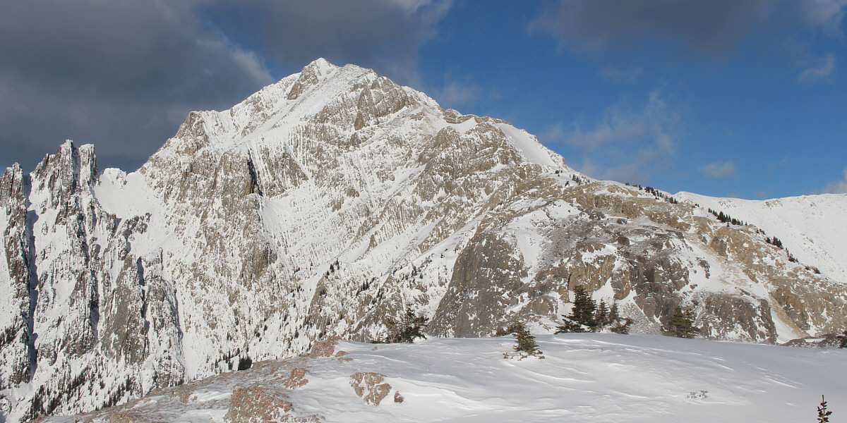
Here is a comprehensive view of the remainder of Alan Kane's route up Mount Cory.


See you at the bottom! Zosia begins the steep descent of Mount Cory's south ridge.
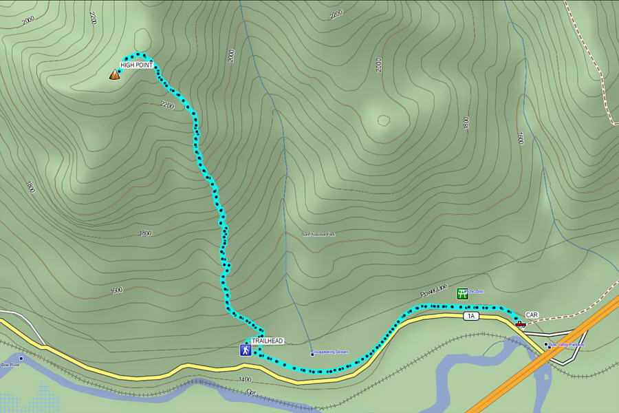
Brutally steep, but the rewards are great. Total Distance:  9.4 kilometres
Round-Trip Time:  7 hours 21 minutes
Net Elevation Gain:  978 metres

GPX Data