BOU AVENUE
Powderface Northeast Ridge

On 12 March 2023, Zosia Zgolak and I skied up an unnamed knob northeast of the main spine of Powderface Ridge in Alberta's Kananaskis Country Public Land Use Zone.  Bob Spirko had hiked over this same knob in 2016 and refers to it as "the east ridge", but because "Powderface East Ridge" has already been attributed by OpenStreetMap to another feature further to the south, I have, for the sake of clarity, named the knob "Powderface Northeast Ridge".  While Spirko ascended this ridge using an approach along Powderface Creek, we would opt for a more skier-friendly approach via a cut block to the southeast.

Starting from the winter gate near Elbow Falls, Zosia and I skied along the continuation of Highway 66 for 3.5 kilometres to the start of a logging corridor which we had hiked the previous year.  By some stroke of luck, there was already an old ski track running up the corridor, and we easily followed this for about 1.5 kilometres to the east end of a vast cut block.  We continued to follow the old ski track through the cut block until we reached the edge of the forest at the west end.  Here, the old ski track turned uphill toward the top of the cut block to the south, but our objective was to the northwest across a forested drainage.  Abandoning the old ski track, we entered the forest and muddled our way down into the drainage which is actually split at this point making the crossing a bit more complicated.  Zosia did a great job of breaking trail and route-finding through the various deadfall choking the split drainages, and we eventually found ourselves at the bottom of a gully which is the funnel point for a big open slope on the south side of Powderface Northeast Ridge.  From here, we zigzagged our way up to the ridge crest and the top of the knob.  This was the steepest and most strenuous climb of the day, and with the warm sun baking the south face of the ridge, we had a lot of problems with wet snow clumping to the bottoms of our skis.  Snow coverage on the high point was rather thin on this day, but we still managed to ski right to the very top where we stopped for a well-deserved break.

For our descent, Zosia and I kept our climbing skins on and stepped gingerly down from the rocky high point.  We then traversed westward until we reached the top of the aforementioned big open slope.  After removing our skins, we skied down this slope and predictably ended up at the bottom of the gully we reached after crossing the drainage.  Instead of retracing our tracks though, we continued down the drainage weaving between trees and deadfall before eventually emerging from the forest along the north edge of the cut block.  This saved us from having to reattach our climbing skins, and in retrospect, this would be a more efficient approach route despite the bushiness of the drainage.  We subsequently ran into a couple of skiers (and their out-of-breath dog!) who had climbed to the top of the cut block and were on their way out.  We followed in their tracks which took us back across the cut block to the logging corridor with relative ease.  Zooming down the logging corridor required us to be vigilant for the odd "shark" sticking out of the snow, but overall, the descent to the highway was quite enjoyable.  In contrast, the return along the highway to the winter gate felt long and mundane even with the benefit of some downhill sections.
I didn't even put my climbing skins on until the last kilometre before the turnoff! Zosia skis along Highway 66.
Finally! I was starting to die of boredom skiing on the highway!

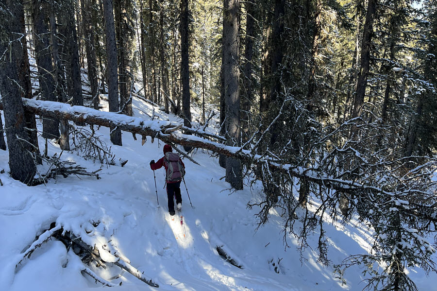
Zosia abandons the highway at the start of a logging corridor.

The old ski track was a godsend too! The logging corridor is wide and easy to follow.
We're making good progress!

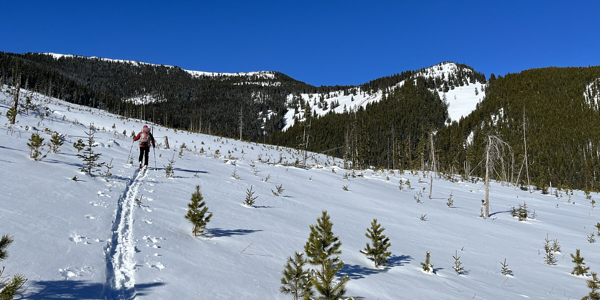
Zosia enters a vast cut block with the knob of Powderface Northeast Ridge visible at centre.
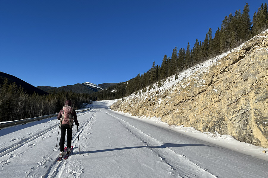
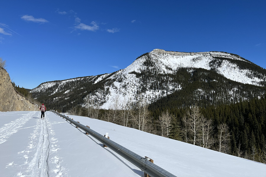
We should have dropped down here to the right to enter the drainage.

Here is a closer look at Powderface Northeast Ridge (right) as Zosia makes her way across the cut block.  The main spine of Powderface Ridge is also visible at left.


Could have been a lot worse though... Zosia navigates through some challenging terrain in the drainage south of Powderface Northeast Ridge.
Looking at those enticing slopes to the left! 
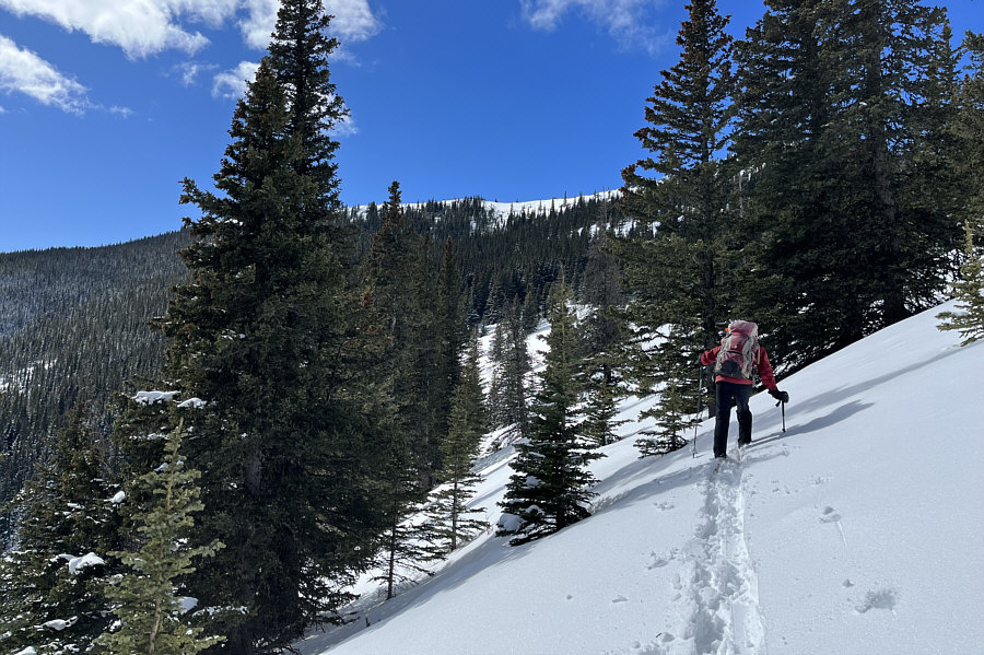
Sonny ascends south-facing slopes below the ridge crest.

Photo courtesy of Zosia Zgolak

The top of the cut block appears to be some skiers' "secret stash"! 
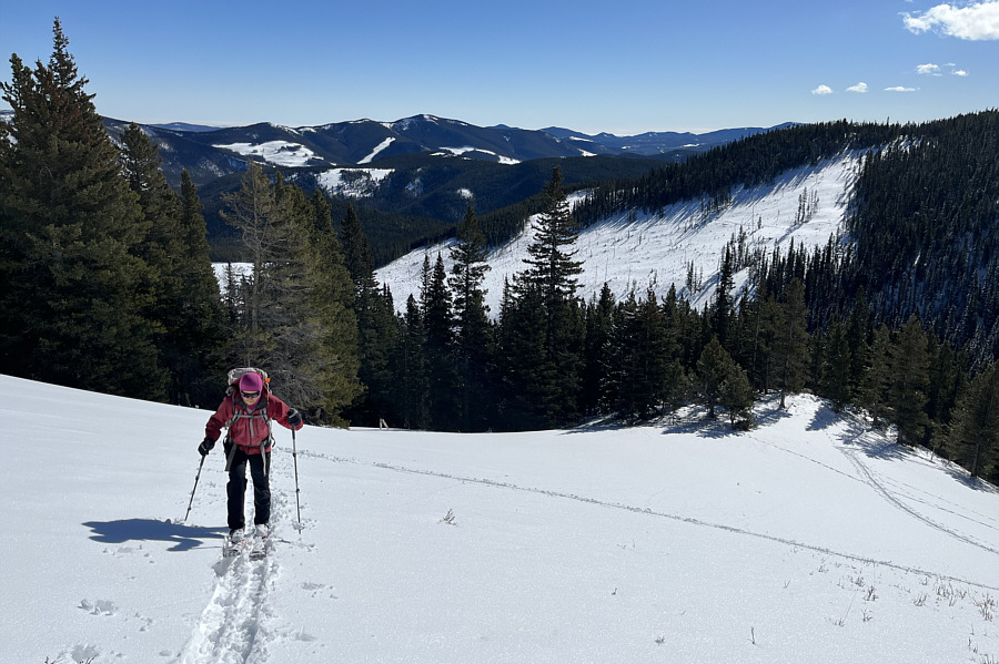
The cut block used for the approach can be seen behind Zosia.
Clumps better than my kitty litter at home! The snow on this slope is wet and prone to clumping on this day due to the warm sunshine.

My skis kinda clash with my pants!

Sonny and Zosia stand on the high point of Powderface Northeast Ridge (2064 metres).


We saw four paragliders over Prairie Mountain. 
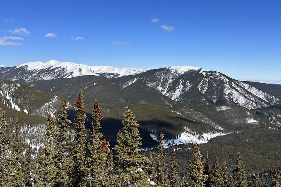
Moose Mountain (far left) and Prairie Mountain fill the view to the northeast.
Myosotis Peak is possibly another good candidate for a front-range ski ascent... Visible to the east are Iyarhe Ipan (left) and Myosotis Peak (right of centre).
Just a little further, please... 
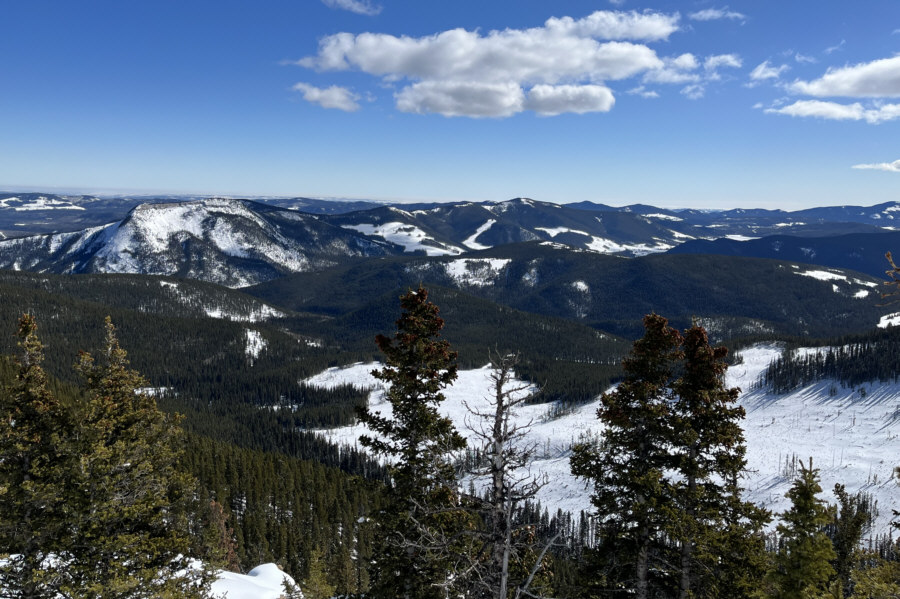
Zosia traverses westward in search of a big open slope to ski down.
Rippin' it! Zosia skis down a big open slope.
Zosia's an artist! 
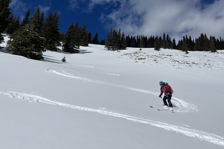
Despite heavy snow conditions, Zosia still manages to make some beautiful turns.
Challenging but also kinda fun! Descending along the drainage south of Powderface Northeast Ridge has its challenges.
That dog is gonna be dog-tired at the end of this day! A dog belonging to some other skiers leads Zosia back across the cut block.
Watch out for "sharks" here! Zosia descends the logging corridor.  Visible at distant left is Forgetmenot Ridge North.
My left ski boot was just killing me at this point! Iyarhe Ipan looks brilliant in the afternoon sun as Zosia returns along the highway.
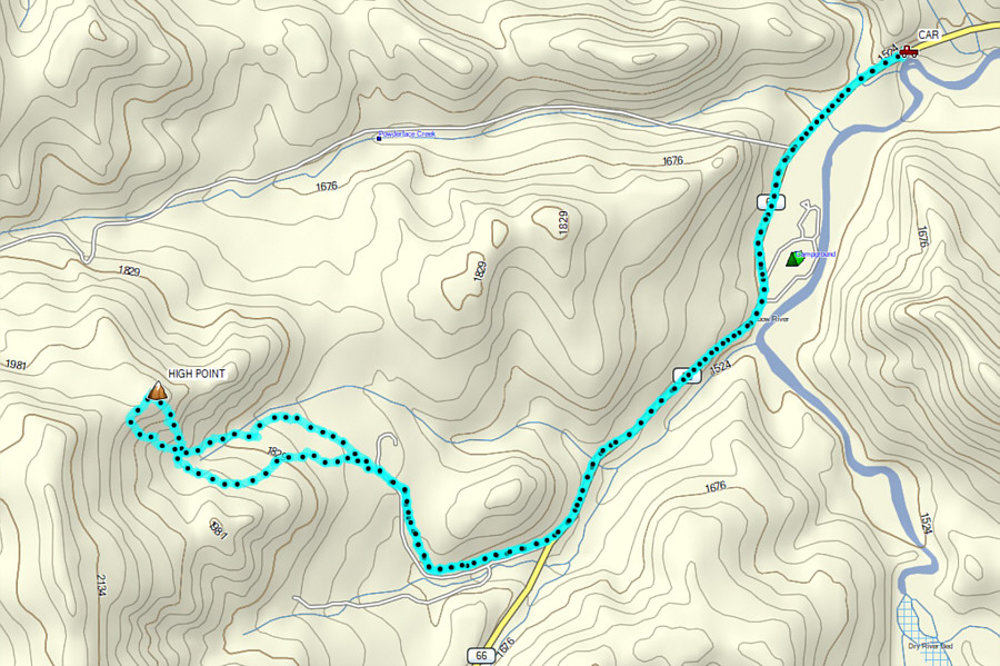
The long highway approach is the only downer in an otherwise fun ski ascent. Total Distance:  13.9 kilometres
Round-Trip Time:  6 hours 45 minutes
Net Elevation Gain:  563 metres

GPX Data