BOU AVENUE
Mount Henkel And Crowfeet Mountain

When I hiked up Swiftcurrent Mountain in the Many Glacier area of Montana's Glacier National Park, my original plan that day was to climb Mount Henkel and Crowfeet Mountain, but that plan was abandoned when I realized too late that I had taken the wrong approach trail.  On 26 July 2014, I returned with Bob Spirko to make another attempt, and this time, we made no mistake in locating the correct trail which is the one that leads to Ptarmigan Lake.  Ironically, we were on the trail only briefly before leaving it to ascend open slopes beside an obvious drainage emanating from the south side of Mount Henkel.  Upon reaching the first set of cliffs, we scrambled partway up a hidden gully before escaping to a ramp leading to easier terrain.  We soon entered a big basin notable for an abundance of red argillite.  After hiking to the back of the basin, we easily climbed up red argillite cliffs and eventually found ourselves in a bowl of yellow rubble.  We then headed to climber's left to gain the summit ridge, and from there, it was an easy hike to the top of Mount Henkel.

After a short break on the summit of Mount Henkel, we traversed the connecting ridge to Crowfeet Mountain.  A stiff breeze kept temperatures rather cool, but I actually welcomed this given my recent ordeal with hot weather on Mount Jackson.   The descent from Mount Henkel was pretty quick and easy, and we were able to pick up a beaten path that led all the way to the final summit block of Crowfeet Mountain.  We had some difficulty surmounting this summit block, but after some trial and error, we eventually climbed up a break in the cliffs near the south end.  The true summit of Crowfeet Mountain is actually at the north end, and it is guarded by an exposed gap in the summit ridge.  Although I did not think twice about stepping across the gap, the exposure was a little beyond Bob's comfort level, and he chose not to cross.  Instead, he returned to the south end of the summit block and waited for me while I performed my usual summit chores.

Leaving the summit of Crowfeet Mountain, I backtracked across the gap and rejoined Bob at the south end of the summit block where we descended the same break in the cliffs that we had come up.  Following the advice from a report on summitpost.org, we descended the western slopes of Crowfeet Mountain aiming to reach Ptarmigan Lake which is a little further to the north.  While much of this slope is very loose and conducive to scree skiing, there are also lots of unseen cliffs below which present some route-finding challenges.  We were actually quite fortunate to find a reasonable route through the largest of the cliff bands, but once we cleared this major obstacle, we had no more serious issues in descending to Ptarmigan Lake.  From near the lake's outlet, we picked up the Ptarmigan Lake trail and settled into a long but easy hike back to the trailhead.  My feet were really aching on this home stretch, and I had a tough time keeping up to Bob who always seems to look more refreshed at the end of a trip!

Be sure to check out Bob's trip report here.
Leave the trail here or a little further on at the creek crossing. 
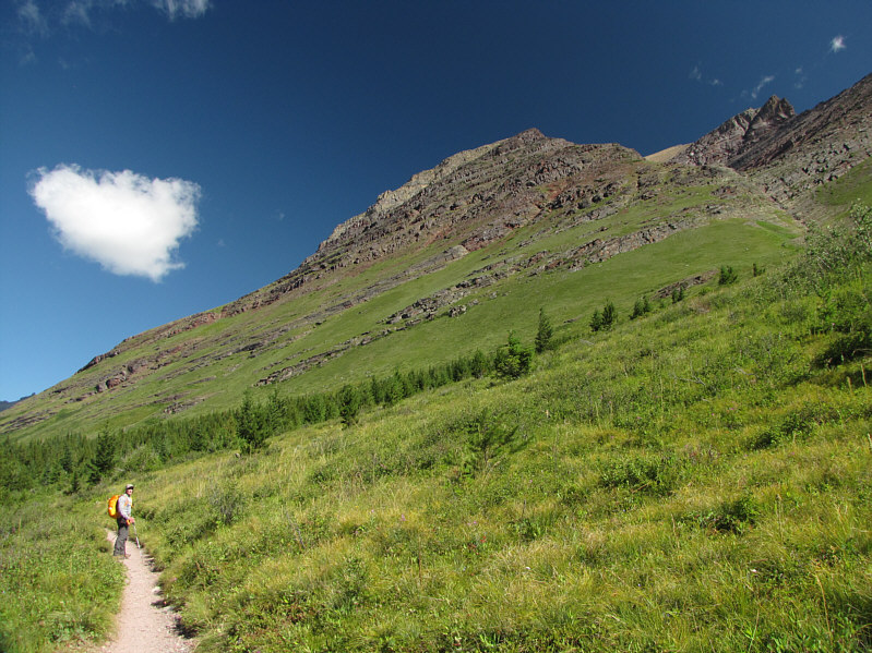
The ascent route for Mount Henkel goes through the breach in the cliffs at upper right.
Sweating already! Bob sticks to climber's right of the obvious drainage emanating from the breach in the cliffs.
A very picturesque valley. 
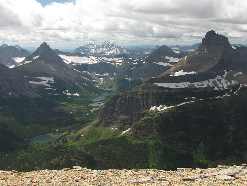
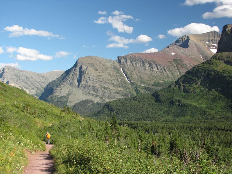
This is looking up the Swiftcurrent Creek valley.  At left is Mount Grinnell, and at far right is Swiftcurrent Mountain.
Now I wanna climb it! 
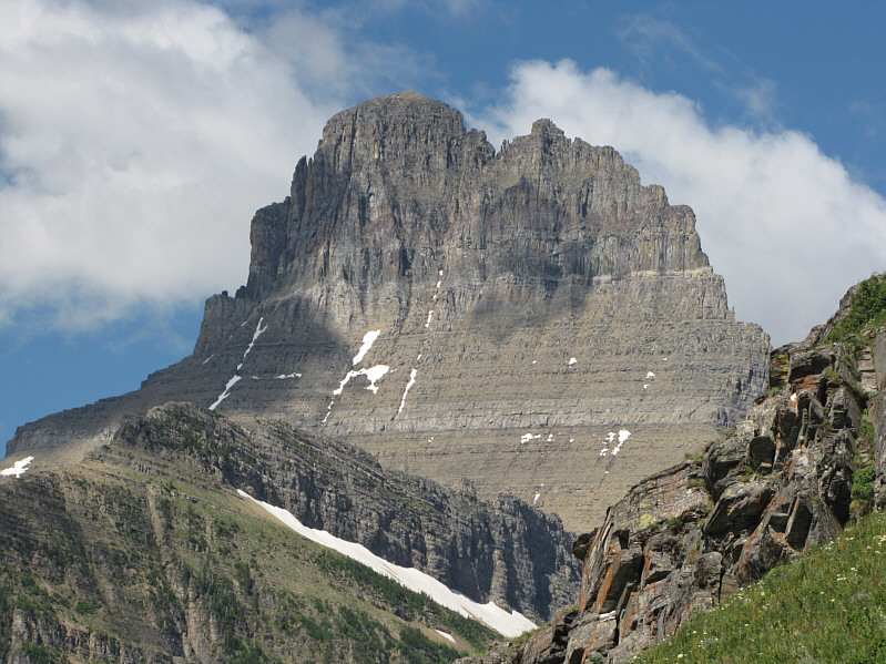
The east face of Mount Wilbur is always a formidable sight.
A good test of one's route-finding capabilities. Bob looks for a way up the first cliffs encountered.  He would eventually back down and go up beside the dead tree trunk at centre.
We will leave this gully shortly... Bob scrambles up a hidden gully.
Easy hiking here. 
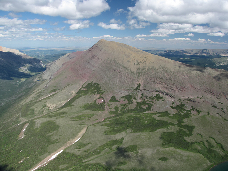
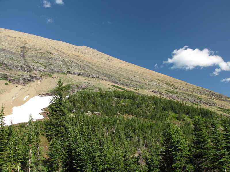
Above the first cliffs is a big red basin.
Pretty much go straight up the middle. Bob approaches the red cliffs at the back of the basin.
Mmmm...good eating! 
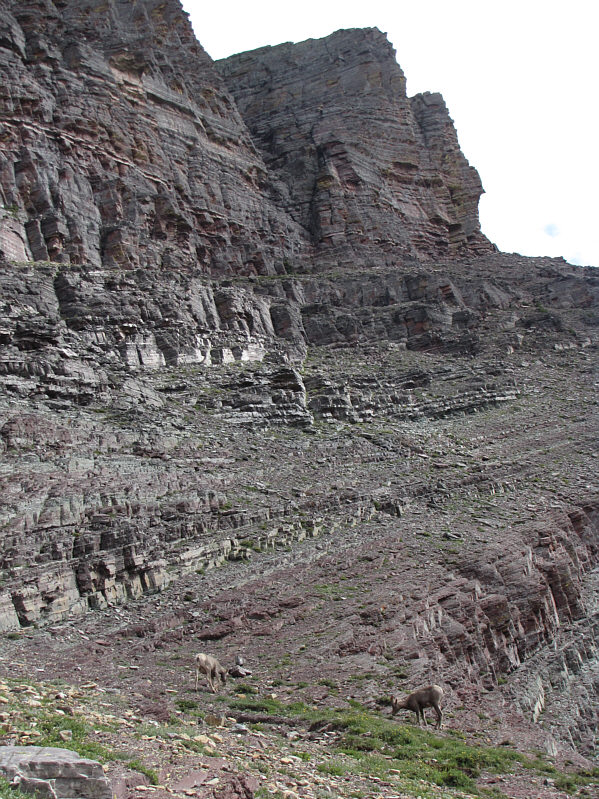
Sheep may safely graze on these terraces at the back of the basin.
Take the path of least resistance. The scrambling is easy here.
Took me about 3.5 hours to hike to the pass. Bob pauses on his way up through the red cliffs.
Can you spot the two mountain goats in the photo? Above the red basin, Bob works his way up a yellow slope.
Goooatttt! 
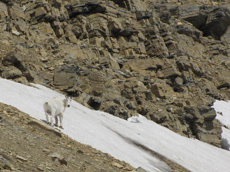
Here is one of three mountain goats that Bob and Sonny spotted on Mount Henkel.
Almost there! Bob approaches the summit of Mount Henkel.

The weather looks nice, but it was actually very windy up here.

Bob and Sonny stand on the 2673-metre summit of Mount Henkel.  Visible at right are Mounts Merritt and Cleveland.

What's with all these clouds rolling in?? Notable peaks that are visible to the southwest include (L to R) Mount Grinnell, Mount Vaught, Heavens Peak, Swiftcurrent Mountain, and Mount Wilbur.
Best view of the day. Crowfeet Mountain and Kennedy Lake steal the show to the north.
I'll save this one for an early season climb in the future. Shadows of clouds drape over Apikuni Mountain to the northeast.
It's about a 288-metre drop in elevation from the summit of Mount Henkel to the intervening col. Bob follows the connecting ridge to Crowfeet Mountain.
It's about a 700-metre drop down this side to the valley floor! Bob takes a peek over the steep east face of Crowfeet Mountain.  The red peak that is barely visible behind Crowfeet Mountain is Seward Mountain.  Chief Mountain is also visible in the distance.
We were on the summit of Mount Henkel only a little over an hour ago. Here is a look back at Mount Henkel along the connecting ridge.
Simply beautiful. Crowfeet Mountain's profile is very striking from this angle.
We were not succesful getting up this way. 
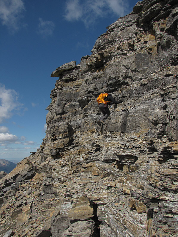
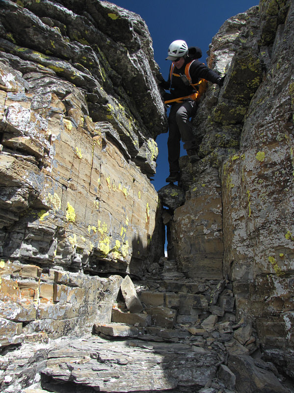
Bob tries to surmount the cliff bands guarding the summit block.
Don't look down! Bob stops at an exposed gap in the summit ridge.
Yay! Sonny stands on the 2719-metre summit of Crowfeet Mountain.

I hope to visit Iceberg Lake in the near future.

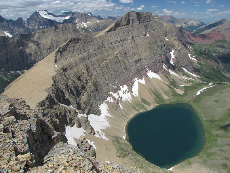
Iceberg Lake is the centrepiece of the view to the southwest.  Towering over the lake are Mount Wilbur and Iceberg Peak.

Mount Merritt is another one that is high on my to-do list. Some of the more obvious landmarks to the northwest include Mount Merritt, Ptarmigan Lake, the trail to Ptarmigan Tunnel, and Elizabeth Lake.
Probably lotsa scree bashing on this peak! The view eastward is dominated by Apikuni Mountain.
Oddly enough, it wasn't that windy up here. Bob waits for Sonny at the south end of the summit block.  Some noteworthy peaks visible on the horizon include Mount Siyeh, Mount Stimson, Mount Jackson, Mount Gould, and Mount Grinnell.
Not everyone's cup of tea! Here is another look at the gap before the true summit of Crowfeet Mountain.
2nd best view of the day! 
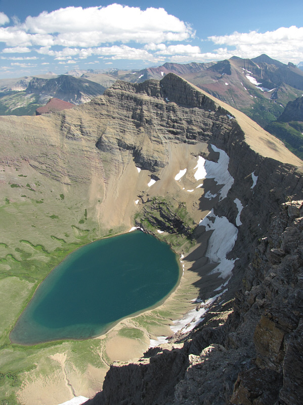
Mount Henkel and Kennedy Lake steal the show to the south.
Helps to be thin here! Bob squeezes through an awkward crack on his way down from the summit block.
Lotsa tricky slabs and hidden cliffs here. Bob searches for the easiest route on his way down to Ptarmigan Lake.
The worst is over. 
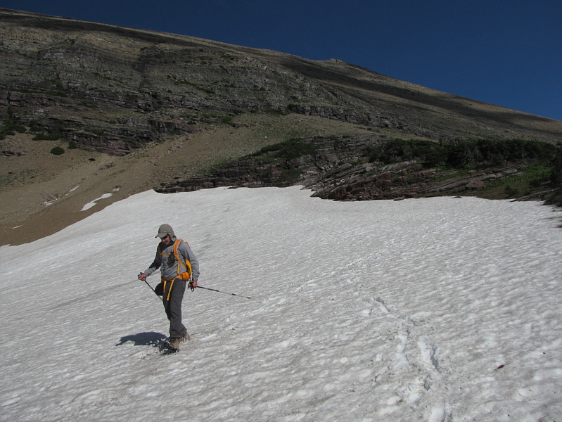
Bob descends an easy snow slope near Ptarmigan Lake.
Wouldn't wanna go up this way...or down! Here is a foreshortened view of Crowfeet Mountain's west slope from the trail to Ptarmigan Tunnel.
Look out for grizzly bears around here... Allen Mountain provides a scenic backdrop on the hike back to the trailhead.
A very tiring but satisfying trip! Total Distance:  15.8 kilometres
Round-Trip Time:  9 hours 12 minutes
Total Elevation Gain:  1511 metres

GPX Data