BOU AVENUE
Monad Peak

On 24 June 2017, Asieh Ghodratabadi, Ali Shariat, Zosia Zgolak and I hiked up Monad Peak in the Livingston area of southwest Alberta.  We drew our inspiration from trip reports by Goldenscrambles.ca and Vern Dewit.  The ascent of Monad Peak shares the same approach road as Isola Peak along Isolation Creek.  From the junction of SR532, we drove south on forestry trunk road 940 for about 7.5 kilometres before turning west onto a rough road in the middle of an open meadow.  The road leads quickly to the Livingstone River, and because there is usually no bridge here, this is the logical start for the trip.  On this day, a tree-planting camp was firmly entrenched here, and when we initially asked a worker where we could park, she tried to persuade us to return to the trunk road and drive several kilometres north or south of the camp.  When I asked her if we could simply park nearby and out of anyone's way in the camp, she claimed that we all had to have "safety training" to remain there.  Evidently, we were not welcomed in the camp.  Rather than argue, we returned to the trunk road and parked in a meadow a few hundred metres to the southeast that was being used as a makeshift parking lot likely by some of the tree-planters camping nearby.

Starting from the makeshift lot and avoiding the tree-planting camp as best as we could, we made our way to the spot where the rough road crosses the river.  We forded the knee-deep Livingstone River without any trouble and continued up the road on the other side.  Much of the landscape along the road has changed since my previous visit to the area with numerous clear-cuts marring what used to be pristine forest.  There are also numerous side roads branching off the main road which can cause some confusion, but for the most part, we stuck fairly close to Isolation Creek as we marched westward to the foot of Monad Peak.  The road eventually turns southward and goes over a broad pass between Monad Peak and Monola Peak.  Before unnecessarily losing any elevation, we turned onto a spur road which zigzags up the eastern slopes of Monad Peak.  We soon dispensed with following roads altogether and just climbed straight up to the summit ridge.  Despite what looks like cliff bands guarding the summit ridge, we encountered no serious difficulties in gaining the ridge crest, and from there, we enjoyed an easy hike to the summit to complete our ascent.

For our descent, we simply retraced our steps back to the approach road and followed it out uneventfully.
I've noticed that Zosia puts on her toque whenever she fords a river! 
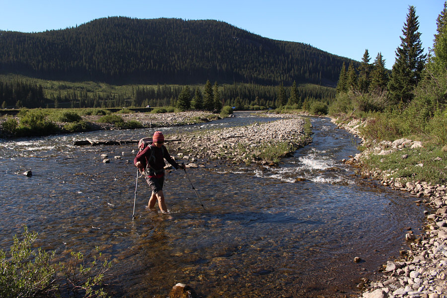
Zosia fords knee-deep Livingstone River.
That's Zosia's hand! This bear track looks pretty fresh.

Photo courtesy of Zosia Zgolak

Ugly... 
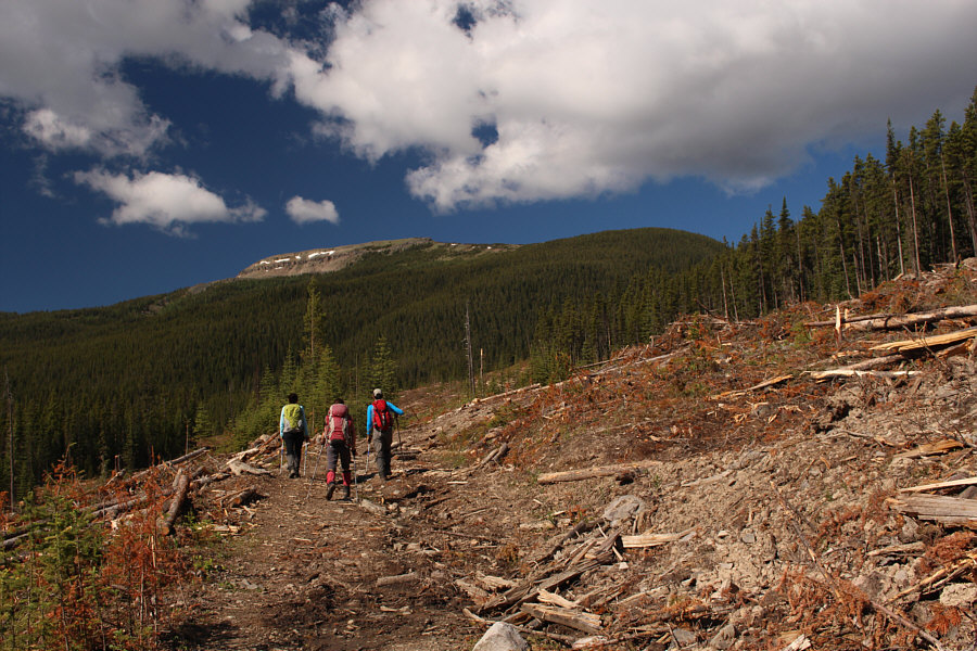
The group hikes through one of many clear-cuts in the area.
Pick your spot to bushwhack through the last trees. 
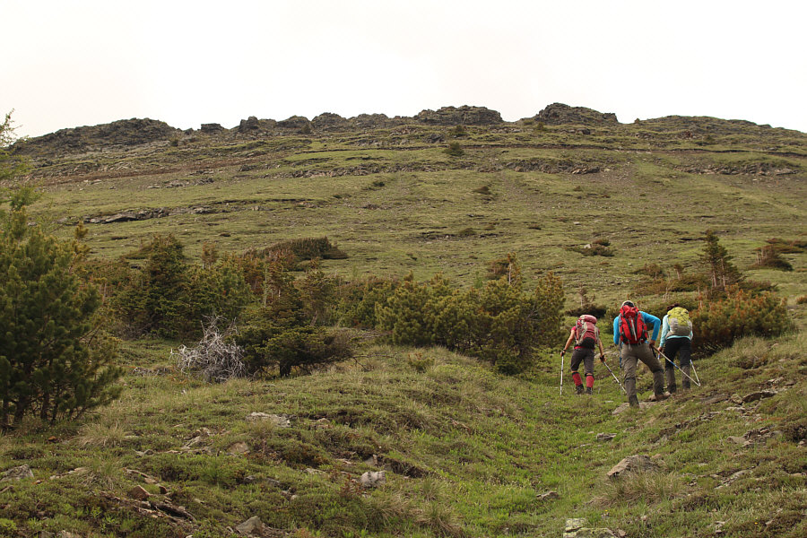
The group takes a spur road that leads to the eastern slopes of Monad Peak.
Steep but easy off-trail hiking here. 
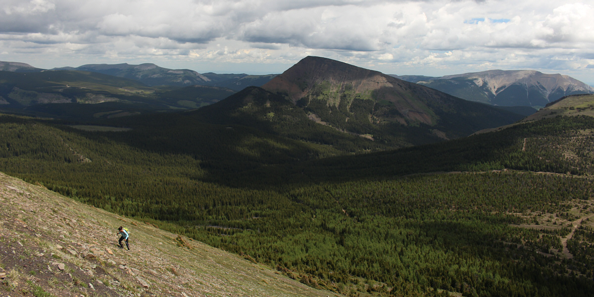
The group goes straight up the eastern slopes.
A couple of plucky Iranians! 
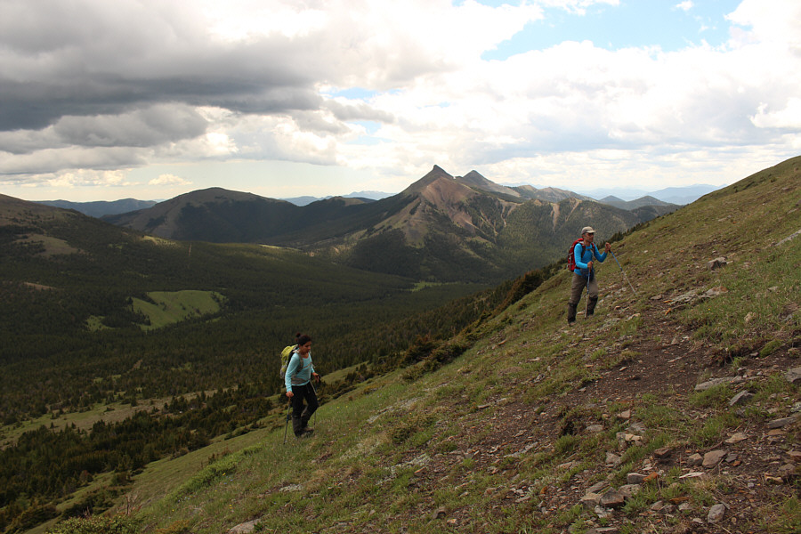
In the distance behind Asieh and Ali are the Twin Peaks of Cabin Ridge.
Zosia is a climbing machine! 
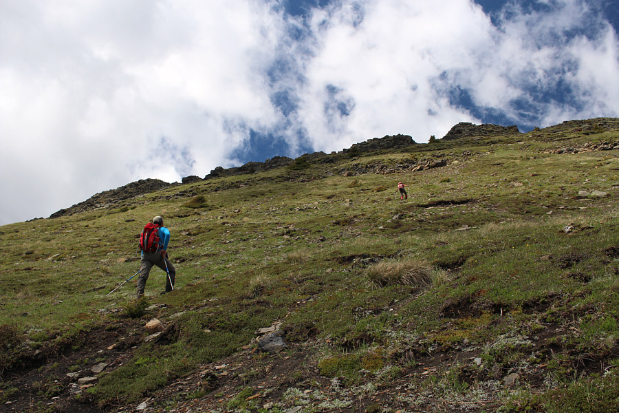
Ali watches as Zosia zooms up the grassy slope.

Still having fun, Asieh??

Isola Peak looks more impressive from the west than from the east.


"Cliffs" might be too strong of a description... 
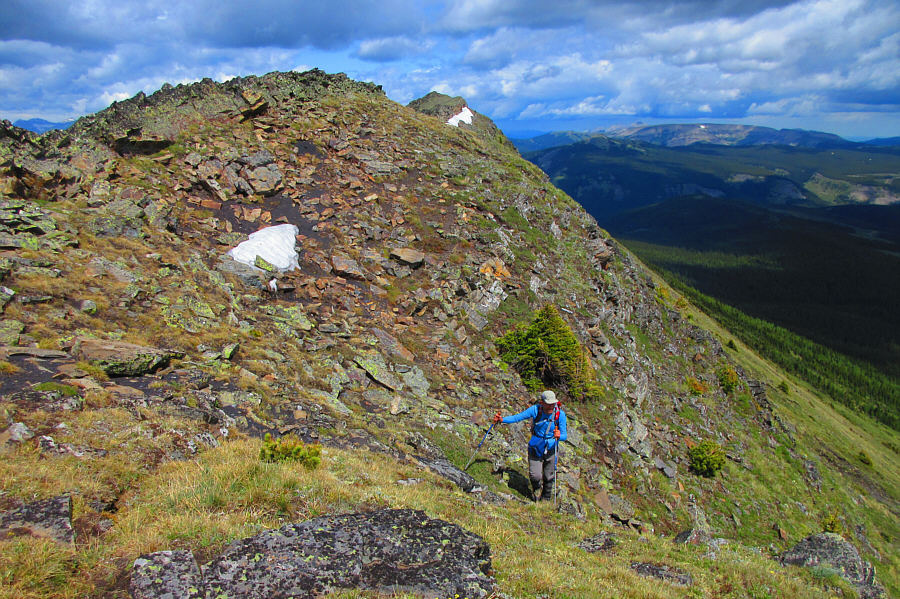
Ali comes through a weakness in the cliffs guarding the summit ridge.

Photo courtesy of Zosia Zgolak

Easy street. Asieh hikes along the summit ridge.  Zosia and Sonny are visible in the distance.

Photo courtesy of Ali Shariat

A bit thin for skiing though... 
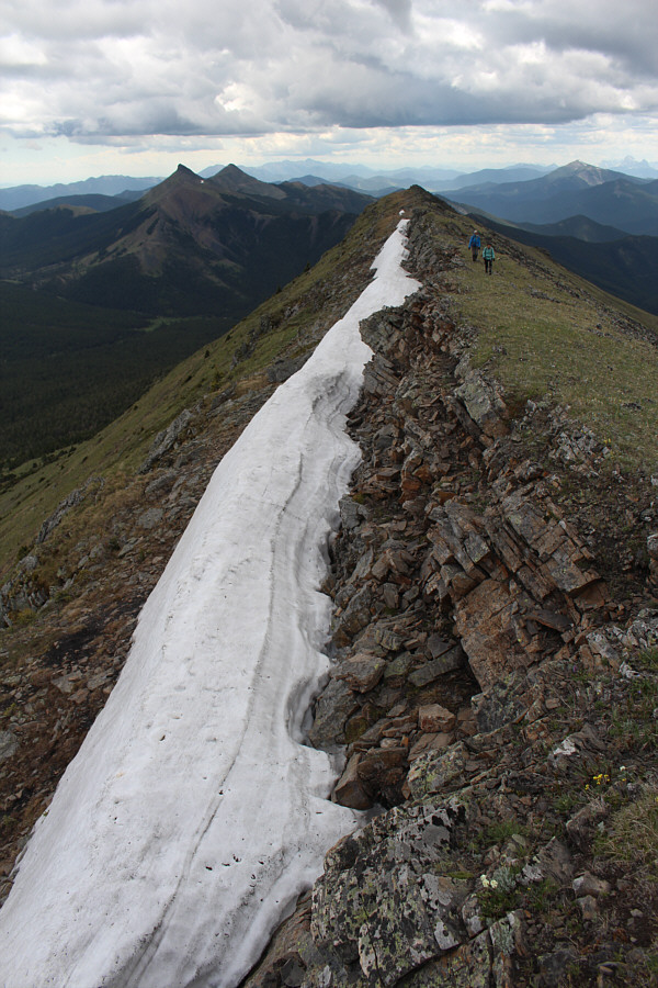
A sliver of snow persists along the summit ridge.
Ayyyyyy!!! Sonny, Zosia, Asieh and Ali stand on the summit of Monad Peak (2549 metres).

There are some intriguing peaks there...

The group enjoys a panoramic view of the High Rock Range to the southwest as they eat lunch.


We probably would have gone and bagged this one had Zosia and I not been in a rush to get home for a dinner party. To the east, Monola Peak, as named by Vern Dewit, is also supposedly an easy hike.

Photo courtesy of Ali Shariat

Looks like they're ready to be climbed! 
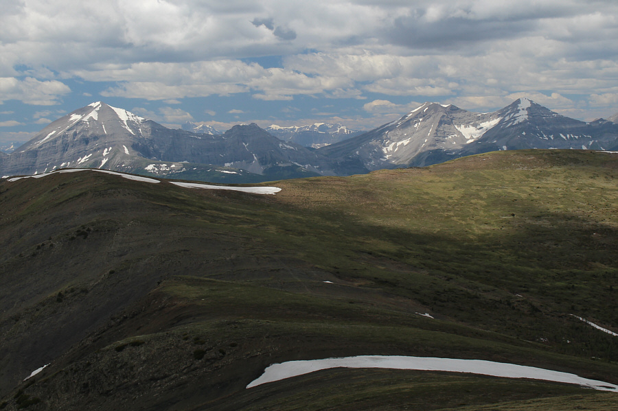
Mount Lyall (left) and the double peaks of Mount Gass (right) are visible to the west.
There's actually some good scree/dirt surfing to be had on the way down! The group makes its way down the weakness in the cliffs on the return trip.
The dirt was literally crumbling beneath me into the creek! Sonny struggles a bit to traverse the hillside at a washed-out section of the road.

Photo courtesy of Zosia Zgolak

A bicycle, a bicycle! My kingdom for a bicycle! Mount Livingstone can be seen at distant right as the group hikes back through a clear-cut.
The water seemingly felt colder this time... The group fords Livingstone River again near the end of the hike.

Photo courtesy of Zosia Zgolak
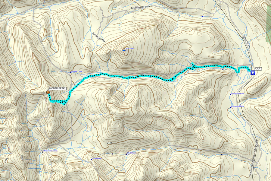
An easy trip probably worth saving for shoulder season. Total Distance:  21.1 kilometres
Round-Trip Time:  7 hours 45 minutes
Net Elevation Gain:  842 metres

GPX Data