BOU AVENUE
Healy Pass Peak
Healy Pass Peak is the unofficial name of a
prominent ridge to the north of well-traveled Healy Pass in Alberta's
Banff National Park. This is a very popular peak-bagging objective
if the wealth of online trip reports is any indication, and Zosia Zgolak
and I had been eyeing it as a possible ski ascent for quite some time.
However, we were adamant about having absolutely clear weather conditions
before making an attempt because we did not want to be cheated out of
what promised to be amazing summit views. When we left Calgary
early on the morning of 24 February 2019, we were still not quite sure
where we wanted to go skiing that day, and the brutally cold temperatures
did not exactly inspire us to try a long and committing trip. We
decided to drive to Sunshine Village Ski Resort, and if the weather was
looking marginal, we would simply skin up the ski-out and do a few
downhill turns for practice. When we arrived at the parking lot
though, it looked like the weather was going to be clear and sunny, and
we opted to give Healy Pass Peak a go.
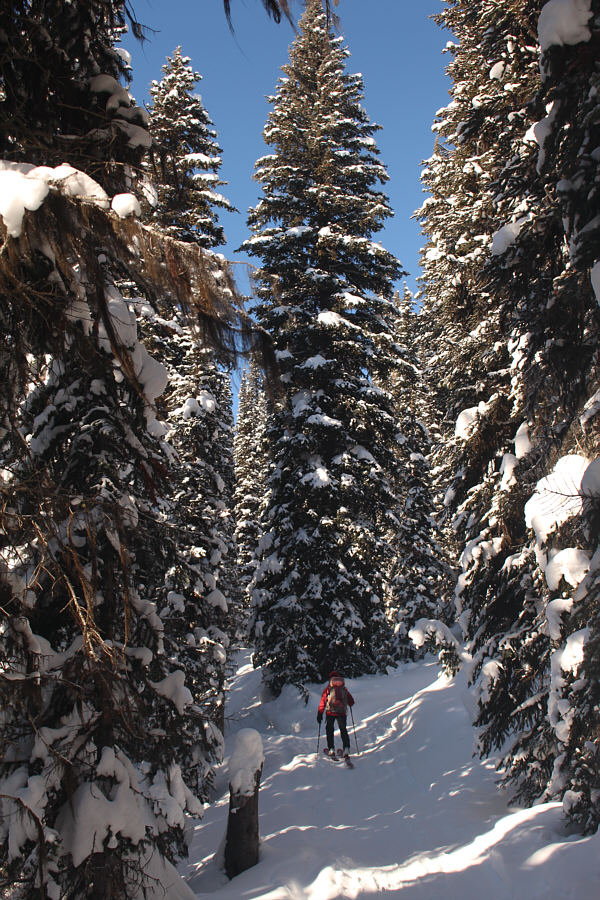
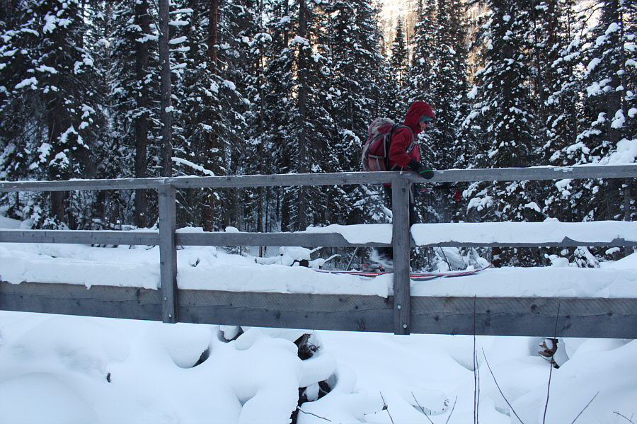
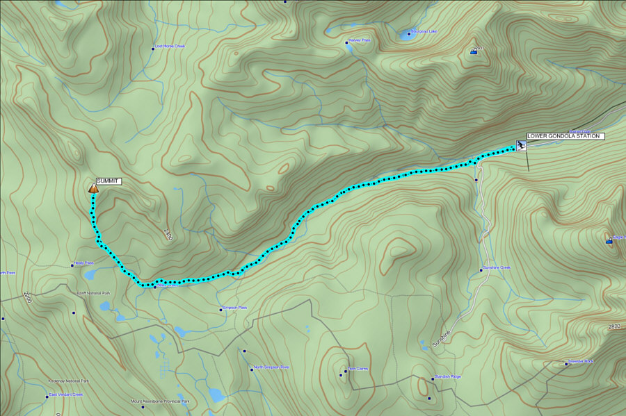
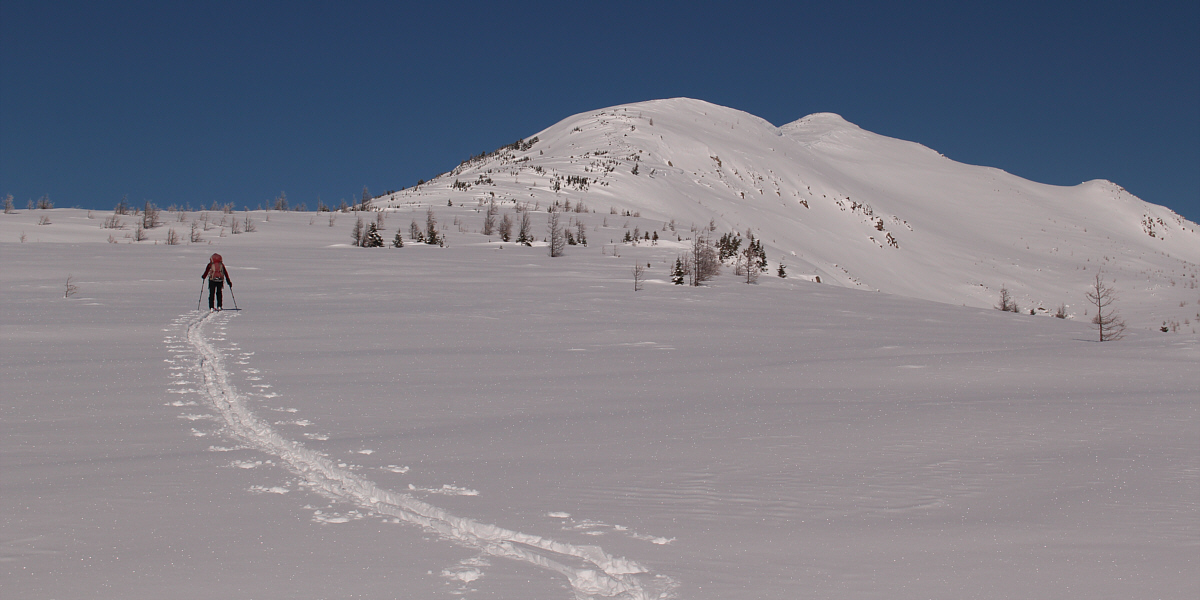
From the lower gondola station, we followed
Lower Canyon ski run for about 700 metres before turning onto the trail
to Healy Pass. This trail descends to a bridge over Sunshine Creek
before continuing westward. The next three hours would be a
somewhat monotonous plod for us up Healy Creek valley on a well-packed
trail. The forest offered little in the way of views, but worse, it
shaded us from the morning sun which made for very frosty conditions.
Even with heat packs--albeit poor ones--in my mittens, I constantly had
to clench my hands into a fist to warm them up. Fortunately, my
toes went numb fairly early, and I did not feel much from them until
later in the day.
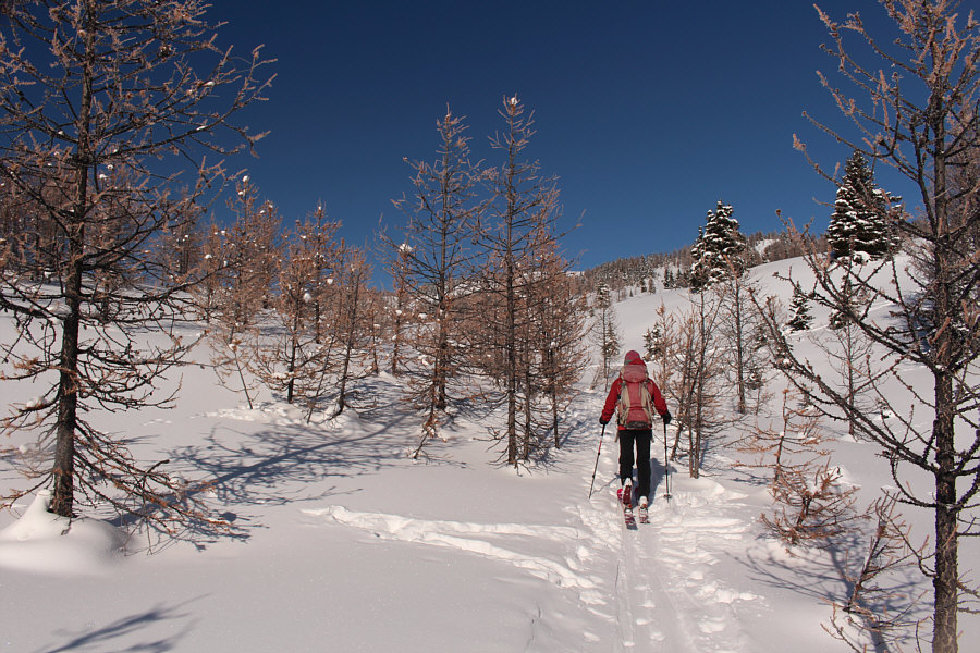
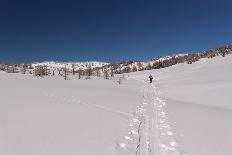
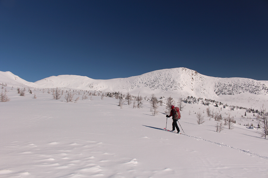
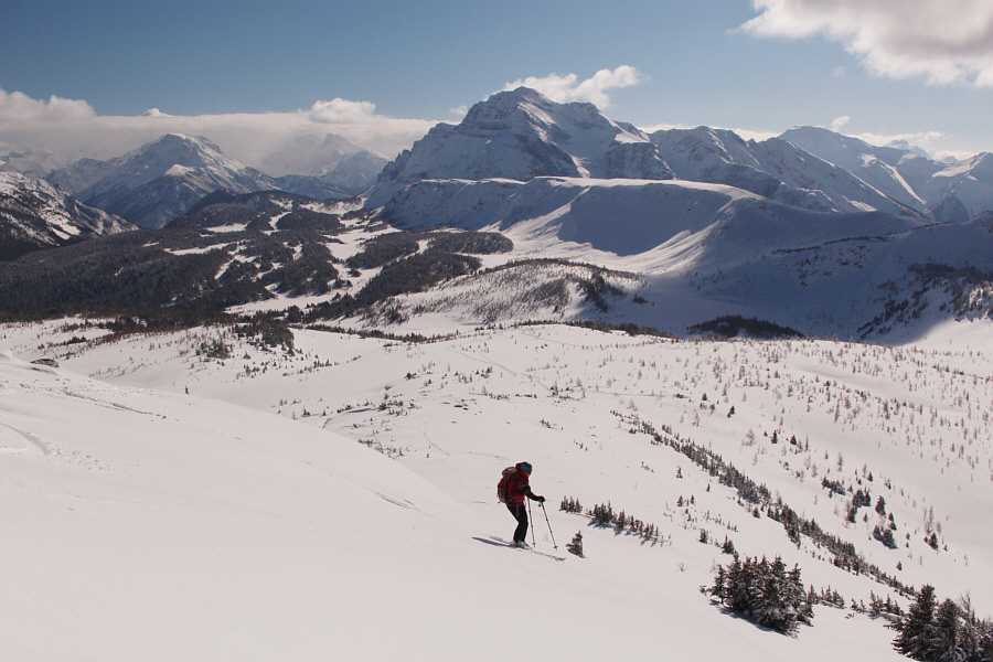
Things improved once we started to break
out of the trees and into the open environs of Healy Pass. The
bright sun warmed us up considerably, and best of all, there was not a
breath of wind anywhere. Before reaching Healy Pass, we veered
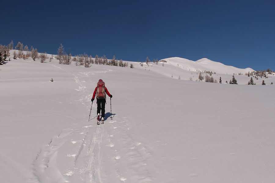
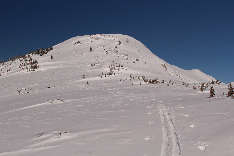
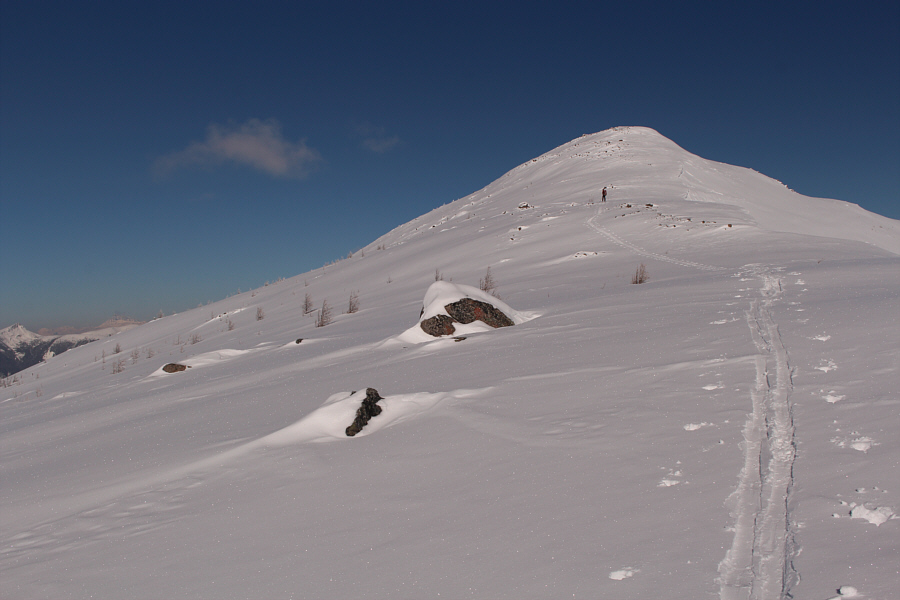
north and easily gained the south ridge of Healy Pass Peak. Except
for a few rocky spots where snow coverage was a bit thin, we generally
had no problems climbing up the south ridge all the way to the summit.
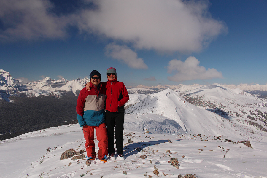
The summit views did not disappoint, and both Zosia and I were jubilant
about picking the right day to be up there with perfect weather
conditions.
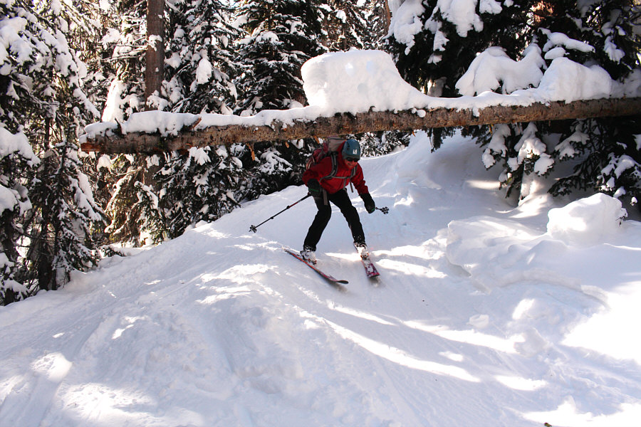
After snapping our requisite photos and
removing our climbing skins, we considered a few options for descending,
but ultimately, we simply skied back down the south ridge. The few thin spots on the ridge probably left a few scrapes on
the bases of our skis, but we managed to get down to the open meadows of
Healy Pass without any spills. We enjoyed a little powder skiing in
the meadows before regaining the Healy Pass trail and re-entering the
forest. Strangely enough, the best skiing of the day was descending
the luge-track-like trail with its many twists and turns through the
forest just below Healy Pass. Snow conditions were excellent which
made the skiing very enjoyable.
The remainder of the ski back along Healy
Creek had short-lived moments of downhill fun interspersed with long
tedious stretches of flat or even uphill sections. Both of us had remnants
of skin glue which remained stuck to our ski bases, and this adversely
affected our glide on the flat sections. However, this was also a
blessing in disguise since we could also walk up the many uphill sections
as if we had grip wax on our skis. This saved us a great deal of
energy since we rarely had to resort to herringboning. In fact, we
had no trouble skiing up the final long uphill section between Sunshine
Creek bridge and Lower Canyon ski run. From there, we easily
cruised back to the lower gondola station to conclude one of the most
satisfying ski trips to date for us.
Zosia approaches the south ridge of Healy Pass Peak.
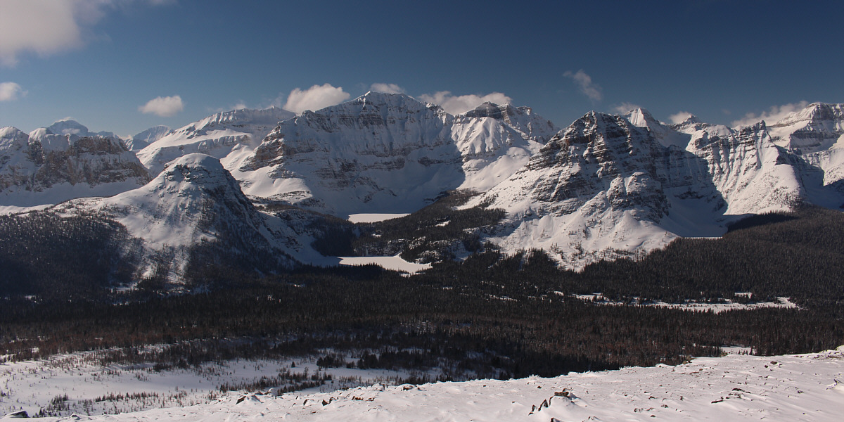
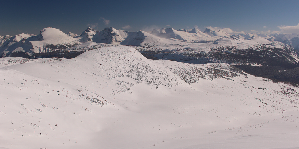
The view to the west includes Sugarloaf Mountain (left
foreground; also known as The Sphinx or Natalko Nubbin), Egypt Lake
(lower), Scarab Lake, Haiduk Peak (right of centre) and Pharaoh Peaks
(right).
The view to the northwest includes
Mount Ball
(far left), Storm
Mountain (left of centre) and Mount Hector (distant horizon right of
centre). The unnamed ridge in the foreground at right is likely
higher than Healy Pass Peak.
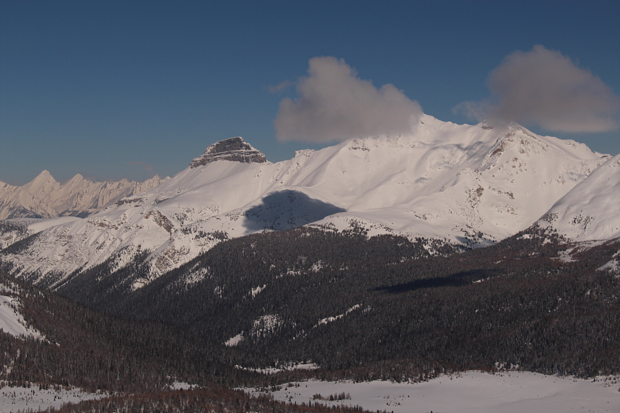 |
Pilot Mountain's
summit block stands out to the northeast while the top of
Mount Brett is
obscured by a passing cloud. |
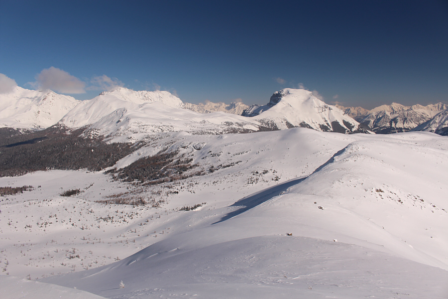 |
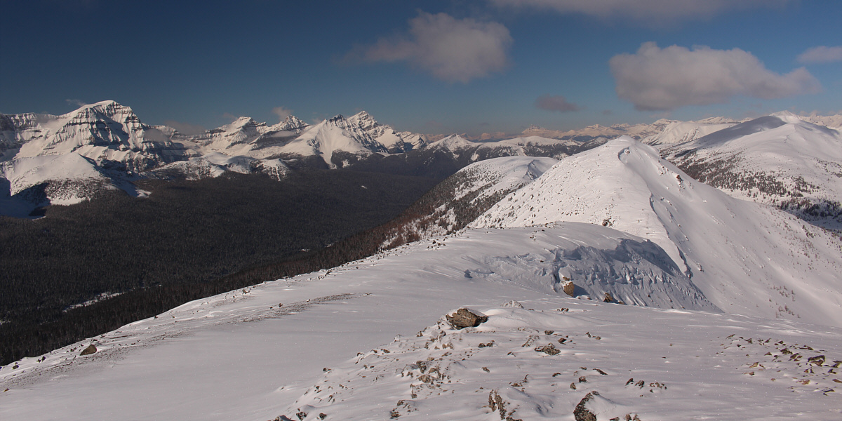
There is a lot of open terrain to explore between Healy Pass Peak and
Mount Bourgeau
(right). |
Notable peaks visible to the southeast include Eagle
Mountain, Mount
Howard Douglas, Fatigue Mountain, Nasswald Peak and Golden Mountain.