BOU AVENUE
Mount Rowe

The recent re-opening of Akamina Parkway after a three-year hiatus combined with a stellar weather forecast prompted Asieh Ghodratabadi, Ali Shariat, Zosia Zgolak and me to hike up Mount Rowe in Alberta's Waterton Lakes National Park on 3 October 2020.  A scrambling ascent route is described in Andrew Nugara's More Scrambles in the Canadian Rockies, but we chose to keep things simple and go up his suggested descent route via the popular Rowe Lakes Trail.  Coincidentally, I was contacted the previous day by Dave McMurray who had invited me to join him and Andrew Nugara for an ascent of both Mount Rowe and nearby Mount Lineham.  Unfortunately, we were unable to coordinate our start times, but there was a good chance that we might run into each other at some point during the day.

Not surprisingly, the Rowe/Tamarack trailhead (10 kilometres west of Waterton townsite along Akamina Parkway) was already quite busy when Asieh, Ali, Zosia and I arrived after a long drive from Calgary.  The well-maintained trail was also very busy as we hiked the first 3.7 kilometres to a junction with the trail leading to Lower Rowe Lake.  We took the short detour to Lower Rowe Lake which offered a brief respite from the crowds.  Returning to the main trail, we walked for another kilometre or so along Rowe Creek before entering a large meadow at the head of the basin.  Shortly after crossing a stream on a simple bridge, we kept left at a signed junction (right is the continuation of Tamarack Trail) and began climbing steadily for a little more than a kilometre up several long switchbacks to reach trail's end at Upper Rowe Lake.  Golden larches were in abundance here, and we took a short break on the lakeshore before following a couple of large groups of hikers up a broad ridge to the west of the lake.  Some route-finding is required to avoid bushwhacking on the lower parts of this ridge, but there are plenty of beaten paths to follow.  Higher up, a stand of larches seemingly blocks the way, but it was easy enough to walk through to reach the Continental Divide just beyond.

Upon reaching the crest of the Continental Divide, Asieh, Ali, Zosia and I turned right to follow one of the groups up to the unnamed high point further to the west (turning left leads to the summit of Mount Rowe).  Much to our delight, we ran into Dave and Andrew here and stopped to chat at length with them.  They had already ascended Mount Rowe earlier via its northeast ridge and were looking for a feasible way to traverse to Mount Lineham from the unnamed high point.  Unable to find a non-technical route, they decided to retreat and head down via Rowe Lakes (be sure to check out Dave's trip report).  After parting ways with Dave and Andrew, the rest of us continued up to the unnamed high point and took another short break here.  When we resumed hiking, we backtracked along the Continental Divide and ascended Mount Rowe without any difficulty.  Although there were several groups of hikers--mostly from Pincher Creek and Lethbridge--wandering back and forth along the Continental Divide on this day, we were lucky enough to have the summit of Mount Rowe to ourselves for at least a short while.

For our descent, Asieh, Ali, Zosia and I returned to roughly where we first gained the crest of the Continental Divide and retraced our steps down the broad ridge to Upper Rowe Lake.  From there, we regained the trail and enjoyed a lengthy but otherwise trouble-free hike back to the trailhead.
Now they just need to build an outhouse here! 
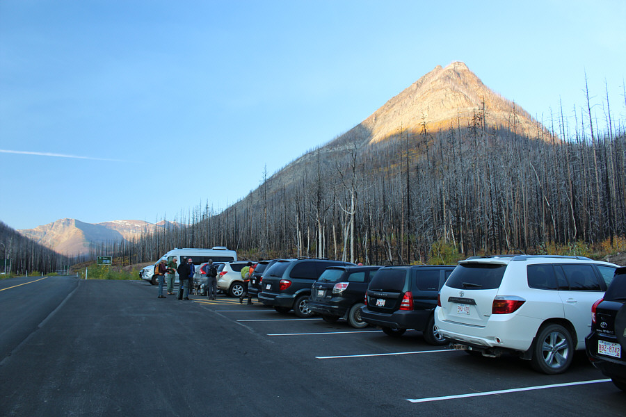
With Akamina Parkway re-opened to motorized traffic for the first time in three years, the Rowe/Tamarack trailhead is understandably busy on this day.
Fall colours are here! 
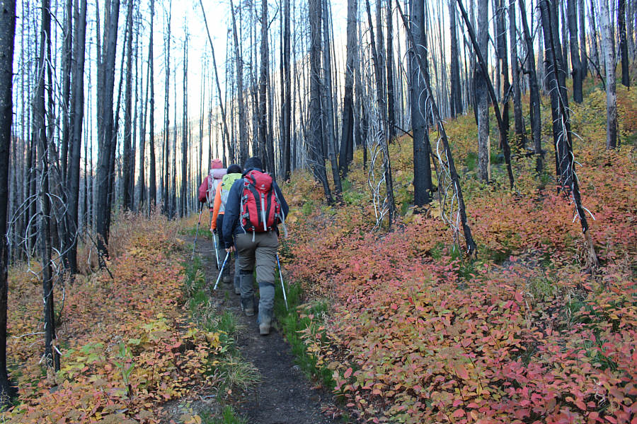
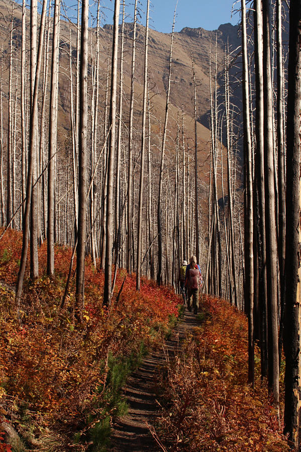
The trail initially climbs through the remains of the forest that was ravaged by the Kenow Wildfire in 2017.
First good photo opportunity here! 
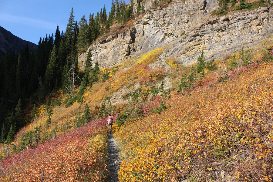
About two kilometres from the trailhead, the trail crosses an open slope before entering the forest at far left.
It's worth the short detour just to get away from the annoying crowds if only briefly. 
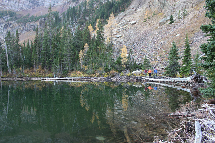
Lower Rowe Lake is refreshingly peaceful and quiet on this day.
Like a bridge over troubled waters... 
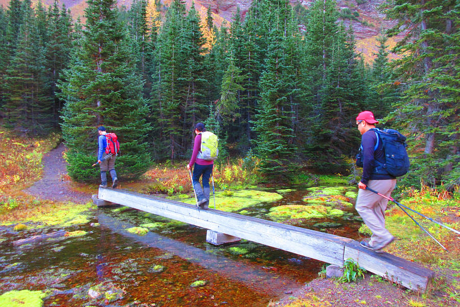
Ali, Asieh and Sonny cross a stream just before the junction for Upper Rowe Lake.

Photo courtesy of Zosia Zgolak

It's a difficult lake to photograph from up close. Asieh, Zosia and Ali arrive at Upper Rowe Lake.
Just follow the noisy crowd! 
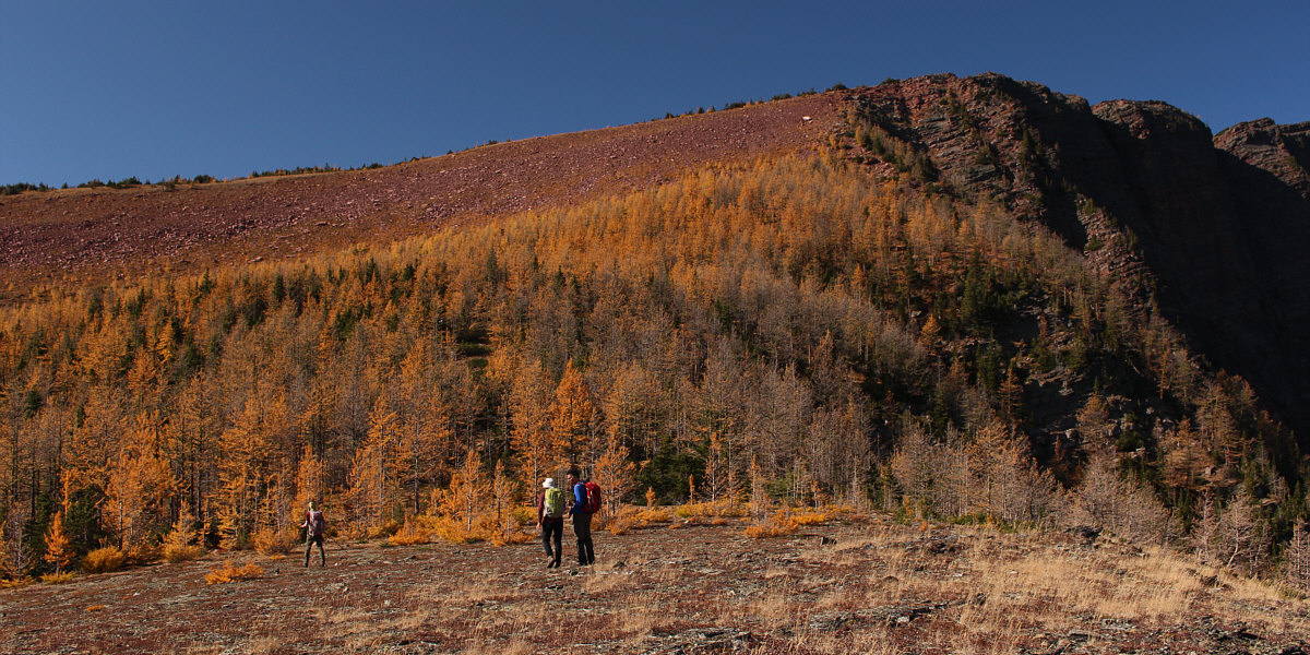
Ali, Asieh and Zosia head for the broad ridge at left.
What a view! Asieh ascends the broad ridge with Upper Rowe Lake behind her.

Prime time for larches here!

The Continental Divide lies just beyond this stand of larches.


Hardest part was NOT stopping every few metres to take a photo! 
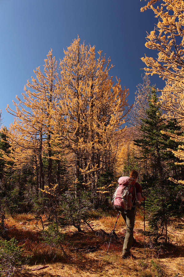
Zosia has no problem walking through the stand of larches.
Most of the hard work is done at this point! 
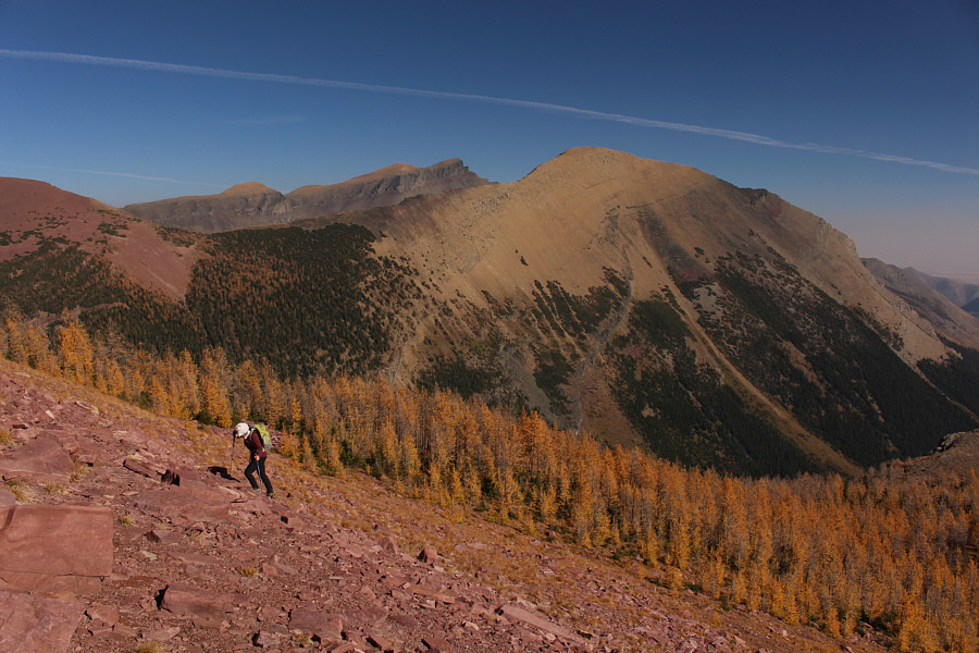
Asieh emerges from the stand of larches and climbs the last few steps to the Continental Divide.  The top of Mount Blakiston (centre) can be seen behind Mount Lineham (right).
And I'm boring everyone with another long-winded story! 
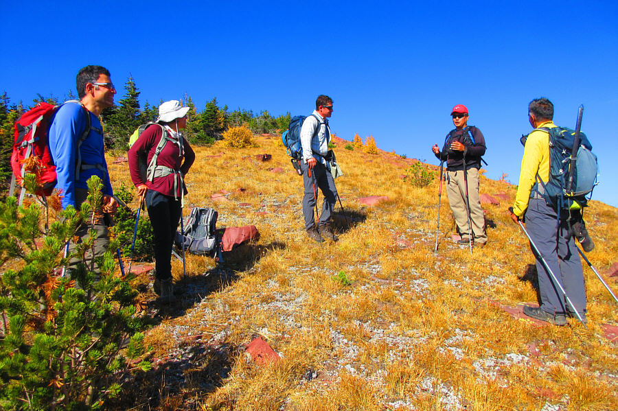
The group runs into Dave McMurray (centre) and Andrew Nugara (far right) on the Continental Divide.

Photo courtesy of Zosia Zgolak

That's a big drop on the right! 
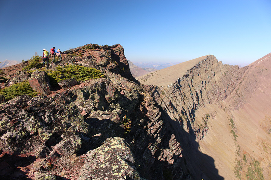
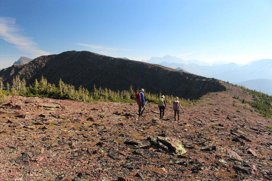
Asieh, Ali and Zosia head for an unnamed high point along the Continental Divide.

I would be interested in climbing all of these!

Visible to the west are Long Knife Peak (US, left), Starvation Peak (right of centre), Miskwasini Peak (left, dark-looking), Kenow Mountain (left, snow patches), and Langemarck Mountain (far right).  In front of Long Knife Peak is unofficially-named Bennett Peak.


Zosia has climbed Festubert Mountain already, and that is why we're not bothering to go there today! 
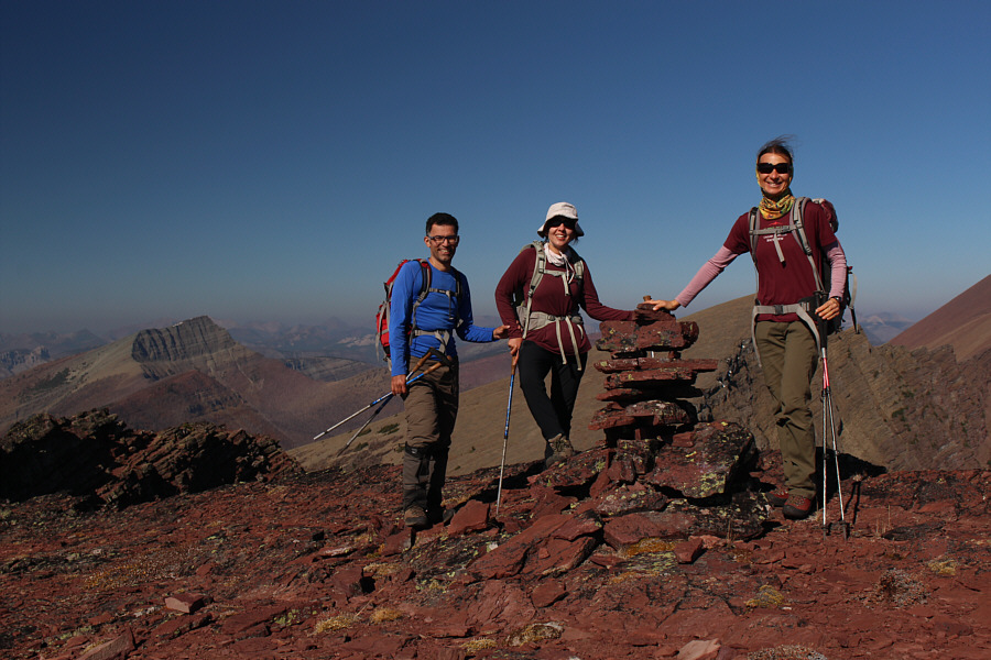
Ali, Asieh and Zosia stand beside a cairn on the unnamed high point (2500 metres).  Festubert Mountain is visible at distant left.
The connecting ridge at left looks rather gnarly... 
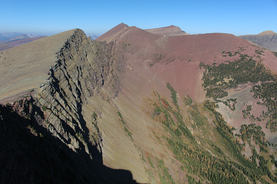
From the unnamed high point, the trail going up to Lineham Ridge is visible to the north.  Right of centre on the horizon is Mount Hawkins.
We may have to come back in winter to ski this! 
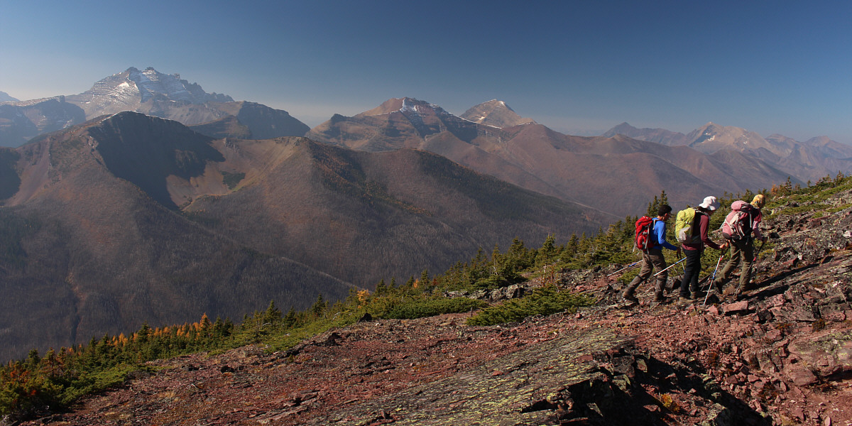
The group heads eastward toward the summit of Mount Rowe at left.  Barely visible on the hazy horizon at right is Mount Cleveland (US).
A bit anticlimactic after climbing the higher unnamed high point! Sonny, Zosia, Asieh and Ali relax on the summit of Mount Rowe (2464 metres).
Such a simple and elegant route! 
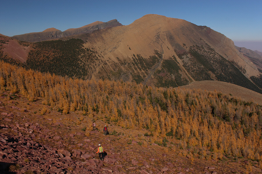
Mount Rowe's summit grants a comprehensive view of the broad ridge running from Upper Rowe Lake to the unnamed high point (left) on the Continental Divide.
Looks kinda like a shoe or an ocarina! 
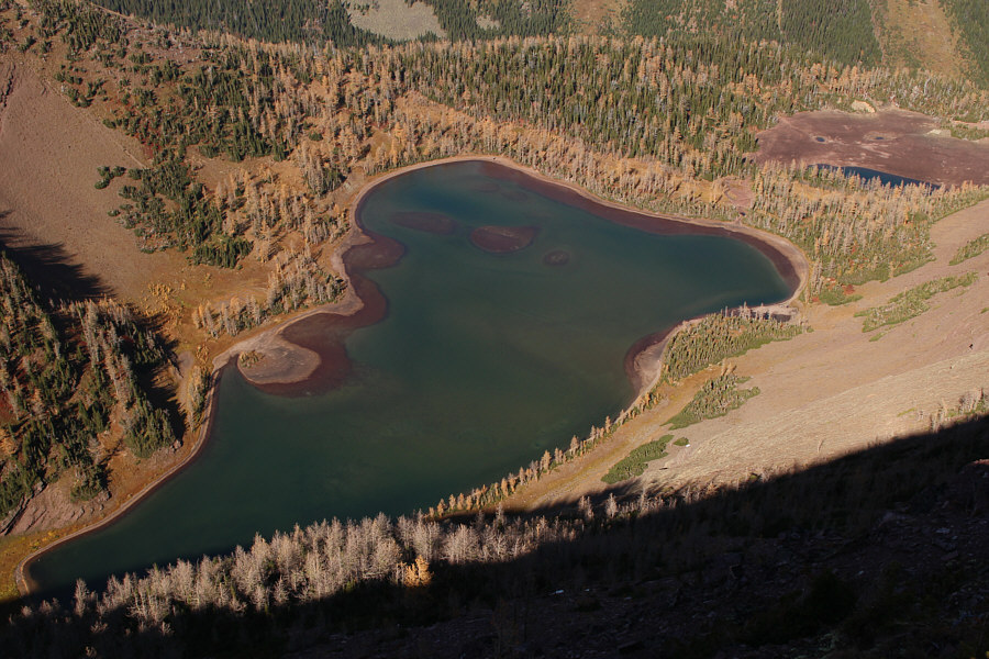
Here is the view of Upper Rowe Lake from the summit of its namesake mountain.
We have to pay PST here! Zosia, Asieh and Ali have to climb back up the lower of the two bumps at centre before they can drop down to the larch-covered ridge at right.
Just in case we didn't get enough of golden larches on this day... The group drops down from the Continental Divide and aims for the ridge at right beyond the larches.
It's hard to leave such a scenic place! Here is a last look at Upper Rowe Lake.  Visible at far left is Mount Crandell.
Amazing colours late in the day! The group hikes back to the trailhead late in the afternoon.
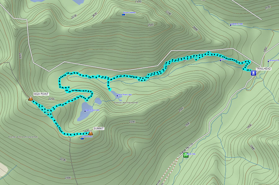
On a sunny day, the jaw-dropping views more than make up for the crowded trail. Total Distance:  19.0 kilometres
Round-Trip Time:  7 hours 55 minutes
Cumulative Elevation Gain:  1107 metres

GPX Data