BOU AVENUE
Mount Broadwood
Zosia Zgolak and I finished off our extended weekend car camping trip in the Flathead region of southeast British Columbia on 22 June 2020 with an ascent of Mount Broadwood.  This massive mountain has been on my radar for quite some time since it is visible from the highway every time I drive between Fernie and Cranbrook.  Despite its close proximity to the town of Elko, Mount Broadwood is infrequently ascended due to accessibility issues and the fact that the upper mountain is guarded by a seemingly impregnable cliff band known as the "China Wall".  The only breach in the China Wall is near the south end of the massif, and this is the key to supposedly the only non-technical route up the mountain as reported by the late, great Rick Collier.

From Highway 3, turn east onto Morrissey Road about 8.8 kilometres south of the turnoff to Fernie Ski Resort or 17 kilometres east and north of the junction with Highway 93.  Cross both the bridge over Elk River and the train tracks before turning right at a T-intersection.  Stay on Morrissey Road and keep right at a split about 3 kilometres south of the T-intersection (there is a cutoff road 560 metres further along the left fork if you miss this split).  From the split, drive 9.1 kilometres along Lodgepole Road to a junction with Wigwam Forest Service Road (FSR).  Turn right and drive for 3.1 kilometres to a junction with what Collier refers to as the "conservation road".  According to him, the conservation road is "open to public travel for only about a month a year from mid-June to mid-July".  This road runs along the south side of Mount Broadwood and eventually connects with River FSR near the town of Elko.  Keep right and drive onto the conservation road passing an information sign board and gate.  There is a washout about 600 metres from the junction which I was barely able to drive across in my Honda CR-V.  About 1.6 kilometres further is a second much larger washout which will likely stymie further progress for most motor vehicles except monster trucks.  Unfortunately, I do not have any information regarding whether or not the conservation road is drivable from the Elko end.  A bicycle would solve all access issues.

Starting from the second washout, Zosia and I walked along the continuation of the conservation road for about another 1.8 kilometres to where it appears to merge with some sort of grassy right-of-way.  We abandoned the road here and cut across the right-of-way, essentially making a beeline for the breach in the China Wall.  Almost right away, my feet were soaked from the morning dew in the tall grasses, but there was not much I could do about that as we commenced an unrelentingly steep climb up the scrubby slopes below the breach.  Ultimately, we reached the base of the cliffs on the left side of the breach, and here, we found a good game trail traversing to the right and entering the drainage inside the breach.  The game trail peters out in a steep talus slope, but we were able to keep traversing to the right side of this slope which is bordered by light forest.  We picked up a beaten path here and followed it up the drainage for a considerable distance until it, too, petered out amidst some scrubby vegetation.  At this point, I made the mistake of trying to stay in the middle of the drainage, but it would have been better to stick closer to climber's right.  Unfortunately, we would only figure this out after enduring another round of occasionally nasty bushwhacking.

Zosia and I eventually escaped the bushes and climbed up more talus before entering a "high alpine valley, choked with snow" as described by Collier.  The remaining snow patches on this day were not an issue as the snow was very supportive and actually facilitated our travel to the back of the valley.  I was also able to replenish my dwindling water supply here which was a great relief to me given the warm weather.  At the back of the valley, we hiked up easy slopes to climber's left and soon gained the crest of the ridge above.  Turning right, we followed this ridge up through a few short cliff bands requiring some moderate scrambling and finished the ascent with a short walk up easy terrain.  Collier placed the summit register in 2011, but we found that only one other party had signed it in 2017.

For our descent, Zosia and I more or less retraced our steps down the mountain.  Getting back down the ridge and hiking out the high alpine valley was pretty straightforward.  In the bushy part of the drainage, we managed to avoid most of the heinous bushwhacking we had endured earlier by staying as much to skier's left as possible.  It looked like it would be smooth sailing once we regained the beaten path we had climbed earlier, but partway down this section, I accidentally snapped one of my trekking poles while stumbling on some loose rocks.  Although this was not completely devastating, I had to be a bit more careful (ie. slower) for the remainder of the descent.  Near where we first entered the drainage, we traversed a little too soon and had to drop down a bit of loose choss to regain the good game trail.

Clearing the China Wall, Zosia and I followed a grassy ridge most of the way down to the conservation road.  This part of the descent felt longer than it really was probably because of a combination of fatigue and dehydration, and our exasperation was palpable when we were faced with one final steep slope and a short bushwhack to reach the road.  I even cursed having to cross the small ditch adjacent to the road!  An easy walk back to my car followed by a final tense drive across the first washout wrapped up our thoroughly satisfying adventure on Mount Broadwood.

Yikes! How are we ever gonna get up there?!

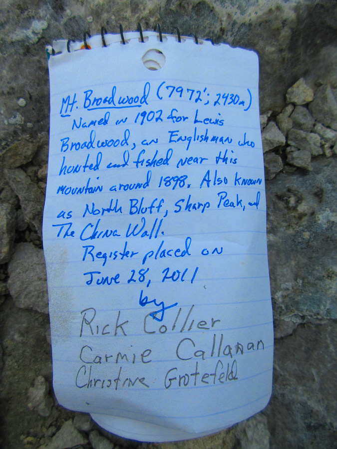
Mount Broadwood is guarded by an encircling band of cliffs known as China Wall.


Thank you, Shell Canada! 
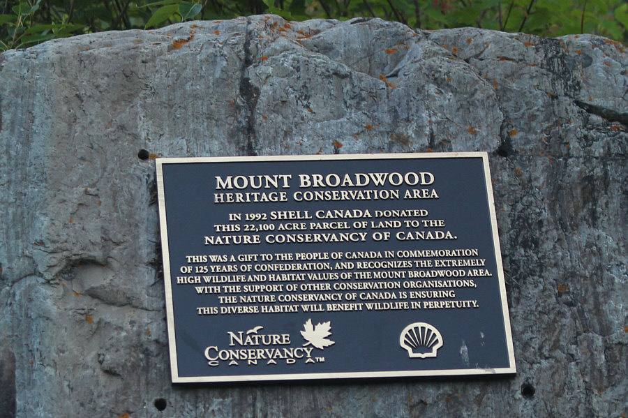
A plaque explains the origins of the Mount Broadwood Heritage Conservation Area.
I could have used a wee bit more clearance! Sonny carefully drives through a washout along the access road.

Photo courtesy of Zosia Zgolak

Only high-clearance 4x4 vehicles beyond this point! A second much larger washout forces Sonny to park his car and start walking.

Photo courtesy of Zosia Zgolak

This is where we storm the Bastille! 
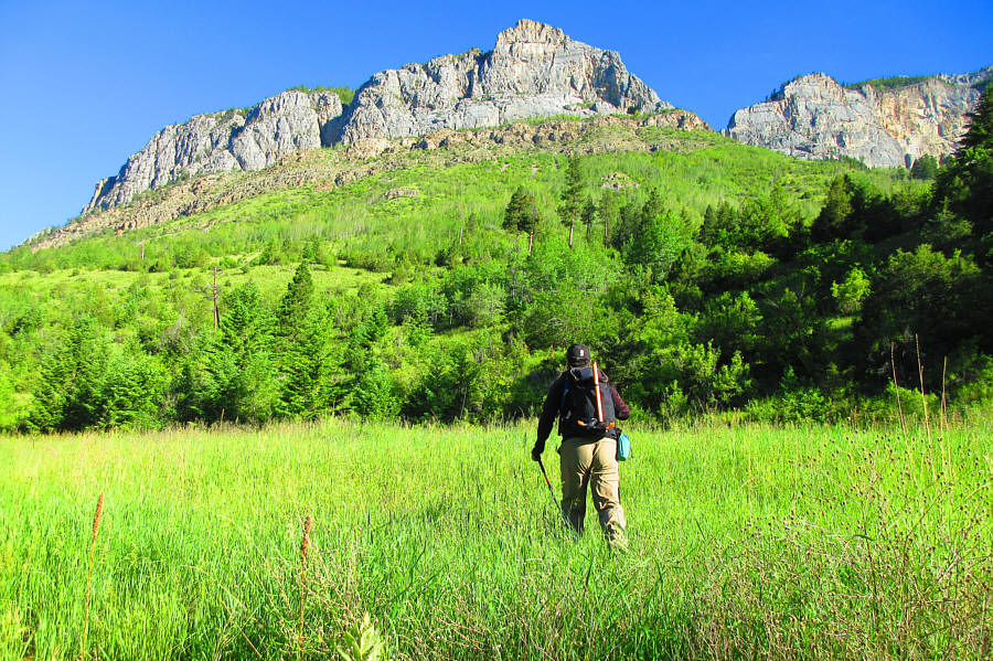
This is the first clear view from the access road of the breach in the China Wall.
And my feet are already wet because of the dew in the grass! 
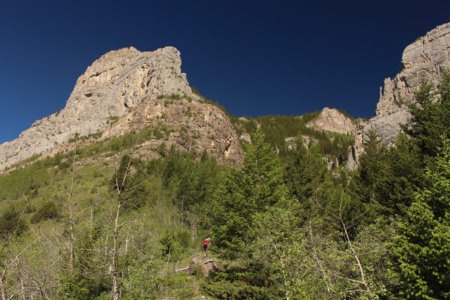
Sonny leaves the access road and makes a beeline for the breach.

Photo courtesy of Zosia Zgolak

Breach or no breach, the steepness is unrelenting! Zosia hikes up the ridge guarding the breach.
Boy, a trail would be nice right about now! 
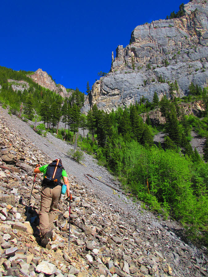
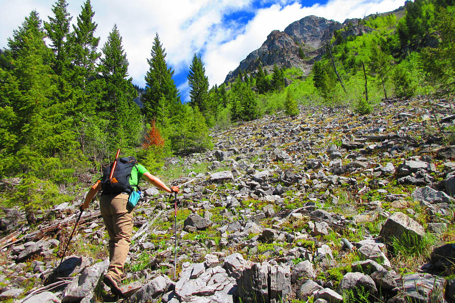
Sonny traverses a steep talus slope inside the breach.

Photo courtesy of Zosia Zgolak

Doesn't look good up ahead! Sonny tries to stay out of the trees as much as he can while ascending the drainage.

Photo courtesy of Zosia Zgolak

Why is the bush getting thicker the higher we climb?? 
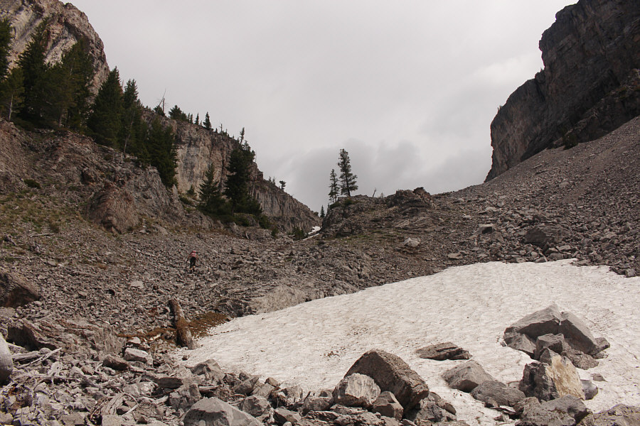
The middle of the drainage is not a good place to be.

Photo courtesy of Zosia Zgolak

We're past the most tedious parts of the ascent at this point! After emerging from the bushes for good, Zosia climbs up more steep talus.
It's nice to walk on flat ground for a change! 
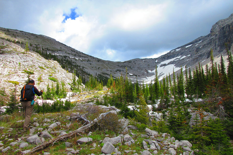
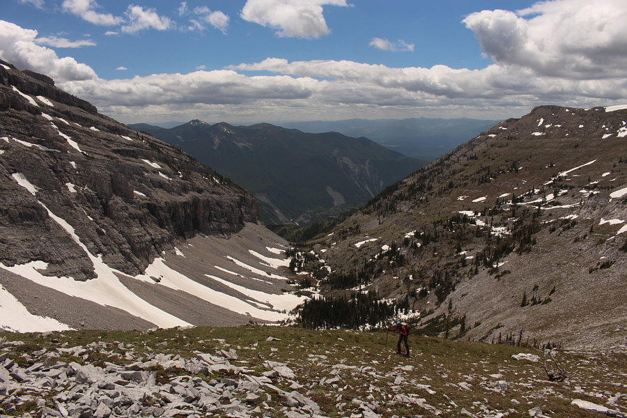
Sonny enters what Rick Collier calls a "high alpine valley".

Photo courtesy of Zosia Zgolak

Interestingly, there is a lot of twisted avalanche debris in this valley. 
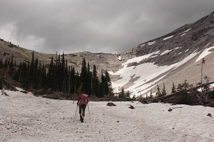
Zosia heads for the back of the valley and will ascend the slope behind the trees at far left.
The trees on the right-hand slope probably get clobbered by avalanches all winter. 
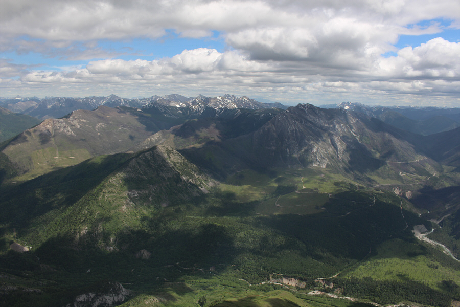
Here is a look back down the high alpine valley from near the ridge crest.
The outlier is probably even more infrequently climbed than Mount Broadwood itself! 
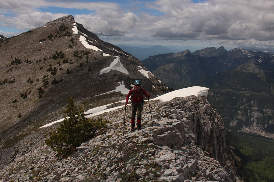
Zosia hikes along the ridge crest with the western outlier of Mount Broadwood behind her.
Looks worse than it really is. 
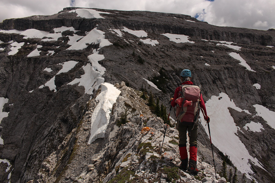
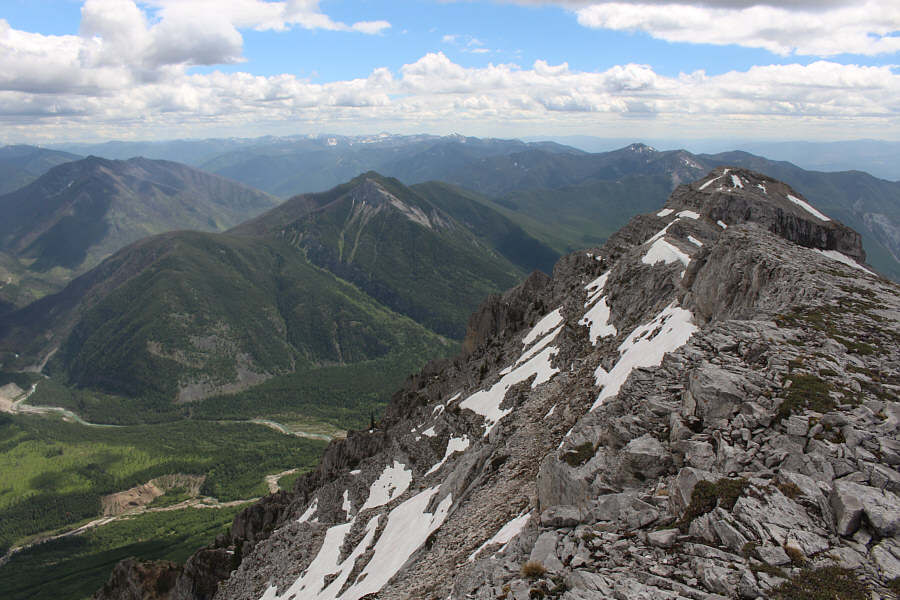
Zosia approaches the final section of ridge before the summit.
And we dragged our ice axes all the way up here for nothing! 
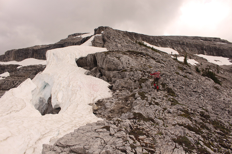
Despite the presence of some large snow cornices, the ascent route along the ridge crest is bone-dry.
"Hands-in-pocket stuff" as Rick Collier would say! 
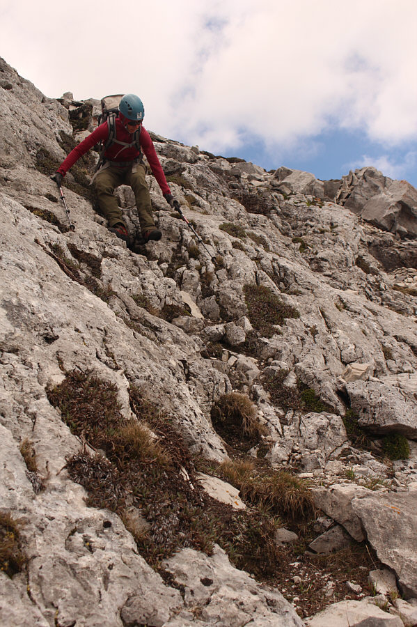
Zosia scrambles up a moderate rock step, the last obstacle before the top.
We made it! Zosia and Sonny stand on the summit of Mount Broadwood (2424 metres).
Hmmm...where's Mardy Roberts' name? On this day, the only other summit register entry is from a party of two that ascended Mount Broadwood in 2017.

Photo courtesy of Zosia Zgolak

Sorry, I had no time to come up with a dirty limerick for this summit! The sun comes out as Zosia signs the summit register.
It's amazing that none of the peaks in the foreground are named! In this view to the northwest, named peaks that are visible include Mount Baker (distant far left), The Steeples (distant left of centre), Mount Fisher (centre horizon), Mount Bisaro (far left horizon), and Three Sisters (also far left horizon).
Both the northeast outlier and Flathead Ridge look like great objectives for future trips. Mount Broadwood's northeast outlier and Flathead Ridge are the most obvious features to the northeast, but notable peaks visible on the horizon include Crowsnest Mountain (left), Mount Ptolemy (left of centre), and Mount Darrah (right of centre).
Lots of interesting places to explore here! This is looking east into the heart of the Flathead region.
The trail to Wigwam Lookout has a difficult ford near the start. Notable features to the south include Soowa Mountain (far left), the site of Wigwam Lookout (left), and Mount Mahaney (snowy bump on horizon left of centre).
Maybe someday we'll come back to tag the western outliers... Parts of Lake Koocanusa are visible beyond Mount Broadwood's western outliers.
No problemo. Zosia carefully descends the moderate rock step near the summit.
Maybe there's a fossilized bottle of mezcal nearby! 
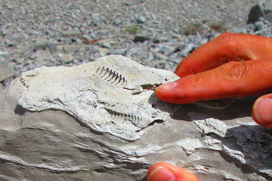
Sonny finds some worm-like fossils in a rock.

Photo courtesy of Zosia Zgolak

And we still have a long drive home after getting back to the car! After a long and knee-jarring descent, Zosia enjoys a relaxing walk back to the car along the conservation road.
An incredibly long day but well-worth all the suffering! Total Distance:  15.7 kilometres
Round-Trip Time:  11 hours 52 minutes
Net Elevation Gain:  1427 metres

GPX Data