BOU AVENUE
Porcupine Hills
Closing out the Victoria Day long weekend, Shaun Luong, Marta Wojnarowska, Zosia Zgolak and I visited the Porcupine Hills of southwest Alberta on 18 May 2020.  We first decided to visit Porcupine Lookout which is the highest point of the Porcupine Hills.

Turn east onto Highway 520 from Highway 22 26.9 kilometres south of the junction with Highway 533 or 44.4 kilometres north of the junction with Highway 3.  Drive 3.3 kilometres to a 4-way intersection (this intersection can also be reached by driving Highway 520 west from Claresholm for 42.9 kilometres).  Turn south onto Skyline Road and drive 11.0 kilometres to a junction with Sharples Creek Road coming from the right (this road is an alternate driving approach and can be accessed from further south along Highway 22 near Maycroft).  Continue straight for another 500 metres to reach a T-intersection with an information sign board.  The northern approach to Porcupine Lookout starts from here.  For the southern approach, turn right and drive south along Heath Creek Road for 2.2 kilometres to another junction.  Turn left and drive 150 metres to a Y-junction which is a logical place to park and start hiking.  The left-hand road continues up to the lookout, and with a 4x4 vehicle, it is possible to drive for another kilometre before reaching a locked gate.  A more direct foot trail to the lookout also begins near the Y-junction.  With the exception of the road up to the lookout, all other roads described here are suitable for 2WD vehicles under dry conditions.

Due to an abundance of snow still clinging to the north side of Porcupine Lookout, we decided to forego the northern approach as described in Mike Potter's guidebook, Fire Lookout Hikes in the Canadian Rockies, and Dave McMurray's excellent trip report.  Instead, we drove to the south side of the lookout and simply walked up the access road.  Partway along the road, an Alberta Fish and Wildlife officer drove up behind us in a truck to check if we were poachers hunting illegally in the area.  Marta and Zosia responded by doing the Chicken Dance which elicited an amused smile from the officer.  He promptly left us alone to carry on with his patrol.

The lookout site appeared deserted on this day, but respecting a "no trespassing" sign there, we decided to circumnavigate around the perimeter (I did sneak inside the perimeter briefly to grab a GPS waypoint).  We eventually stopped for a break on a rocky bluff just west of the helipad to the south of the lookout site.  Coincidentally, a helicopter came and landed while we were relaxing on the bluff.  Not wanting to disturb the people unloading the helicopter, we decided to descend the ridge below the bluff.  We soon picked up a good trail which led us without fuss back to the Y-junction where we parked.
Cha cha cha! 
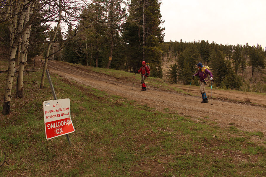
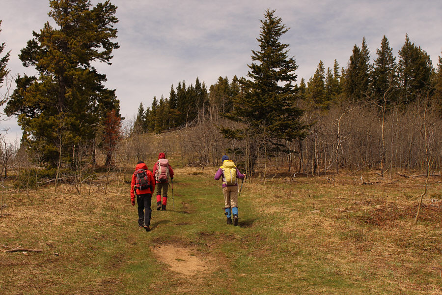
Zosia and Marta dance their way up the road to Porcupine Lookout.
Had I driven this far, this would have been a very short hike! 
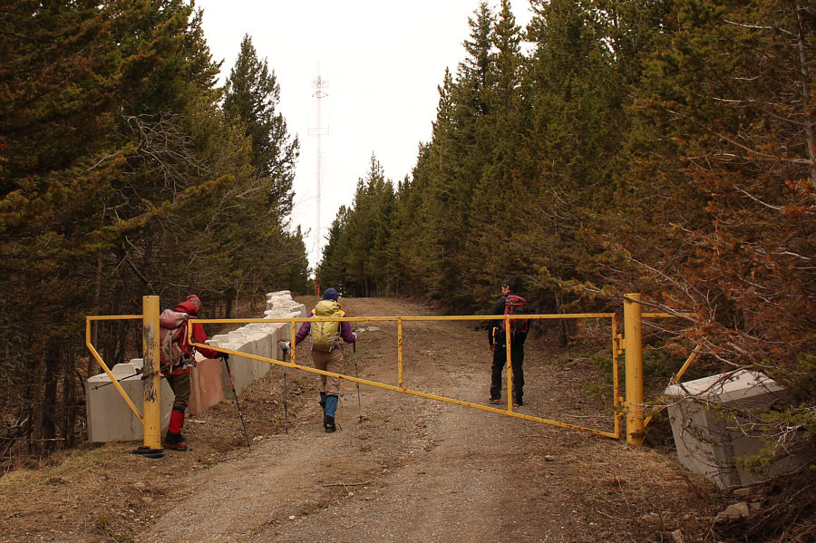
The group passes a locked gate near the lookout site.
Hello! Anybody home? 
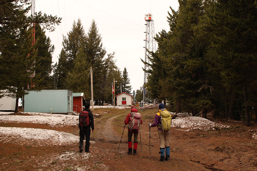
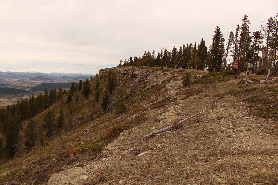
Porcupine Lookout appears deserted on this day.
Shaun looks like a ninja! 
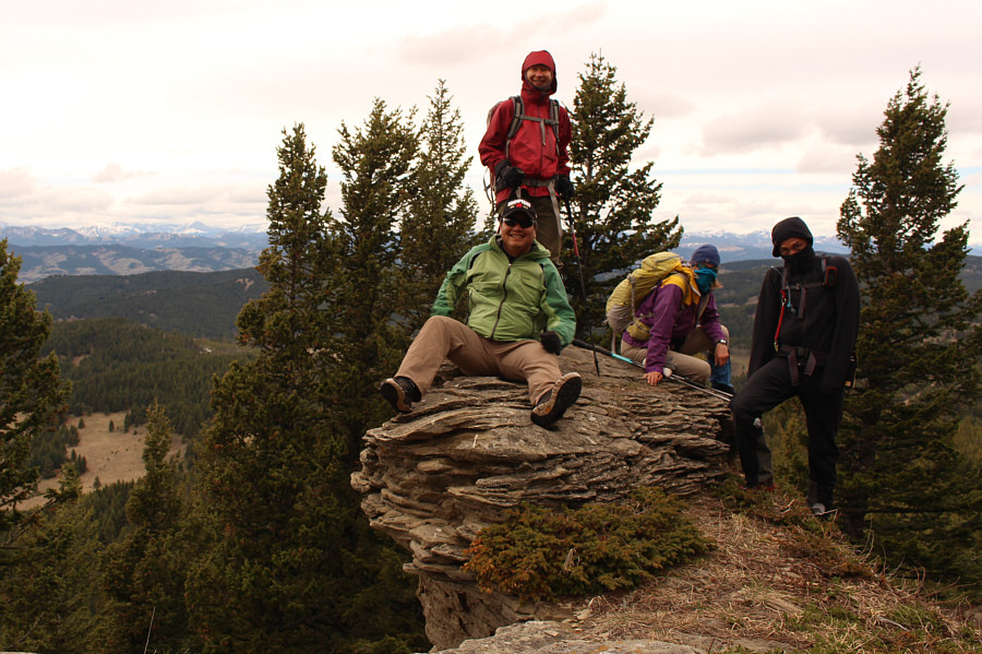
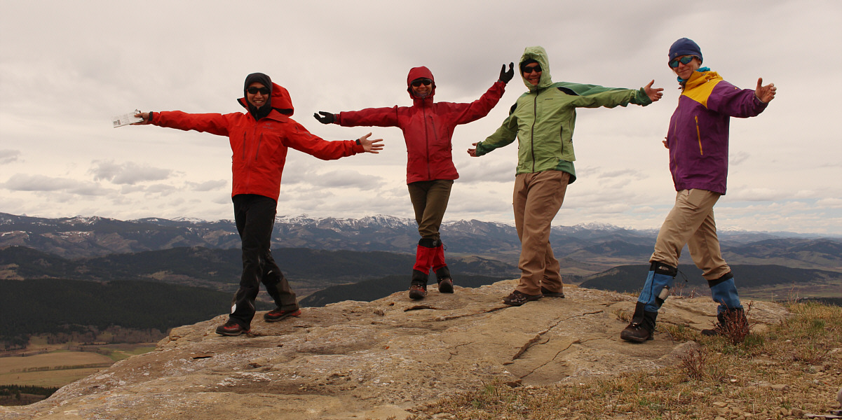
Sonny, Zosia, Marta and Shaun pose on a hoodoo not far from the high point (1818 metres) of Porcupine Lookout which also happens to be the highest point in all of Porcupine Hills.
Still waiting for all that snow to disappear... 
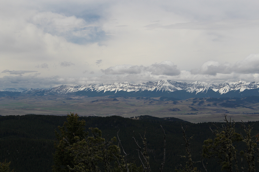
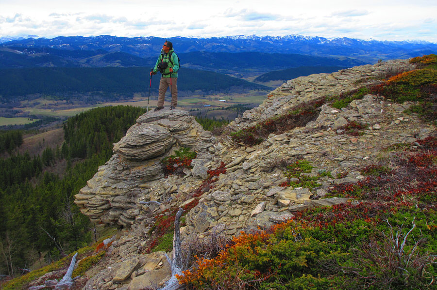
Caudron Peak (centre) and Centre Peak (right of centre) are visible through a break in the trees to the southwest.

Photo courtesy of Zosia Zgolak

Watch out for incoming helicopters! 
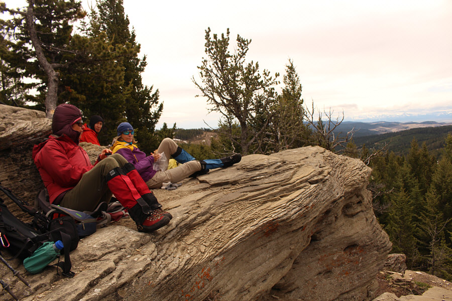
The group takes a break on a rocky bluff a little bit to the south of the lookout site.

Photo courtesy of Zosia Zgolak

I'm not sure why these clear cuts still have the odd tree standing. 
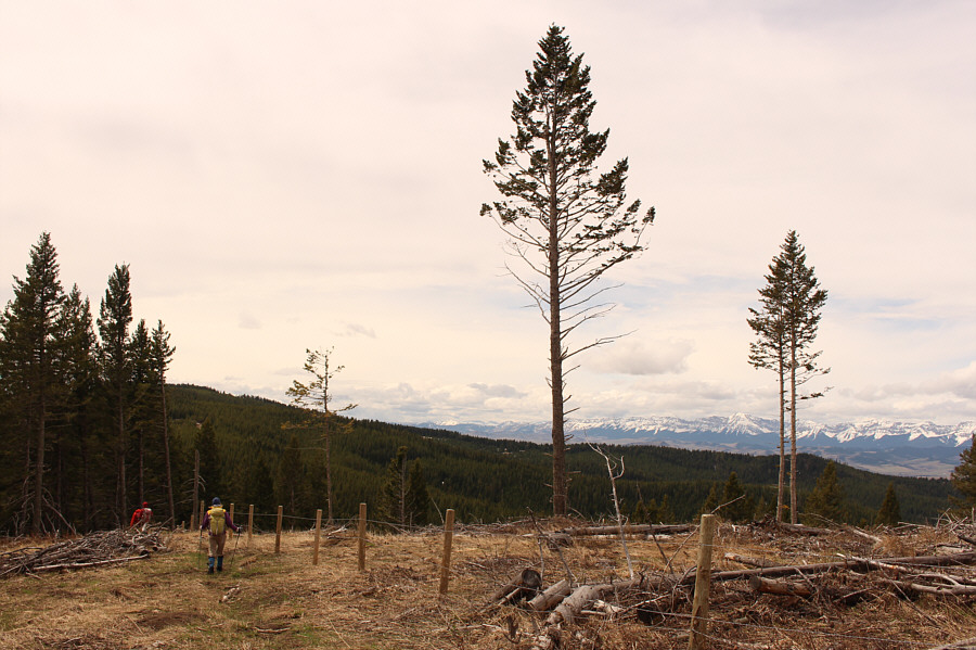
The group descends Porcupine Lookout via a footpath.
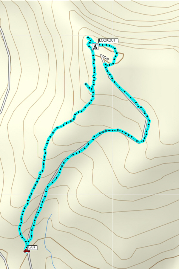
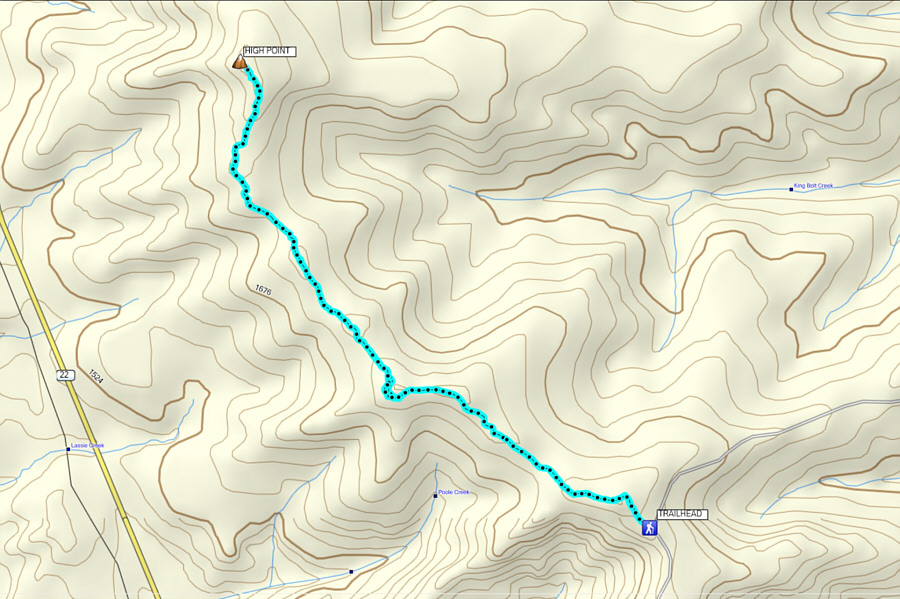
It's not really worth the long drive unless you combine it with another nearby hike. Total Distance:  3.1 kilometres
Round-Trip Time:  1 hour 55 minutes
Net Elevation Gain:  137 metres

GPX Data

After returning from Porcupine Lookout, we still had a lot of daylight and energy left and decided to go for a second hike to another high point further to the north which I dub, "Porcupine Hills North".  While it is possible to climb up Porcupine Hills North directly from Highway 22 (starting from a pullout 6.0 kilometres north of the junction with Highway 520 or 20.9 kilometres south of the junction with Highway 533), we opted to make it a longer and more interesting walk by utilizing the popular Porcupine Hills Ridge Trail.  The Rocky Mountain Ramblers also hiked to this same high point in 2015 and 2017, but they used a slightly different approach via Adair Creek.

From the aforementioned 4-way intersection (junction of Highway 520 and Skyline Road), drive north for 3.5 kilometres to a large scenic pullout on the left side of the road.  The hiking route begins on an obvious 4x4 track climbing up the hill to the north.

From the pullout, we followed the 4x4 track and passed through a barbed wire gate near the top of the first hill.  We then followed the scenic Porcupine Hills Ridge Trail until it began to turn west and descend into the valley roughly about two kilometres from the start.  We left the trail here and hopped a barbed wire fence in order to continue north along the ridge.  We soon picked up a fainter trail which runs parallel to another barbed wire fence.  This trail follows the many undulations of the ridge and is mostly in forest until the final rise to the top of Porcupine Hills North.  Upon reaching the very scenic high point, we took a short break before retracing our steps all the way back along the ridge.  Although this trip felt long at times with its many ups and downs, we had very few issues throughout, and the company of good friends made the hike that much more pleasant.

The Porcupine Hills encompass a vast area, and while Zosia and I have now visited several locations including Sand Bluff and Trout Creek Ridge, there is still much for us to explore here.  With a deep snow pack persisting in the main ranges of the Canadian Rockies this year, we may be back sooner than later.
No 4x4 vehicle needed! The group climbs up a 4x4 track at the start of the hike.
Expect to see families and dogs on this popular trail! 
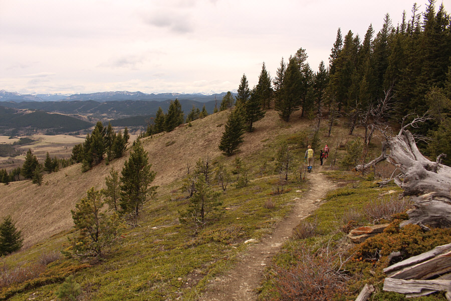
Porcupine Hills Ridge Trail is well-maintained and very scenic.
Not much to see, but it sure beats post-holing! 
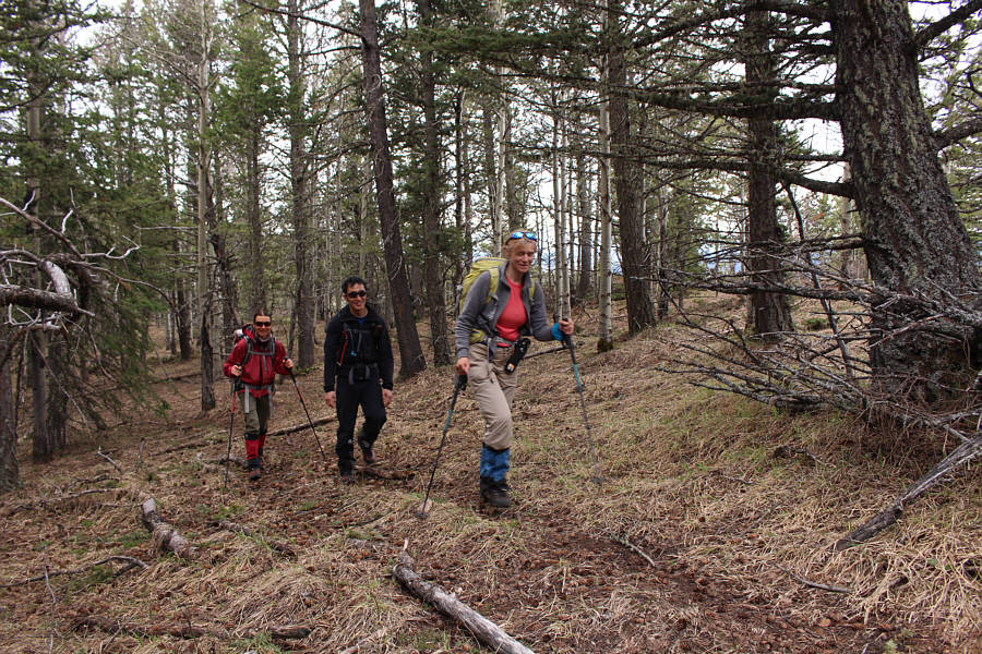
Zosia, Shaun and Marta hike the faint trail which follows the crest of the ridge.
"Suicide trees" according to Zosia. 
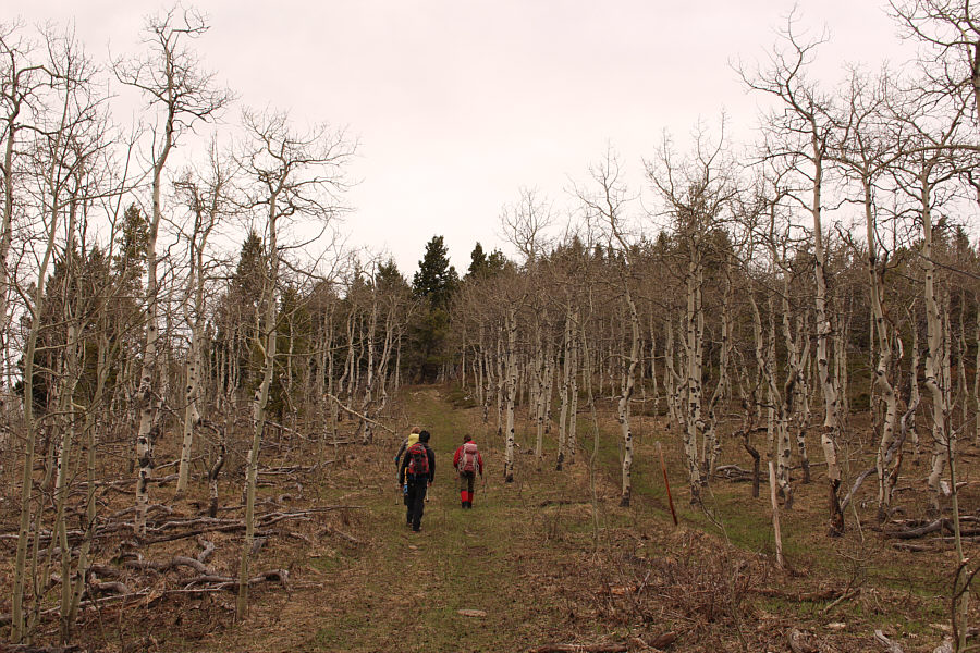
The group passes through a stand of aspen trees on the ridge.
Very cool! 
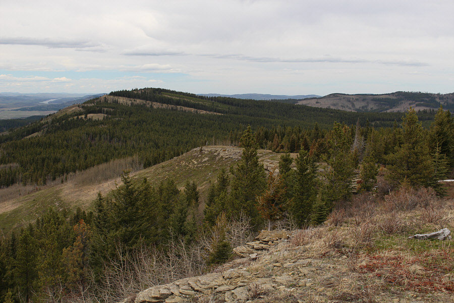
The forest gives way to rocky bluffs near the top of Porcupine Hills North.
There is some scrambling to be found here! Sonny climbs onto a hoodoo amongst the rocky bluffs.

Photo courtesy of Zosia Zgolak

Thank goodness it wasn't the Chicken Dance!

Shaun, Zosia, Sonny and Marta dance atop a bluff near the high point (1794 metres) of Porcupine Hills North.


Fun times! Familiar mountains to the northwest include Coffin Mountain (left), Mount Livingstone (right of centre) and Saddle Mountain (far right).
Beautiful country! 
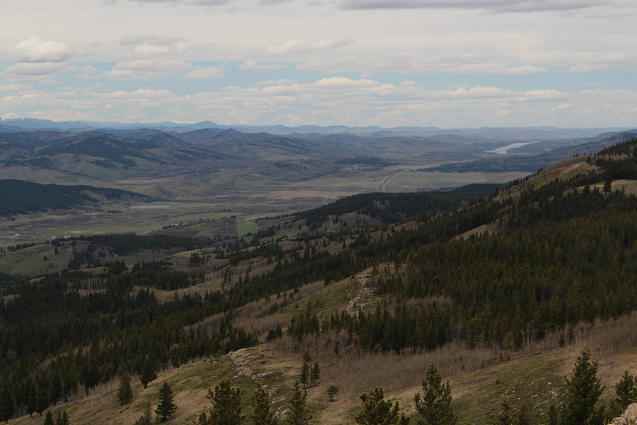
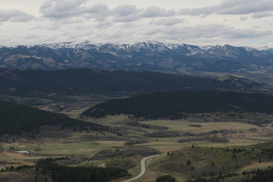
Chain Lakes Reservoir is visible to the north.
Might be worth returning to finsih the northern part of this traverse... The ridge continues north and connects with Trout Creek Ridge at distant right.
Had I been on the ball, we could have set up a convenient car shuttle! Marta and Zosia start the long walk back to the trailhead.  Porcupine Lookout is visible on the left horizon.
A surprisingly enjoyable ramble! Total Distance:  9.9 kilometres
Round-Trip Time:  3 hours 50 minutes
Total Elevation Gain:  ~400 metres

GPX Data