BOU AVENUE
Glasgow North (Peak 466270)
Hoping to take advantage of a fantastic weather forecast but unwilling to drive very far, Zosia Zgolak and I ascended the northernmost outlier of Mount Glasgow located along Little Elbow River in Alberta's Kananaskis Country on 24 July 2022.  An easy ascent route via the outlier's east ridge is described in Gillean Daffern's Kananaskis Country Trail Guide.  While Daffern refers to the outlier as "Peak 466270", the name "Glasgow North" has seemingly been adopted by most online trip reports.

At the Little Elbow Trailhead parking lot, Zosia and I met a recent acquaintance who was part of a group of Rocky Mountain Ramblers heading to Forgetmenot Mountain that day.  We chatted at length with them as we all walked together to the nearby Harold Chapman Bridge.  Crossing to the south side of Little Elbow River, we parted ways as the Ramblers headed east while Zosia and I headed west.  The maze of trails here makes route-finding a bit challenging, but for the most part, we tried to stay as close as possible to the south bank of the river while working our way westward.  Some trails would disappear in a washout or boggy section, but we were always able to find another trail to follow without much bushwhacking.  Roughly two kilometres west of the bridge, we followed a flagged beaten path up an eroded embankment which enabled us to connect with a good trail rising up the east ridge.  This trail led us without fuss up to tree line and the first of several false summits along the ridge.  Each of the false summits requires a short down-climb, but none of them are too difficult.  After the final down-climb, we followed a convenient beaten path in the rubble the rest of the way to the top.  We briefly considered traversing to an even higher outlier--"Garriochmill Peak" or "Peak 461258" as Daffern calls it--to the southwest as many others have done, but ultimately, we decided to save that one for another day.  Why spoil an already nice and pleasant outing with exposure and scree bashing?

Enjoying the beautiful weather, Zosia and I relaxed on the summit of Glasgow North for nearly an hour and a half before retracing our steps back down the east ridge.  On the way down, we took a short detour up to a treeless knob just to make sure that we had tagged every false summit along the east ridge.  Near the bottom, we skipped the eroded embankment that we had come up and tried to follow the ridge crest all the way down to its terminus.  This entailed a wee bit of bushwhacking since the trail that winds up at the very bottom is not the same as the one that we followed up the ridge.  In any case, we eventually regained our up-track beside the river, but even then, the walk back to the bridge was fraught with minor route variations.  Perhaps it is just as well that there is no one definitive access trail to the start of Glasgow North's east ridge.  If Alberta Parks were ever to formalize an official trail along the south bank of Little Elbow River, I have no doubt that Glasgow North would be overrun with people much like nearby Nihahi Ridge.
It's shaping up to be a beautiful day!

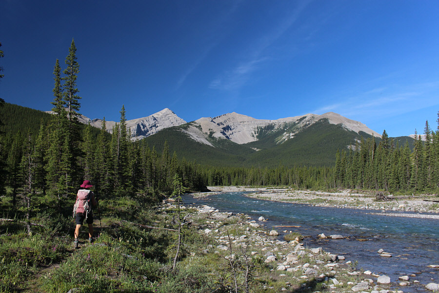
Hiking along the south bank of Little Elbow River, Zosia gets a good look at Mount Glasgow (left of centre), Garriochmill Peak (centre), and Glasgow North (right).

This is probably the most obvious way to gain the ridge.

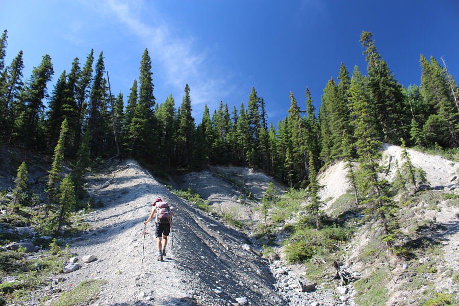
Zosia follows a flagged beaten path up an eroded embankment to gain the ridge leading to Glasgow North.

Keep ploddin' upward! 
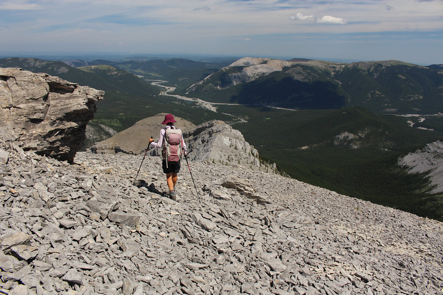
Trees begin to thin out as Zosia climbs higher up the ridge.  Ahead is the first of several false summits.

Seems like a lifetime ago when I traversed it...

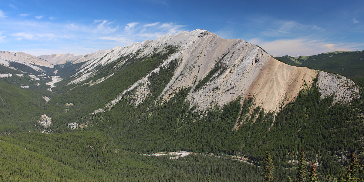
Nihahi Ridge captures all the attention across the valley to the north.


Scrambling is optional!

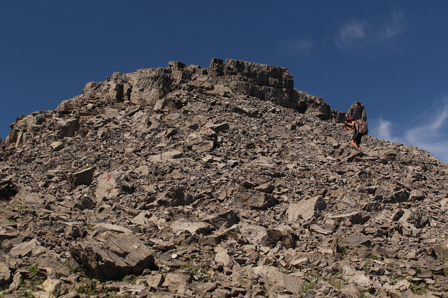
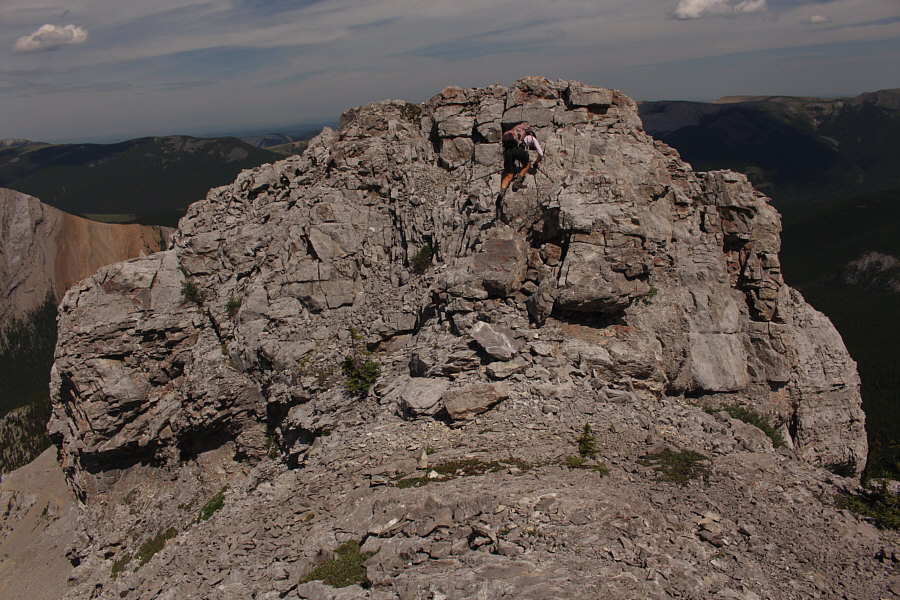
Some rock flakes at the first false summit pose no serious challenges.

The top still looks far away! From the first false summit, Zosia surveys the remainder of the ridge leading to the top of Glasgow North.
There is some mild exposure down-climbing the other side. 
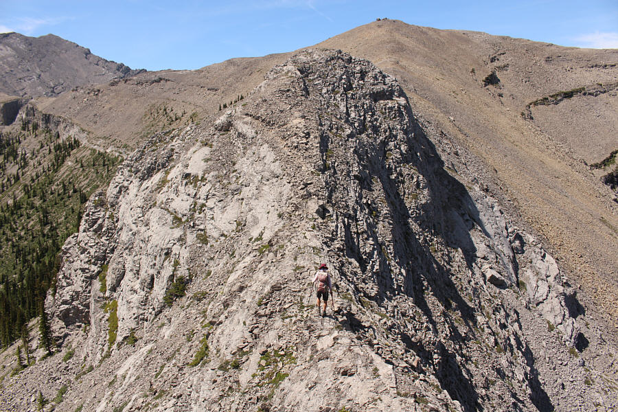
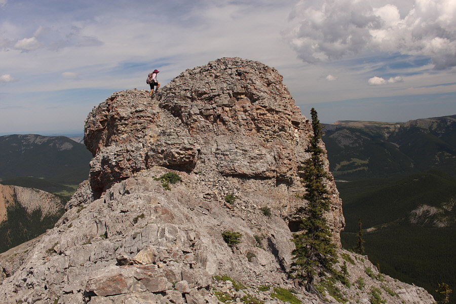
Zosia approaches a second false summit which appears more daunting than it really is.
We got this! 
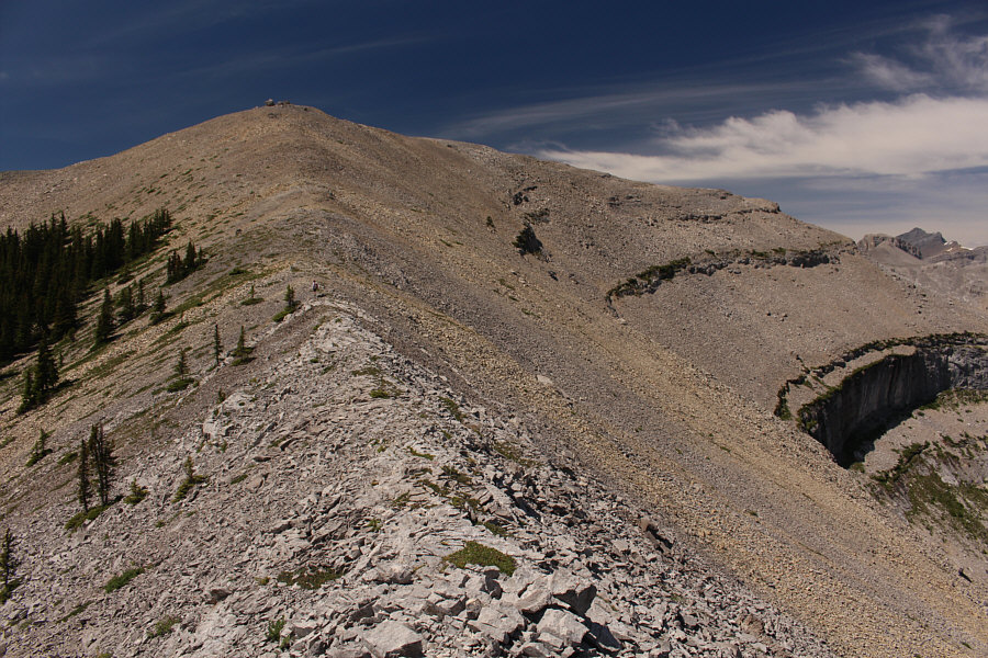
Past a third drop-off, the remainder of the ridge is an easy walk-up.
Zosia is so tough she hiked up here in her bare feet!

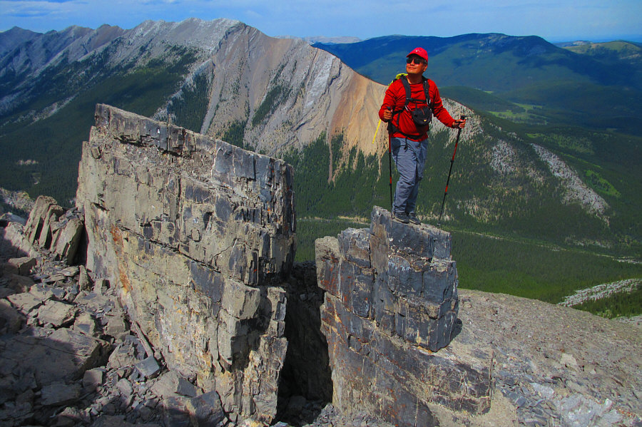
Sonny and Zosia stand on the summit of Glasgow North (2481 metres).

It's probably a zoo at the pond right now! 
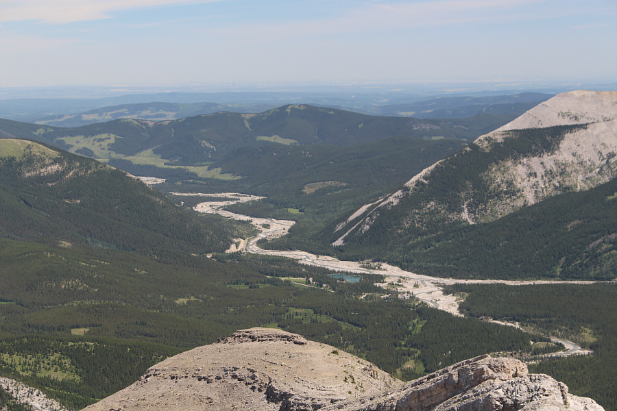
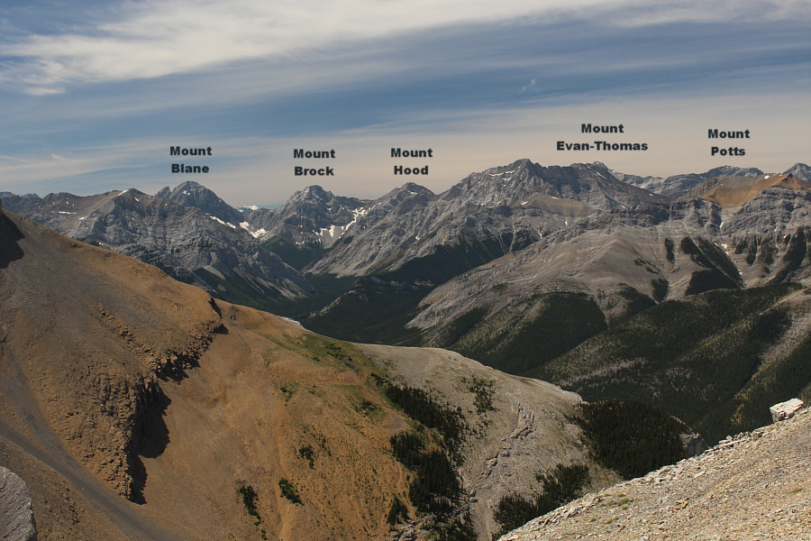
Forgetmenot Pond is the easily-identified patch of blue in this view to the east.  Also, the first false summit can be seen at bottom centre while the city of Calgary is barely visible on the hazy horizon just left of centre.
We'll save Garriochmill Peak for another day when we don't feel like driving very far! 
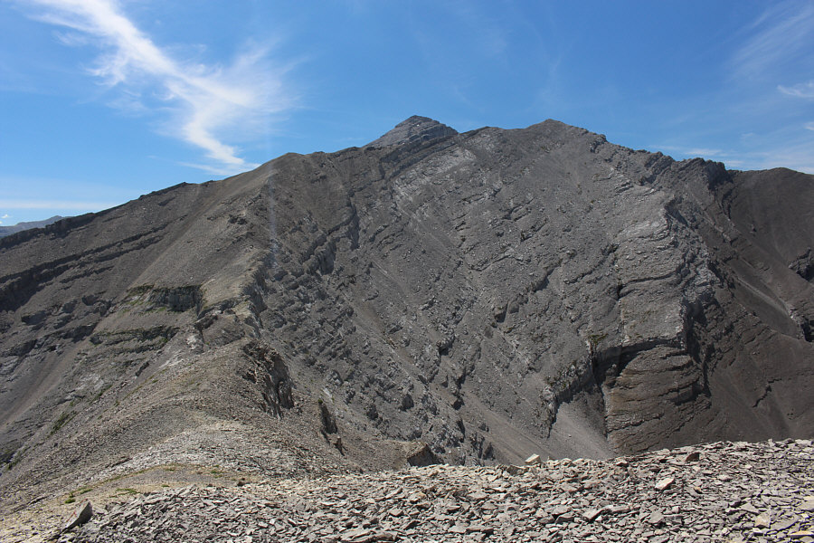
To the south, the top of Mount Glasgow pokes just above the ridge east of Garriochmill Peak's summit (right).
I'm very curious about the massive peak to the right of Mount Hood in the photo... 
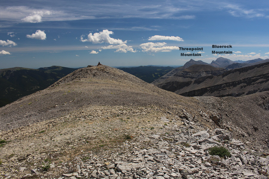
Numerous peaks of the Opal Range stretch across the western horizon.
So many memories of chasing Kane peaks! 
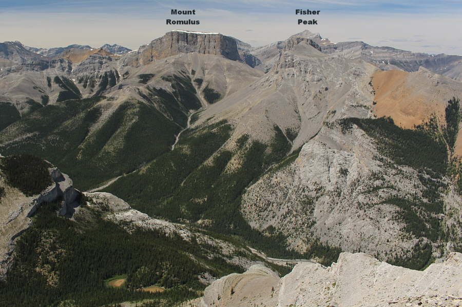
Mount Remus sits right in front of Fisher Peak in this photograph.
I was up there more than a quarter century ago! Mount Fullerton fills the view to the northwest.
I came over here because Zosia was airing out her feet and boots! This is looking back at the top of Glasgow North from the north end of the summit ridge.
Keepin' it simple! For the descent, Zosia heads back the way she came.  At right in the distance is Forgetmenot Ridge.
A rare occasion when the scrambling was more fun on the way down! Zosia scrambles back up the third and last drop-off that she had to down-climb during the ascent.
This was the hardest of all the down-climbs during the ascent. Zosia climbs back over the second false summit.
I was praying that the rock wouldn't crumble beneath me! Sonny poses on one of the rock flakes near the first false summit.

Photo courtesy of Zosia Zgolak

Do I make you horny, baby? 
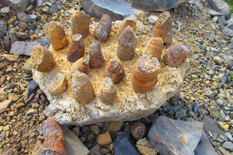
There is an abundance of fossilized horn corals along the trail above tree line.

Photo courtesy of Zosia Zgolak

Don't worry! I'm not counting this as a separate summit even though it took a little bit of extra effort to get here! 
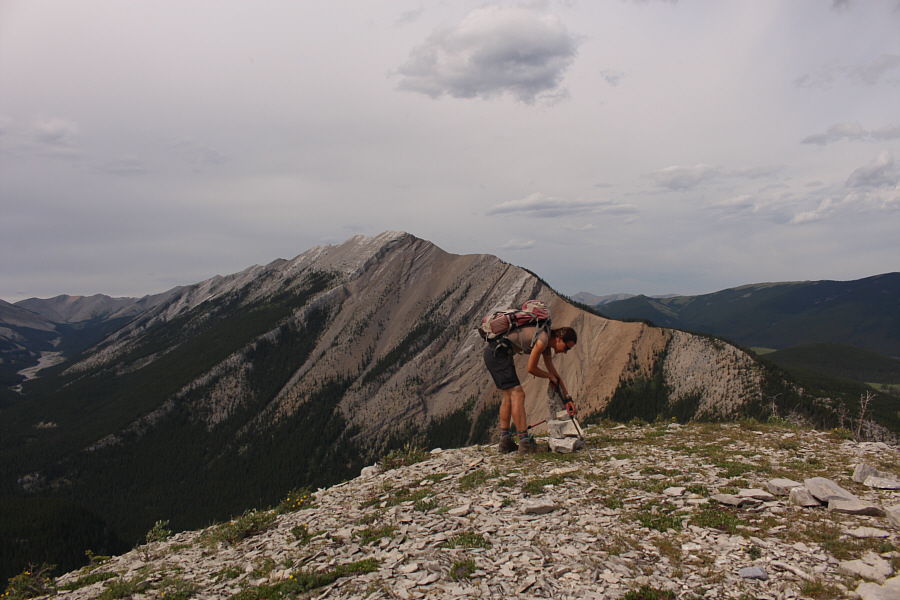
Zosia builds a cairn on a treeless knob (2076 metres) located about halfway up the ridge.
I needed that! 
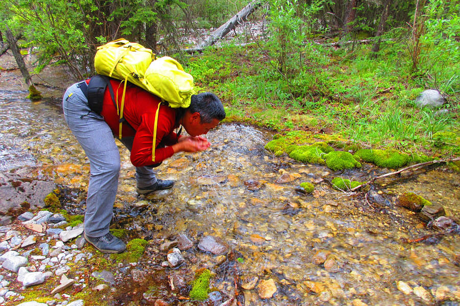
After descending the ridge, Sonny cools himself off with a quick splash in a shallow creek.

Photo courtesy of Zosia Zgolak

Whew! I'm tired! 
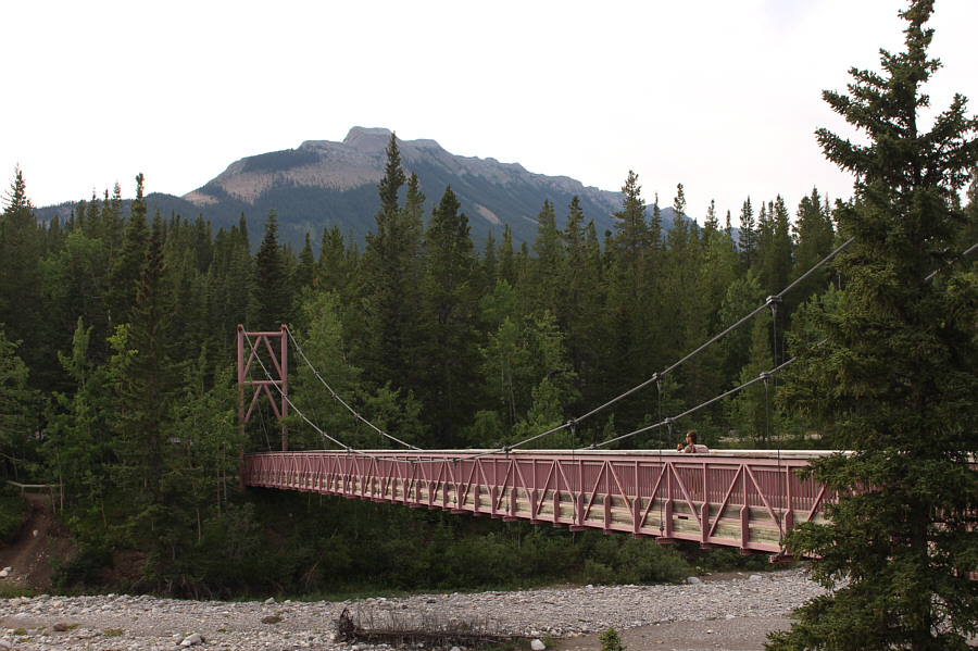
Zosia crosses back to the north side of Little Elbow River on the Harold Chapman Bridge.
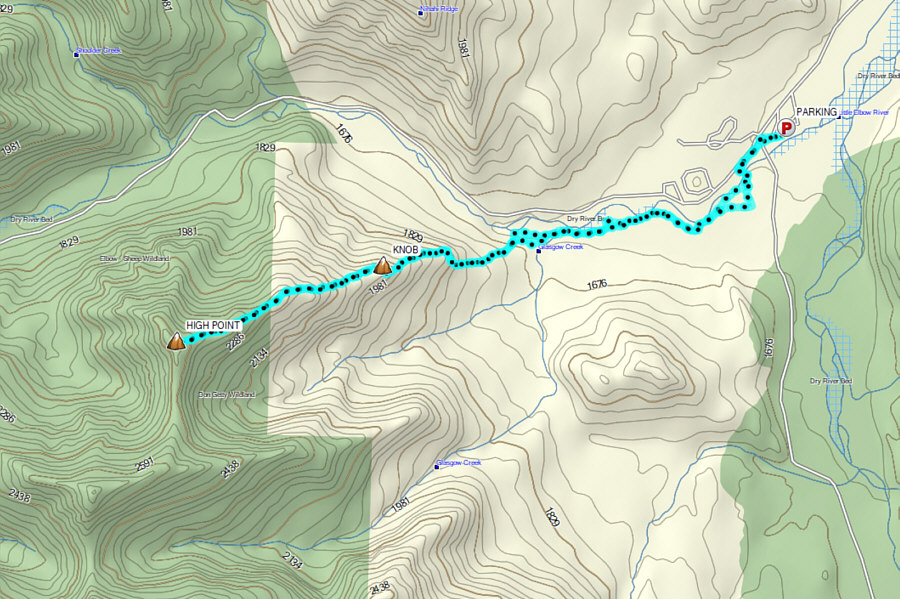
Arguably the best hike in the vicinity of Little Elbow! Total Distance:  13.4 kilometres
Round-Trip Time:  8 hours 49 minutes
Cumulative Elevation Gain:  1025 metres

GPX Data