BOU AVENUE
Savanna Creek Hills

Asieh Ghodratabadi, Ali Shariat, Zosia Zgolak and I returned to the north end of Alberta's Public Land Use Zone on 13 June 2020 to hike up some hills located east of Pasque Mountain and south of Plateau Mountain.  Officially, these hills are unnamed, but for the sake of clarity, I refer to them as "Savanna Creek Hills" (I was going to use "Savanna Creek Ridge", but Zosia came up with "Savanna Creek Hills" which I think is better).  It is possible to access these hills from the south via a gas well road along Savanna Creek, but hoping to avoid the tedium of walking up a long and boring road, I opted to approach the hills from the north via steep and partially open slopes.

From Highway 22, turn west onto Highway 532 and drive 26 kilometres to the junction with Highway 940 (Forestry Trunk Road).  Turn right and continue west for 4.2 kilometres to the turn-off to a gas well site on the south side of the Forestry Trunk Road.  This spot can also be reached by driving south from Highwood Junction on the Forestry Trunk Road for 28 kilometres.  There is room for two vehicles to park beside a locked gate to the gas well site (be sure not to block the gate).

Passing through the locked gate, we headed south past the gas well site and immediately began bushwhacking up a steep, forested slope.  The bush was not too bad, and we even found some intermittent game trails to follow.  Higher up, we encountered some lingering snow patches, but before our boots got wet, we broke out of the trees onto a vast talus slope which was bone-dry.  The rocks on the talus slope were generally quite stable, and we had few difficulties grinding our way up to our first hilltop of the day.

Aiming for a higher ridge to the southwest, we descended open slopes and eventually entered another larger section of forest that still harboured an abundance of snow.  The post-holing here was not of the epic variety which Zosia and I had endured on Grassy Mountain about a month earlier, but it was miserable enough to warrant a few deep sighs from me.  Fortunately, the suffering was not prolonged, and we were back on dry ground once we emerged from the forest onto open slopes below the higher ridge.  Despite the presence of another lingering snow patch guarding the ridge, we had no problems kicking steps directly up to the crest, and we were soon standing on the high point of the day.

When we arrived at the high point, there was some drizzle in the air, and the sky looked threatening.  Fortunately, there was no bone-chilling wind to immediately chase us off, and we stuck around a bit longer hoping that the light rain would dissipate.  As luck would have it, the rain clouds soon cleared off to the north and left us under bright, sunny skies for the rest of the trip.

After an extended pleasant stay on the high point, we headed north along the crest of the ridge and dropped down briefly into a dip before hiking over another hilltop similar to the first one we climbed earlier in the day.  Dropping down the north slope of this last hilltop, we entered more forest, and once again, we had to contend with more lingering snow.  Thankfully, it is easier to post-hole while descending, and we got through the snowy sections here without too much grief.  Before the start of our trip, I was a little worried about running into hidden drop-offs or cliff bands while descending this north slope, but none ever materialized along our chosen route.  At the bottom, we had to splash across shallow Dry Creek before reaching the Forestry Trunk Road.  An easy plod along the dusty road brought us back to our starting point to complete the loop.

Be sure to check out Ali's interactive record of this loop hike.
Those trees on the slope hide some unpleasantness in the form of deadfall and lingering snow. 
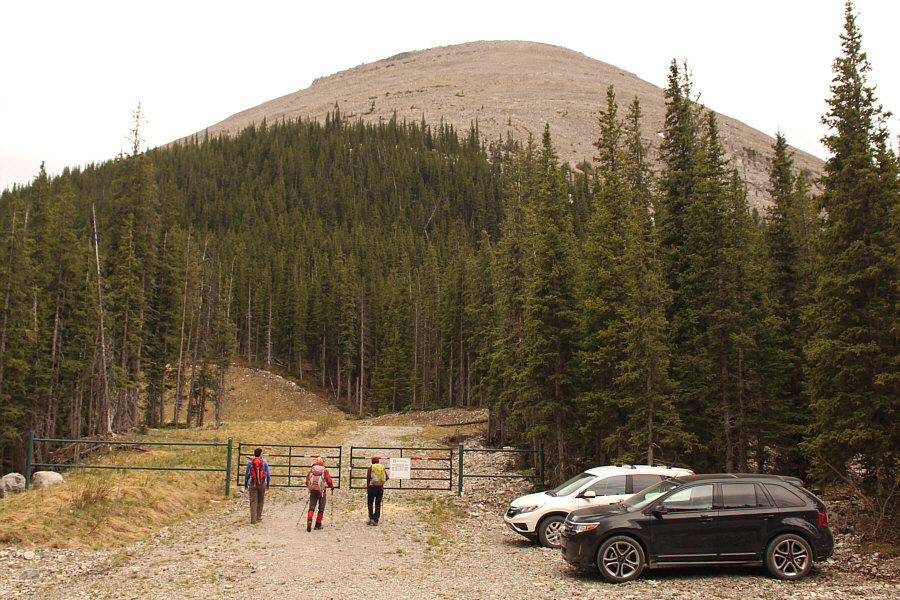
The group starts hiking at a gate to a nearby gas well site and will ascend the hill in the background.
I've definitely had worse bushwhacking! 
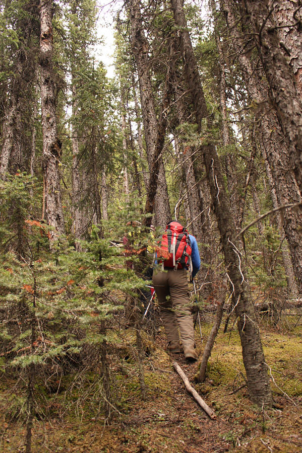
Climbing the initial steep slope entails some moderate bushwhacking.
So much for keeping my feet dry! 
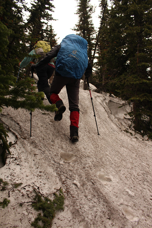
Higher up, there are still some lingering snow patches on this day.
The footing was better than expected though! Above tree line, the group grovels up a vast talus slope.
Great views already! 
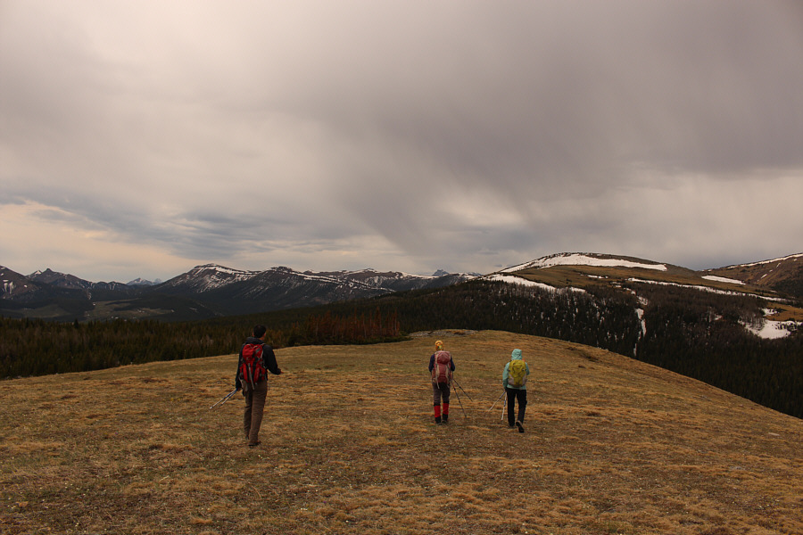
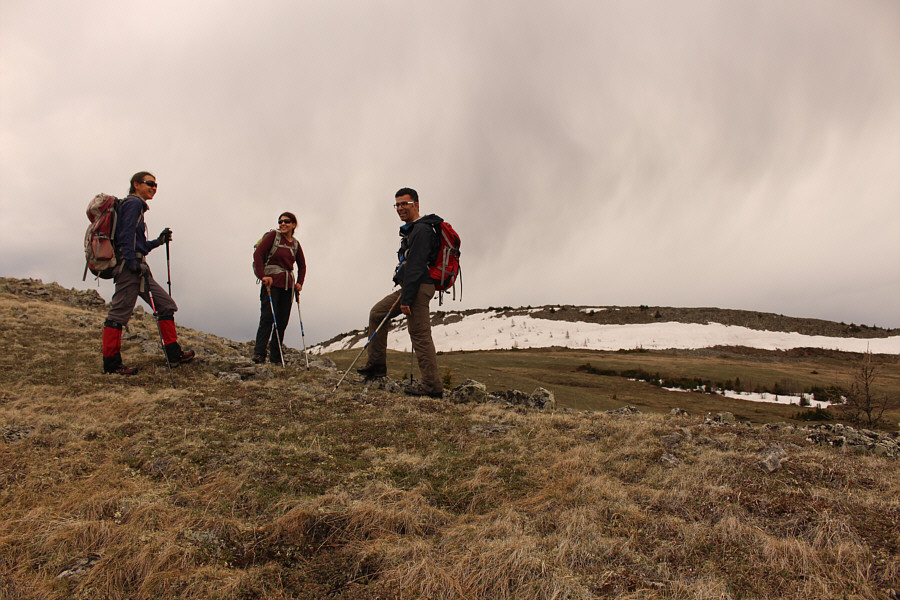
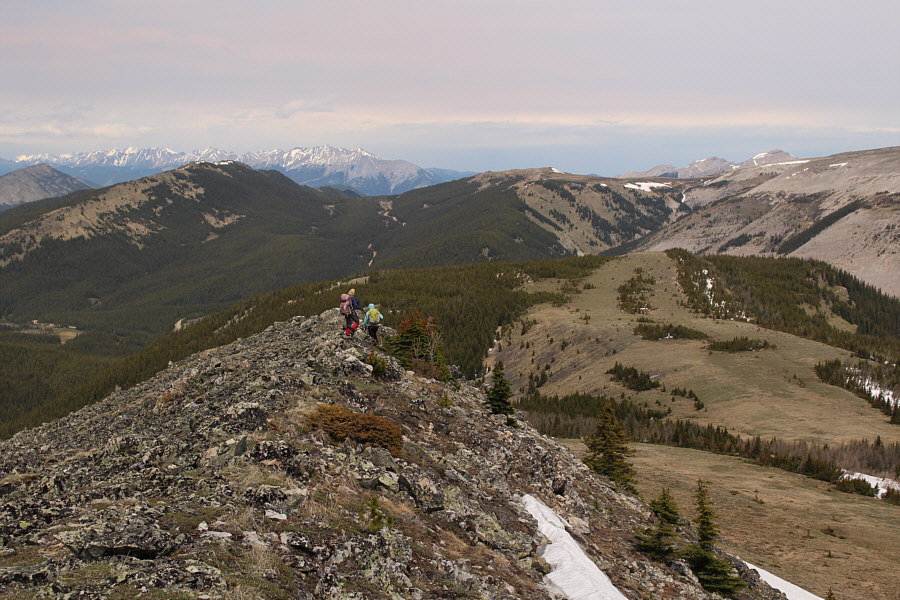
Upon cresting the first hill, the group heads for a higher ridge at right.
Marmots live under these rocks too! There are patterns in the ground here similar to that found on nearby Plateau Mountain.  According to Kananaskis Country Trail Guide author, Gillean Daffern, "What happened is that continual freezing and thawing during a colder, wetter era forced the larger rocks upwards and outwards from areas of finer material into an amazing self-perpetuating pattern of circles and polygons."
Yes, I occasionally do break trail...when I feel like it! 
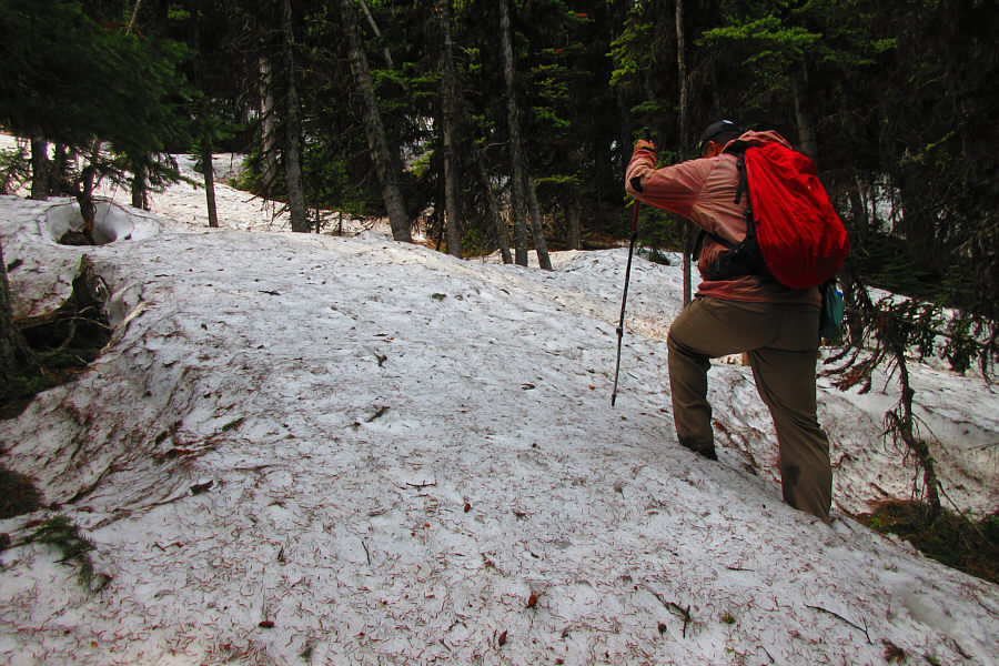
Sonny breaks trail through some more lingering snow patches on the approach to the higher ridge.

Photo courtesy of Zosia Zgolak

It's definitely a late spring. 
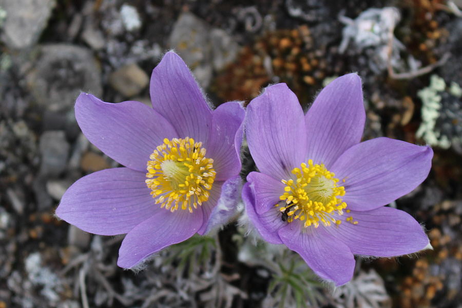
Pasque flowers are still blooming in the area.
The sky doesn't look very promising... The group is happy to break out of the trees again with the higher ridge in the background.
A good place for practicing self-arrest with an ice axe! 
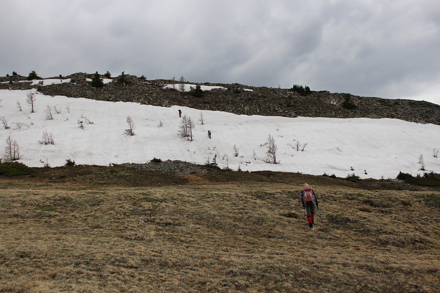
Zosia follows Ali and Asieh up a large snow patch guarding the ridge top.

It looks like we're about to get soaked!

Rain clouds gather as the group reaches the high point of the day.


Despite the light rain, it wasn't windy and cold. 
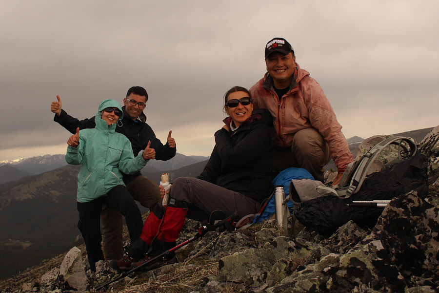
Asieh, Ali, Zosia and Sonny endure some light rain on the high point (2413 metres) of Savanna Creek Hills.

There are some other ridges worth exploring in this area...

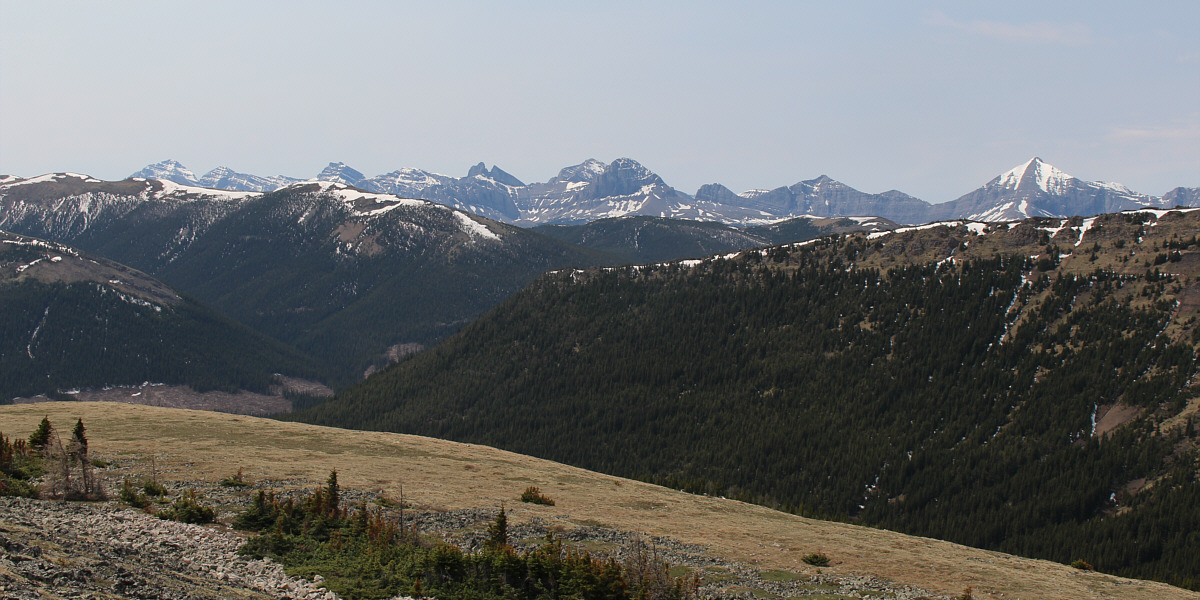
Notable peaks visible on the southwest horizon include Tornado Mountain (far left), The Elevators (left of centre), Beehive Mountain (centre), and Mount Lyall (far right).


I biked up Plateau Mountain in 1993. 
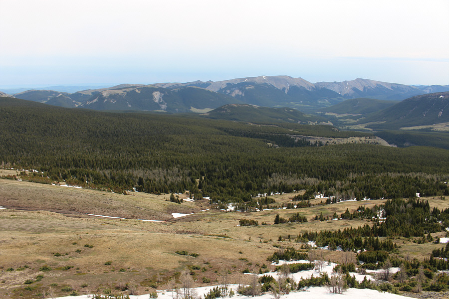
Plateau Mountain dominates the view to the north.
I think the far right bump should be called "Hailstone BUTT"! 
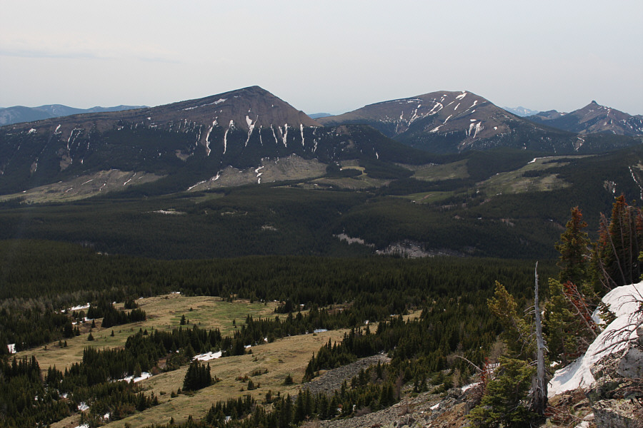
Visible to the northeast are Hailstone Butte (left) and Hailstone Butte South (centre).
Mean Creek Ridge and Mount Hornecker are also visible but harder to discern. Some recognizable peaks to the east include Windy Peak (left), Saddle Mountain (double bumps at centre), Mount Livingstone (right of centre), and Coffin Mountain (far right).
Isola Peak looks much more impressive from this angle. Isola Peak (left), Monola Peak (right), and Twin Peaks (far right) round out the view to the southeast.
The rocks on the ridge crest are a bit tedious to walk over. It might be better to drop off the ridge sooner and hike the grassy meadows at lower right. 
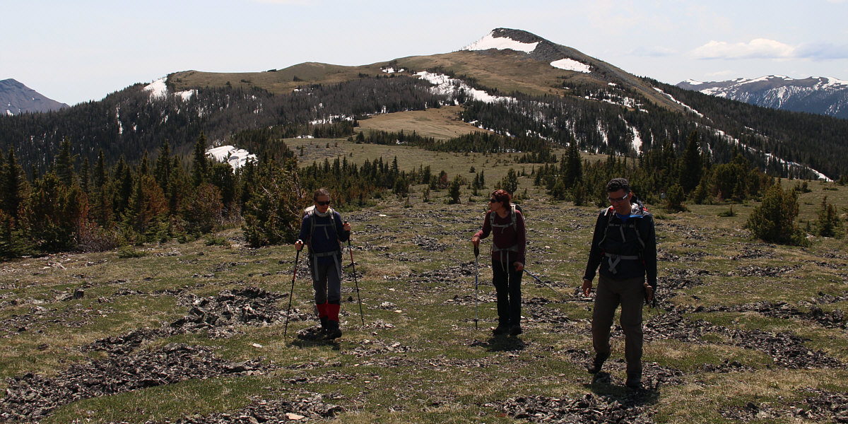
The group descends the ridge north of the high point and will continue toward another broad hilltop at right.

Boy, did we ever luck out with the weather!

Here is a last look back at the high point of Savanna Creek Hills.


And that's Plateau Mountain across the valley! The group descends the north slope of the aforementioned broad hilltop.
Didn't feel much more different, really! With his boots already soaking wet from post-holing through snow, Sonny casually walks through shallow Dry Creek just before reaching the Forestry Trunk Road.

Photo courtesy of Zosia Zgolak
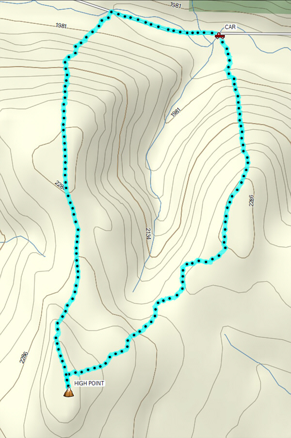
Short and simple...except for the moderate bushwhacking and post-holing! Total Distance:  7.1 kilometres
Round-Trip Time:  5 hours 43 minutes
Net Elevation Gain:  473 metres

GPX Data