

From the junction with Highway 532, drive south for 7.3 kilometres along Forestry Trunk Road 940 and turn right onto a rough road which soon ends on the east bank of Livingstone River. Park anywhere along the east bank and ford the river to start the hike.
While Zosia braved the icy waters of Livingstone River wearing sandals, Ali and I kept our boots on and successfully crossed a somewhat awkward log further downstream. After regrouping on the far side of the river, we found that a short section of the road had been completely obliterated probably to dissuade motorized vehicles from venturing up Isolation Creek. We picked up the road again after walking across the short stretch of devastation and quickly settled into a steady plod up the valley. While the road was easy enough to follow, a light covering of snow slowed our pace a bit, and we had to pay attention to avoid plunging through the occasional half-frozen mud hole.
About two kilometres west of the river, there is a split in road. On our previous trip to Monad Peak, we made the mistake of taking the wider right fork and had to bushwhack a bit to get back on track. We correctly took the rougher left fork this time and carried on without any issues.
|
|
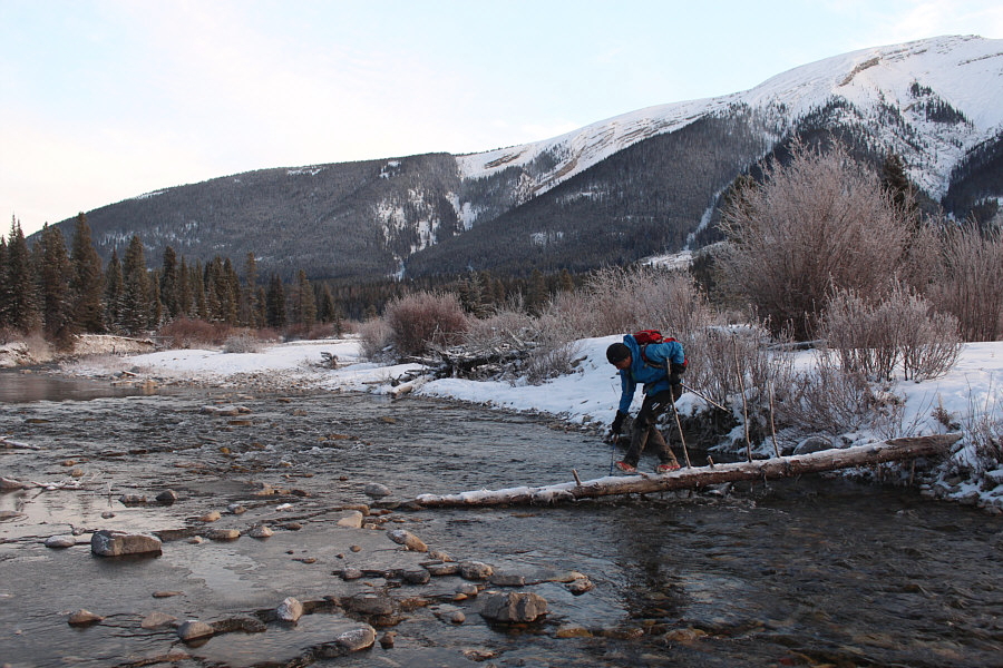
Ali crosses Livingstone River on a downed log. |
|
|
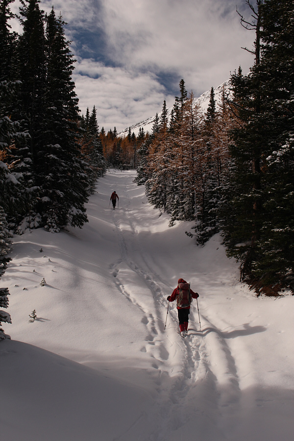
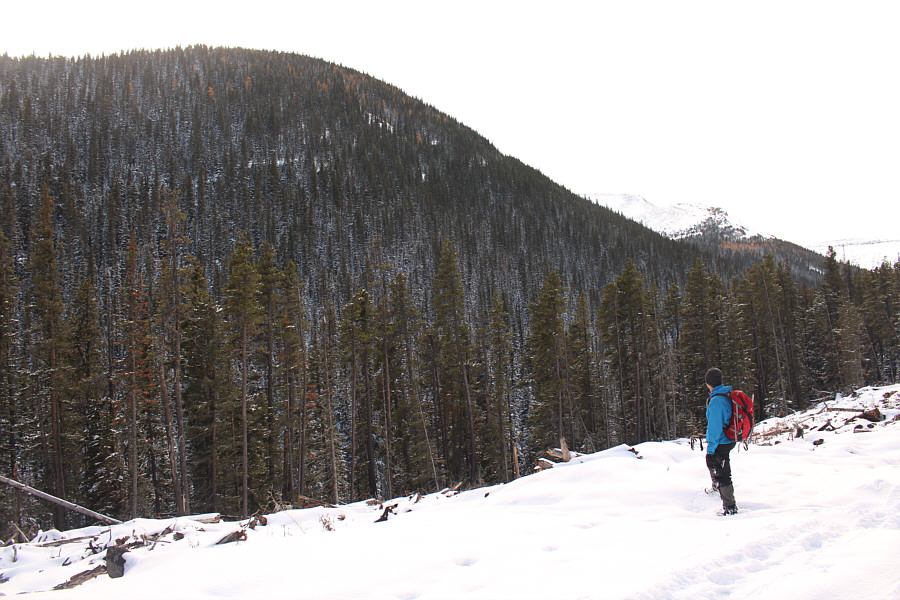
Ali and Zosia hike along Isolation Creek road. Monola Peak is visible in the distance at left. |
|
|
Ali and Zosia traverse above a washed-out section of road. |
|
|
Larches appear alongside the snowy road. |
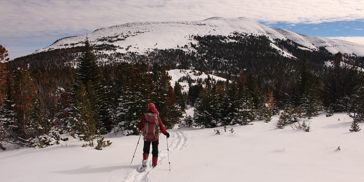
Zosia leaves the road and aims for the tracks at centre with Monola Peak in the background.
 |
Zosia and Ali grind their way up the northwest slope of Monola Peak. |
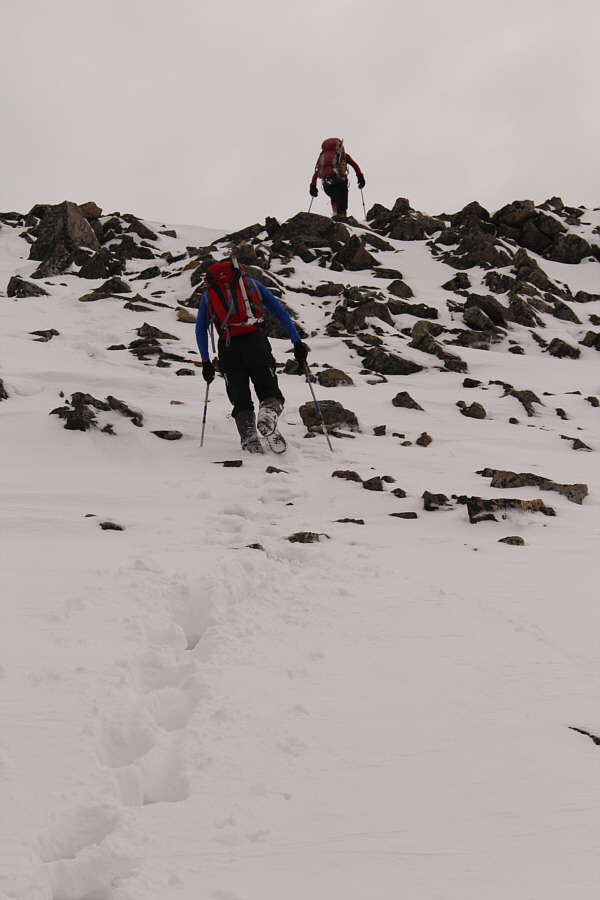 |
Ali follows Zosia up a rocky section to gain the summit ridge. |
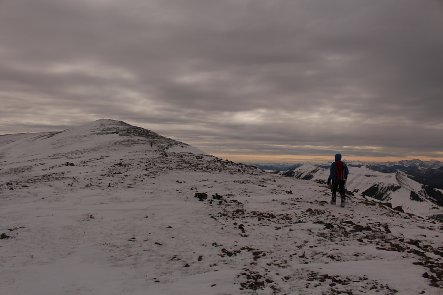 |
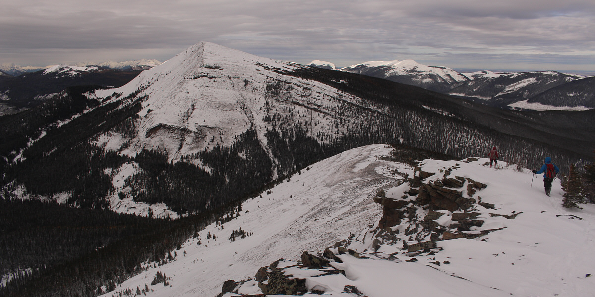
Zosia and Ali hike up the broad summit ridge. |
Sonny, Zosia and Ali stand on the west summit of Monola Peak (2536 metres).
 |
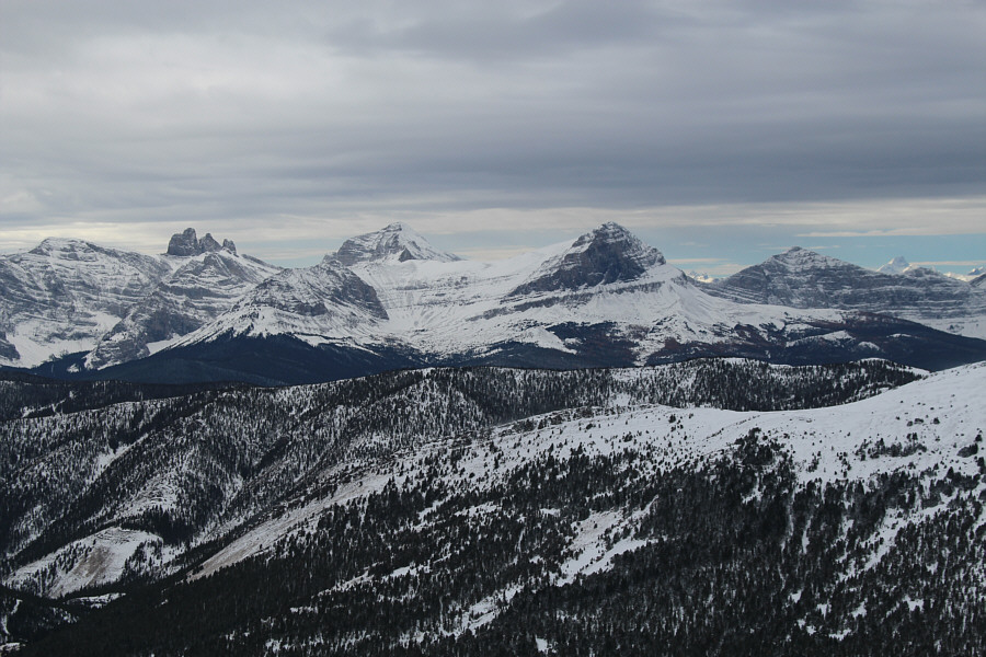
Some unnamed ridges to the south invite further exploration. Visible on the distant horizon are Chief Mountain and Mount Cleveland. |
The view to the southwest includes the Twin Peaks of Cabin Ridge (left) and Tornado Mountain (highest peak on right horizon).
 |
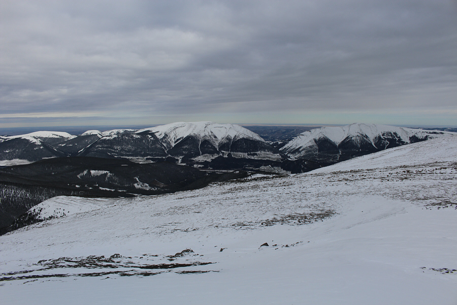
The Elevators (left) and Beehive Mountain (right of centre) are visible to the west. |
 |
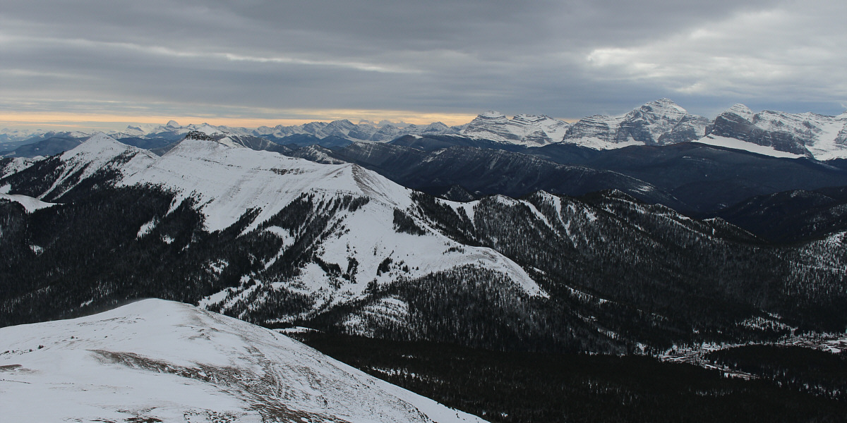
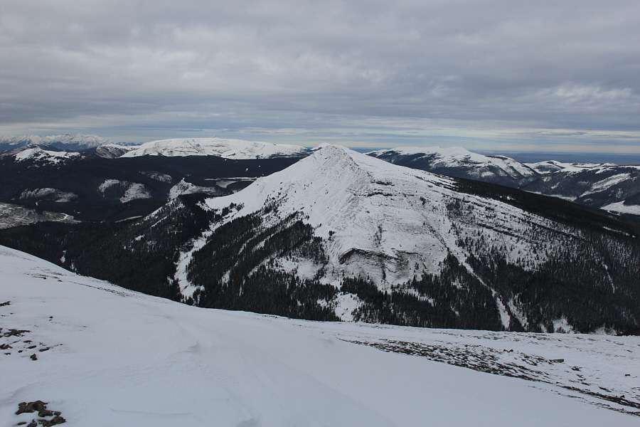
Monad Peak dominates the view to the northwest. |
 |
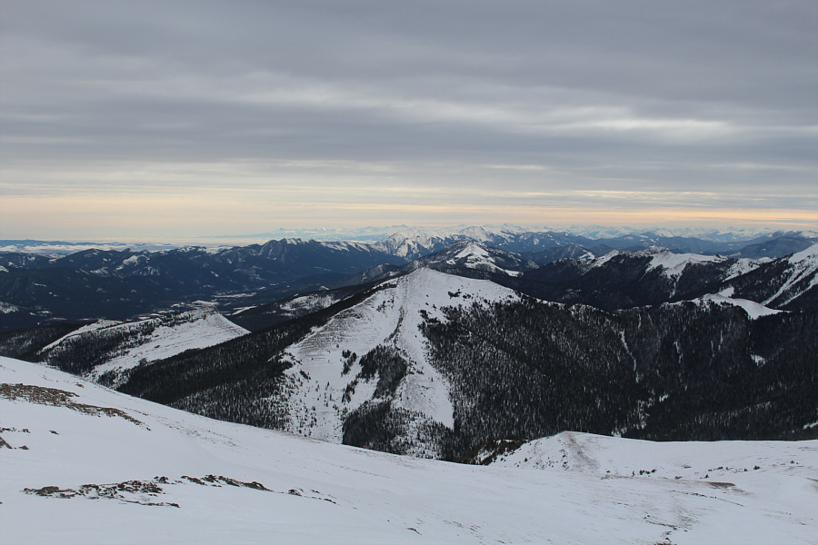
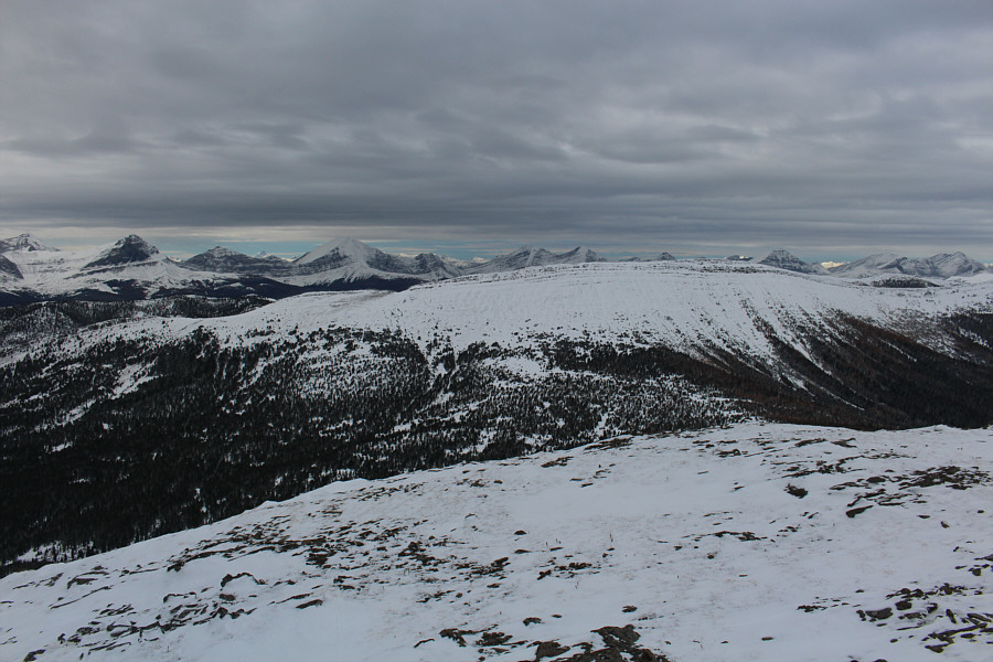
Stretched across the horizon behind Isola Peak to the north are Plateau Mountain, Sentinel Peak and Hailstone Butte. |
 |
Windy Peak, Mount Hornecker, Mount Livingstone and Coffin Mountain round out the views to the east. Monola Peak's northeast ridge can be seen at lower left. |
 |
Zosia and Ali scout out a possible alternate descent route from the east summit (2538 metres). |
The drive back to Calgary was a bit more problematic when we encountered a jack-knifed horse trailer blocking Highway 532 near Hailstone Butte. We ended up backtracking to the Forestry Trunk Road and driving north all the way to Highway 40 at Highwood Junction before heading home through Longview. I find it ironic that after taking a shortcut down Monola Peak, we still had to take the long way home!
Zosia and Ali descend the northeast ridge of Monola Peak.
 |
Ali and Sonny carefully descend a
rocky outcrop along the northeast ridge. Photo courtesy of Zosia Zgolak |
 |
Zosia drops down a steep snow slope at the end of the northeast ridge. |
 |
The snow actually makes it easier to descend some bushy sections. |
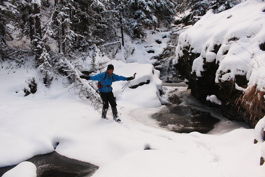 |
Ali gingerly crosses an early-season snow bridge over Isolation Creek. |
 |
Ali looks back at the forested end of Monola Peaks northeast ridge which he just descended. |
 |
Zosia walks across Livingstone River in her boots at the end of the trip. |
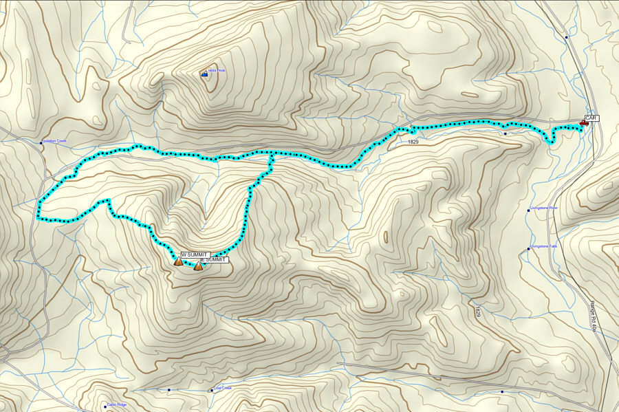 |
Total
Distance: 19.0 kilometres Round-Trip Time: 8 hours 36 minutes Net Elevation Gain: 835 metres |